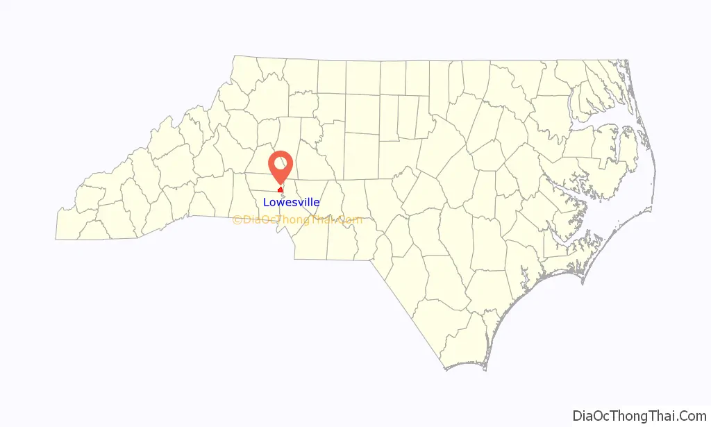
Lowesville is a census-designated place (CDP) in Lincoln County, North Carolina, United States. The population was 2,945 at the 2010 census, up from 1,440 in 2000.
| Name: | Lowesville CDP |
|---|---|
| LSAD Code: | 57 |
| LSAD Description: | CDP (suffix) |
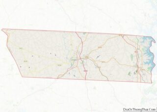
| State: | North Carolina |
| County: | Lincoln County |
| Elevation: | 804 ft (245 m) |
| Total Area: | 6.80 sq mi (17.62 km²) |
| Land Area: | 6.79 sq mi (17.60 km²) |
| Water Area: | 0.01 sq mi (0.02 km²) |
| Total Population: | 3,281 |
| Population Density: | 482.86/sq mi (186.43/km²) |
| FIPS code: | 3739520 |
| GNISfeature ID: | 0989108 |
Online Interactive Map
Click on ![]() to view map in "full screen" mode.
to view map in "full screen" mode.
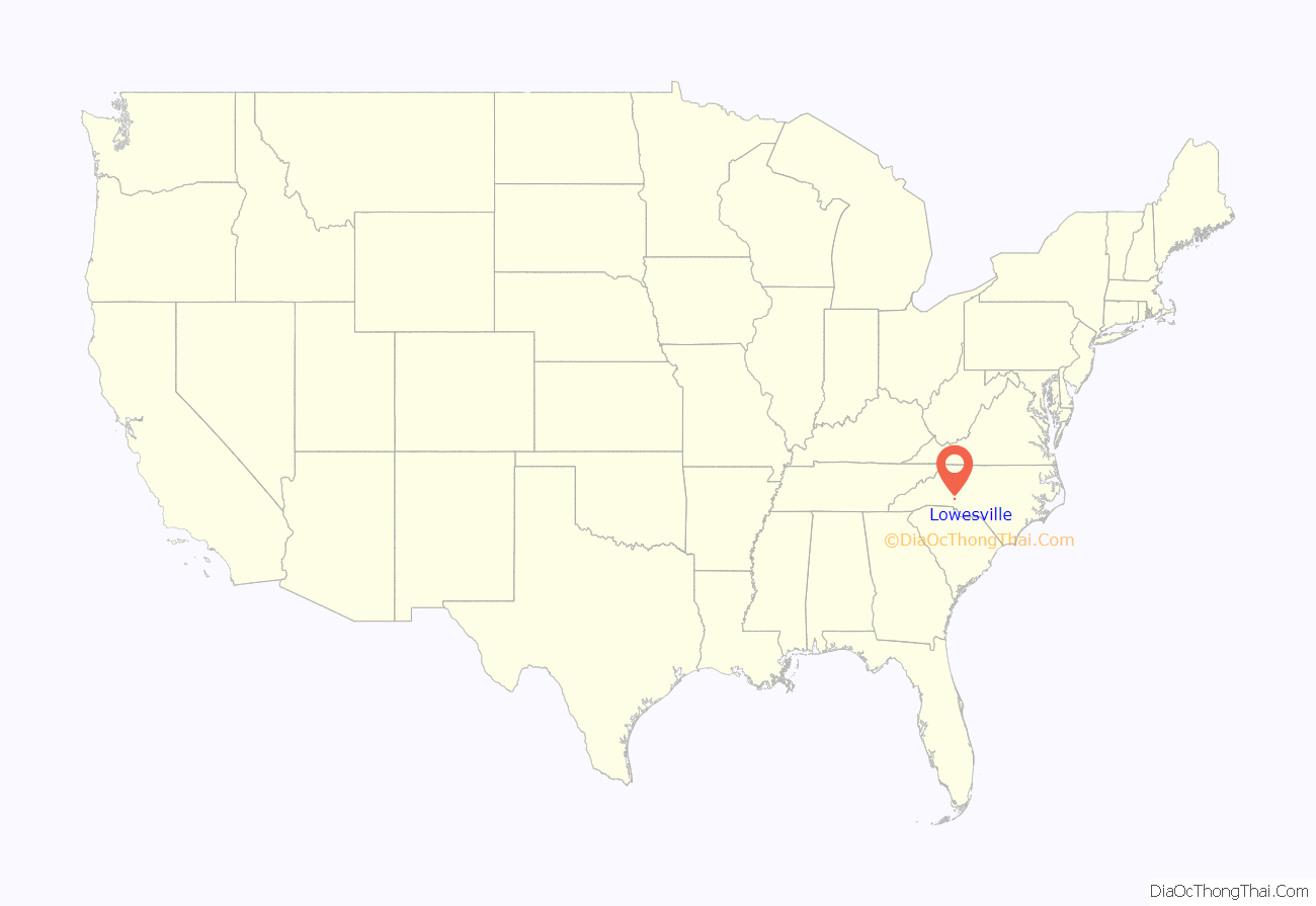
Lowesville location map. Where is Lowesville CDP?
History
Mount Welcome was listed on the National Register of Historic Places in 1991.
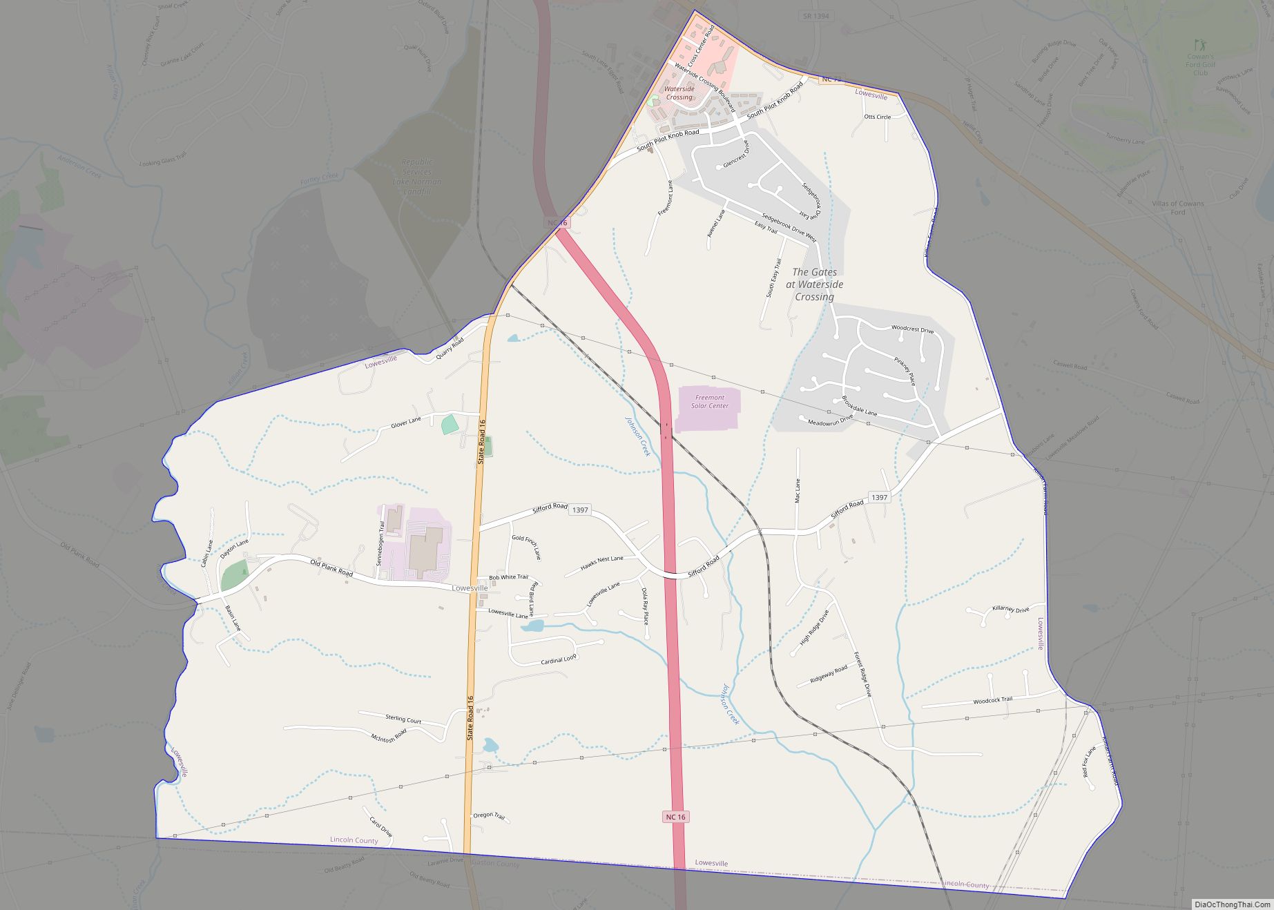
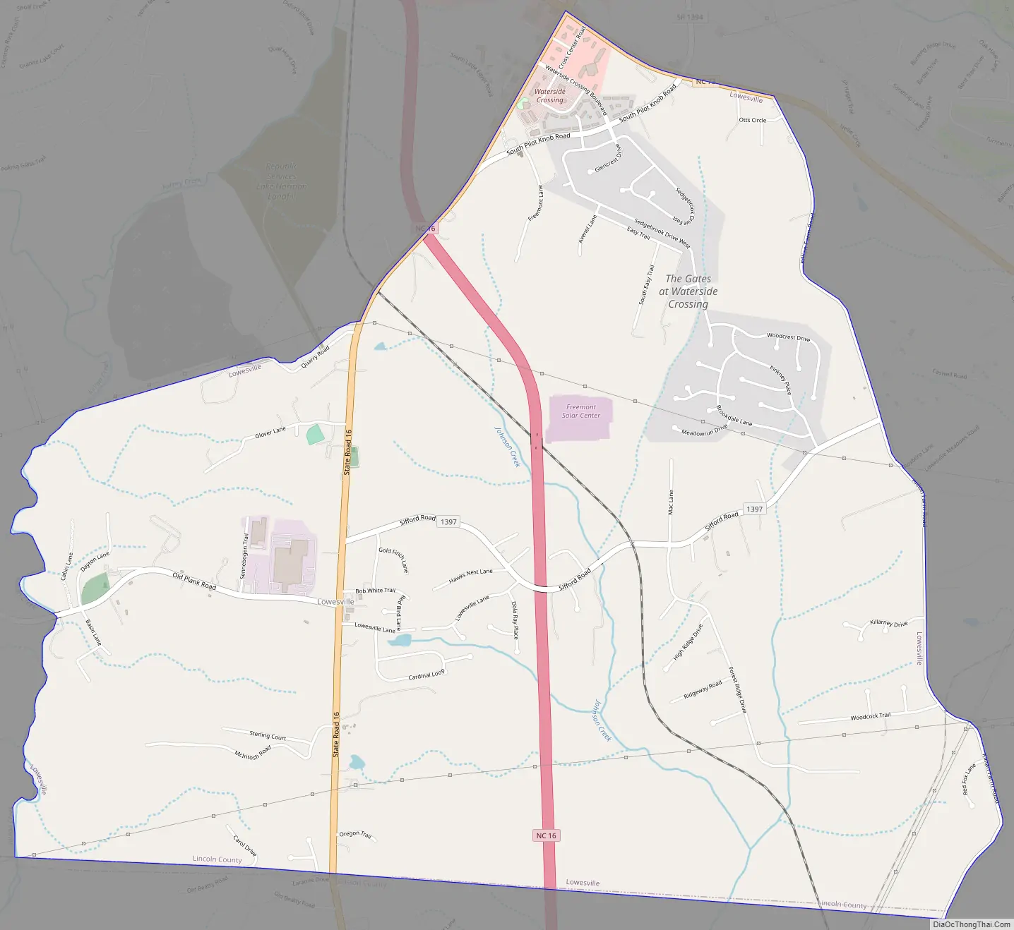
Lowesville Road Map
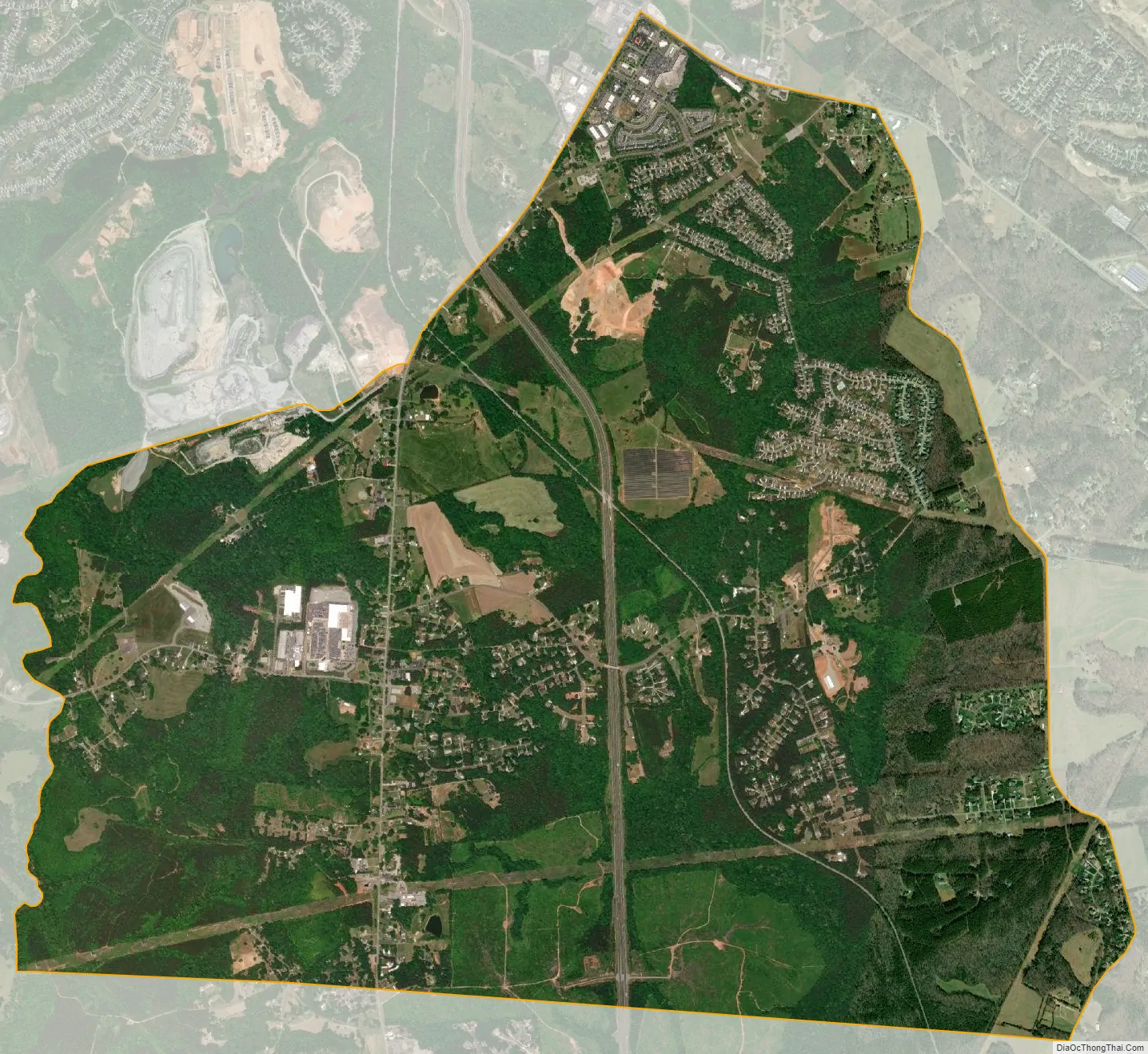
Lowesville city Satellite Map
Geography
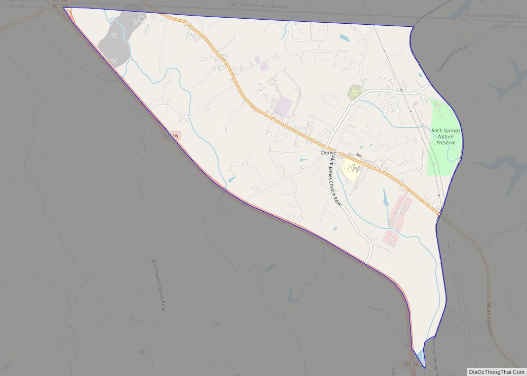
Lowesville is located in the southeast corner of Lincoln County at 35°25′17″N 81°0′9″W / 35.42139°N 81.00250°W / 35.42139; -81.00250 (35.421325, -81.002412). It is bordered to the south by Gaston County. North Carolina Highway 16, a four-lane freeway, passes through the east side of the community, leading northwest 24 miles (39 km) to Newton and southeast 17 miles (27 km) to Charlotte. It is paralleled by old Highway 16 (NC-16 Business), a two-lane road that runs through the center of Lowesville. Access to new Highway 16 is only from North Carolina Highway 73 at the northern end of the CDP or from NC-16 Business in Lucia, 2 miles (3 km) south of the center of Lowesville. NC 73 forms the northern edge of the CDP; it leads east 9 miles (14 km) to Interstate 77 in northern Huntersville and west 15 miles (24 km) to Lincolnton, the Lincoln county seat.
According to the United States Census Bureau, the Lowesville CDP has a total area of 6.8 square miles (17.6 km), of which 0.01 square miles (0.02 km), or 0.10%, are water. Killian Creek forms the western edge of the CDP, and Johnson Creek drains the eastern side of the community. The entire community is in the Catawba River watershed.
Lowesville uses the Stanley, North Carolina, 28164 ZIP code.
See also
Map of North Carolina State and its subdivision:- Alamance
- Alexander
- Alleghany
- Anson
- Ashe
- Avery
- Beaufort
- Bertie
- Bladen
- Brunswick
- Buncombe
- Burke
- Cabarrus
- Caldwell
- Camden
- Carteret
- Caswell
- Catawba
- Chatham
- Cherokee
- Chowan
- Clay
- Cleveland
- Columbus
- Craven
- Cumberland
- Currituck
- Dare
- Davidson
- Davie
- Duplin
- Durham
- Edgecombe
- Forsyth
- Franklin
- Gaston
- Gates
- Graham
- Granville
- Greene
- Guilford
- Halifax
- Harnett
- Haywood
- Henderson
- Hertford
- Hoke
- Hyde
- Iredell
- Jackson
- Johnston
- Jones
- Lee
- Lenoir
- Lincoln
- Macon
- Madison
- Martin
- McDowell
- Mecklenburg
- Mitchell
- Montgomery
- Moore
- Nash
- New Hanover
- Northampton
- Onslow
- Orange
- Pamlico
- Pasquotank
- Pender
- Perquimans
- Person
- Pitt
- Polk
- Randolph
- Richmond
- Robeson
- Rockingham
- Rowan
- Rutherford
- Sampson
- Scotland
- Stanly
- Stokes
- Surry
- Swain
- Transylvania
- Tyrrell
- Union
- Vance
- Wake
- Warren
- Washington
- Watauga
- Wayne
- Wilkes
- Wilson
- Yadkin
- Yancey
- Alabama
- Alaska
- Arizona
- Arkansas
- California
- Colorado
- Connecticut
- Delaware
- District of Columbia
- Florida
- Georgia
- Hawaii
- Idaho
- Illinois
- Indiana
- Iowa
- Kansas
- Kentucky
- Louisiana
- Maine
- Maryland
- Massachusetts
- Michigan
- Minnesota
- Mississippi
- Missouri
- Montana
- Nebraska
- Nevada
- New Hampshire
- New Jersey
- New Mexico
- New York
- North Carolina
- North Dakota
- Ohio
- Oklahoma
- Oregon
- Pennsylvania
- Rhode Island
- South Carolina
- South Dakota
- Tennessee
- Texas
- Utah
- Vermont
- Virginia
- Washington
- West Virginia
- Wisconsin
- Wyoming