Pilot Mountain is a town in Surry County, North Carolina, United States. The population was 1,443 at the 2020 census. It is named for the nearby landmark of Pilot Mountain, a distinctive geological formation. It is believed to be the inspiration for the fictional town of Mount Pilot on The Andy Griffith Show and Mayberry RFD. On the first Saturday of every month, Pilot Mountain hosts one of its staples during the summer months, its monthly cruise-in and car show. Starting in the mid-2000s, this has become one of the larger car shows in the Triad and in Northwestern North Carolina. Cars line up and down Main Street to gather to have fun. Food trucks, live bands with beach music, and downtown stores are all open during the shows that run from May to October. Old cars, trucks, motorcycles, muscle cars, and street rods are welcome to the event. The schedule for dates and bands can be found below
2023 Band Info
| Name: | Pilot Mountain town |
|---|---|
| LSAD Code: | 43 |
| LSAD Description: | town (suffix) |
| State: | North Carolina |
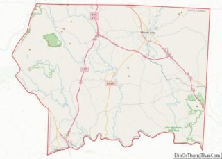
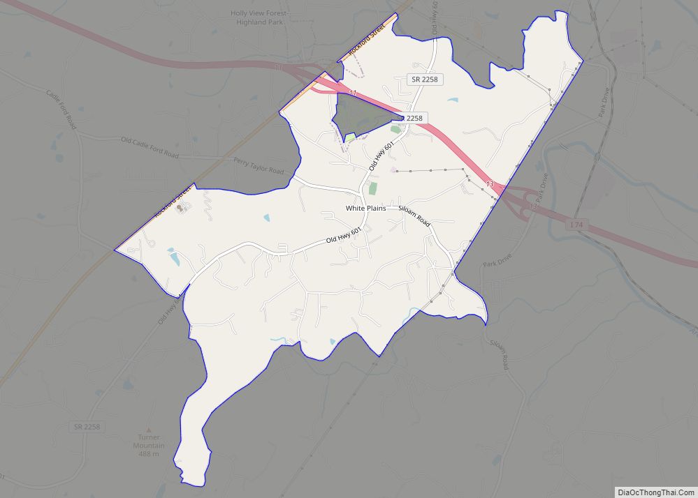
| County: | Surry County |
| Elevation: | 1,158 ft (353 m) |
| Total Area: | 2.06 sq mi (5.33 km²) |
| Land Area: | 2.04 sq mi (5.27 km²) |
| Water Area: | 0.02 sq mi (0.06 km²) |
| Total Population: | 1,440 |
| Population Density: | 707.27/sq mi (273.08/km²) |
| ZIP code: | 27041 |
| Area code: | 336 |
| FIPS code: | 3751820 |
| GNISfeature ID: | 0992211 |
| Website: | www.townofpilotmountain.com |
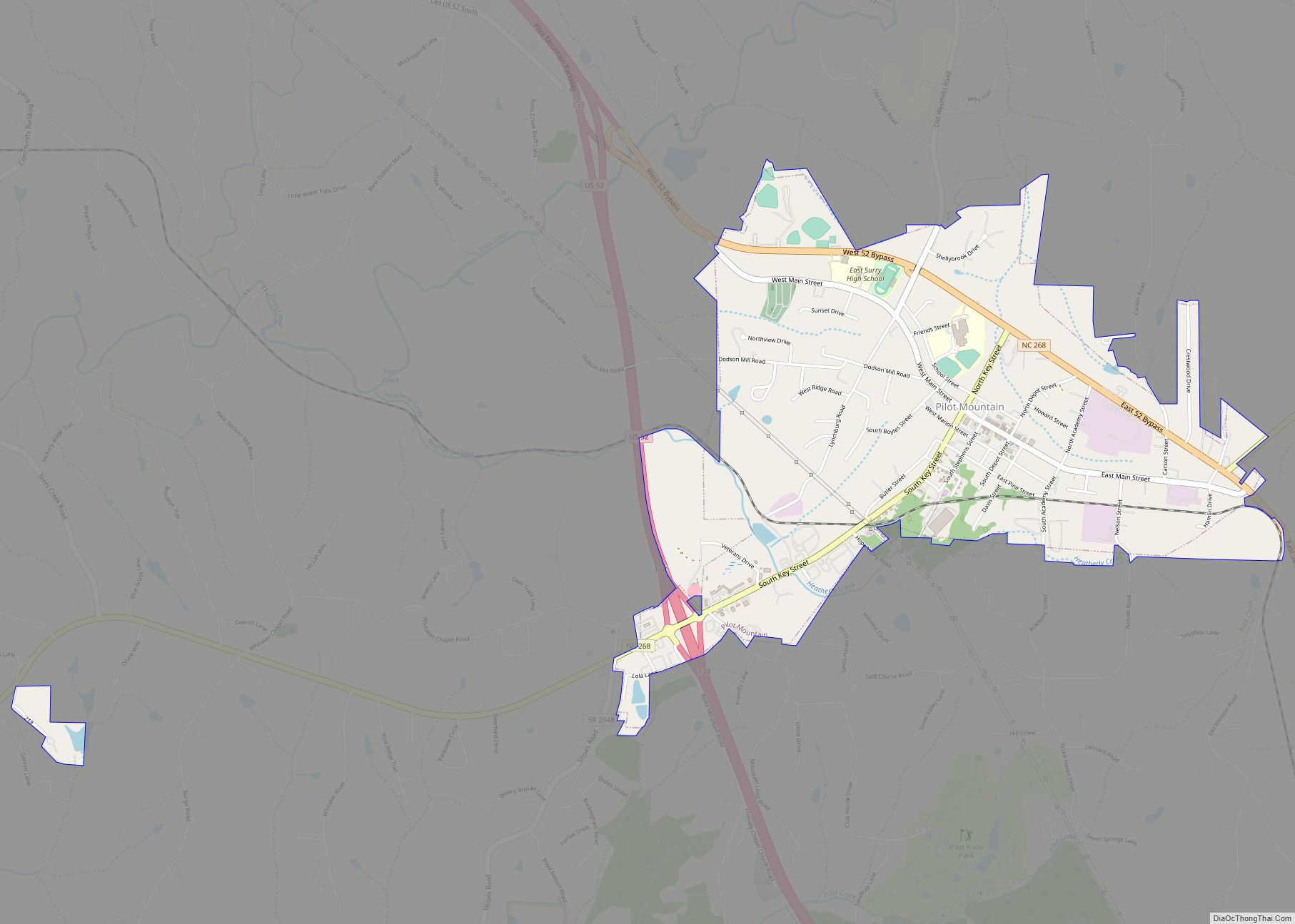
Online Interactive Map
Click on ![]() to view map in "full screen" mode.
to view map in "full screen" mode.
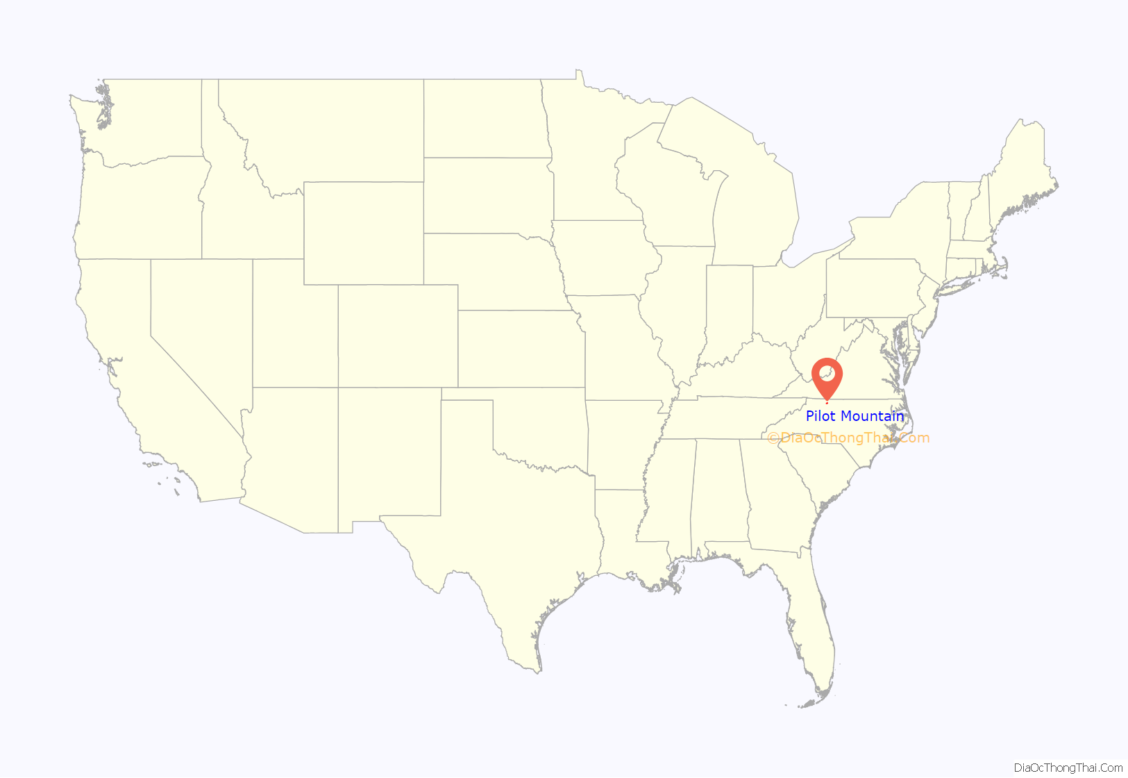
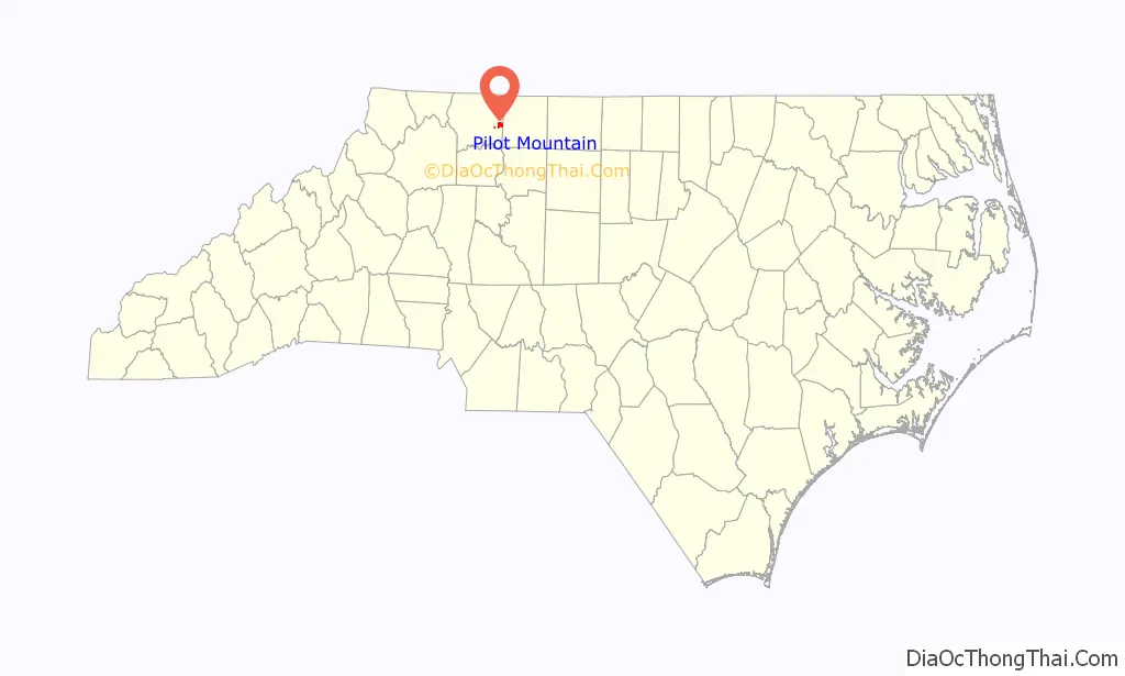
Pilot Mountain location map. Where is Pilot Mountain town?
History
The Bank of Pilot Mountain was listed on the National Register of Historic Places in 1997.
Pilot Mountain Road Map
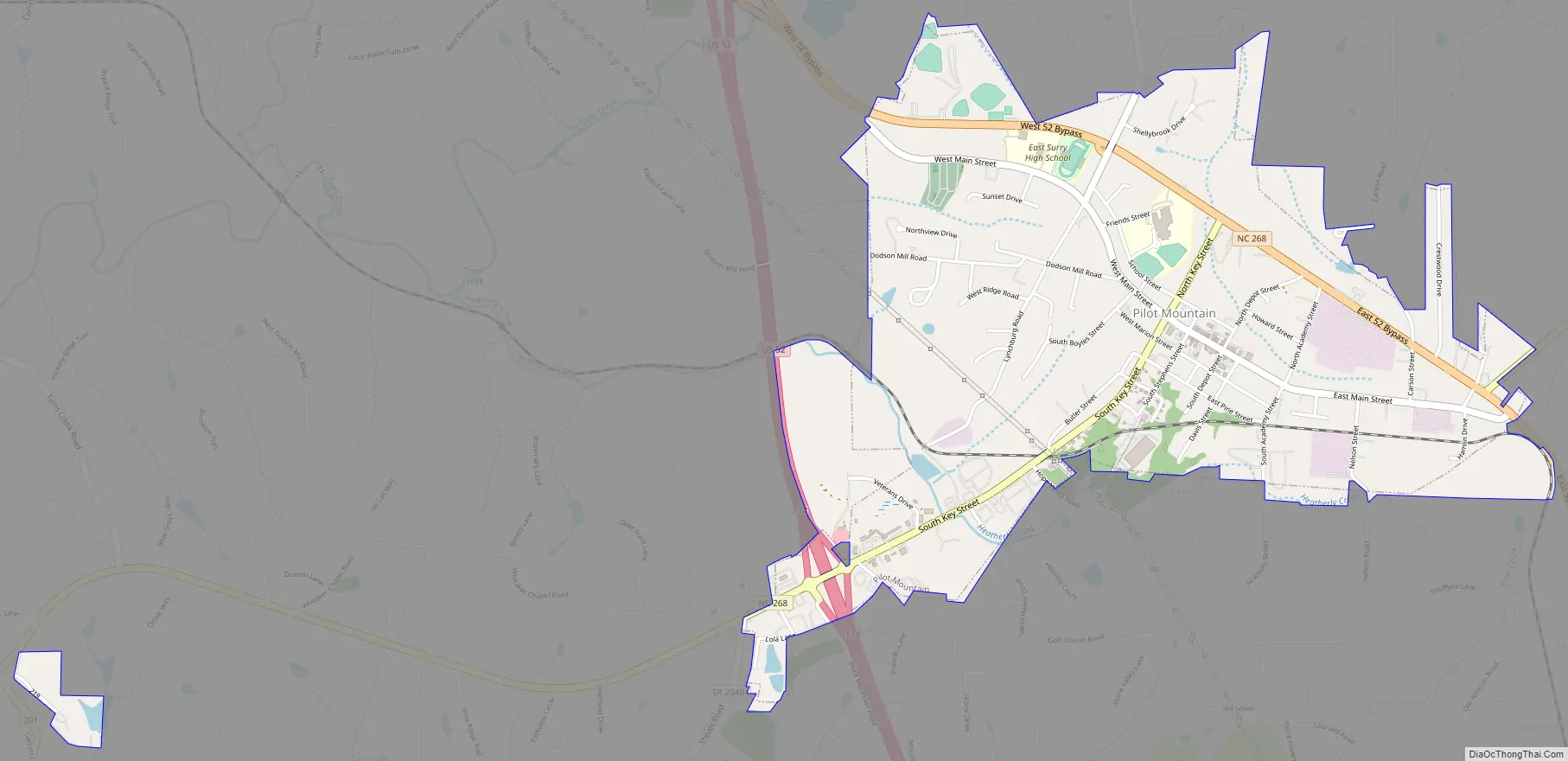
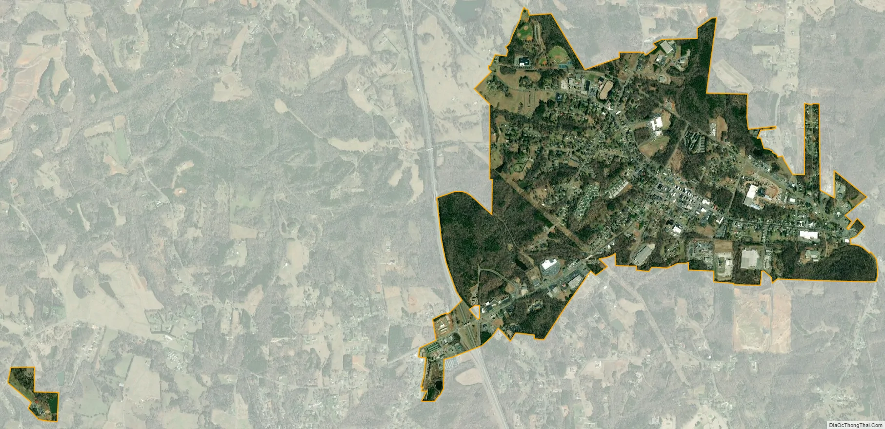
Pilot Mountain city Satellite Map
Geography
Pilot Mountain is located at 36°23′4″N 80°28′9″W / 36.38444°N 80.46917°W / 36.38444; -80.46917 (36.384407, -80.469083).
According to the United States Census Bureau, the town has a total area of 1.7 square miles (4.4 km), all land.
See also
Map of North Carolina State and its subdivision:- Alamance
- Alexander
- Alleghany
- Anson
- Ashe
- Avery
- Beaufort
- Bertie
- Bladen
- Brunswick
- Buncombe
- Burke
- Cabarrus
- Caldwell
- Camden
- Carteret
- Caswell
- Catawba
- Chatham
- Cherokee
- Chowan
- Clay
- Cleveland
- Columbus
- Craven
- Cumberland
- Currituck
- Dare
- Davidson
- Davie
- Duplin
- Durham
- Edgecombe
- Forsyth
- Franklin
- Gaston
- Gates
- Graham
- Granville
- Greene
- Guilford
- Halifax
- Harnett
- Haywood
- Henderson
- Hertford
- Hoke
- Hyde
- Iredell
- Jackson
- Johnston
- Jones
- Lee
- Lenoir
- Lincoln
- Macon
- Madison
- Martin
- McDowell
- Mecklenburg
- Mitchell
- Montgomery
- Moore
- Nash
- New Hanover
- Northampton
- Onslow
- Orange
- Pamlico
- Pasquotank
- Pender
- Perquimans
- Person
- Pitt
- Polk
- Randolph
- Richmond
- Robeson
- Rockingham
- Rowan
- Rutherford
- Sampson
- Scotland
- Stanly
- Stokes
- Surry
- Swain
- Transylvania
- Tyrrell
- Union
- Vance
- Wake
- Warren
- Washington
- Watauga
- Wayne
- Wilkes
- Wilson
- Yadkin
- Yancey
- Alabama
- Alaska
- Arizona
- Arkansas
- California
- Colorado
- Connecticut
- Delaware
- District of Columbia
- Florida
- Georgia
- Hawaii
- Idaho
- Illinois
- Indiana
- Iowa
- Kansas
- Kentucky
- Louisiana
- Maine
- Maryland
- Massachusetts
- Michigan
- Minnesota
- Mississippi
- Missouri
- Montana
- Nebraska
- Nevada
- New Hampshire
- New Jersey
- New Mexico
- New York
- North Carolina
- North Dakota
- Ohio
- Oklahoma
- Oregon
- Pennsylvania
- Rhode Island
- South Carolina
- South Dakota
- Tennessee
- Texas
- Utah
- Vermont
- Virginia
- Washington
- West Virginia
- Wisconsin
- Wyoming