Pinebluff is a town in Moore County, North Carolina, United States. The population was 1,337 at the 2010 census.
| Name: | Pinebluff town |
|---|---|
| LSAD Code: | 43 |
| LSAD Description: | town (suffix) |
| State: | North Carolina |
| County: | Moore County |
| Elevation: | 443 ft (135 m) |
| Total Area: | 2.64 sq mi (6.85 km²) |
| Land Area: | 2.62 sq mi (6.77 km²) |
| Water Area: | 0.03 sq mi (0.07 km²) |
| Total Population: | 1,473 |
| Population Density: | 563.07/sq mi (217.42/km²) |
| ZIP code: | 28373 |
| FIPS code: | 3751840 |
| GNISfeature ID: | 1021932 |
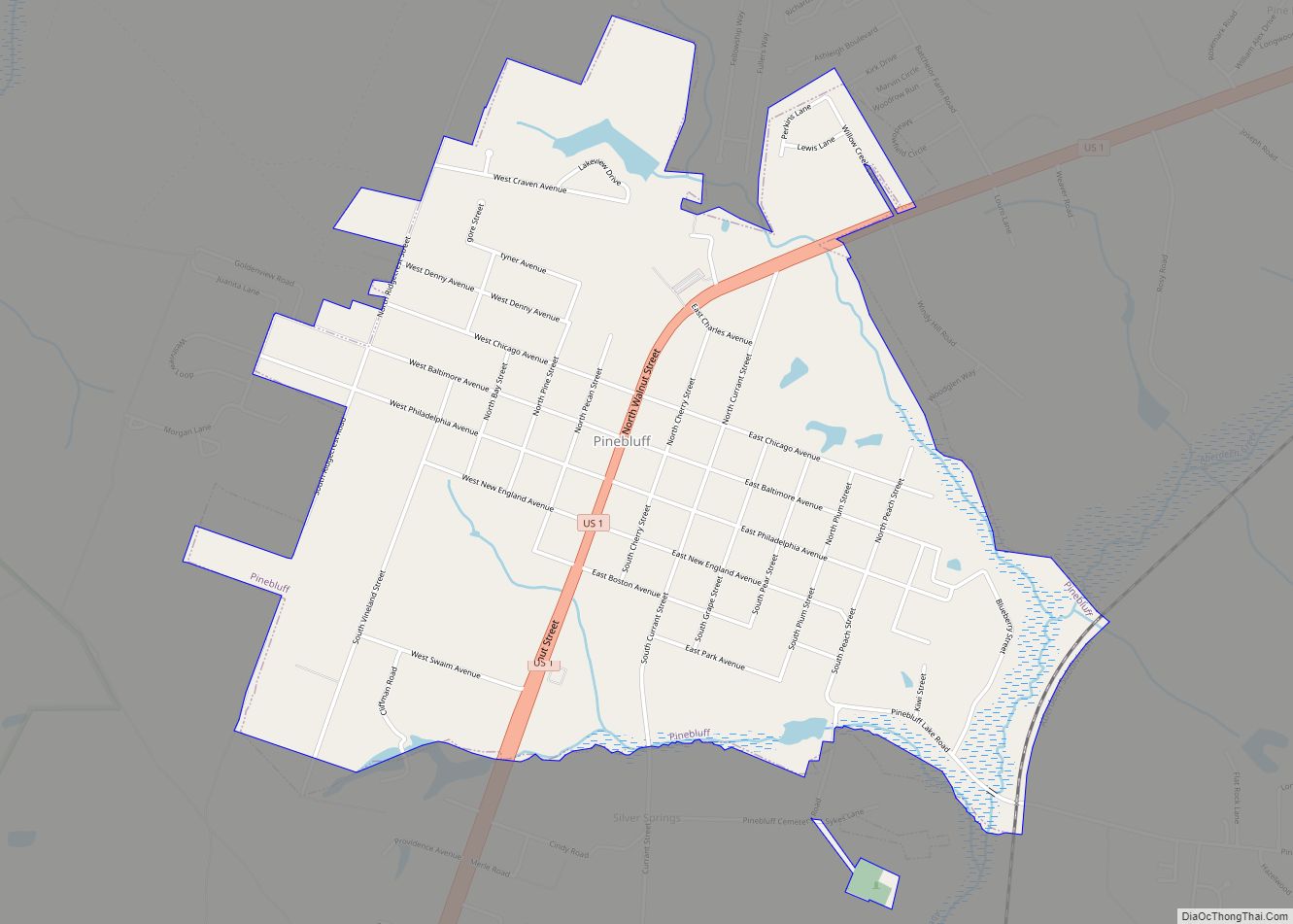
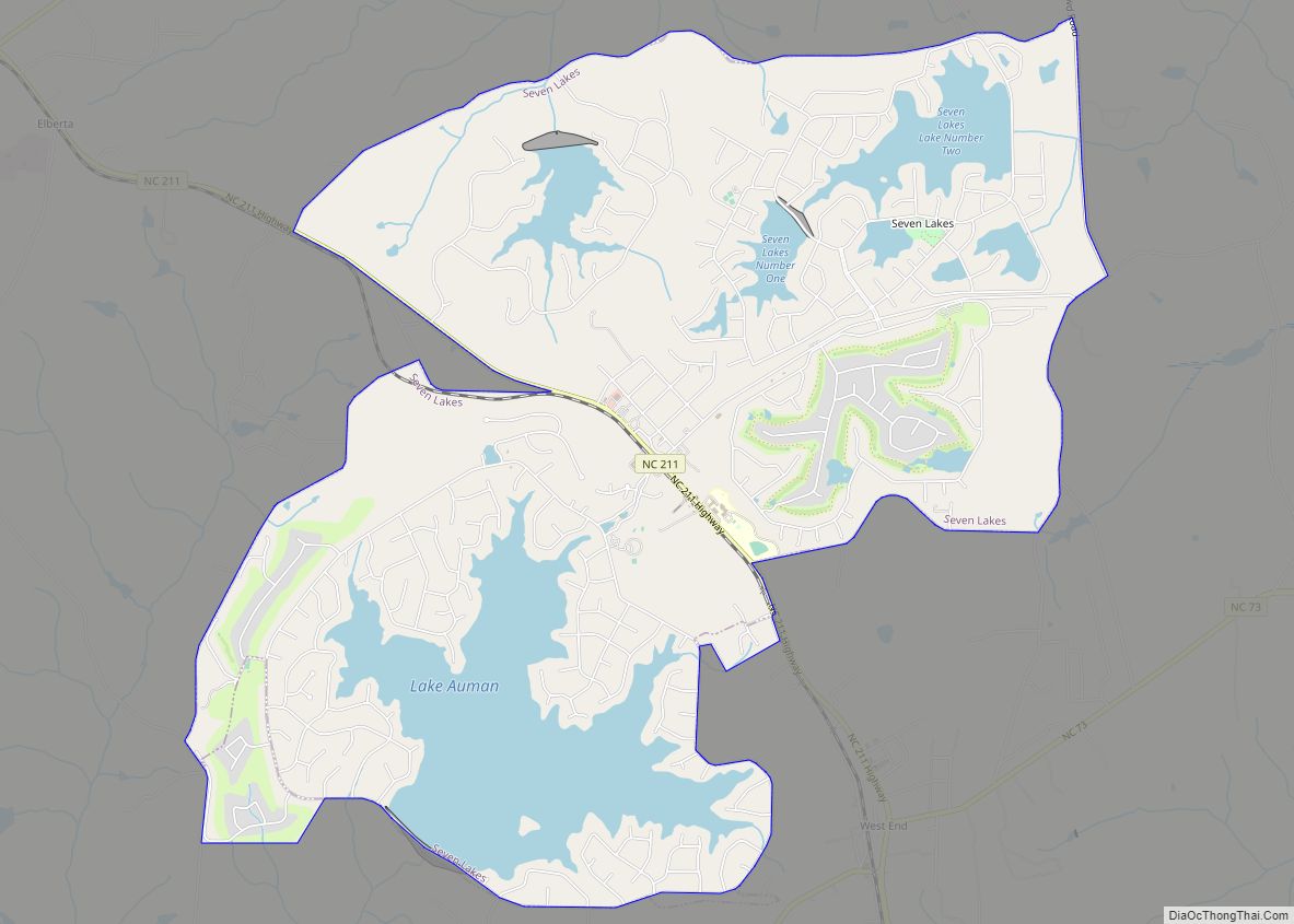
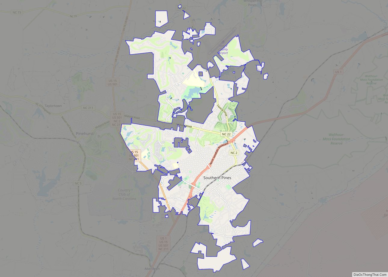
Online Interactive Map
Click on ![]() to view map in "full screen" mode.
to view map in "full screen" mode.
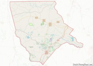
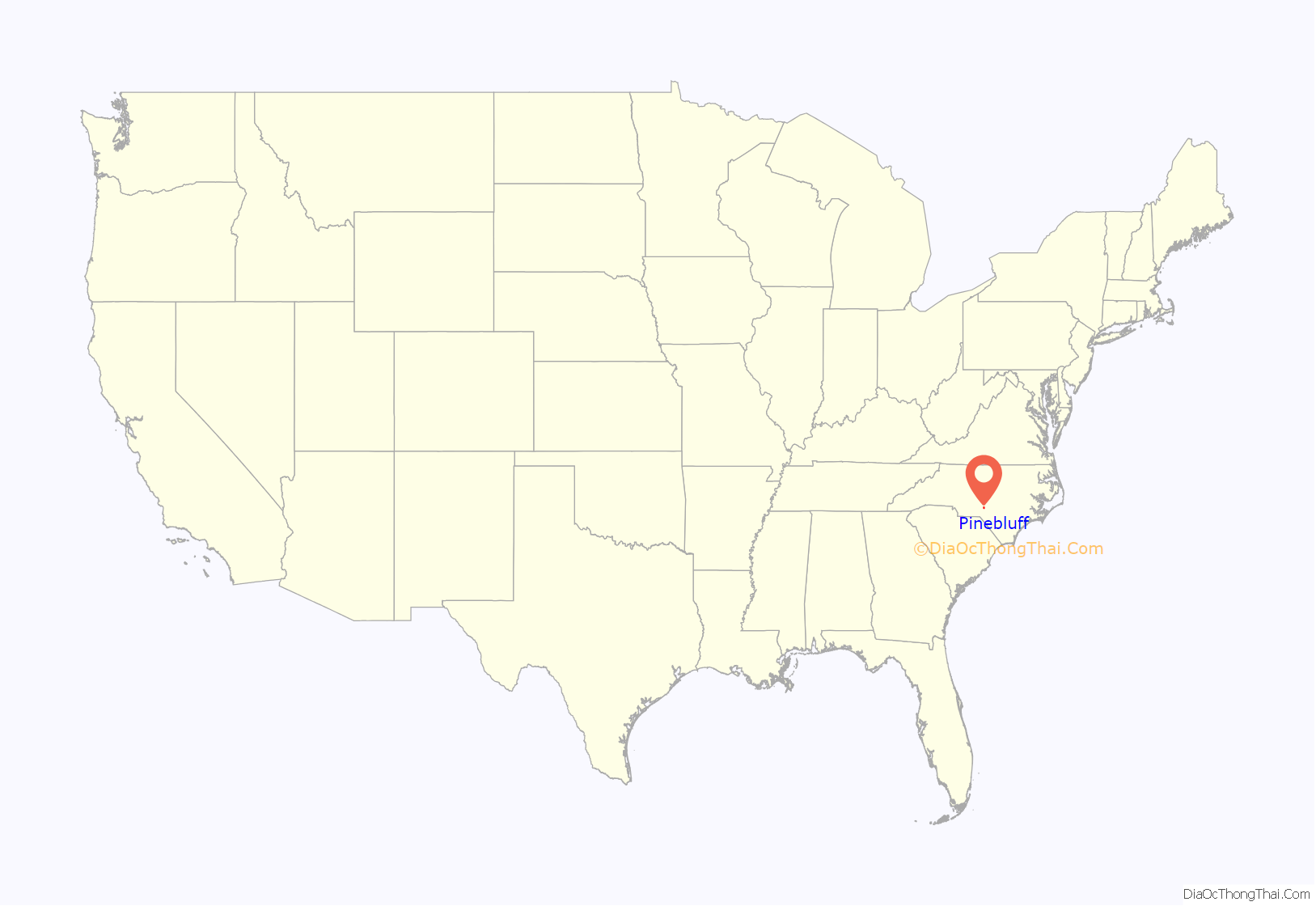
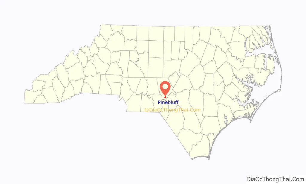
Pinebluff location map. Where is Pinebluff town?
History
Pinebluff was once a regional resort area during the early 1900s, enjoying even greater renown than Pinehurst Resort at the time. After an uncontrollable fire, the town was permanently damaged, and is currently a small residential area. As of 1909, Pinebluff was a sundown town, where African Americans were not allowed to live or stay overnight. The Lincoln Park School and McLeod Family Rural Complex are listed on the National Register of Historic Places.
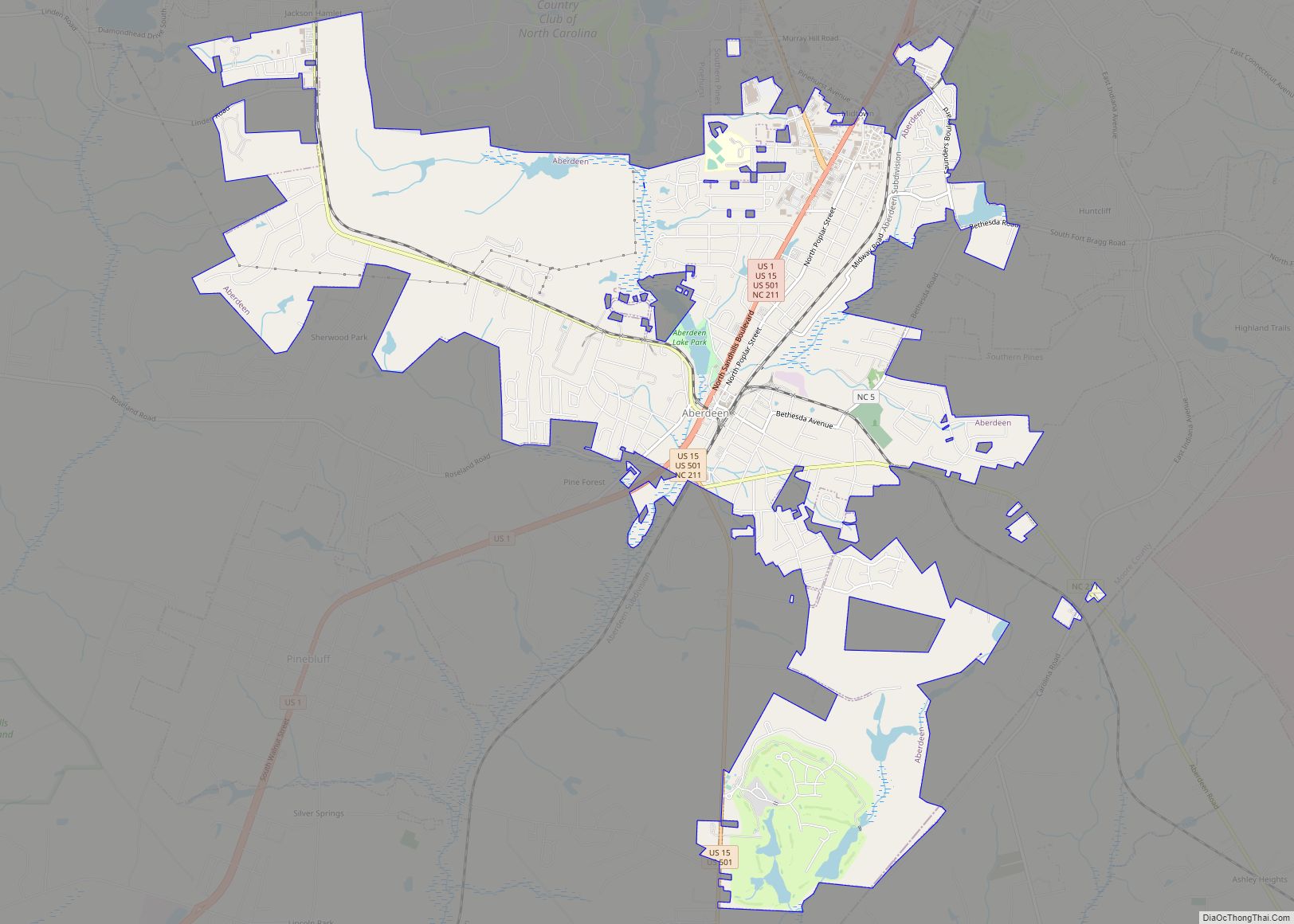
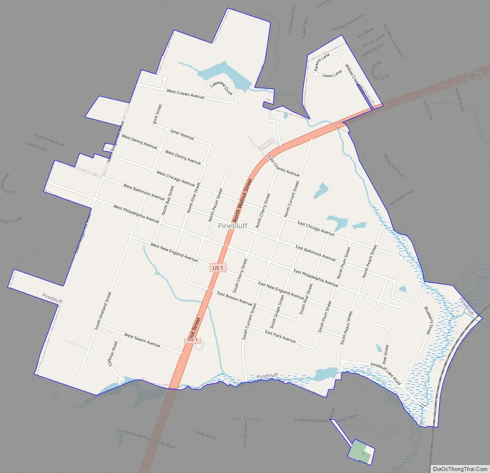
Pinebluff Road Map
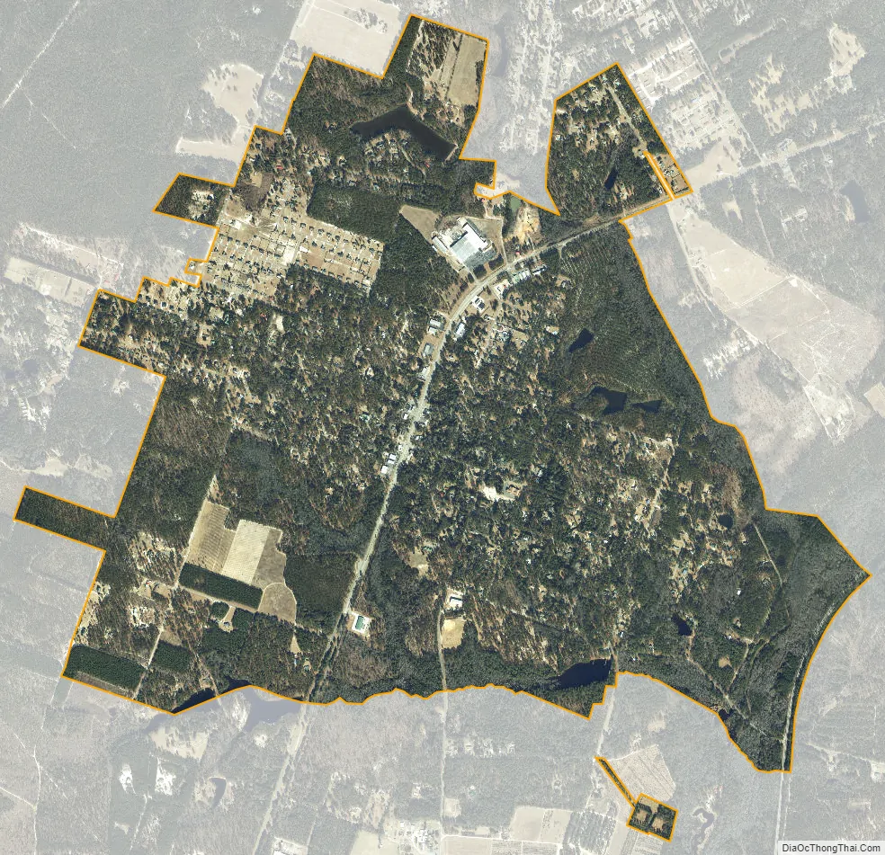
Pinebluff city Satellite Map
Geography
Pinebluff is located at 35°6′24″N 79°28′13″W / 35.10667°N 79.47028°W / 35.10667; -79.47028 (35.106739, -79.470303). According to the United States Census Bureau, the town has a total area of 2.4 square miles (6.2 km), of which 2.4 square miles (6.2 km) is land and 0.04 square mile (0.1 km) (1.24%) is water.
See also
Map of North Carolina State and its subdivision:- Alamance
- Alexander
- Alleghany
- Anson
- Ashe
- Avery
- Beaufort
- Bertie
- Bladen
- Brunswick
- Buncombe
- Burke
- Cabarrus
- Caldwell
- Camden
- Carteret
- Caswell
- Catawba
- Chatham
- Cherokee
- Chowan
- Clay
- Cleveland
- Columbus
- Craven
- Cumberland
- Currituck
- Dare
- Davidson
- Davie
- Duplin
- Durham
- Edgecombe
- Forsyth
- Franklin
- Gaston
- Gates
- Graham
- Granville
- Greene
- Guilford
- Halifax
- Harnett
- Haywood
- Henderson
- Hertford
- Hoke
- Hyde
- Iredell
- Jackson
- Johnston
- Jones
- Lee
- Lenoir
- Lincoln
- Macon
- Madison
- Martin
- McDowell
- Mecklenburg
- Mitchell
- Montgomery
- Moore
- Nash
- New Hanover
- Northampton
- Onslow
- Orange
- Pamlico
- Pasquotank
- Pender
- Perquimans
- Person
- Pitt
- Polk
- Randolph
- Richmond
- Robeson
- Rockingham
- Rowan
- Rutherford
- Sampson
- Scotland
- Stanly
- Stokes
- Surry
- Swain
- Transylvania
- Tyrrell
- Union
- Vance
- Wake
- Warren
- Washington
- Watauga
- Wayne
- Wilkes
- Wilson
- Yadkin
- Yancey
- Alabama
- Alaska
- Arizona
- Arkansas
- California
- Colorado
- Connecticut
- Delaware
- District of Columbia
- Florida
- Georgia
- Hawaii
- Idaho
- Illinois
- Indiana
- Iowa
- Kansas
- Kentucky
- Louisiana
- Maine
- Maryland
- Massachusetts
- Michigan
- Minnesota
- Mississippi
- Missouri
- Montana
- Nebraska
- Nevada
- New Hampshire
- New Jersey
- New Mexico
- New York
- North Carolina
- North Dakota
- Ohio
- Oklahoma
- Oregon
- Pennsylvania
- Rhode Island
- South Carolina
- South Dakota
- Tennessee
- Texas
- Utah
- Vermont
- Virginia
- Washington
- West Virginia
- Wisconsin
- Wyoming