Church Hill is a city in Hawkins County, Tennessee, United States. The population was 6,998 at the 2020 census and 6,737 at the 2010 census. It is part of the Kingsport–Bristol (TN)–Bristol (VA) Metropolitan Statistical Area, which is a component of the Johnson City–Kingsport–Bristol, TN-VA Combined Statistical Area – commonly known as the “Tri-Cities” region. It is the largest municipality located entirely within Hawkins County.
| Name: | Church Hill city |
|---|---|
| LSAD Code: | 25 |
| LSAD Description: | city (suffix) |
| State: | Tennessee |
| County: | Hawkins County |
| Elevation: | 1,217 ft (371 m) |
| Total Area: | 9.86 sq mi (25.52 km²) |
| Land Area: | 9.44 sq mi (24.44 km²) |
| Water Area: | 0.42 sq mi (1.09 km²) |
| Total Population: | 6,998 |
| Population Density: | 741.71/sq mi (286.39/km²) |
| ZIP code: | 37642, 37645 |
| Area code: | 423 |
| FIPS code: | 4714980 |
| GNISfeature ID: | 1305931 |
| Website: | www.churchhilltn.gov |
Online Interactive Map
Click on ![]() to view map in "full screen" mode.
to view map in "full screen" mode.
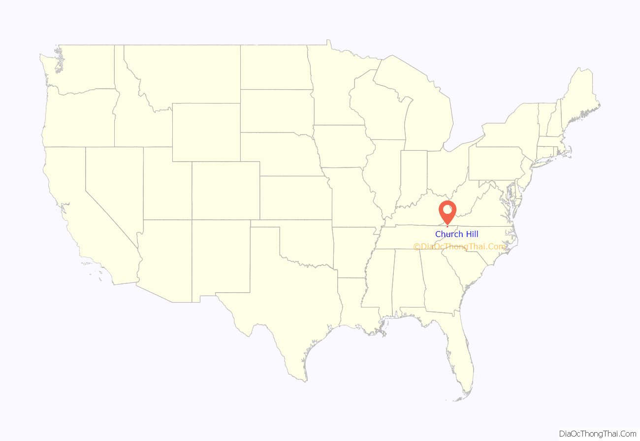
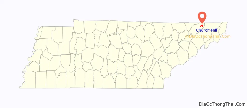
Church Hill location map. Where is Church Hill city?
History
The community was established as a trading post and stagecoach stop called Spencer’s Mill and Patterson Mill in the late 18th century. The name “Church Hill” came later, following the establishment of a Methodist church “on the hill” overlooking the Holston River valley. The church still stands today on Grandview Street. The city of Church Hill was incorporated in 1958.
One of Church Hill’s most notable landmarks is the New Canton Plantation and its antebellum mansion, Canton Hall, owned by the Hord family. Other landmarks include Smith Place, built in the early 20th century, and the former site of Carter’s Store, a 1770s-era trading outpost established by Tennessee pioneer John Carter.
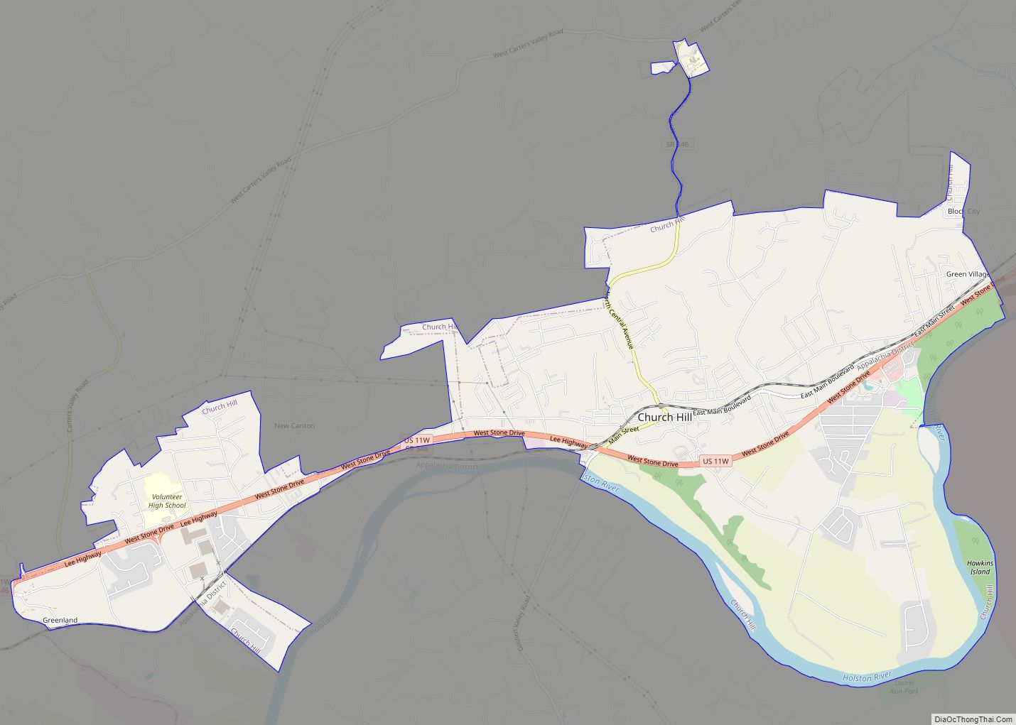
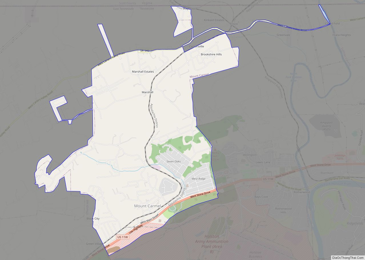
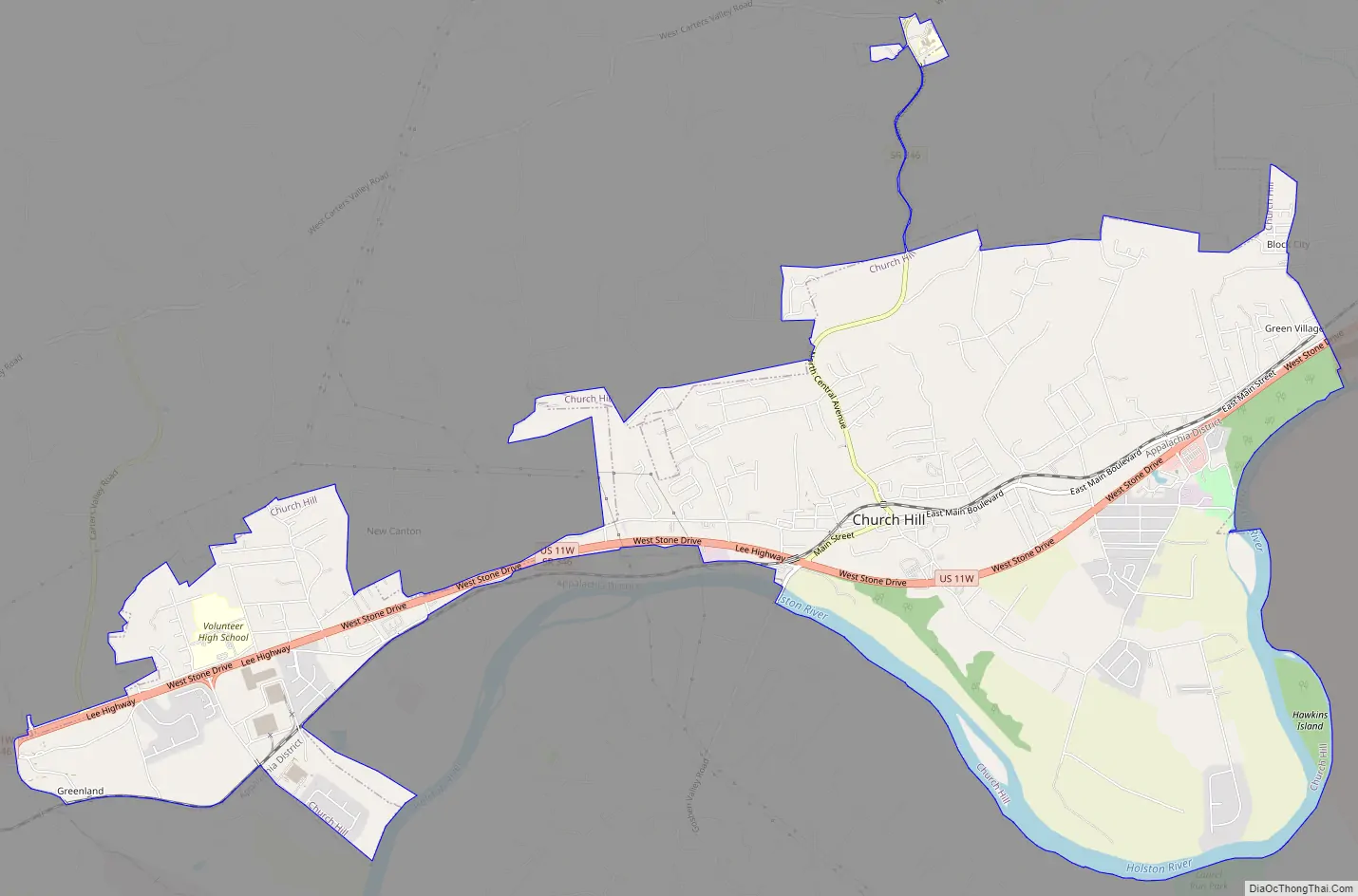
Church Hill Road Map
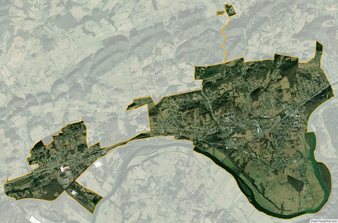
Church Hill city Satellite Map
Geography
Church Hill is located in eastern Hawkins County at 36°31′15″N 82°43′32″W / 36.52083°N 82.72556°W / 36.52083; -82.72556 (36.520845, -82.725472). The city is situated among rolling hills on the northern portion of Smith Bend, overlooking the Holston River. The city is bordered by Mount Carmel to the northeast, and the Holston Army Ammunition Plant lies to the southeast, across the Holston River. Bays Mountain, a prominent Ridge-and-Valley formation, dominates the horizon to the south.
U.S. Route 11W connects Church Hill with Rogersville to the southwest and the Tri-Cities area to the northeast. State Route 346 intersects 11W near the center of the city.
According to the United States Census Bureau, the city has a total area of 9.8 square miles (25.4 km), of which 9.3 square miles (24.2 km) are land and 0.46 square miles (1.2 km), or 4.63%, are water.
See also
Map of Tennessee State and its subdivision:- Anderson
- Bedford
- Benton
- Bledsoe
- Blount
- Bradley
- Campbell
- Cannon
- Carroll
- Carter
- Cheatham
- Chester
- Claiborne
- Clay
- Cocke
- Coffee
- Crockett
- Cumberland
- Davidson
- Decatur
- DeKalb
- Dickson
- Dyer
- Fayette
- Fentress
- Franklin
- Gibson
- Giles
- Grainger
- Greene
- Grundy
- Hamblen
- Hamilton
- Hancock
- Hardeman
- Hardin
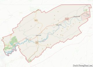
- Hawkins
- Haywood
- Henderson
- Henry
- Hickman
- Houston
- Humphreys
- Jackson
- Jefferson
- Johnson
- Knox
- Lake
- Lauderdale
- Lawrence
- Lewis
- Lincoln
- Loudon
- Macon
- Madison
- Marion
- Marshall
- Maury
- McMinn
- McNairy
- Meigs
- Monroe
- Montgomery
- Moore
- Morgan
- Obion
- Overton
- Perry
- Pickett
- Polk
- Putnam
- Rhea
- Roane
- Robertson
- Rutherford
- Scott
- Sequatchie
- Sevier
- Shelby
- Smith
- Stewart
- Sullivan
- Sumner
- Tipton
- Trousdale
- Unicoi
- Union
- Van Buren
- Warren
- Washington
- Wayne
- Weakley
- White
- Williamson
- Wilson
- Alabama
- Alaska
- Arizona
- Arkansas
- California
- Colorado
- Connecticut
- Delaware
- District of Columbia
- Florida
- Georgia
- Hawaii
- Idaho
- Illinois
- Indiana
- Iowa
- Kansas
- Kentucky
- Louisiana
- Maine
- Maryland
- Massachusetts
- Michigan
- Minnesota
- Mississippi
- Missouri
- Montana
- Nebraska
- Nevada
- New Hampshire
- New Jersey
- New Mexico
- New York
- North Carolina
- North Dakota
- Ohio
- Oklahoma
- Oregon
- Pennsylvania
- Rhode Island
- South Carolina
- South Dakota
- Tennessee
- Texas
- Utah
- Vermont
- Virginia
- Washington
- West Virginia
- Wisconsin
- Wyoming