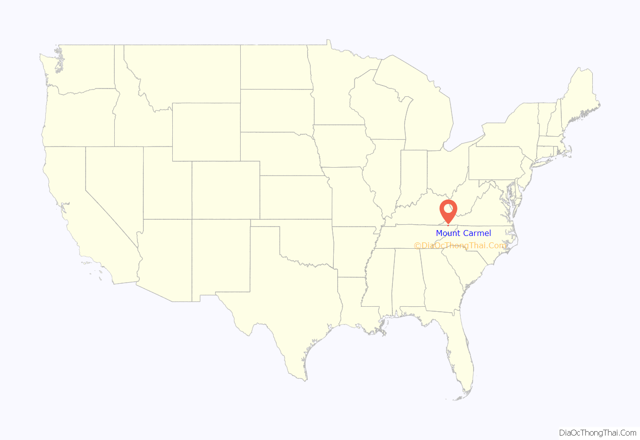
Mount Carmel is a city in Hawkins County, Tennessee, United States. As of the 2010 census, the population was 5,429, an increase of 634 since the 2000 census. It is part of the Kingsport–Bristol (TN)–Bristol (VA) Metropolitan Statistical Area, which is a component of the Johnson City–Kingsport–Bristol, TN-VA Combined Statistical Area – commonly known as the “Tri-Cities” region.
| Name: | Mount Carmel town |
|---|---|
| LSAD Code: | 43 |
| LSAD Description: | town (suffix) |
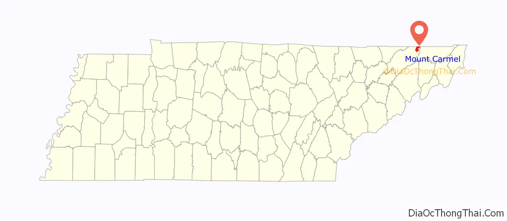
| State: | Tennessee |
| County: | Hawkins County |
| Incorporated: | 1961 |
| Elevation: | 1,365 ft (416 m) |
| Total Area: | 6.65 sq mi (17.22 km²) |
| Land Area: | 6.64 sq mi (17.21 km²) |
| Water Area: | 0.01 sq mi (0.02 km²) |
| Total Population: | 5,473 |
| Population Density: | 823.87/sq mi (318.10/km²) |
| ZIP code: | 37645 |
| Area code: | 423 |
| FIPS code: | 4750580 |
| GNISfeature ID: | 1294565 |
| Website: | www.mountcarmeltn.gov |
Online Interactive Map
Click on ![]() to view map in "full screen" mode.
to view map in "full screen" mode.
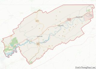
Mount Carmel location map. Where is Mount Carmel town?
History
Mount Carmel is in Hawkins County, which was once called Spencer county, and was a part of the State of Franklin. The State of Franklin comprised eight counties in western North Carolina in the late 1700s. Governed by John Sevier, it operated as an independent state for four years before it ultimately rejoined North Carolina.
Mount Carmel once garnered national attention in the mid-2000s because of a CBS News story stating the town’s geography is situated on only one side of the main highway through the area. Since then, the city has secured property on the other side of the road and has built a cemetery.
Since the 1980s, the community has faced economic hardship due to political turmoil in its government operations, and the outsourcing of its retail and municipal services to neighboring Church Hill and Kingsport. In 2020, the city would begin discussions of connecting to either of the two cities’ sewer systems following the Mount Carmel sewer plant going insolvent. Calls for Mount Carmel to merge into Kingsport or Church Hill have been raised since 2021 because of the financial instability.
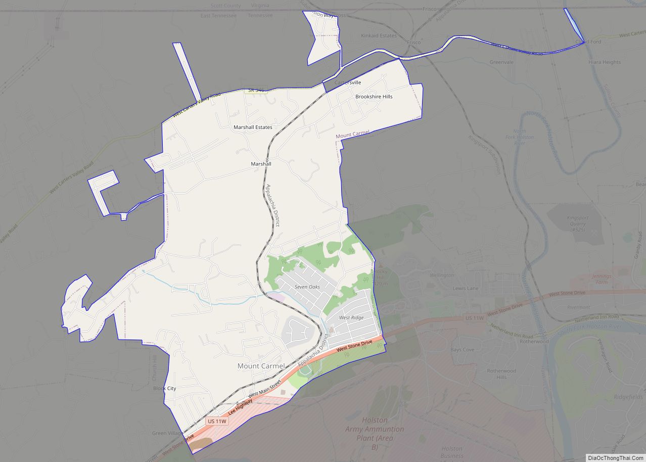
Mount Carmel Road Map
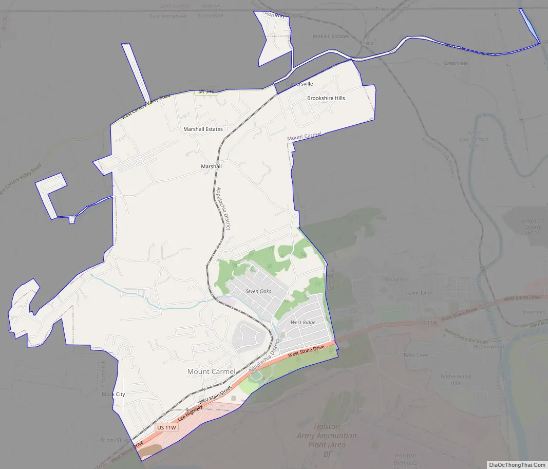
Mount Carmel city Satellite Map

Geography
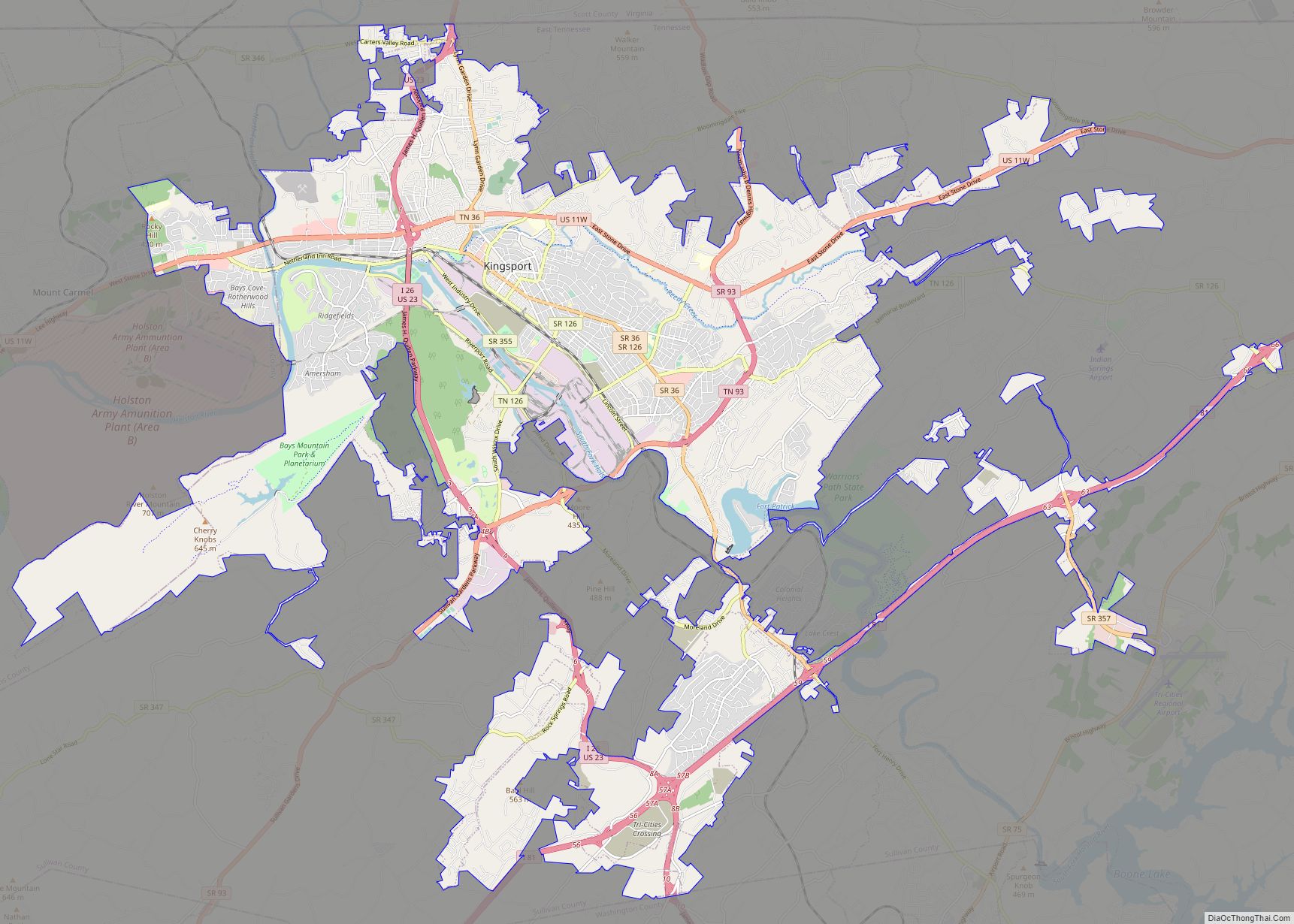
Mount Carmel is located in eastern Hawkins County at 36°33′56″N 82°39′12″W / 36.56556°N 82.65333°W / 36.56556; -82.65333 (36.565666, -82.653265). It is bordered to the east by the city of Kingsport and to the west by the city of Church Hill. U.S. Route 11W is the main highway through the town, leading east into Kingsport and southwest 22 miles (35 km) to Rogersville, the Hawkins county seat.
According to the United States Census Bureau, Mount Carmel has a total area of 6.9 square miles (18.0 km), of which 0.01 square miles (0.02 km), or 0.11%, are water.
See also
Map of Tennessee State and its subdivision:- Anderson
- Bedford
- Benton
- Bledsoe
- Blount
- Bradley
- Campbell
- Cannon
- Carroll
- Carter
- Cheatham
- Chester
- Claiborne
- Clay
- Cocke
- Coffee
- Crockett
- Cumberland
- Davidson
- Decatur
- DeKalb
- Dickson
- Dyer
- Fayette
- Fentress
- Franklin
- Gibson
- Giles
- Grainger
- Greene
- Grundy
- Hamblen
- Hamilton
- Hancock
- Hardeman
- Hardin
- Hawkins
- Haywood
- Henderson
- Henry
- Hickman
- Houston
- Humphreys
- Jackson
- Jefferson
- Johnson
- Knox
- Lake
- Lauderdale
- Lawrence
- Lewis
- Lincoln
- Loudon
- Macon
- Madison
- Marion
- Marshall
- Maury
- McMinn
- McNairy
- Meigs
- Monroe
- Montgomery
- Moore
- Morgan
- Obion
- Overton
- Perry
- Pickett
- Polk
- Putnam
- Rhea
- Roane
- Robertson
- Rutherford
- Scott
- Sequatchie
- Sevier
- Shelby
- Smith
- Stewart
- Sullivan
- Sumner
- Tipton
- Trousdale
- Unicoi
- Union
- Van Buren
- Warren
- Washington
- Wayne
- Weakley
- White
- Williamson
- Wilson
- Alabama
- Alaska
- Arizona
- Arkansas
- California
- Colorado
- Connecticut
- Delaware
- District of Columbia
- Florida
- Georgia
- Hawaii
- Idaho
- Illinois
- Indiana
- Iowa
- Kansas
- Kentucky
- Louisiana
- Maine
- Maryland
- Massachusetts
- Michigan
- Minnesota
- Mississippi
- Missouri
- Montana
- Nebraska
- Nevada
- New Hampshire
- New Jersey
- New Mexico
- New York
- North Carolina
- North Dakota
- Ohio
- Oklahoma
- Oregon
- Pennsylvania
- Rhode Island
- South Carolina
- South Dakota
- Tennessee
- Texas
- Utah
- Vermont
- Virginia
- Washington
- West Virginia
- Wisconsin
- Wyoming