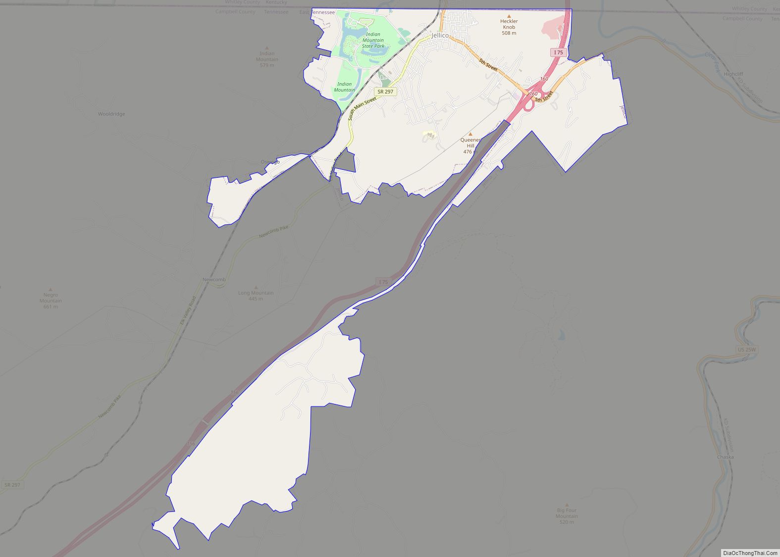
Jellico is a city in Campbell County, Tennessee, United States, on the state border with Kentucky, 58 miles (93 km) by road north of Knoxville. The population was 2,355 at the 2010 census.
| Name: | Jellico city |
|---|---|
| LSAD Code: | 25 |
| LSAD Description: | city (suffix) |
| State: | Tennessee |
| County: | Campbell County |
| Founded: | 1878 |
| Incorporated: | 1883 |
| Elevation: | 971 ft (296 m) |
| Total Area: | 6.29 sq mi (16.29 km²) |
| Land Area: | 6.22 sq mi (16.11 km²) |
| Water Area: | 0.07 sq mi (0.19 km²) |
| Total Population: | 2,154 |
| Population Density: | 346.36/sq mi (133.74/km²) |
| ZIP code: | 37762 |
| Area code: | 423 |
| FIPS code: | 4738020 |
| GNISfeature ID: | 1289336 |
Online Interactive Map
Click on ![]() to view map in "full screen" mode.
to view map in "full screen" mode.
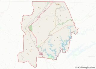
Jellico location map. Where is Jellico city?


History
The name “Jellico” is a local alteration of “angelica”, the name of an herb that grows in abundance in the surrounding mountains. The name was first applied to the mountains to the west and to the mountains’ main drainage, Jellico Creek, which passes 5 miles (8 km) west of the city of Jellico and empties into the Cumberland River near Williamsburg, Kentucky.
In the early 1880s, a high quality bituminous coal was discovered in the Jellico Mountains, and with the completion of railroad tracks to the area in 1883, coal mines quickly sprang up throughout the area. The city of Jellico was initially founded as “Smithburg” in 1878 but changed its name to “Jellico” in 1883 to capitalize on the growing popularity of Jellico coal. The city was incorporated on March 7, 1883.
Throughout the 1890s and early 1900s, Jellico was one of the most productive coal fields in Kentucky and Tennessee. In 1906, a railroad car packed with dynamite exploded in Jellico, killing eight and destroying part of the town. The town quickly recovered, however, and many of the buildings in the Main Street area date from this period.
On July 6, 1944, at High Cliff (3 miles east of Jellico), a troop train carrying new recruits on the Louisville and Nashville Railroad derailed, causing the locomotive and 4 leading cars to fall 50 feet into Clear Fork; 35 people were killed and 100 more injured.
In 1971, Indian Mountain State Park was created at the site of a reclaimed strip mine in western Jellico. In 1999, much of North and South Main Street was placed on the National Register of Historic Places as the Jellico Commercial Historic District.
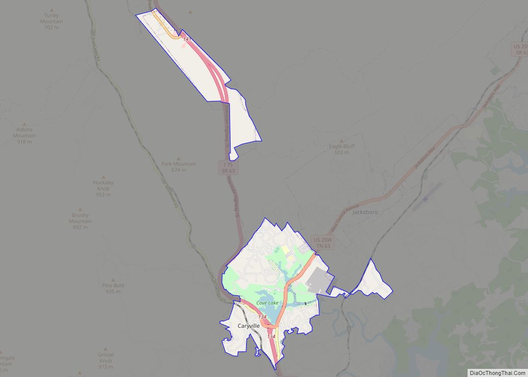
Jellico Road Map
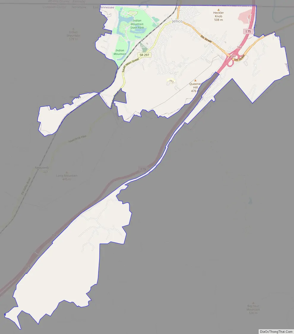
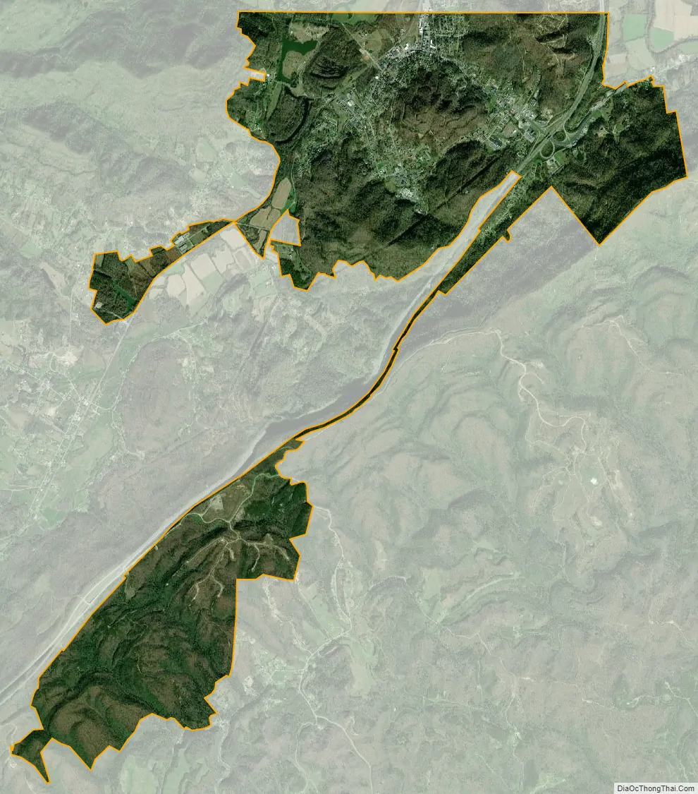
Jellico city Satellite Map
Geography
Jellico is located along the northern border of Tennessee at 36°34′57″N 84°7′50″W / 36.58250°N 84.13056°W / 36.58250; -84.13056 (36.582627, -84.130608). The city is situated amidst the Cumberland Mountains in the valley of Elk Creek, which flows north into Kentucky. Jellico spans the western bases and slopes of three steep hills that split the Elk Creek valley from the larger Clear Fork valley to the east. A prominent knob known as Indian Mountain rises nearly 1,000 feet (300 m) above Jellico to the west, and is visible from most of the city. This mountain and an adjacent lake are now home to Indian Mountain State Park. The larger Jellico Mountain dominates the area beyond Indian Mountain to the west, and Pine Mountain dominates the area beyond the Clear Fork Valley to the east.
Jellico is concentrated around the junction of U.S. Route 25W (North Main Street and 5th Street), which connects Jellico to Interstate 75 to the southeast and Corbin, Kentucky, to the north, and Tennessee State Route 297 (South Main Street), which connects Jellico with Huntsville to the southwest. The Tennessee-Kentucky state line forms Jellico’s official northern boundary, although houses and businesses associated with the city are on both sides of the border.
According to the United States Census Bureau, the city has a total area of 6.4 square miles (16.5 km), of which 6.3 square miles (16.3 km) is land and 0.08 square miles (0.2 km), or 1.15%, is water.
See also
Map of Tennessee State and its subdivision:- Anderson
- Bedford
- Benton
- Bledsoe
- Blount
- Bradley
- Campbell
- Cannon
- Carroll
- Carter
- Cheatham
- Chester
- Claiborne
- Clay
- Cocke
- Coffee
- Crockett
- Cumberland
- Davidson
- Decatur
- DeKalb
- Dickson
- Dyer
- Fayette
- Fentress
- Franklin
- Gibson
- Giles
- Grainger
- Greene
- Grundy
- Hamblen
- Hamilton
- Hancock
- Hardeman
- Hardin
- Hawkins
- Haywood
- Henderson
- Henry
- Hickman
- Houston
- Humphreys
- Jackson
- Jefferson
- Johnson
- Knox
- Lake
- Lauderdale
- Lawrence
- Lewis
- Lincoln
- Loudon
- Macon
- Madison
- Marion
- Marshall
- Maury
- McMinn
- McNairy
- Meigs
- Monroe
- Montgomery
- Moore
- Morgan
- Obion
- Overton
- Perry
- Pickett
- Polk
- Putnam
- Rhea
- Roane
- Robertson
- Rutherford
- Scott
- Sequatchie
- Sevier
- Shelby
- Smith
- Stewart
- Sullivan
- Sumner
- Tipton
- Trousdale
- Unicoi
- Union
- Van Buren
- Warren
- Washington
- Wayne
- Weakley
- White
- Williamson
- Wilson
- Alabama
- Alaska
- Arizona
- Arkansas
- California
- Colorado
- Connecticut
- Delaware
- District of Columbia
- Florida
- Georgia
- Hawaii
- Idaho
- Illinois
- Indiana
- Iowa
- Kansas
- Kentucky
- Louisiana
- Maine
- Maryland
- Massachusetts
- Michigan
- Minnesota
- Mississippi
- Missouri
- Montana
- Nebraska
- Nevada
- New Hampshire
- New Jersey
- New Mexico
- New York
- North Carolina
- North Dakota
- Ohio
- Oklahoma
- Oregon
- Pennsylvania
- Rhode Island
- South Carolina
- South Dakota
- Tennessee
- Texas
- Utah
- Vermont
- Virginia
- Washington
- West Virginia
- Wisconsin
- Wyoming