Glen Carbon is a village in Madison County, Illinois, United States, 14 miles (23 km) northeast of St. Louis. The population was 13,842 at the 2020 census.
| Name: | Glen Carbon village |
|---|---|
| LSAD Code: | 47 |
| LSAD Description: | village (suffix) |
| State: | Illinois |
| County: | Madison County |
| Founded: | 1892 |
| Elevation: | 505 ft (154 m) |
| Total Area: | 10.37 sq mi (26.86 km²) |
| Land Area: | 10.26 sq mi (26.56 km²) |
| Water Area: | 0.12 sq mi (0.30 km²) |
| Total Population: | 13,842 |
| Population Density: | 1,349.65/sq mi (521.11/km²) |
| ZIP code: | 62034 |
| Area code: | 618 |
| FIPS code: | 1729639 |
| GNISfeature ID: | 2398970 |
| Website: | www.glen-carbon.il.us |
Online Interactive Map
Click on ![]() to view map in "full screen" mode.
to view map in "full screen" mode.
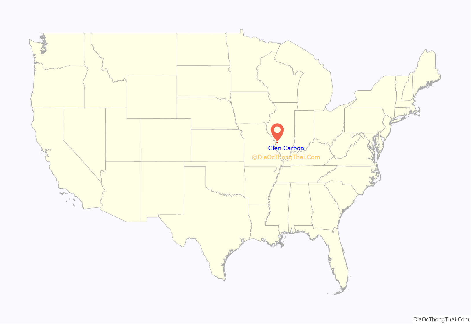
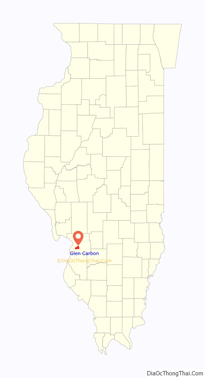
Glen Carbon location map. Where is Glen Carbon village?
History
In 1801, Colonel Samuel Judy received a military grant for 100 acres (0.40 km) of land near the base of the bluffs just north of Judys Branch, and became one of the first permanent settlers of Madison County. The land was called Goshen Settlement, after the biblical land of Goshen. It was renamed “Glen Carbon” to reflect its coal mining heritage.
Glen Carbon was incorporated as a village in 1892. It operated many coal mines until the last one shut down in 1934. Another industry was the St. Louis brick company, which burned down in the 1930s; then, right after being rebuilt, it burned down and was never rebuilt again.
Glen Carbon residents served during World War I. The city’s Doughboy statue, which honors the sacrifice made by two of its residents, has been selected as part of a national competition for restoration as part of the nation’s World War I centennial activities.
Three railroads once served Glen Carbon. The Illinois Central Railroad, now the Ronald J. Foster Sr. Heritage Bike Trail, became one of the first rails to trails projects in the US, in 1992. The other two lines were the Norfolk Southern line and the Chicago and North Western line, which ran parallel with each other the entire way through Glen Carbon, and stopped operating in Glen Carbon in March 2000. The Nickel Plate Bike Trail follows both of those right-of-ways, switching back and forth between the NS and CNW lines the whole way through Glen Carbon.
Heritage Museum
Originally built in 1914, this building began as School Street in what is considered “Old Town” Glen Carbon.
Exhibits include:
- Artifacts that stress the importance of the railroads and coal mines
- Military memorabilia from Glen Carbon’s veterans
- Historical photograph collection
- Baseball memorabilia
- Military memorabilia owned by World War 2 Drama Actor; Colin W. Houston
- Native American stone tool collection
Yanda Log Cabin
The Yanda Log Cabin is a satellite addition to the Heritage museum. In February 2017, the Yanda Log Cabin received a historical recognition plaque from the National Society Colonial Dames XVII Century organization. The Yanda Log Cabin was built around 1853 by William and Anna Zrala Yanda. They immigrated from Bohemia, Austria and plied their blacksmithing trade on this offshoot of the Goshen Road. The family handed the home down through the generations before selling it in the 1940s.
In 1989, the home was scheduled to serve as a practice burn for the local fire department. The Historical and Museum Commission found out about this and worked to save the building. The Village of Glen Carbon purchased the cabin with knowledge that it would restored by volunteers and be used as a gathering place for residents.
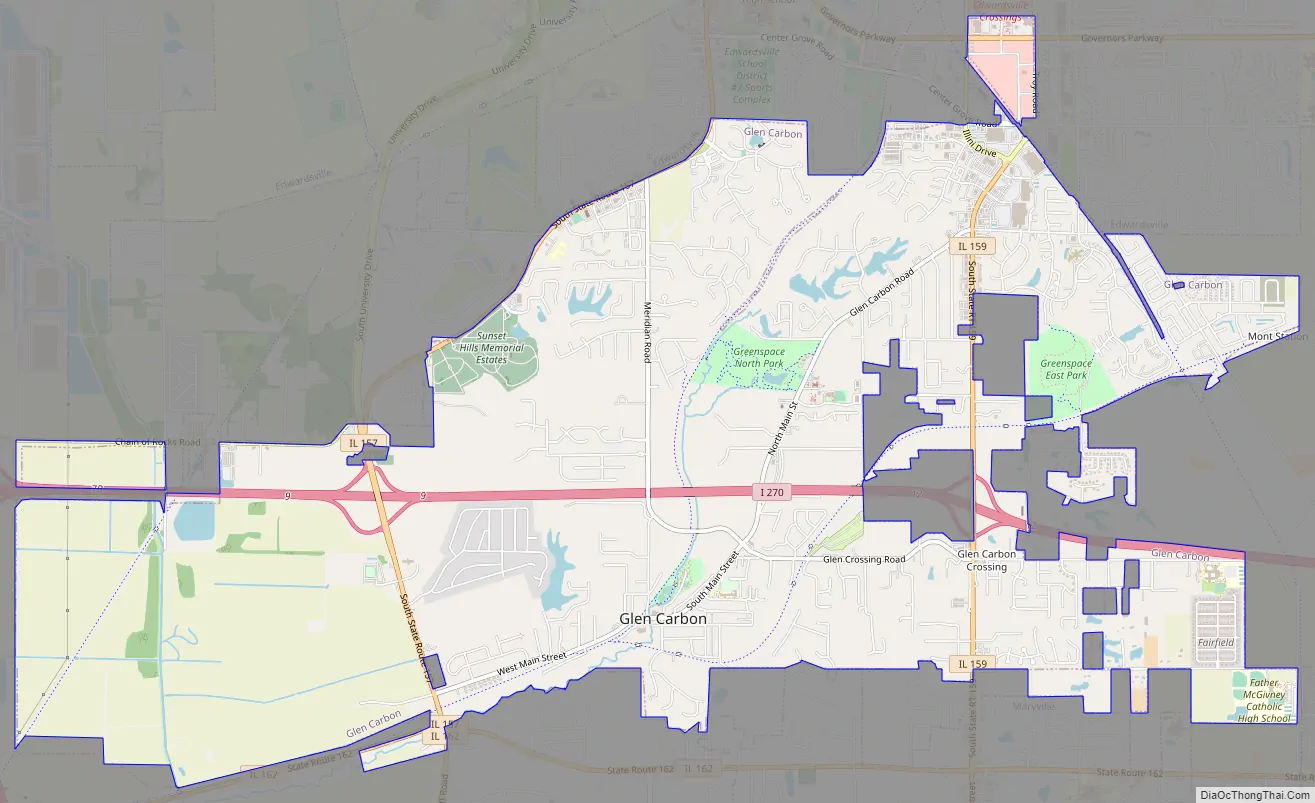
Glen Carbon Road Map
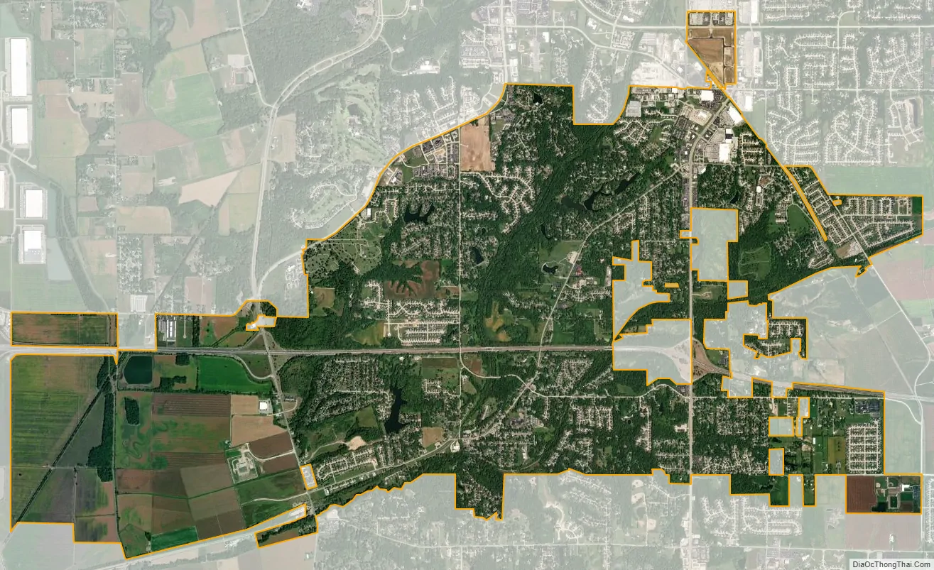
Glen Carbon city Satellite Map
Geography
Glen Carbon is located southwest of the center of Madison County at 38°45′35″N 89°58′9″W / 38.75972°N 89.96917°W / 38.75972; -89.96917 (38.759801, -89.969204). It is bordered to the north by Edwardsville, the county seat, to the southeast by Troy, to the south by Maryville, and to the west by Pontoon Beach. Interstate 270 passes through the village north of its center, with access from exits 9 and 12. I-270 leads west 19 miles (31 km) to Florissant, Missouri, and east 4 miles (6 km) to Interstate 70, which continues east 50 miles (80 km) to Vandalia. Illinois Route 157 passes through the west side of the village, leading northeast 6 miles (10 km) to the center of Edwardsville and south 5 miles (8 km) to the west side of Collinsville, while Illinois Route 159 passes through the east side of the village, leading north to the center of Edwardsville and south 6 miles (10 km) to the center of Collinsville.
According to the U.S. Census Bureau, Glen Carbon has a total area of 10.37 square miles (26.86 km), of which 10.26 square miles (26.57 km) are land and 0.12 square miles (0.31 km), or 1.12%, are water. Judys Branch passes through the village just south of its center, leading west into the Mississippi River valley lowlands.
See also
Map of Illinois State and its subdivision:- Adams
- Alexander
- Bond
- Boone
- Brown
- Bureau
- Calhoun
- Carroll
- Cass
- Champaign
- Christian
- Clark
- Clay
- Clinton
- Coles
- Cook
- Crawford
- Cumberland
- De Kalb
- De Witt
- Douglas
- Dupage
- Edgar
- Edwards
- Effingham
- Fayette
- Ford
- Franklin
- Fulton
- Gallatin
- Greene
- Grundy
- Hamilton
- Hancock
- Hardin
- Henderson
- Henry
- Iroquois
- Jackson
- Jasper
- Jefferson
- Jersey
- Jo Daviess
- Johnson
- Kane
- Kankakee
- Kendall
- Knox
- La Salle
- Lake
- Lake Michigan
- Lawrence
- Lee
- Livingston
- Logan
- Macon
- Macoupin
- Madison
- Marion
- Marshall
- Mason
- Massac
- McDonough
- McHenry
- McLean
- Menard
- Mercer
- Monroe
- Montgomery
- Morgan
- Moultrie
- Ogle
- Peoria
- Perry
- Piatt
- Pike
- Pope
- Pulaski
- Putnam
- Randolph
- Richland
- Rock Island
- Saint Clair
- Saline
- Sangamon
- Schuyler
- Scott
- Shelby
- Stark
- Stephenson
- Tazewell
- Union
- Vermilion
- Wabash
- Warren
- Washington
- Wayne
- White
- Whiteside
- Will
- Williamson
- Winnebago
- Woodford
- Alabama
- Alaska
- Arizona
- Arkansas
- California
- Colorado
- Connecticut
- Delaware
- District of Columbia
- Florida
- Georgia
- Hawaii
- Idaho
- Illinois
- Indiana
- Iowa
- Kansas
- Kentucky
- Louisiana
- Maine
- Maryland
- Massachusetts
- Michigan
- Minnesota
- Mississippi
- Missouri
- Montana
- Nebraska
- Nevada
- New Hampshire
- New Jersey
- New Mexico
- New York
- North Carolina
- North Dakota
- Ohio
- Oklahoma
- Oregon
- Pennsylvania
- Rhode Island
- South Carolina
- South Dakota
- Tennessee
- Texas
- Utah
- Vermont
- Virginia
- Washington
- West Virginia
- Wisconsin
- Wyoming


