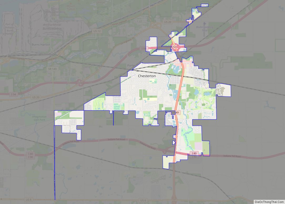
Beverly Shores is a town in Pine Township, Porter County, Indiana, United States, about 36 miles (58 km) east of downtown Chicago. The population was 613 at the 2010 census.
| Name: | Beverly Shores town |
|---|---|
| LSAD Code: | 43 |
| LSAD Description: | town (suffix) |
| State: | Indiana |
| County: | Porter County |
| Elevation: | 620 ft (189 m) |
| Total Area: | 5.83 sq mi (15.09 km²) |
| Land Area: | 3.58 sq mi (9.28 km²) |
| Water Area: | 2.25 sq mi (5.81 km²) |
| Total Population: | 599 |
| Population Density: | 167.18/sq mi (64.54/km²) |
| ZIP code: | 46301 |
| Area code: | 219 |
| FIPS code: | 1805158 |
| GNISfeature ID: | 430998 |
| Website: | www.beverlyshoresindiana.org |
Online Interactive Map
Click on ![]() to view map in "full screen" mode.
to view map in "full screen" mode.
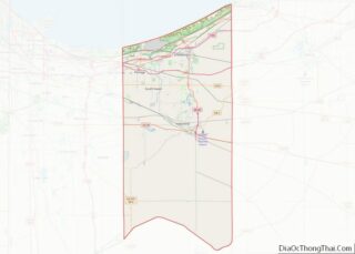
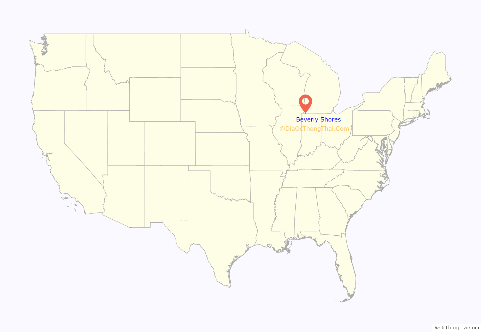
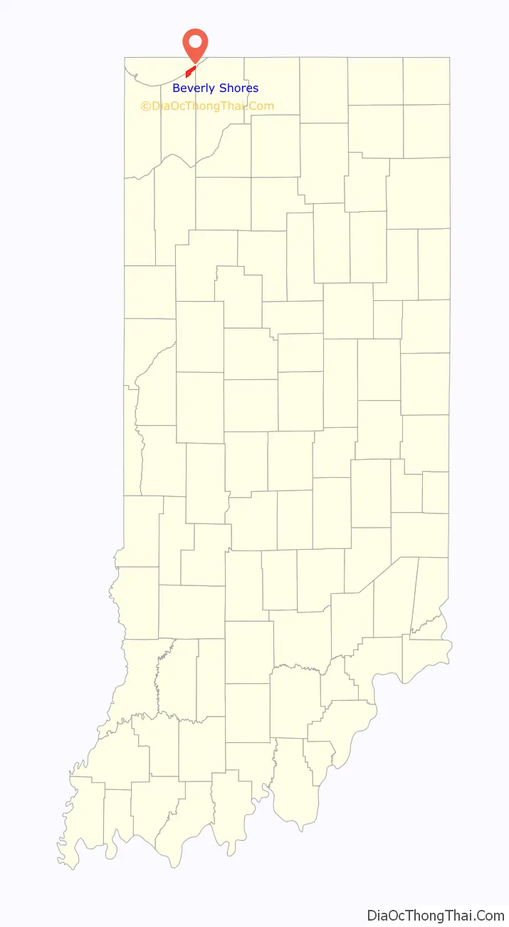
Beverly Shores location map. Where is Beverly Shores town?
History
Beverly Shores began life as a planned resort community. The Chicago, Lake Shore & South Bend railroad began to provide service from South Bend to Chicago shortly after 1900. The Chicago businessman Samuel Insull reorganized the line as the Chicago, South Shore & South Bend (today’s South Shore Line) in 1925, upgrading the stations and encouraging tourism. A number of promotional posters were issued, many of which remain in print.
The Frederick H. Bartlett Company, at that time one of Chicago’s largest real-estate developers, bought 3,600 acres (1,500 ha) in the area in 1927, and plotted thousands of homesites. He named the prospective development Lake Shore, North Shore Beach and South Shore Acres. The Great Depression dampened its prospects, and many of the plots were never built on.
Robert Bartlett, Frederick Bartlett’s brother, purchased the properties in 1933. He named the entire development after his daughter Beverly, and continued to develop its infrastructure with roads, a school, a golf course, and a hotel. He purchased and relocated sixteen structures from Chicago’s 1933-34 Century of Progress World’s Fair, four of which were transported by barges on Lake Michigan.
The community was incorporated in 1947. After World War II, a number of industrial developments, including Burns Harbor, were built to the west, and by the 1950s environmental organizations had begun to push for preservation of the area. The Indiana Dunes National Lakeshore was established in 1966. During the 1970s, there was a movement to purchase all the homes in Beverly Shores and incorporate the entire town into the National Lakeshore. This initiative did not succeed, but many local properties were acquired, especially those in the wetlands that constitute the southern portion. The acquisition process is ongoing. The owners of lots fronting on the beach were granted lifetime leasebacks with the proviso that the property would revert to the National Lakeshore; many of these houses have since been demolished.
The 1970s saw a period of record high lake levels and beach erosion; the owners of lakefront properties often responded by dumping large quantities of concrete blocks (riprap) onto the sand in front of their houses, which continue to mar the beach. The beach is now conspicuously public, although nearby parking is limited.
A resurgence of development took place during the 1990s and 2000s, when many million-dollar-plus houses were built on the dunes near the lakefront. In the early 2000s, excessive levels of arsenic, boron, lead, and manganese were found in wells in the nearby town of Pines, and pipelines delivering Lake Michigan water treated by Michigan City were extended into Beverly Shores. This time period also saw explosive growth of the local white-tailed deer population, a problem that has polarized its residents.
In 1998, the Spanish Colonial Revival train depot, originally built in 1929, was reopened following a historic renovation. The restored train depot now also houses a museum, displaying historic photographs and memorabilia, and a gallery, featuring rotating exhibits of local art.
Easily accessible from Chicago, Beverly Shores is a second home to many Chicagoans who are referred to locally as some-timers. Both full-time and some-time residents come together for community activities such as ice skating on the frozen pond during Winterfest, the 5k Necktie Race held on Father’s Day, and the annual summertime event the Fireman’s Ball which raises money for the volunteer fire department.
Beverly Shores has always enjoyed the reputation of being a “gay-friendly” community. For example, the “Last Outpost” and “Los Compadres” restaurants were, in their heyday, major points of interest in northwest Indiana for the homosexual community. Along with the acceptance of gay culture, Beverly Shores has long been a haven for artists.
In the recent years up to 2008, there were no local Beverly Shores eating or drinking establishments. Grecco’s and the Red Lantern were two restaurants down by the beachfront but they closed a long time ago. In November 2008, the old Bruno’s Bar was reopened after much renovation under the name Bartlett’s, a nod to the developer, Robert Bartlett. Bartlett’s closed in 2019. Later that year, a restaurant, deli, and bar, the Goblin and the Grocer, opened at the corner of Broadway and Dunes Highway. In 2010, the Rolling Stonebaker, a Studebaker fire truck converted into a wood-fired pizzeria, opened in Beverly Shores. In 2011, The Rolling Stonebaker was named the best pizza in the state of Indiana by Food Network Magazine.
Beverly Shores attracts many visitors, particularly nature enthusiasts, cyclists and bird watchers, who come to enjoy the beaches and the marshlands. Overnight lodging options are limited but visitors who wish to stay the night can reserve a campsite at Dunewood Camp.
On June 24, 2014, the International Dark-Sky Association announced Beverly Shores as the world’s seventh international dark sky community.
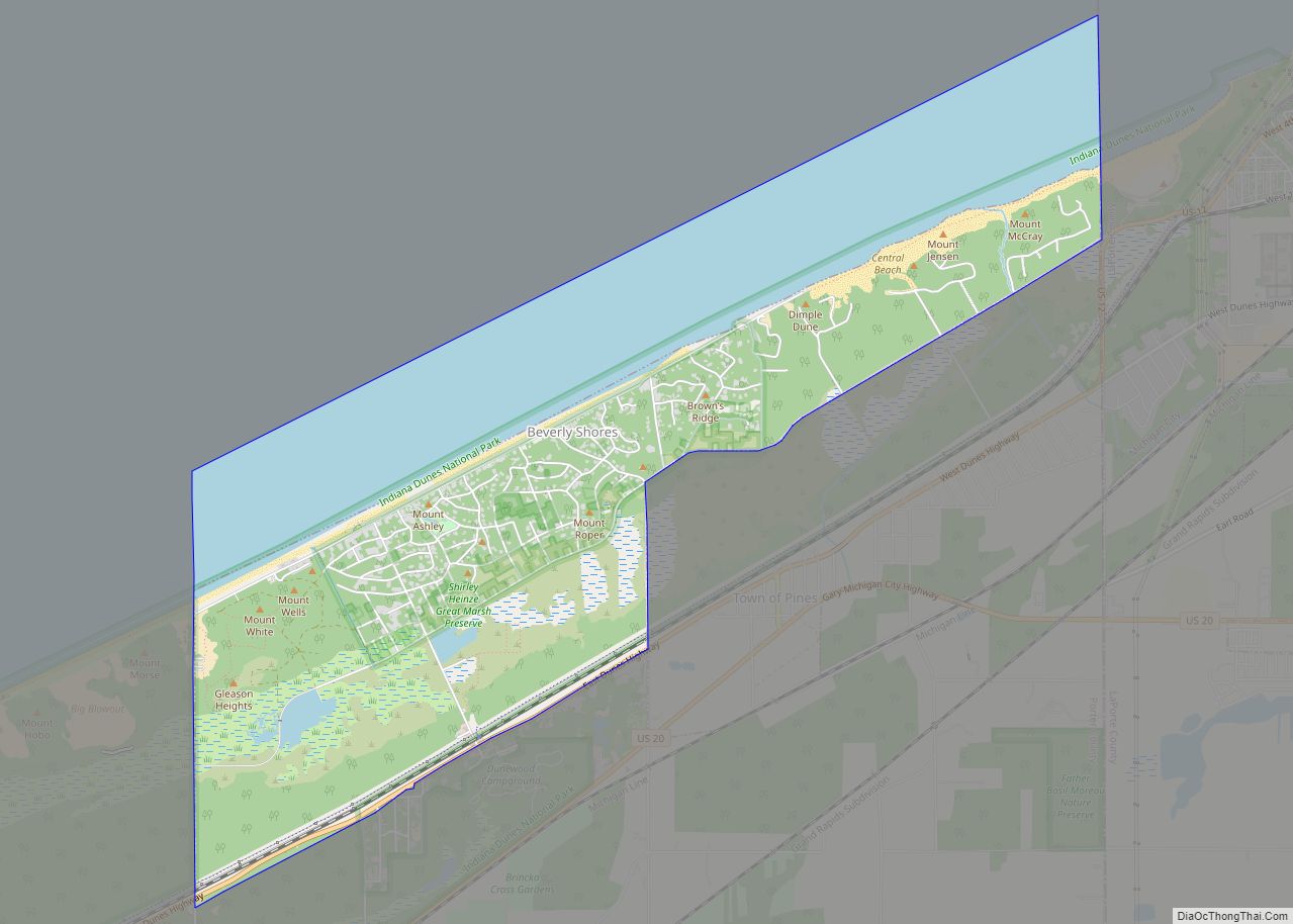
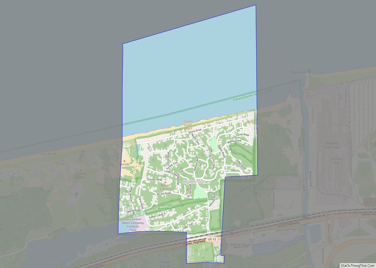
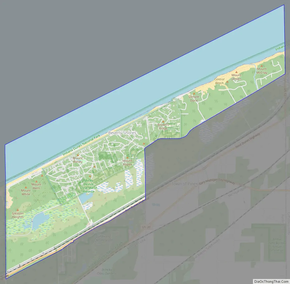
Beverly Shores Road Map
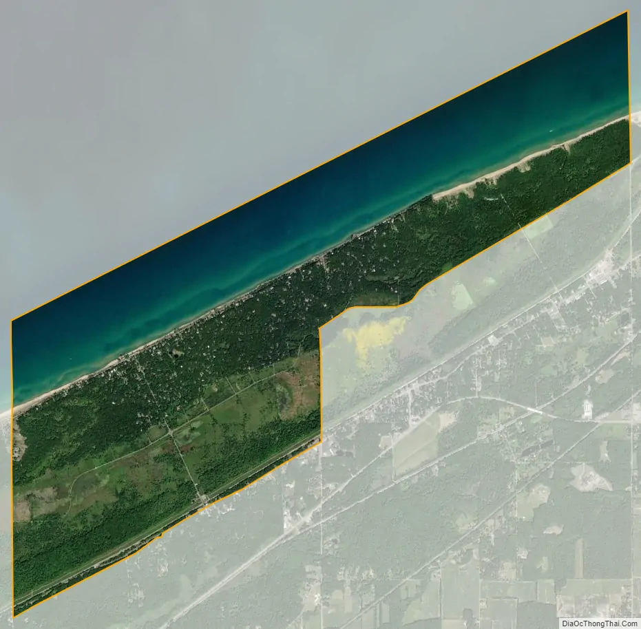
Beverly Shores city Satellite Map
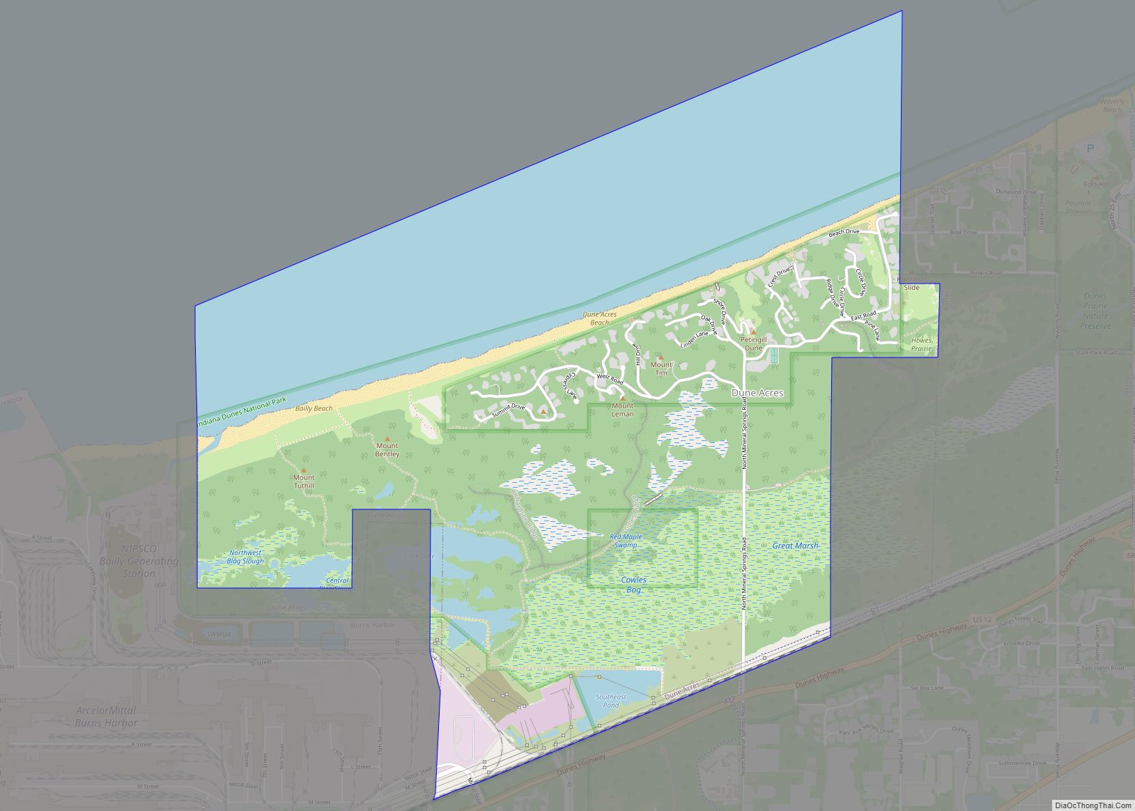
Geography
Located along the Lake Michigan shoreline and adjacent to the Indiana Dunes National Park, the town was initially developed as a planned resort community of second homes for Chicago residents. Six sites are listed in the National Register of Historic Places. These include a cluster of six buildings that were transported by barge from the Homes of Tomorrow Exhibition of the 1933 Century of Progress World’s Fair which took place in Chicago. This site is known as the Century of Progress Architectural District. Beverly Shores is located at 41°41′03″N 86°59′08″W / 41.684265°N 86.985672°W / 41.684265; -86.985672, along the Lake Michigan shoreline. It is bordered by Indiana Dunes State Park on the west, Lake Michigan on the north, the village of Pines on the south, and Michigan City on the east. Much of the immediate area is part of Indiana Dunes National Park.
According to the 2010 census, Beverly Shores has a total area of 5.82 square miles (15.07 km), of which 3.58 square miles (9.27 km) (or 61.51%) is land and 2.24 square miles (5.80 km) (or 38.49%) is water.
See also
Map of Indiana State and its subdivision:- Adams
- Allen
- Bartholomew
- Benton
- Blackford
- Boone
- Brown
- Carroll
- Cass
- Clark
- Clay
- Clinton
- Crawford
- Daviess
- De Kalb
- Dearborn
- Decatur
- Delaware
- Dubois
- Elkhart
- Fayette
- Floyd
- Fountain
- Franklin
- Fulton
- Gibson
- Grant
- Greene
- Hamilton
- Hancock
- Harrison
- Hendricks
- Henry
- Howard
- Huntington
- Jackson
- Jasper
- Jay
- Jefferson
- Jennings
- Johnson
- Knox
- Kosciusko
- LaGrange
- Lake
- Lake Michigan
- LaPorte
- Lawrence
- Madison
- Marion
- Marshall
- Martin
- Miami
- Monroe
- Montgomery
- Morgan
- Newton
- Noble
- Ohio
- Orange
- Owen
- Parke
- Perry
- Pike
- Porter
- Posey
- Pulaski
- Putnam
- Randolph
- Ripley
- Rush
- Saint Joseph
- Scott
- Shelby
- Spencer
- Starke
- Steuben
- Sullivan
- Switzerland
- Tippecanoe
- Tipton
- Union
- Vanderburgh
- Vermillion
- Vigo
- Wabash
- Warren
- Warrick
- Washington
- Wayne
- Wells
- White
- Whitley
- Alabama
- Alaska
- Arizona
- Arkansas
- California
- Colorado
- Connecticut
- Delaware
- District of Columbia
- Florida
- Georgia
- Hawaii
- Idaho
- Illinois
- Indiana
- Iowa
- Kansas
- Kentucky
- Louisiana
- Maine
- Maryland
- Massachusetts
- Michigan
- Minnesota
- Mississippi
- Missouri
- Montana
- Nebraska
- Nevada
- New Hampshire
- New Jersey
- New Mexico
- New York
- North Carolina
- North Dakota
- Ohio
- Oklahoma
- Oregon
- Pennsylvania
- Rhode Island
- South Carolina
- South Dakota
- Tennessee
- Texas
- Utah
- Vermont
- Virginia
- Washington
- West Virginia
- Wisconsin
- Wyoming