Colfax is a town in Perry Township, Clinton County, Indiana, United States. The population was 691 at the 2010 census. The town was originally known as Midway since it was a half-way point on the IC&L Railroad between Chicago & Louisville. Railways intersected North/South & East/West making Colfax a popular transfer destination. The town was renamed to honor Vice President Schuyler Colfax in 1857.
| Name: | Colfax town |
|---|---|
| LSAD Code: | 43 |
| LSAD Description: | town (suffix) |
| State: | Indiana |
| County: | Clinton County |
| Founded: | 1849 |
| Elevation: | 840 ft (256 m) |
| Total Area: | 0.37 sq mi (0.96 km²) |
| Land Area: | 0.37 sq mi (0.96 km²) |
| Water Area: | 0.00 sq mi (0.00 km²) |
| Total Population: | 702 |
| Population Density: | 1,897.30/sq mi (733.11/km²) |
| ZIP code: | 46035 |
| Area code: | 765 |
| FIPS code: | 1814284 |
| GNISfeature ID: | 0432758 |
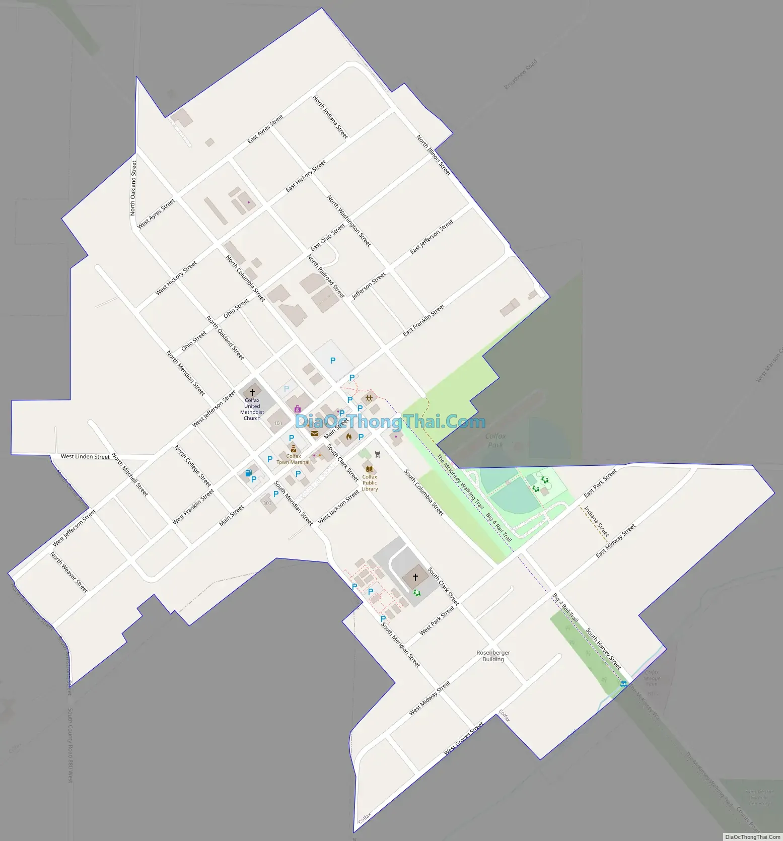
Online Interactive Map
Click on ![]() to view map in "full screen" mode.
to view map in "full screen" mode.
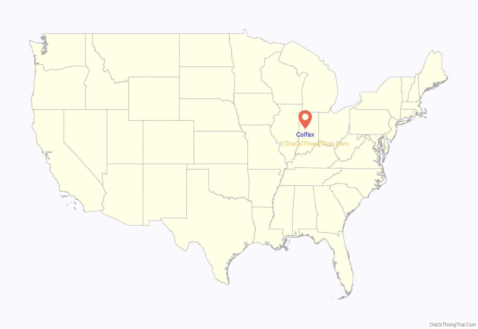
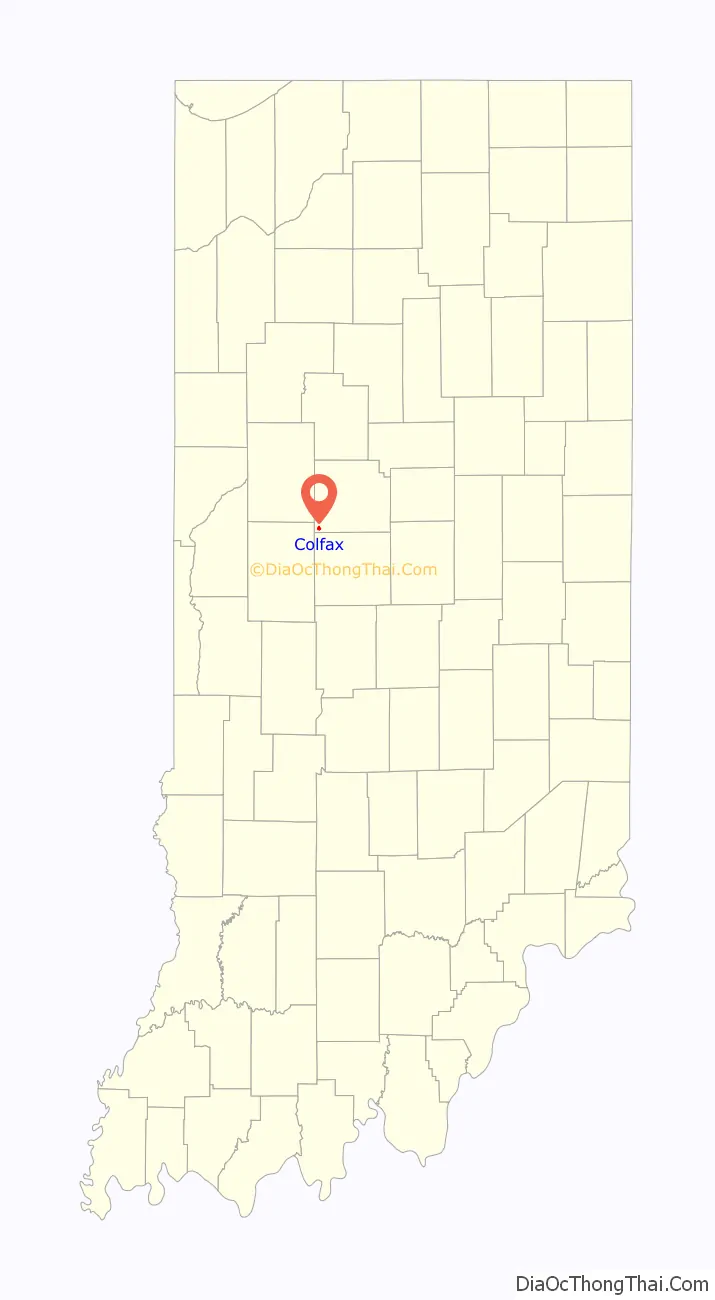
Colfax location map. Where is Colfax town?
History
Colfax was laid out in 1849 by Montgomery Stroud. It was originally named Midway for its position between Chicago and Louisville along the IC&L railroad. In 1853 the town gained a post office named Colfax, and in December 1857 the name of the town itself became Colfax, by petition of the residents. By 1861 the town had two churches, two general stores, a hotel, a saw mill and approximately 200 residents.
An incorporation election held December 25, 1869, resulted in 24 yeas and 1 no. The town had 187 residents in 1870, but with the construction of the Vandalia railroad through town in 1870-71 it grew quickly and by 1880 had a population of 638.
The Colfax Carnegie Library and Rosenberger Building are listed on the National Register of Historic Places.
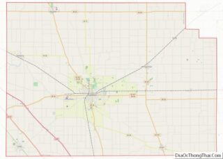
Colfax Road Map
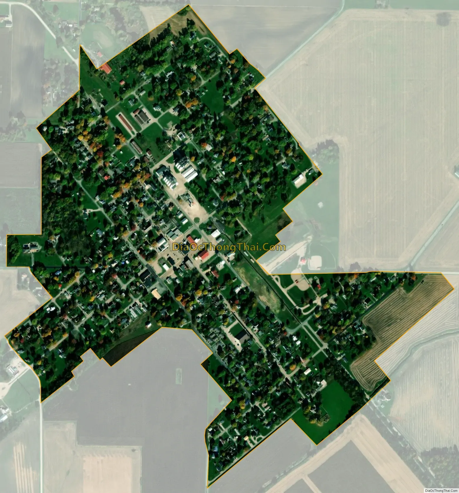
Colfax city Satellite Map
Geography
Colfax is located at 40°11′38″N 86°40′5″W / 40.19389°N 86.66806°W / 40.19389; -86.66806 (40.193788, -86.668085).
According to the 2010 census, Colfax has a total area of 0.36 square miles (0.93 km), all land.
See also
Map of Indiana State and its subdivision:- Adams
- Allen
- Bartholomew
- Benton
- Blackford
- Boone
- Brown
- Carroll
- Cass
- Clark
- Clay
- Clinton
- Crawford
- Daviess
- De Kalb
- Dearborn
- Decatur
- Delaware
- Dubois
- Elkhart
- Fayette
- Floyd
- Fountain
- Franklin
- Fulton
- Gibson
- Grant
- Greene
- Hamilton
- Hancock
- Harrison
- Hendricks
- Henry
- Howard
- Huntington
- Jackson
- Jasper
- Jay
- Jefferson
- Jennings
- Johnson
- Knox
- Kosciusko
- LaGrange
- Lake
- Lake Michigan
- LaPorte
- Lawrence
- Madison
- Marion
- Marshall
- Martin
- Miami
- Monroe
- Montgomery
- Morgan
- Newton
- Noble
- Ohio
- Orange
- Owen
- Parke
- Perry
- Pike
- Porter
- Posey
- Pulaski
- Putnam
- Randolph
- Ripley
- Rush
- Saint Joseph
- Scott
- Shelby
- Spencer
- Starke
- Steuben
- Sullivan
- Switzerland
- Tippecanoe
- Tipton
- Union
- Vanderburgh
- Vermillion
- Vigo
- Wabash
- Warren
- Warrick
- Washington
- Wayne
- Wells
- White
- Whitley
- Alabama
- Alaska
- Arizona
- Arkansas
- California
- Colorado
- Connecticut
- Delaware
- District of Columbia
- Florida
- Georgia
- Hawaii
- Idaho
- Illinois
- Indiana
- Iowa
- Kansas
- Kentucky
- Louisiana
- Maine
- Maryland
- Massachusetts
- Michigan
- Minnesota
- Mississippi
- Missouri
- Montana
- Nebraska
- Nevada
- New Hampshire
- New Jersey
- New Mexico
- New York
- North Carolina
- North Dakota
- Ohio
- Oklahoma
- Oregon
- Pennsylvania
- Rhode Island
- South Carolina
- South Dakota
- Tennessee
- Texas
- Utah
- Vermont
- Virginia
- Washington
- West Virginia
- Wisconsin
- Wyoming