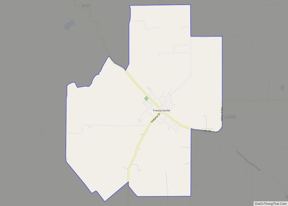
Freelandville or Freelandsville is an unincorporated community and census-designated place in Widner Township, Knox County, Indiana, United States. As of the 2010 United States Census it had a population of 643.
| Name: | Freelandville CDP |
|---|---|
| LSAD Code: | 57 |
| LSAD Description: | CDP (suffix) |
| State: | Indiana |
| County: | Knox County |
| Elevation: | 574 ft (175 m) |
| Total Area: | 5.57 sq mi (14.41 km²) |
| Land Area: | 5.57 sq mi (14.41 km²) |
| Water Area: | 0.00 sq mi (0.00 km²) |
| Total Population: | 617 |
| Population Density: | 110.87/sq mi (42.81/km²) |
| ZIP code: | 47535 |
| Area code: | 812 |
| FIPS code: | 1825810 |
| GNISfeature ID: | 434813 |
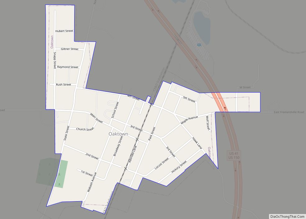
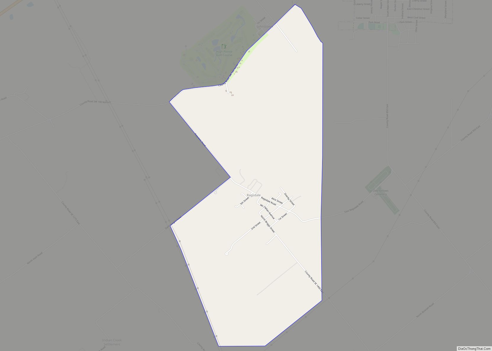
Online Interactive Map
Click on ![]() to view map in "full screen" mode.
to view map in "full screen" mode.
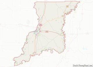
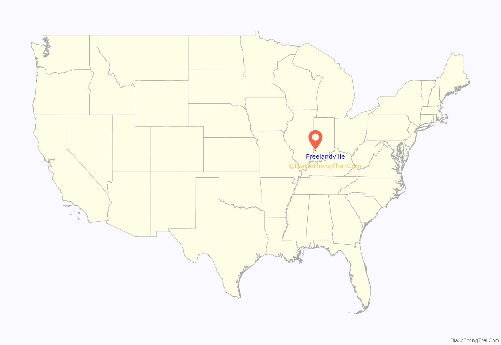
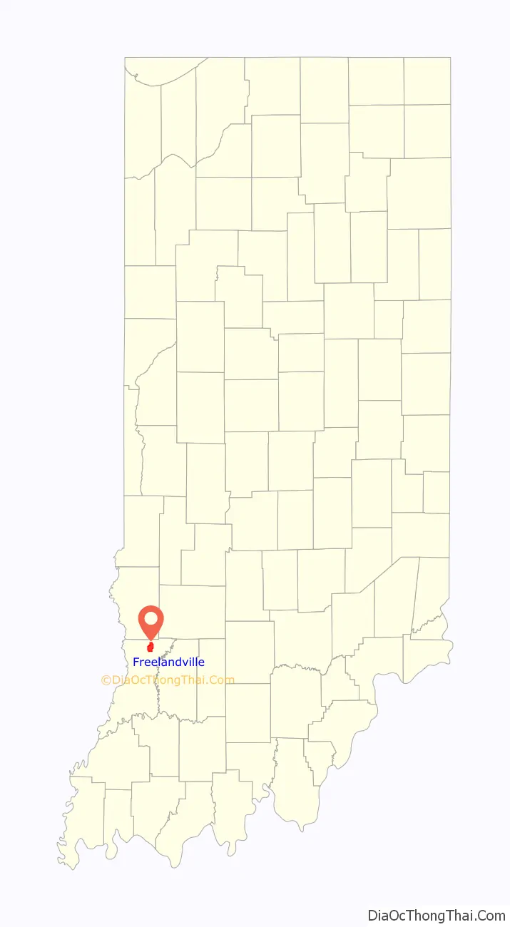
Freelandville location map. Where is Freelandville CDP?
History
The first settler of the area was John Widner, who came to Knox County in 1798 and in 1804 settled on land two and a half miles northwest of Freelandville. William Polk, uncle of James Polk, settled on land about two miles from Widner in 1808. In 1812, Fort Widner was built as protection against the Native Americans during the second war with Great Britain.
Although the area was initially settled by the English, cheap available government land and the aspect of work on the Wabash & Erie Canal brought other immigrants to the area. Freelandville was settled mostly by immigrants from Germany, many from the kingdom of Prussia, in the mid-1800s. The German settlers originally referred to the place as “Bethlehem” or “Kreuzweg“, meaning “crossroads”. The town was not officially laid out until July 31, 1866, when done so by John Ritterskamp. Residents chose to name the town “Freelandsville” to honor John F. Freeland, a prominent local physician. Maps from that period refer to the area as Freelandsville, and some local sources still refer to the area with this name. It is not clear when the shorter spelling became predominant.
Kixmiller’s Store, on the north side of the intersection of Highways 58 and 159, was added to the National Register of Historic Places in 1978. The building was partially demolished on 20 February 2017 after its structure had significantly deteriorated.
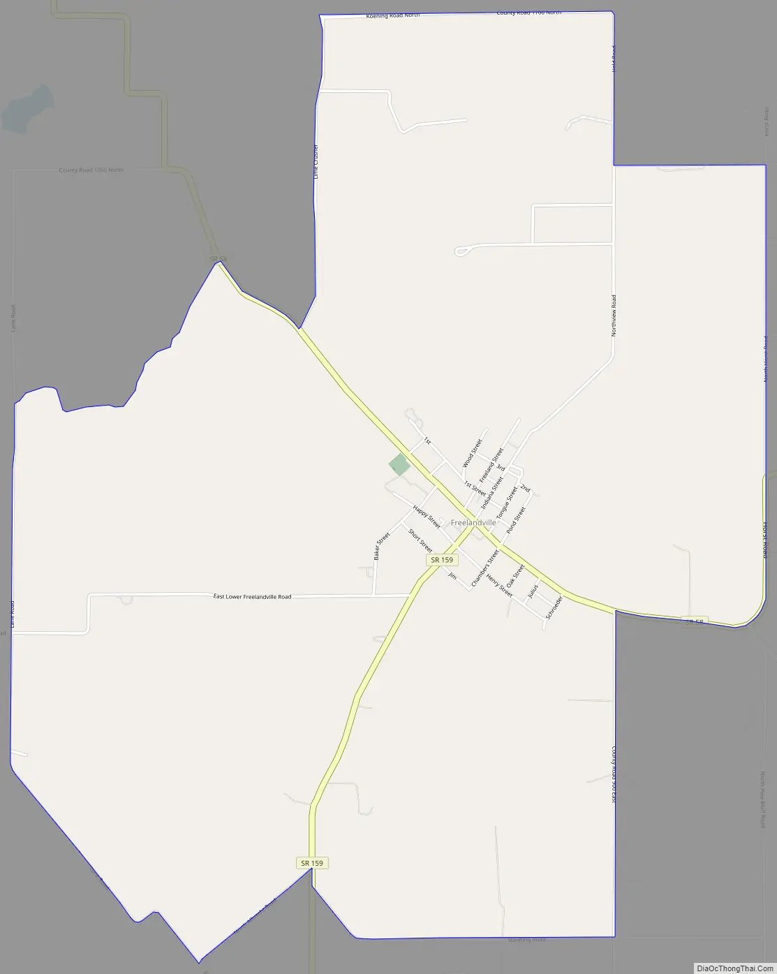
Freelandville Road Map
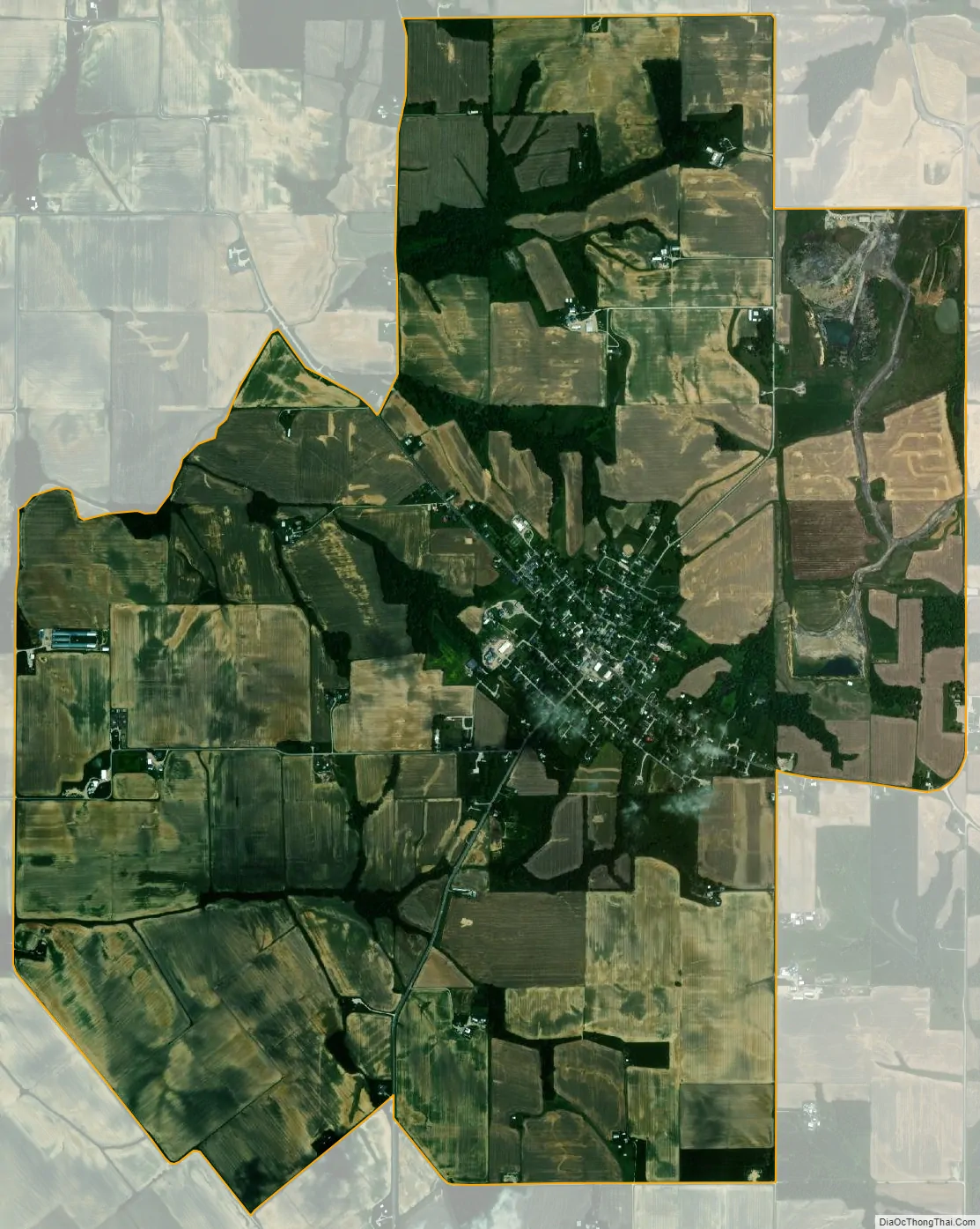
Freelandville city Satellite Map
Geography
Freelandville is in northeastern Knox County, located around the intersection of State Roads 58 and 159. It is 5 miles (8 km) west of Westphalia, 6 miles (10 km) north of Bicknell, and 20 miles (32 km) northeast of Vincennes, the county seat.
According to the United States Census Bureau, the Freelandville CDP has an area of 5.5 square miles (14.2 km), all of it land.
See also
Map of Indiana State and its subdivision:- Adams
- Allen
- Bartholomew
- Benton
- Blackford
- Boone
- Brown
- Carroll
- Cass
- Clark
- Clay
- Clinton
- Crawford
- Daviess
- De Kalb
- Dearborn
- Decatur
- Delaware
- Dubois
- Elkhart
- Fayette
- Floyd
- Fountain
- Franklin
- Fulton
- Gibson
- Grant
- Greene
- Hamilton
- Hancock
- Harrison
- Hendricks
- Henry
- Howard
- Huntington
- Jackson
- Jasper
- Jay
- Jefferson
- Jennings
- Johnson
- Knox
- Kosciusko
- LaGrange
- Lake
- Lake Michigan
- LaPorte
- Lawrence
- Madison
- Marion
- Marshall
- Martin
- Miami
- Monroe
- Montgomery
- Morgan
- Newton
- Noble
- Ohio
- Orange
- Owen
- Parke
- Perry
- Pike
- Porter
- Posey
- Pulaski
- Putnam
- Randolph
- Ripley
- Rush
- Saint Joseph
- Scott
- Shelby
- Spencer
- Starke
- Steuben
- Sullivan
- Switzerland
- Tippecanoe
- Tipton
- Union
- Vanderburgh
- Vermillion
- Vigo
- Wabash
- Warren
- Warrick
- Washington
- Wayne
- Wells
- White
- Whitley
- Alabama
- Alaska
- Arizona
- Arkansas
- California
- Colorado
- Connecticut
- Delaware
- District of Columbia
- Florida
- Georgia
- Hawaii
- Idaho
- Illinois
- Indiana
- Iowa
- Kansas
- Kentucky
- Louisiana
- Maine
- Maryland
- Massachusetts
- Michigan
- Minnesota
- Mississippi
- Missouri
- Montana
- Nebraska
- Nevada
- New Hampshire
- New Jersey
- New Mexico
- New York
- North Carolina
- North Dakota
- Ohio
- Oklahoma
- Oregon
- Pennsylvania
- Rhode Island
- South Carolina
- South Dakota
- Tennessee
- Texas
- Utah
- Vermont
- Virginia
- Washington
- West Virginia
- Wisconsin
- Wyoming