French Lick is a town in French Lick Township, Orange County, Indiana. The population was 1,807 at the time of the 2010 census.
| Name: | French Lick town |
|---|---|
| LSAD Code: | 43 |
| LSAD Description: | town (suffix) |
| State: | Indiana |
| County: | Orange County |
| Elevation: | 568 ft (173 m) |
| Total Area: | 1.82 sq mi (4.72 km²) |
| Land Area: | 1.82 sq mi (4.72 km²) |
| Water Area: | 0.00 sq mi (0.00 km²) |
| Total Population: | 1,722 |
| Population Density: | 944.60/sq mi (364.77/km²) |
| ZIP code: | 47432 |
| Area code: | 812 |
| FIPS code: | 1825972 |
| GNISfeature ID: | 2396952 |
Online Interactive Map
Click on ![]() to view map in "full screen" mode.
to view map in "full screen" mode.
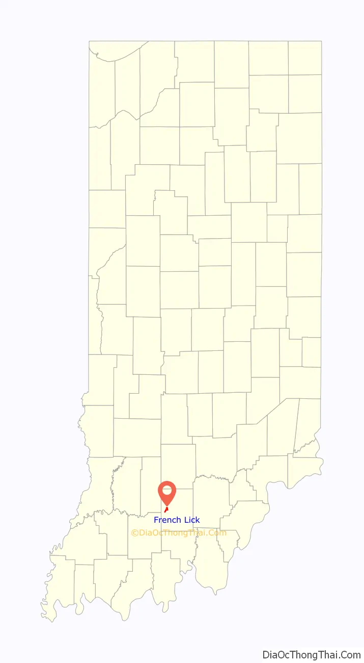
French Lick location map. Where is French Lick town?
History
French Lick was originally a French trading post built near a spring and salt lick. A fortified ranger post was established near the springs in 1811. On Johnson’s 1837 map of Indiana, the community was known as Salt Spring. The town was founded in 1857. French Lick’s post office has been in operation since 1847.
The sulfur springs were commercially exploited for medical benefits starting in 1840. By the later half of the 19th century, French Lick was famous in the United States as a spa town. In the early 20th century it also featured casinos attracting celebrities such as boxer Joe Louis, composer Irving Berlin and gangster Al Capone.
Because of wartime travel restrictions, the Chicago Cubs and Chicago White Sox held spring training in French Lick from 1943 to 1944; in 1945 the Cubs stayed in town while the White Sox moved to Terre Haute, utilizing Memorial Stadium. In order to conserve rail transport during World War II, 1943 spring training was limited to an area east of the Mississippi River and north of the Ohio River.
The French Lick Resort Casino was the focal point of most of the entertainment; the hotel remained open well after the casinos were closed down and the heyday of the town was well past. The resort closed for renovation in 2005 and re-opened in 2006.
Pluto Water, a best-selling laxative of the first half of the 20th century, was bottled here. It was also home to a large 7 Up bottling facility, which ceased operations in the mid-20th century.
Franklin D. Roosevelt announced his intention to run for president at a National Governors’ Convention held at the French Lick Springs Hotel.
In 2015, the Pete Dye Course at French Lick Resort played host to the KitchenAid Senior PGA Championship.
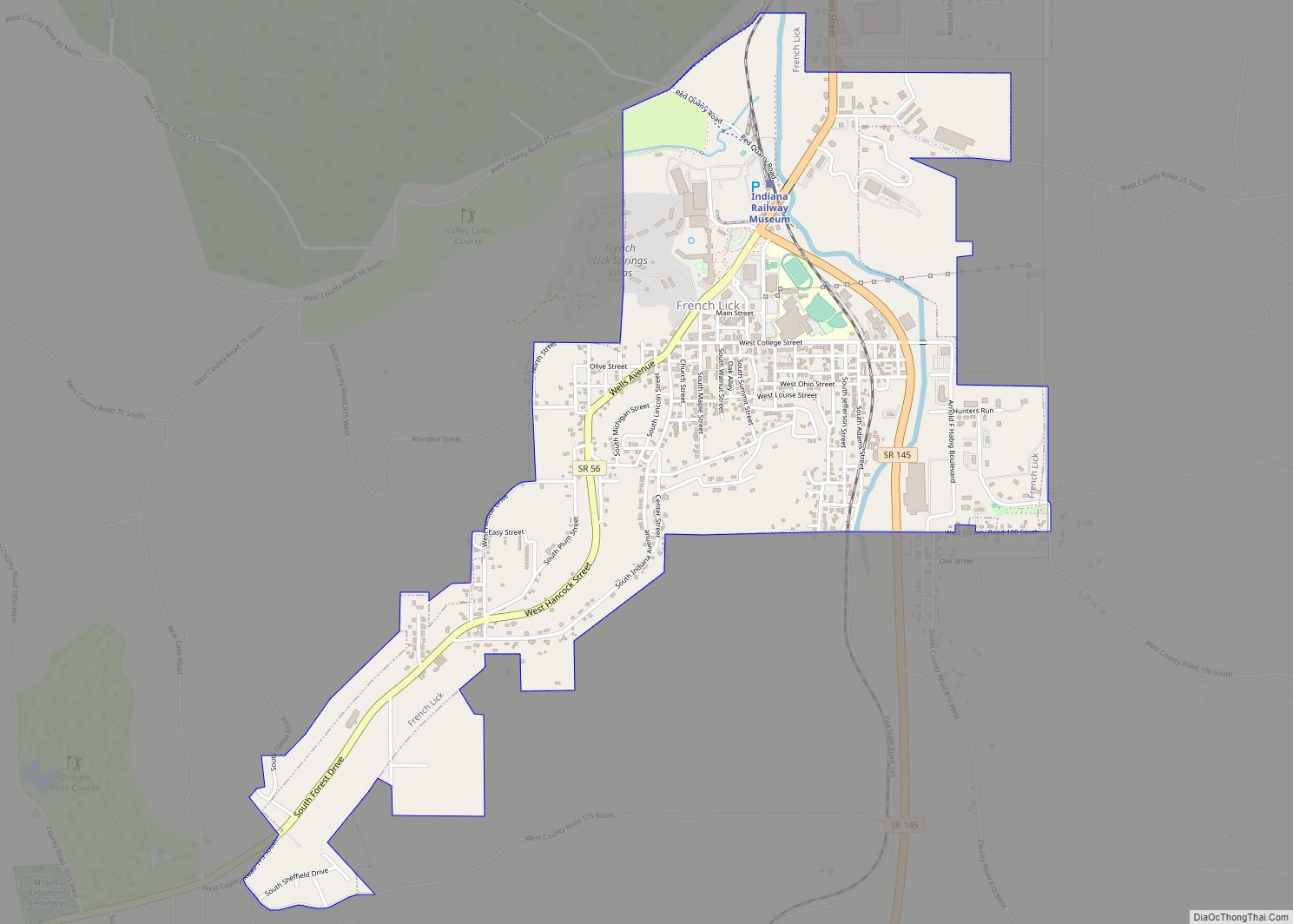
French Lick Road Map
French Lick city Satellite Map
Geography
According to the 2010 census, French Lick has a total area of 1.77 square miles (4.58 km), all land.
See also
Map of Indiana State and its subdivision:- Adams
- Allen
- Bartholomew
- Benton
- Blackford
- Boone
- Brown
- Carroll
- Cass
- Clark
- Clay
- Clinton
- Crawford
- Daviess
- De Kalb
- Dearborn
- Decatur
- Delaware
- Dubois
- Elkhart
- Fayette
- Floyd
- Fountain
- Franklin
- Fulton
- Gibson
- Grant
- Greene
- Hamilton
- Hancock
- Harrison
- Hendricks
- Henry
- Howard
- Huntington
- Jackson
- Jasper
- Jay
- Jefferson
- Jennings
- Johnson
- Knox
- Kosciusko
- LaGrange
- Lake
- Lake Michigan
- LaPorte
- Lawrence
- Madison
- Marion
- Marshall
- Martin
- Miami
- Monroe
- Montgomery
- Morgan
- Newton
- Noble
- Ohio
- Orange
- Owen
- Parke
- Perry
- Pike
- Porter
- Posey
- Pulaski
- Putnam
- Randolph
- Ripley
- Rush
- Saint Joseph
- Scott
- Shelby
- Spencer
- Starke
- Steuben
- Sullivan
- Switzerland
- Tippecanoe
- Tipton
- Union
- Vanderburgh
- Vermillion
- Vigo
- Wabash
- Warren
- Warrick
- Washington
- Wayne
- Wells
- White
- Whitley
- Alabama
- Alaska
- Arizona
- Arkansas
- California
- Colorado
- Connecticut
- Delaware
- District of Columbia
- Florida
- Georgia
- Hawaii
- Idaho
- Illinois
- Indiana
- Iowa
- Kansas
- Kentucky
- Louisiana
- Maine
- Maryland
- Massachusetts
- Michigan
- Minnesota
- Mississippi
- Missouri
- Montana
- Nebraska
- Nevada
- New Hampshire
- New Jersey
- New Mexico
- New York
- North Carolina
- North Dakota
- Ohio
- Oklahoma
- Oregon
- Pennsylvania
- Rhode Island
- South Carolina
- South Dakota
- Tennessee
- Texas
- Utah
- Vermont
- Virginia
- Washington
- West Virginia
- Wisconsin
- Wyoming

