Homecroft is a town in Perry Township, Marion County, Indiana, United States. The population was 752 at the 2020 census. Incorporated in 1949, it has existed as an included town since 1970, when it was incorporated into Indianapolis as part of Unigov. It is part of Indianapolis, but retains a functioning town government under IC 36-3-1-11.
| Name: | Homecroft town |
|---|---|
| LSAD Code: | 43 |
| LSAD Description: | town (suffix) |
| State: | Indiana |
| County: | Marion County |
| Elevation: | 758 ft (231 m) |
| Total Area: | 0.24 sq mi (0.62 km²) |
| Land Area: | 0.24 sq mi (0.62 km²) |
| Water Area: | 0.00 sq mi (0.00 km²) |
| Total Population: | 752 |
| Population Density: | 3,133.33/sq mi (1,209.42/km²) |
| ZIP code: | 46227 |
| FIPS code: | 1834420 |
| GNISfeature ID: | 0436370 |
| Website: | www.townofhomecroftin.gov |
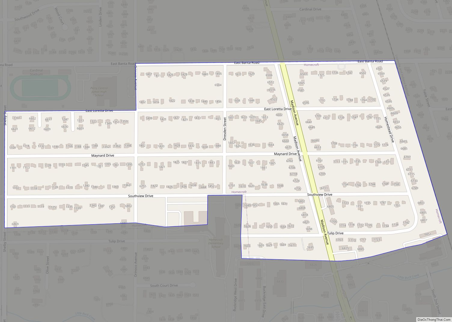
Online Interactive Map
Click on ![]() to view map in "full screen" mode.
to view map in "full screen" mode.
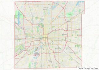
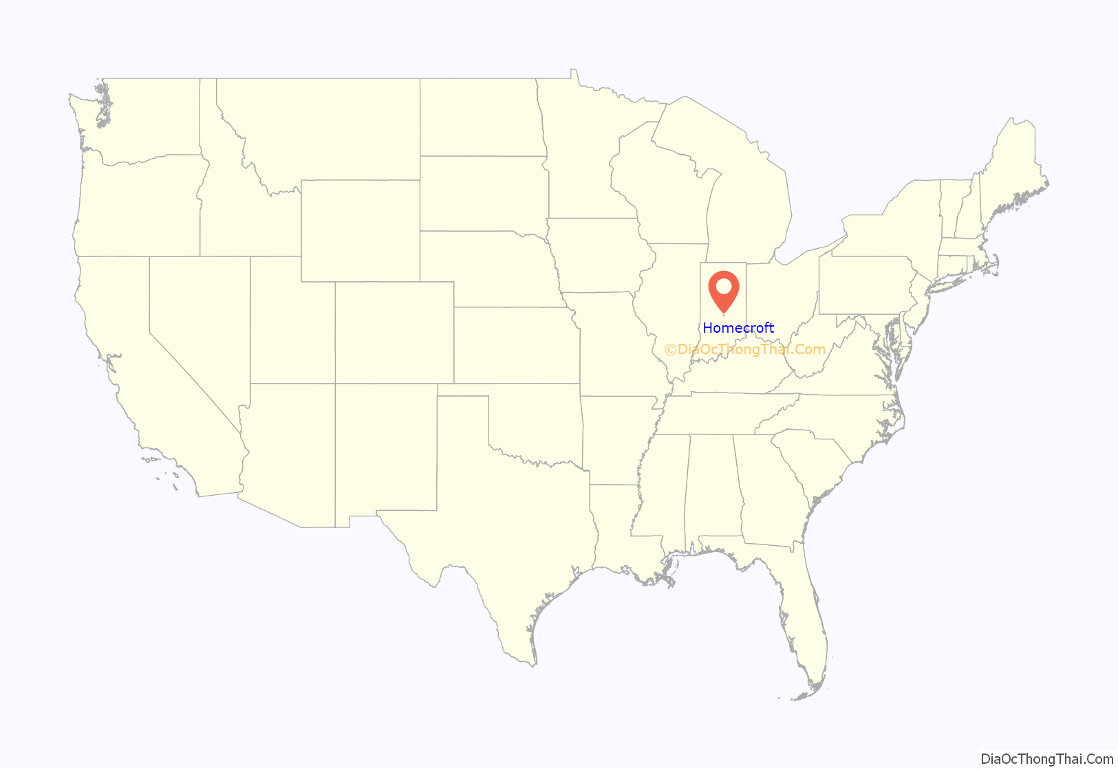
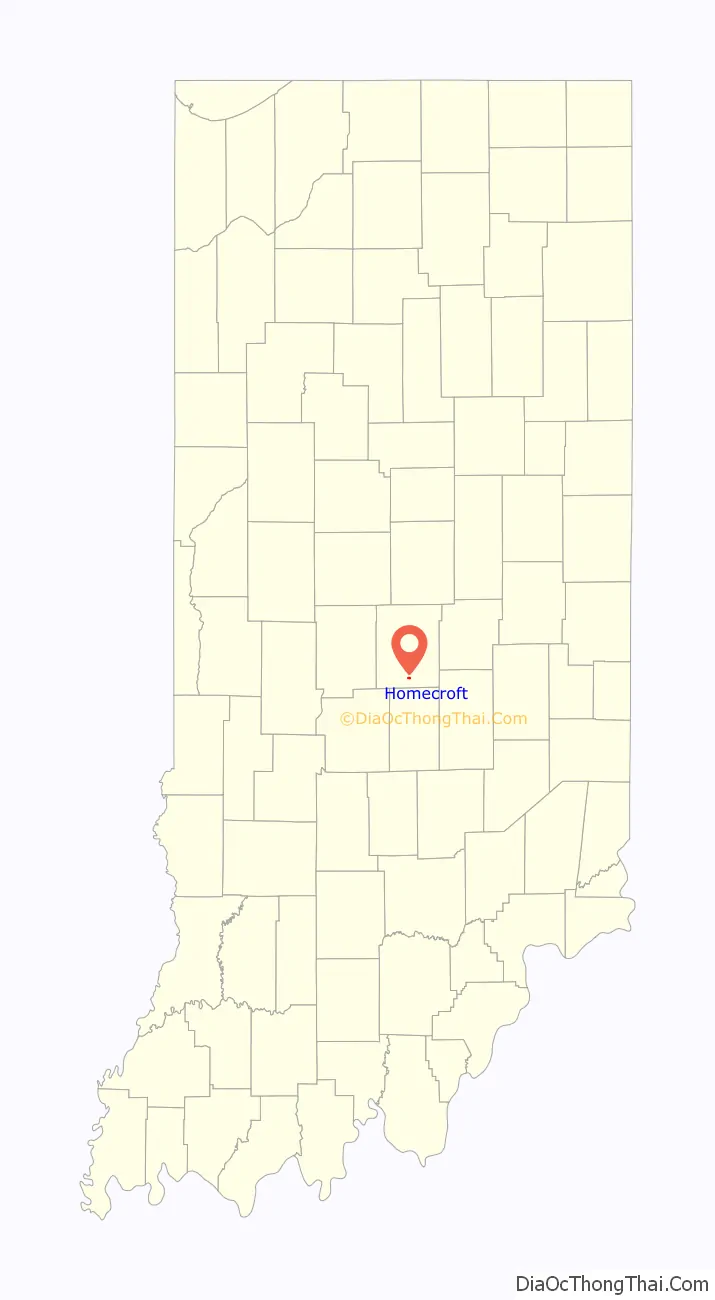
Homecroft location map. Where is Homecroft town?
History
Homecroft began in 1923 when Frank Gates and his son Oliver bought 150 acres (61 ha) and, after working with the Works Progress Administration in the early 1930s to install storm sewers to drain the swampy area, started selling lots on 80 acres (32 ha). The development’s location close to the interurban line in the 1930s and 1940s, and, as the automobile became prominent, to Madison Avenue in the 1950s and 1960s, made it popular for prospective suburban homeowners.
The town was incorporated in 1949. Two additional sections of 40 acres (16 ha) and 30 acres (12 ha), respectively, were developed in the early 1950s.
The town was designed to be exclusively residential, although a few commercial establishments have been built along Madison Avenue. A large portion of the town has been recognized on the National Register of Historic Places as the Homecroft Historic District.
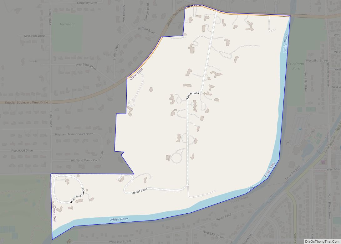
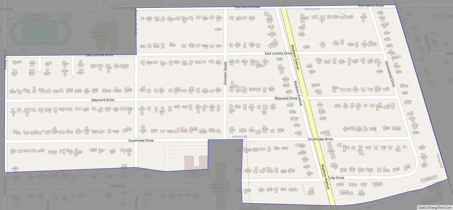
Homecroft Road Map
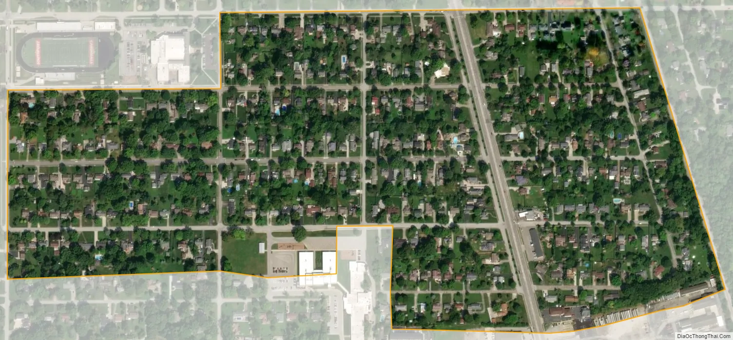
Homecroft city Satellite Map
Geography
Homecroft is located in southern Marion County at 39°40′8″N 86°7′48″W / 39.66889°N 86.13000°W / 39.66889; -86.13000 (39.668945, -86.129862). It is bounded roughly by Banta Road, the Louisville and Indiana Railroad tracks, Tulip Drive and Shelby Street. The town of Southport borders the south side of Homecroft.
According to the U.S. Census Bureau, Homecroft has a total area of 0.24 square miles (0.62 km), all land.
See also
Map of Indiana State and its subdivision:- Adams
- Allen
- Bartholomew
- Benton
- Blackford
- Boone
- Brown
- Carroll
- Cass
- Clark
- Clay
- Clinton
- Crawford
- Daviess
- De Kalb
- Dearborn
- Decatur
- Delaware
- Dubois
- Elkhart
- Fayette
- Floyd
- Fountain
- Franklin
- Fulton
- Gibson
- Grant
- Greene
- Hamilton
- Hancock
- Harrison
- Hendricks
- Henry
- Howard
- Huntington
- Jackson
- Jasper
- Jay
- Jefferson
- Jennings
- Johnson
- Knox
- Kosciusko
- LaGrange
- Lake
- Lake Michigan
- LaPorte
- Lawrence
- Madison
- Marion
- Marshall
- Martin
- Miami
- Monroe
- Montgomery
- Morgan
- Newton
- Noble
- Ohio
- Orange
- Owen
- Parke
- Perry
- Pike
- Porter
- Posey
- Pulaski
- Putnam
- Randolph
- Ripley
- Rush
- Saint Joseph
- Scott
- Shelby
- Spencer
- Starke
- Steuben
- Sullivan
- Switzerland
- Tippecanoe
- Tipton
- Union
- Vanderburgh
- Vermillion
- Vigo
- Wabash
- Warren
- Warrick
- Washington
- Wayne
- Wells
- White
- Whitley
- Alabama
- Alaska
- Arizona
- Arkansas
- California
- Colorado
- Connecticut
- Delaware
- District of Columbia
- Florida
- Georgia
- Hawaii
- Idaho
- Illinois
- Indiana
- Iowa
- Kansas
- Kentucky
- Louisiana
- Maine
- Maryland
- Massachusetts
- Michigan
- Minnesota
- Mississippi
- Missouri
- Montana
- Nebraska
- Nevada
- New Hampshire
- New Jersey
- New Mexico
- New York
- North Carolina
- North Dakota
- Ohio
- Oklahoma
- Oregon
- Pennsylvania
- Rhode Island
- South Carolina
- South Dakota
- Tennessee
- Texas
- Utah
- Vermont
- Virginia
- Washington
- West Virginia
- Wisconsin
- Wyoming