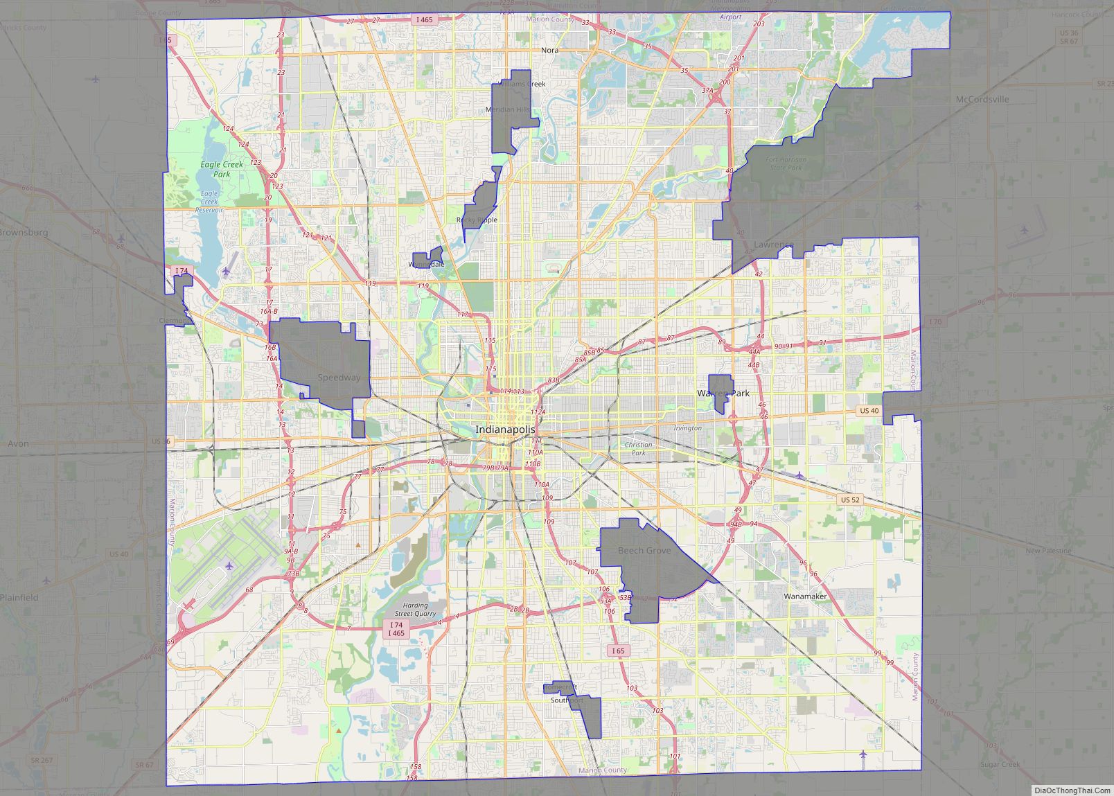
Lawrence is a city in Marion County, Indiana, United States. It is one of four “excluded cities” in Marion County. The city is home to Fort Benjamin Harrison within Fort Harrison State Park. The population was 49,370 at the 2020 census. The city is on the northeast side of Indianapolis.
| Name: | Lawrence city |
|---|---|
| LSAD Code: | 25 |
| LSAD Description: | city (suffix) |
| State: | Indiana |
| County: | Marion County |
| Elevation: | 873 ft (266 m) |
| Total Area: | 20.25 sq mi (52.43 km²) |
| Land Area: | 20.15 sq mi (52.18 km²) |
| Water Area: | 0.10 sq mi (0.25 km²) |
| Total Population: | 49,370 |
| Population Density: | 2,450.37/sq mi (946.11/km²) |
| ZIP code: | 46216, 46226, 46235, 46236 |
| Area code: | 317, 463 |
| FIPS code: | 1842426 |
| GNISfeature ID: | 0437666 |
| Website: | www.cityoflawrence.org |
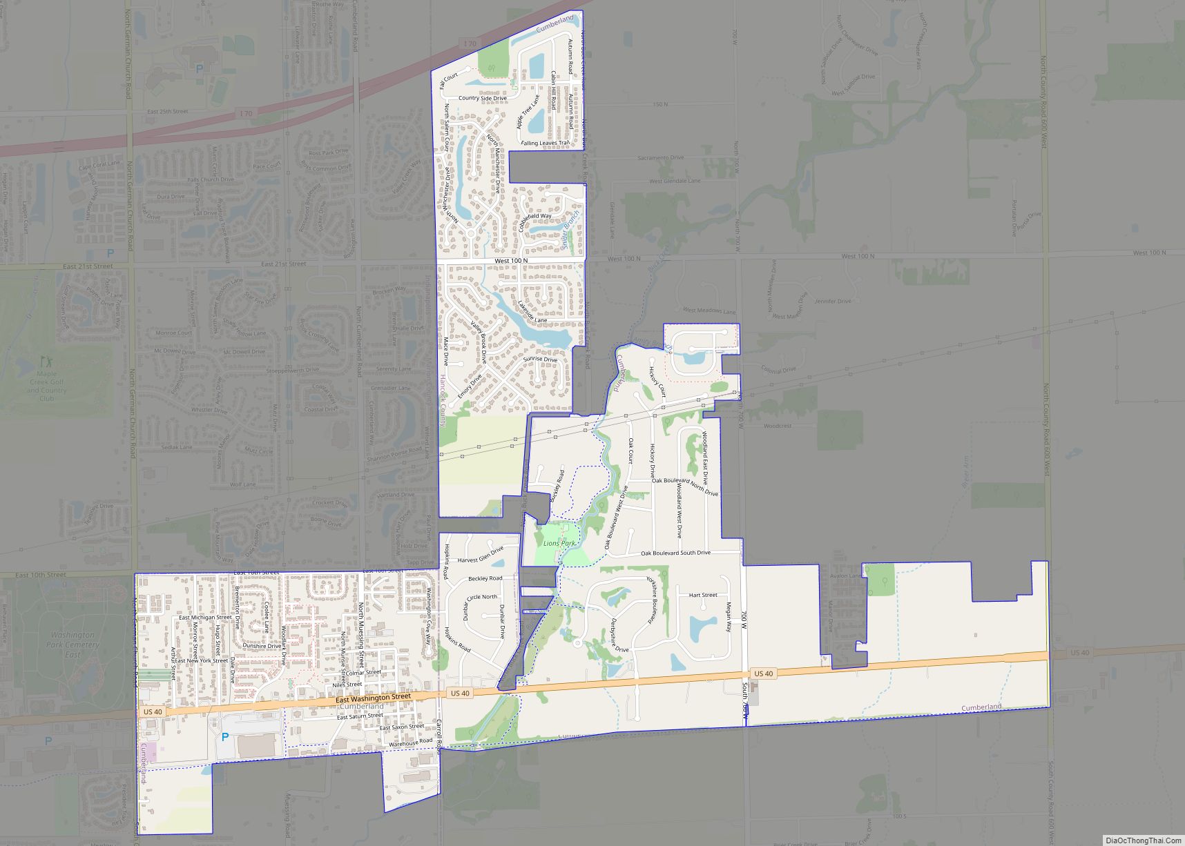
Online Interactive Map
Click on ![]() to view map in "full screen" mode.
to view map in "full screen" mode.
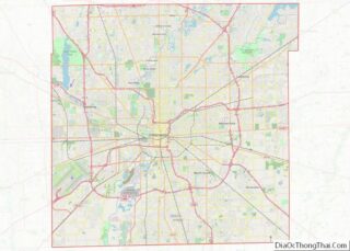
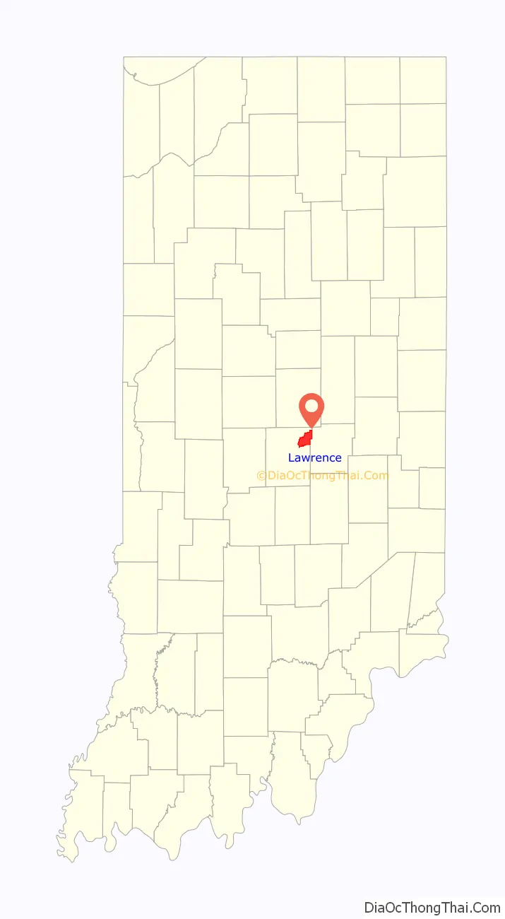
Lawrence location map. Where is Lawrence city?

History
The municipality was platted in 1849 under the name “Lanesville”, but other names were tried because there was already another Lanesville in Indiana. The name “Jamestown”, in honor of the town’s founder James White, was used for a while, but in 1866 the Marion County Commissioners approved the name “Lawrence”, which is also the name of the township in which it is located. The name was in honor of Captain James Lawrence, naval hero of the War of 1812. In 1929 the citizens of Lawrence voted to become an independent town, where they first established the town marshal, as well as other parts of government.
In 1969, Indianapolis and Marion County adopted a unified government structure known as Unigov. Lawrence is one of four “excluded cities” and therefore retains its own municipal government. Its citizens vote not only for the mayor and council of Lawrence, but also for the mayor of Indianapolis and representatives on the Indianapolis City-County Council.
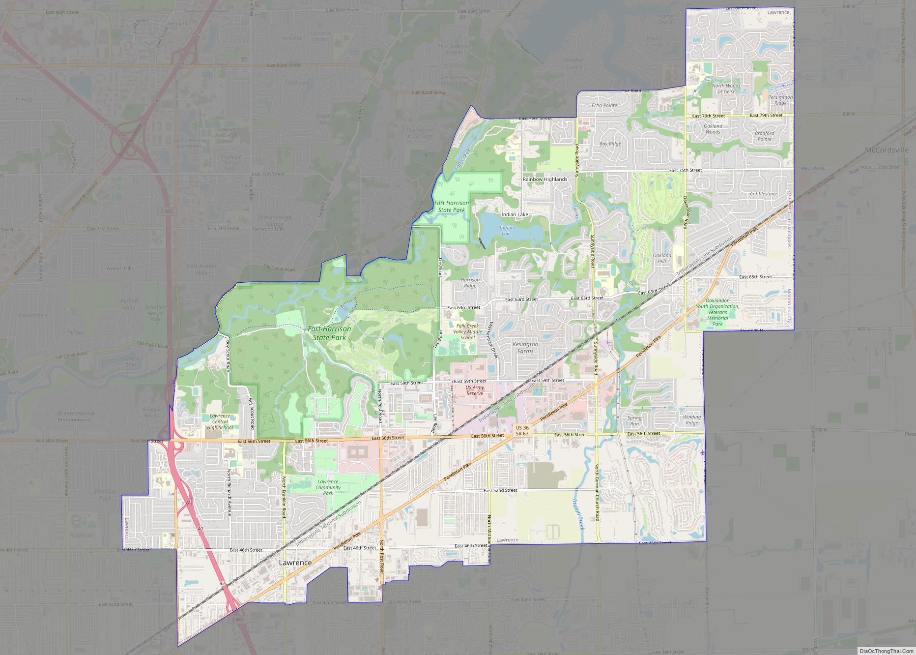
Lawrence Road Map
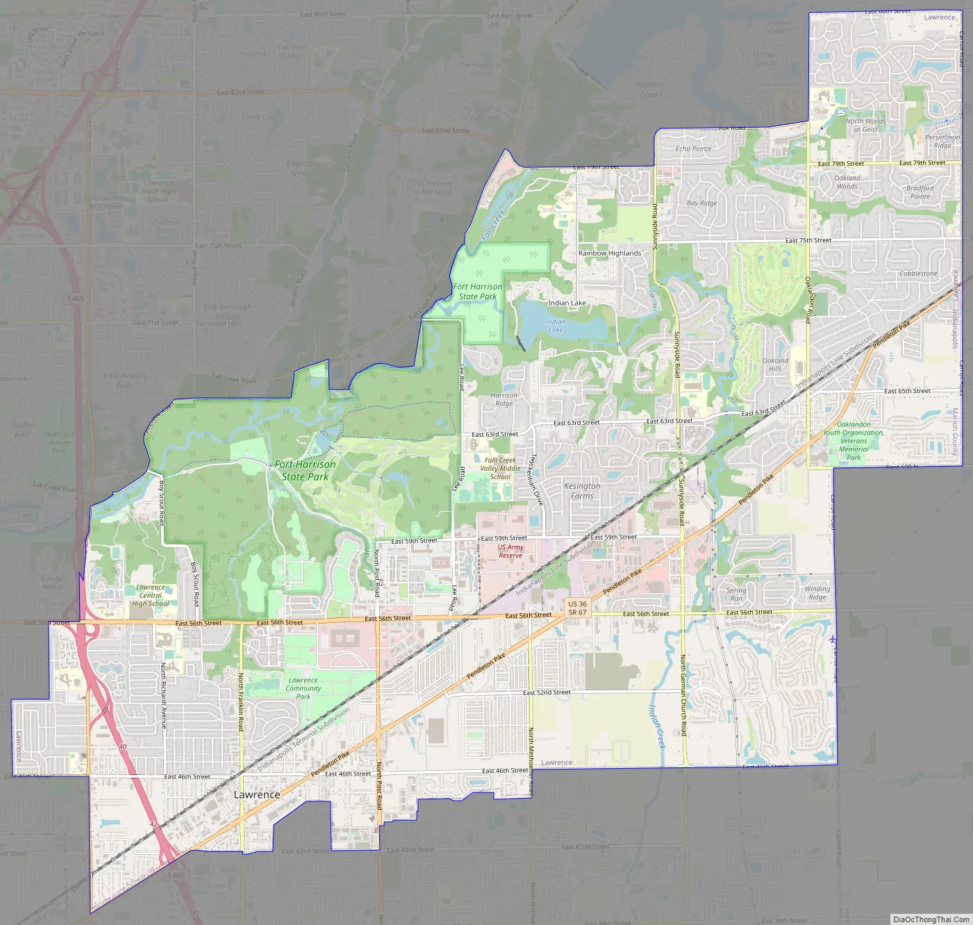
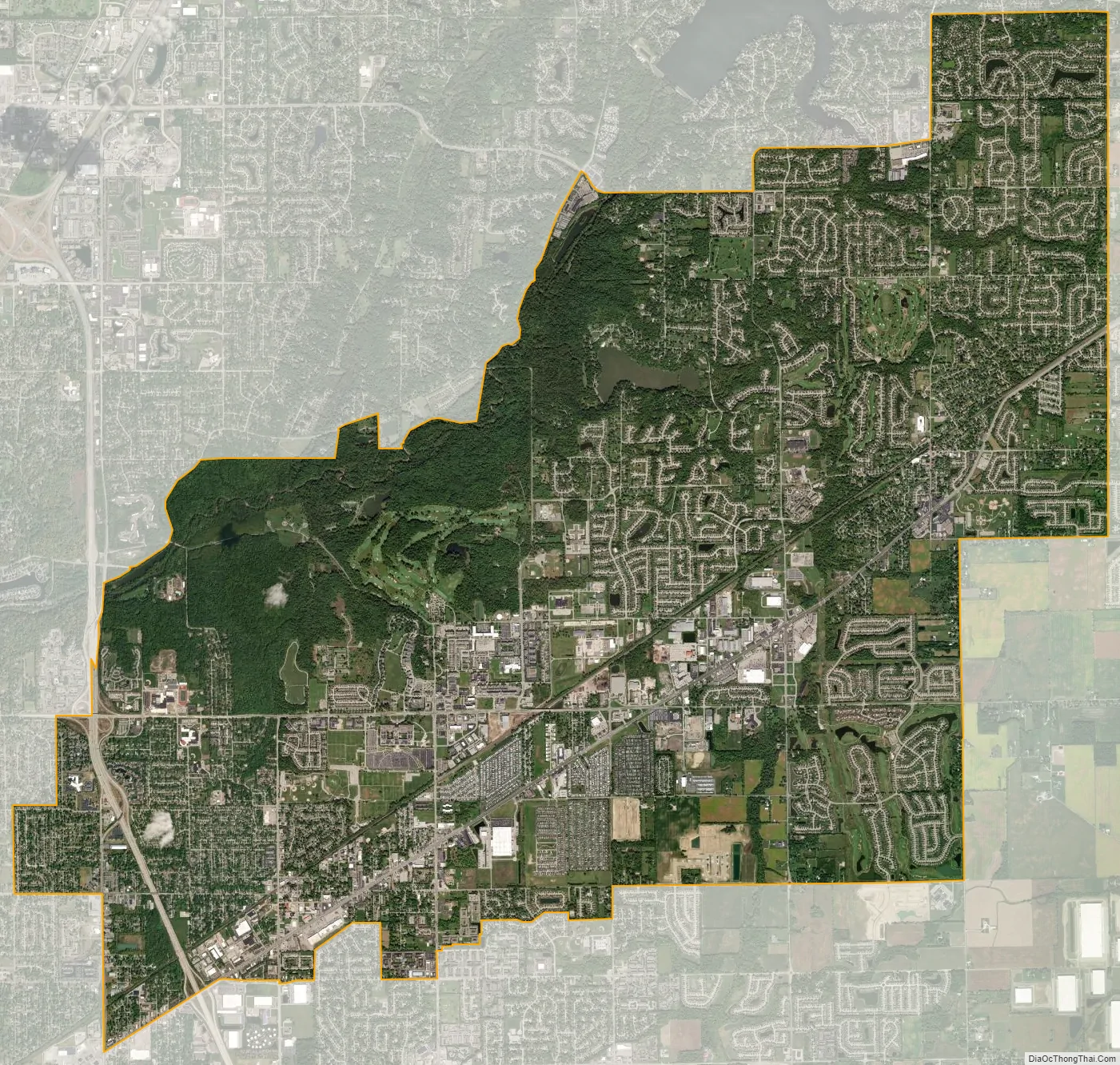
Lawrence city Satellite Map
Geography
Lawrence is located in northeastern Marion County at 39°51′46″N 85°59′39″W / 39.86278°N 85.99417°W / 39.86278; -85.99417 (39.862739, −85.994264). It is bordered to the east by Hancock County, including the town of McCordsville. Downtown Indianapolis is 9 miles (14 km) to the southwest. U.S. Route 36 (Pendleton Pike) runs through the city, leading northeast 22 miles (35 km) to Pendleton. US 36 intersects Interstate 465, the Indianapolis beltway, at that highway’s Exit 42 at the southwest corner of Lawrence. Exit 40 on I-465, with East 56th Street and North Shadeland Avenue, is along the western border of Lawrence.
According to the U.S. Census Bureau, Lawrence has a total area of 20.25 square miles (52.45 km), of which 0.10 square miles (0.26 km), or 0.48%, are water. Fall Creek, a southwest-flowing tributary of the White River flows through the northwest part of the city, and in places forms the city’s northwest boundary. Fort Harrison State Park is in the northwest part of the city as well.
Climate
The climate in this area is characterized by hot, humid summers and generally mild to cold winters. According to the Köppen Climate Classification system, Lawrence has a humid continental climate with hot summers and year around precipitation, abbreviated “Dfa” on climate maps.
See also
Map of Indiana State and its subdivision:- Adams
- Allen
- Bartholomew
- Benton
- Blackford
- Boone
- Brown
- Carroll
- Cass
- Clark
- Clay
- Clinton
- Crawford
- Daviess
- De Kalb
- Dearborn
- Decatur
- Delaware
- Dubois
- Elkhart
- Fayette
- Floyd
- Fountain
- Franklin
- Fulton
- Gibson
- Grant
- Greene
- Hamilton
- Hancock
- Harrison
- Hendricks
- Henry
- Howard
- Huntington
- Jackson
- Jasper
- Jay
- Jefferson
- Jennings
- Johnson
- Knox
- Kosciusko
- LaGrange
- Lake
- Lake Michigan
- LaPorte
- Lawrence
- Madison
- Marion
- Marshall
- Martin
- Miami
- Monroe
- Montgomery
- Morgan
- Newton
- Noble
- Ohio
- Orange
- Owen
- Parke
- Perry
- Pike
- Porter
- Posey
- Pulaski
- Putnam
- Randolph
- Ripley
- Rush
- Saint Joseph
- Scott
- Shelby
- Spencer
- Starke
- Steuben
- Sullivan
- Switzerland
- Tippecanoe
- Tipton
- Union
- Vanderburgh
- Vermillion
- Vigo
- Wabash
- Warren
- Warrick
- Washington
- Wayne
- Wells
- White
- Whitley
- Alabama
- Alaska
- Arizona
- Arkansas
- California
- Colorado
- Connecticut
- Delaware
- District of Columbia
- Florida
- Georgia
- Hawaii
- Idaho
- Illinois
- Indiana
- Iowa
- Kansas
- Kentucky
- Louisiana
- Maine
- Maryland
- Massachusetts
- Michigan
- Minnesota
- Mississippi
- Missouri
- Montana
- Nebraska
- Nevada
- New Hampshire
- New Jersey
- New Mexico
- New York
- North Carolina
- North Dakota
- Ohio
- Oklahoma
- Oregon
- Pennsylvania
- Rhode Island
- South Carolina
- South Dakota
- Tennessee
- Texas
- Utah
- Vermont
- Virginia
- Washington
- West Virginia
- Wisconsin
- Wyoming