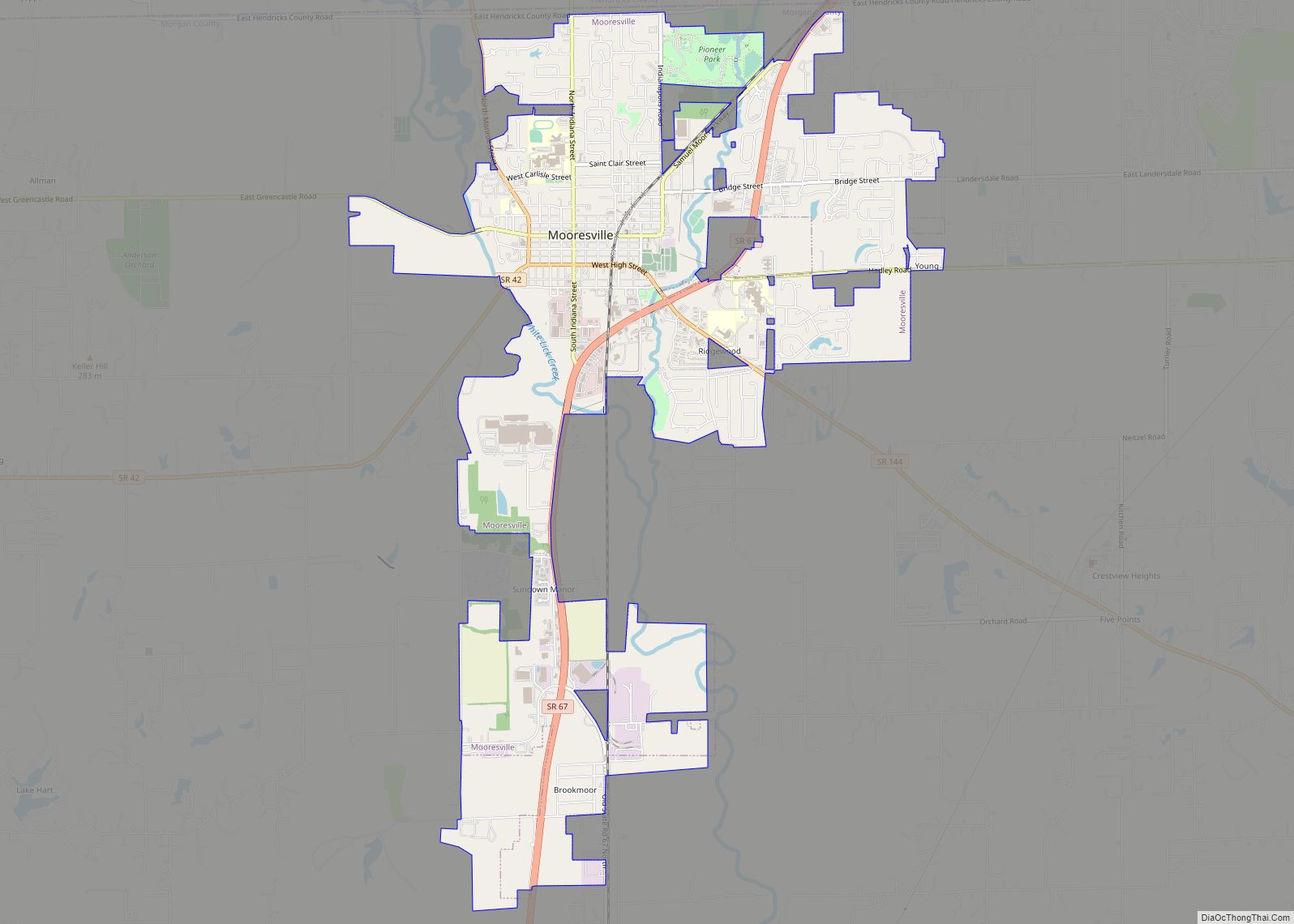
Mooresville is a town in Brown Township, Morgan County, in the U.S. state of Indiana. As of the 2020 census, the town population was 9,411.
| Name: | Mooresville town |
|---|---|
| LSAD Code: | 43 |
| LSAD Description: | town (suffix) |
| State: | Indiana |
| County: | Morgan County |
| Elevation: | 718 ft (219 m) |
| Total Area: | 6.76 sq mi (17.52 km²) |
| Land Area: | 6.71 sq mi (17.37 km²) |
| Water Area: | 0.06 sq mi (0.15 km²) |
| Total Population: | 9,411 |
| Population Density: | 1,403.37/sq mi (541.88/km²) |
| ZIP code: | 46158 |
| Area code: | 317, 463 |
| FIPS code: | 1850976 |
| GNISfeature ID: | 439412 |
| Website: | mooresville.in.gov |
Online Interactive Map
Click on ![]() to view map in "full screen" mode.
to view map in "full screen" mode.
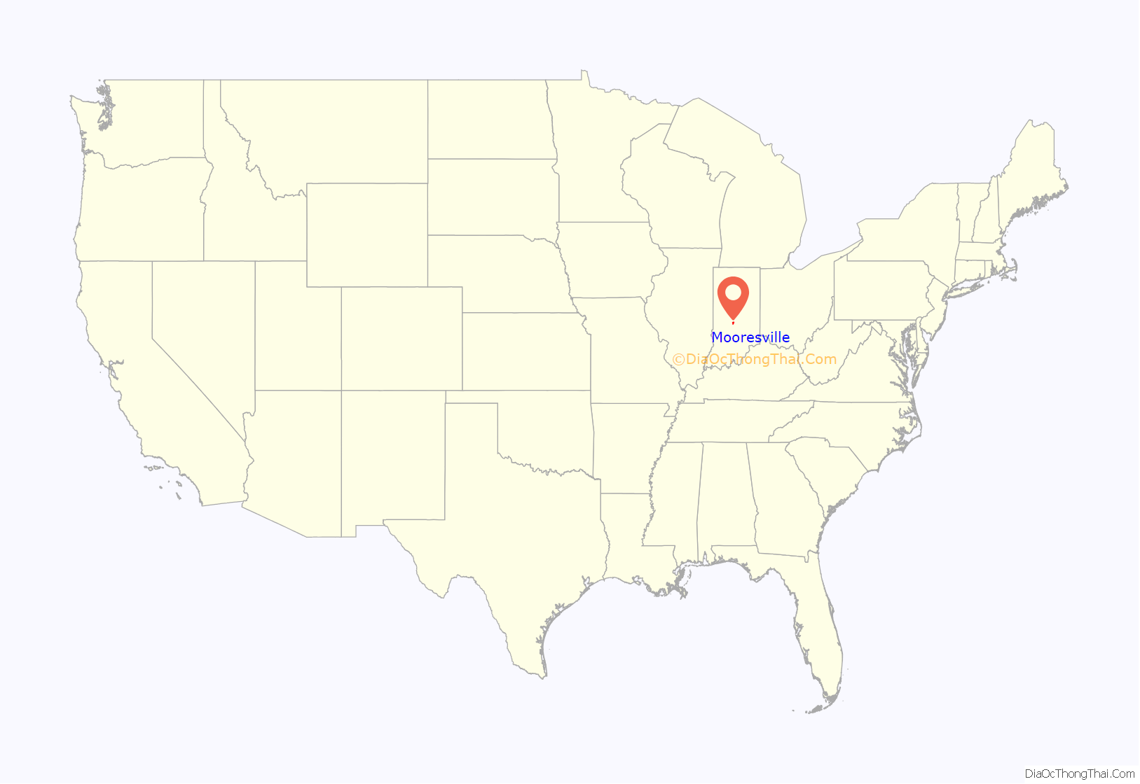
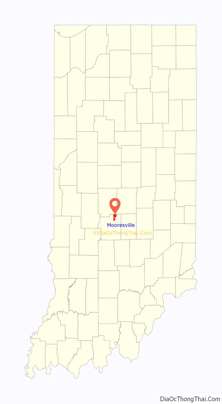
Mooresville location map. Where is Mooresville town?
History
Mooresville was founded in 1824 by Samuel Moore, and named for him. A post office has been in operation at Mooresville since 1826.
The Mooresville Commercial Historic District, Mooresville Friends Academy Building, and Mooresville Gymnasium are listed on the National Register of Historic Places.
On April 8, 2020, an EF1 tornado hit downtown, with significant winds around 100 miles per hour (160 km/h).
Mooresville Road Map
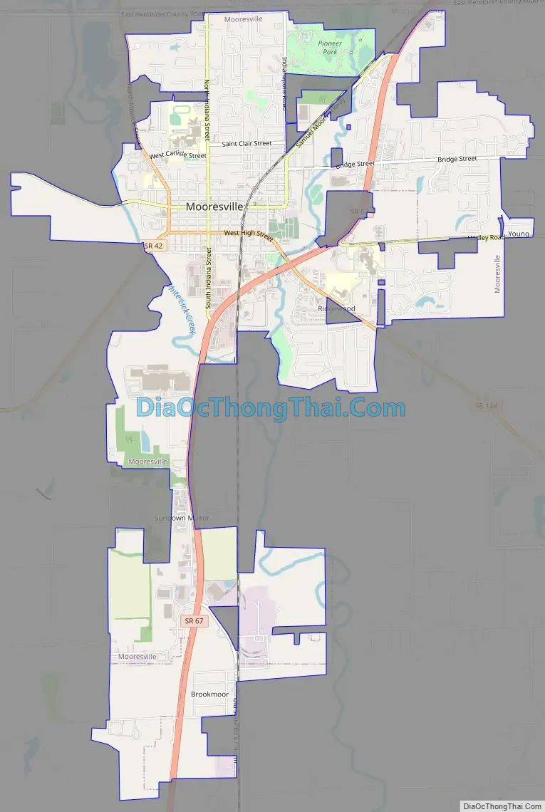
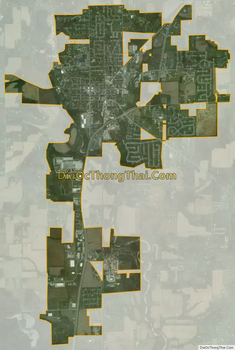
Mooresville city Satellite Map
Geography
Mooresville is in northeastern Morgan County; the northern border of the town follows the Hendricks County line. Indiana State Road 42 passes through the center of town on High Street. It leads west 6 miles (10 km) to Monrovia, and its eastern terminus is at State Road 67 on the east side of Mooresville. SR 67 is a four-lane highway that leads northeast 16 miles (26 km) to Indianapolis and south-southwest 15 miles (24 km) to Martinsville, the Morgan county seat. State Road 144 begins at the SR 42/SR67 intersection and leads southeast 19 miles (31 km) to Franklin.
According to the U.S. Census Bureau, Mooresville has a total area of 6.76 square miles (17.51 km), of which 0.06 square miles (0.16 km), or 0.84%, are water. The center of Mooresville sits between White Lick Creek to the west and its East Fork to the east. White Lick Creek flows south to join the White River north of Martinsville.
See also
Map of Indiana State and its subdivision:- Adams
- Allen
- Bartholomew
- Benton
- Blackford
- Boone
- Brown
- Carroll
- Cass
- Clark
- Clay
- Clinton
- Crawford
- Daviess
- De Kalb
- Dearborn
- Decatur
- Delaware
- Dubois
- Elkhart
- Fayette
- Floyd
- Fountain
- Franklin
- Fulton
- Gibson
- Grant
- Greene
- Hamilton
- Hancock
- Harrison
- Hendricks
- Henry
- Howard
- Huntington
- Jackson
- Jasper
- Jay
- Jefferson
- Jennings
- Johnson
- Knox
- Kosciusko
- LaGrange
- Lake
- Lake Michigan
- LaPorte
- Lawrence
- Madison
- Marion
- Marshall
- Martin
- Miami
- Monroe
- Montgomery
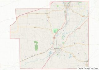
- Morgan
- Newton
- Noble
- Ohio
- Orange
- Owen
- Parke
- Perry
- Pike
- Porter
- Posey
- Pulaski
- Putnam
- Randolph
- Ripley
- Rush
- Saint Joseph
- Scott
- Shelby
- Spencer
- Starke
- Steuben
- Sullivan
- Switzerland
- Tippecanoe
- Tipton
- Union
- Vanderburgh
- Vermillion
- Vigo
- Wabash
- Warren
- Warrick
- Washington
- Wayne
- Wells
- White
- Whitley
- Alabama
- Alaska
- Arizona
- Arkansas
- California
- Colorado
- Connecticut
- Delaware
- District of Columbia
- Florida
- Georgia
- Hawaii
- Idaho
- Illinois
- Indiana
- Iowa
- Kansas
- Kentucky
- Louisiana
- Maine
- Maryland
- Massachusetts
- Michigan
- Minnesota
- Mississippi
- Missouri
- Montana
- Nebraska
- Nevada
- New Hampshire
- New Jersey
- New Mexico
- New York
- North Carolina
- North Dakota
- Ohio
- Oklahoma
- Oregon
- Pennsylvania
- Rhode Island
- South Carolina
- South Dakota
- Tennessee
- Texas
- Utah
- Vermont
- Virginia
- Washington
- West Virginia
- Wisconsin
- Wyoming