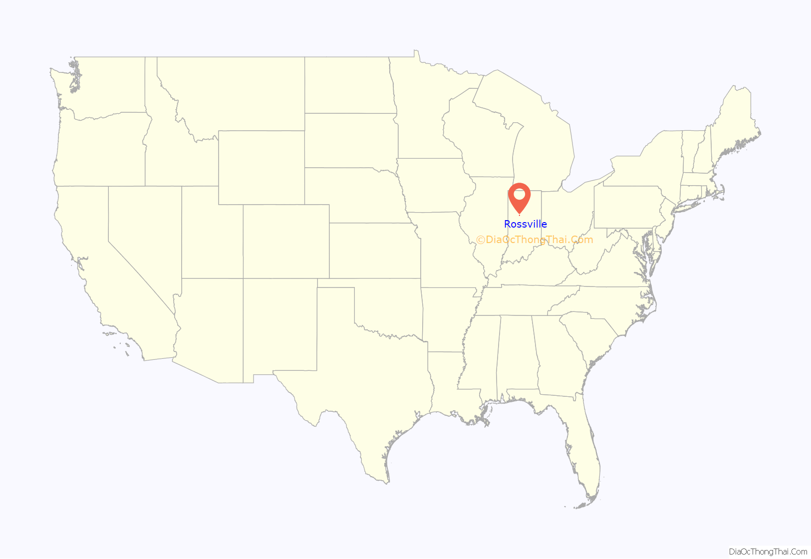
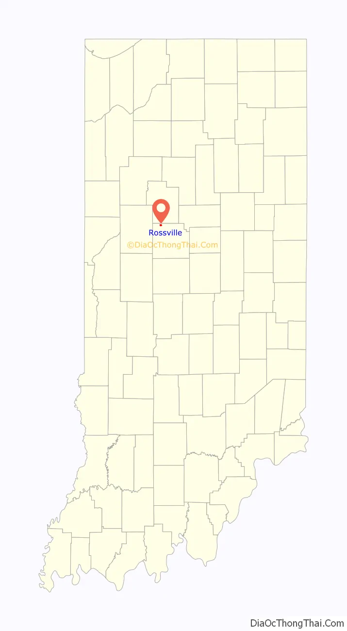
Rossville is a town in Ross Township, Clinton County, Indiana, United States. The population was 1,653 at the 2010 census.
| Name: | Rossville town |
|---|---|
| LSAD Code: | 43 |
| LSAD Description: | town (suffix) |
| State: | Indiana |
| County: | Clinton County |
| Founded: | 1832 |
| Incorporated: | 1870 |
| Elevation: | 725 ft (221 m) |
| Total Area: | 0.46 sq mi (1.19 km²) |
| Land Area: | 0.46 sq mi (1.19 km²) |
| Water Area: | 0.00 sq mi (0.00 km²) |
| Total Population: | 1,508 |
| Population Density: | 3,285.40/sq mi (1,268.04/km²) |
| ZIP code: | 46065 |
| Area code: | 765 |
| FIPS code: | 1866150 |
| GNISfeature ID: | 0442329 |
| Website: | www.rossville.net |
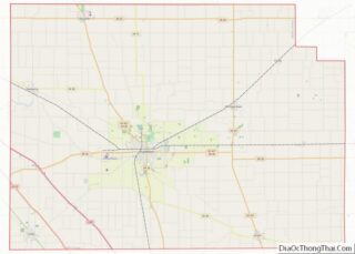
Online Interactive Map
Click on ![]() to view map in "full screen" mode.
to view map in "full screen" mode.
Rossville location map. Where is Rossville town?
History
In 1832, Thomas Ewing, with his wife and infant child, settled on 160 acres (0.65 km) of land north of what is now Main Street in Rossville. In 1834, Ewing and Thomas Smith platted the town of Rossville with the intention of starting a blacksmith shop at the location. The town grew steadily and gained a store operated by William Seawright, a saddler (John H. Smith) and a physician (Dr. James Wilson). Residents of Rossville are also referred to as “Rossvillians”.
A petition to incorporate the town was filed on October 22, 1870, at which time the town had 339 residents and 66 families. The incorporation election, held November 5, passed with a vote of 35 to 19 and on December 1, 1870, Rossville was incorporated. The town is named for John Ross, a pioneer settler and associate county judge.
The Monon Railroad was completed through Rossville in 1883.
Rossville Road Map
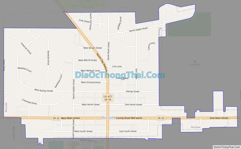
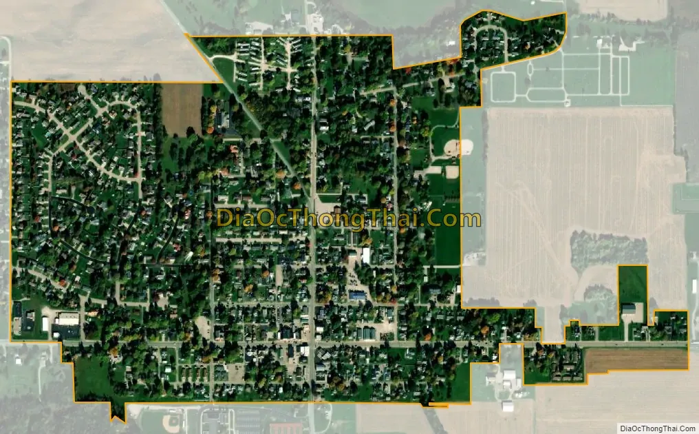
Rossville city Satellite Map
Geography
Rossville is located at 40°25′9″N 86°35′47″W / 40.41917°N 86.59639°W / 40.41917; -86.59639 (40.419138, -86.596466).
According to the 2010 census, Rossville has a total area of 0.52 square miles (1.35 km), all land.
See also
Map of Indiana State and its subdivision:- Adams
- Allen
- Bartholomew
- Benton
- Blackford
- Boone
- Brown
- Carroll
- Cass
- Clark
- Clay
- Clinton
- Crawford
- Daviess
- De Kalb
- Dearborn
- Decatur
- Delaware
- Dubois
- Elkhart
- Fayette
- Floyd
- Fountain
- Franklin
- Fulton
- Gibson
- Grant
- Greene
- Hamilton
- Hancock
- Harrison
- Hendricks
- Henry
- Howard
- Huntington
- Jackson
- Jasper
- Jay
- Jefferson
- Jennings
- Johnson
- Knox
- Kosciusko
- LaGrange
- Lake
- Lake Michigan
- LaPorte
- Lawrence
- Madison
- Marion
- Marshall
- Martin
- Miami
- Monroe
- Montgomery
- Morgan
- Newton
- Noble
- Ohio
- Orange
- Owen
- Parke
- Perry
- Pike
- Porter
- Posey
- Pulaski
- Putnam
- Randolph
- Ripley
- Rush
- Saint Joseph
- Scott
- Shelby
- Spencer
- Starke
- Steuben
- Sullivan
- Switzerland
- Tippecanoe
- Tipton
- Union
- Vanderburgh
- Vermillion
- Vigo
- Wabash
- Warren
- Warrick
- Washington
- Wayne
- Wells
- White
- Whitley
- Alabama
- Alaska
- Arizona
- Arkansas
- California
- Colorado
- Connecticut
- Delaware
- District of Columbia
- Florida
- Georgia
- Hawaii
- Idaho
- Illinois
- Indiana
- Iowa
- Kansas
- Kentucky
- Louisiana
- Maine
- Maryland
- Massachusetts
- Michigan
- Minnesota
- Mississippi
- Missouri
- Montana
- Nebraska
- Nevada
- New Hampshire
- New Jersey
- New Mexico
- New York
- North Carolina
- North Dakota
- Ohio
- Oklahoma
- Oregon
- Pennsylvania
- Rhode Island
- South Carolina
- South Dakota
- Tennessee
- Texas
- Utah
- Vermont
- Virginia
- Washington
- West Virginia
- Wisconsin
- Wyoming