South Lyon is a city in Oakland County in the U.S. state of Michigan. The population was 11,746 at the 2020 census, up from 11,327 at the 2010 census.
As a western suburb of Metro Detroit, South Lyon is about 20 miles (32.2 km) northwest of the city of Detroit and the same distance northeast of the city of Ann Arbor.
| Name: | South Lyon city |
|---|---|
| LSAD Code: | 25 |
| LSAD Description: | city (suffix) |
| State: | Michigan |
| County: | Oakland County |
| Incorporated: | 1873 (village) 1930 (city) |
| Elevation: | 928 ft (283 m) |
| Land Area: | 3.74 sq mi (9.69 km²) |
| Water Area: | 0.00 sq mi (0.01 km²) |
| Population Density: | 3,139.80/sq mi (1,212.19/km²) |
| Area code: | 248 |
| FIPS code: | 2675100 |
| GNISfeature ID: | 0638381 |
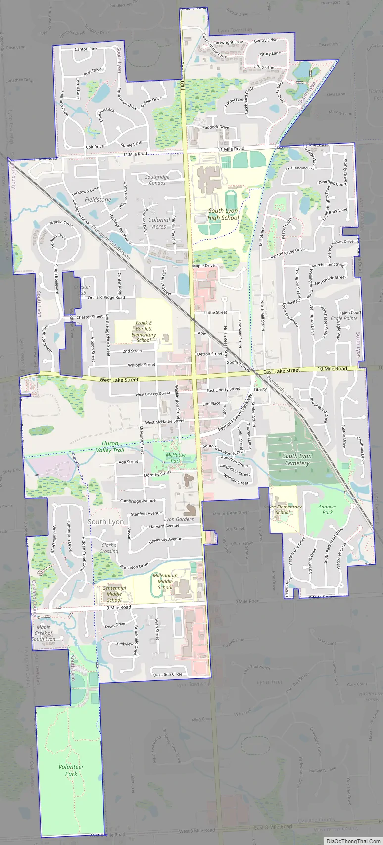
Online Interactive Map
Click on ![]() to view map in "full screen" mode.
to view map in "full screen" mode.
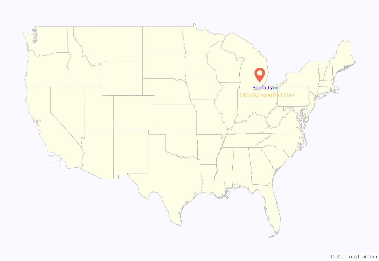
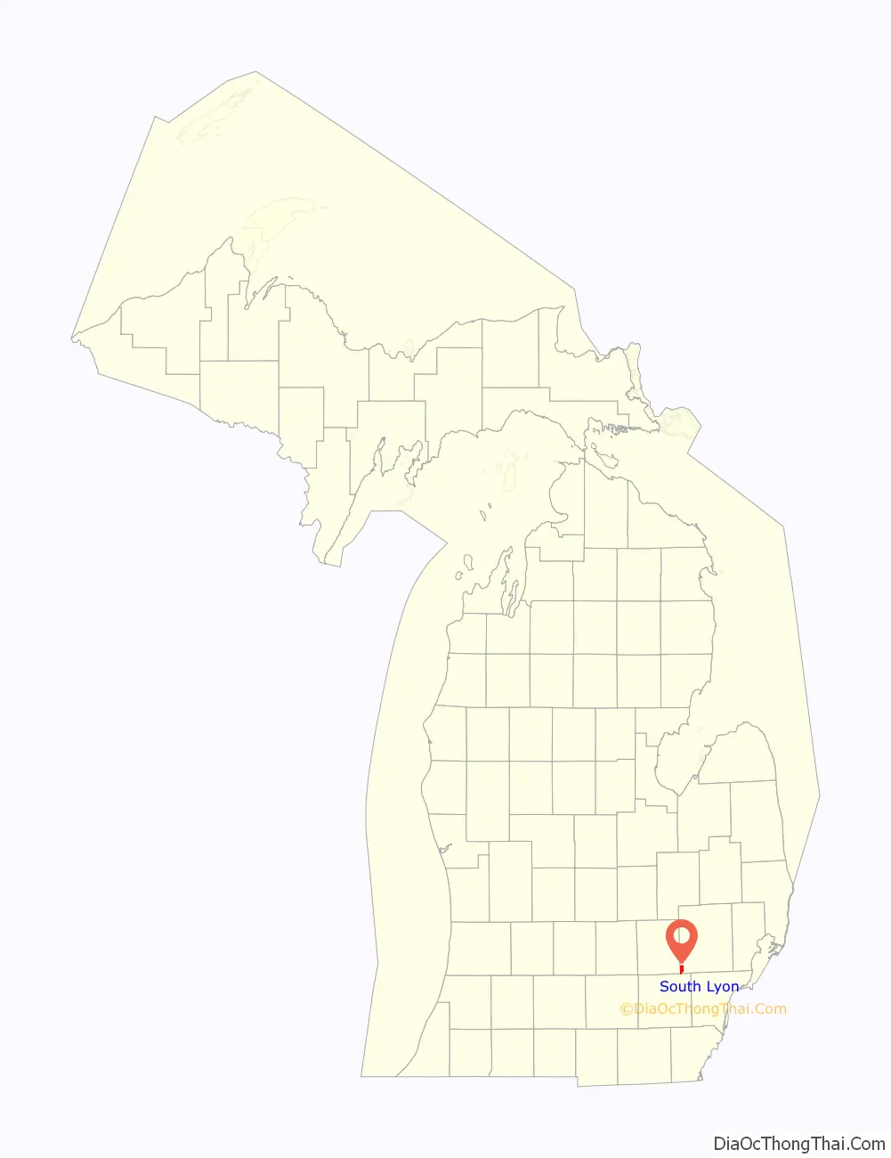
South Lyon location map. Where is South Lyon city?
History
South Lyon was founded in 1832 and was called Thompson’s Corners. In the same year, the surrounding township was named Lyon after Lucius Lyon, a member of the state legislature. The village was given a name for its location within the township. South Lyon was incorporated as a village in 1873 and as a city in 1930.
Three rail lines once passed through South Lyon. In the summer of 1871, the Detroit, Lansing, and Northern Railroad were built west from Plymouth on the way to Lansing and Ionia. In 1880, the predecessor to the Ann Arbor Railroad built a line into town from Ann Arbor. This line’s goal was to continue toward Pontiac, but that did not occur under the original owners. The line was pulled up around 1890. In 1883 the Grand Trunk built their Jackson Branch from Pontiac to Jackson, which crossed the Pere Marquette at South Lyon. The GTW branch line continued to serve South Lyon until the early 1980s. The branch line is now a paved bicycle trail through town, and Reynold Sweet Parkway follows the original route. Today, South Lyon hosts the CSX main line from Detroit to Grand Rapids, and a passing track is located there.
South Lyon Road Map
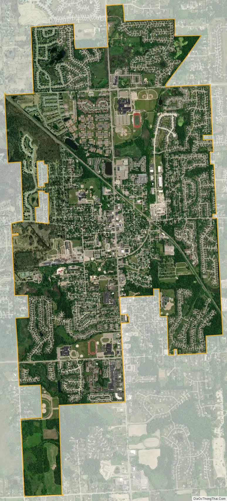
South Lyon city Satellite Map
Geography
According to the United States Census Bureau, the city has a total area of 3.74 square miles (9.69 km), of which 3.73 square miles (9.66 km) is land and 0.01 square miles (0.03 km) (0.27%) is water.
See also
Map of Michigan State and its subdivision:- Alcona
- Alger
- Allegan
- Alpena
- Antrim
- Arenac
- Baraga
- Barry
- Bay
- Benzie
- Berrien
- Branch
- Calhoun
- Cass
- Charlevoix
- Cheboygan
- Chippewa
- Clare
- Clinton
- Crawford
- Delta
- Dickinson
- Eaton
- Emmet
- Genesee
- Gladwin
- Gogebic
- Grand Traverse
- Gratiot
- Hillsdale
- Houghton
- Huron
- Ingham
- Ionia
- Iosco
- Iron
- Isabella
- Jackson
- Kalamazoo
- Kalkaska
- Kent
- Keweenaw
- Lake
- Lake Hurron
- Lake Michigan
- Lake St. Clair
- Lake Superior
- Lapeer
- Leelanau
- Lenawee
- Livingston
- Luce
- Mackinac
- Macomb
- Manistee
- Marquette
- Mason
- Mecosta
- Menominee
- Midland
- Missaukee
- Monroe
- Montcalm
- Montmorency
- Muskegon
- Newaygo
- Oakland
- Oceana
- Ogemaw
- Ontonagon
- Osceola
- Oscoda
- Otsego
- Ottawa
- Presque Isle
- Roscommon
- Saginaw
- Saint Clair
- Saint Joseph
- Sanilac
- Schoolcraft
- Shiawassee
- Tuscola
- Van Buren
- Washtenaw
- Wayne
- Wexford
- Alabama
- Alaska
- Arizona
- Arkansas
- California
- Colorado
- Connecticut
- Delaware
- District of Columbia
- Florida
- Georgia
- Hawaii
- Idaho
- Illinois
- Indiana
- Iowa
- Kansas
- Kentucky
- Louisiana
- Maine
- Maryland
- Massachusetts
- Michigan
- Minnesota
- Mississippi
- Missouri
- Montana
- Nebraska
- Nevada
- New Hampshire
- New Jersey
- New Mexico
- New York
- North Carolina
- North Dakota
- Ohio
- Oklahoma
- Oregon
- Pennsylvania
- Rhode Island
- South Carolina
- South Dakota
- Tennessee
- Texas
- Utah
- Vermont
- Virginia
- Washington
- West Virginia
- Wisconsin
- Wyoming


