Keytesville is a city in and the county seat of Chariton County, Missouri, United States. The population was 440 as of the 2020 census. Keytesville is the hometown of U.S. Army General Maxwell D. Taylor, who commanded the “Screaming Eagles” 101st Airborne division during the Normandy invasion of World War II. Confederate General Sterling Price, who attacked Keytesville during an unsuccessful cavalry raid across his home state, had previously operated a hotel there.
| Name: | Keytesville city |
|---|---|
| LSAD Code: | 25 |
| LSAD Description: | city (suffix) |
| State: | Missouri |
| County: | Chariton County |
| Incorporated: | 1868 |
| Elevation: | 702 ft (214 m) |
| Total Area: | 0.78 sq mi (2.02 km²) |
| Land Area: | 0.77 sq mi (1.99 km²) |
| Water Area: | 0.01 sq mi (0.03 km²) |
| Total Population: | 440 |
| Population Density: | 572.17/sq mi (220.93/km²) |
| ZIP code: | 65261 |
| Area code: | 660 |
| FIPS code: | 2938468 |
| GNISfeature ID: | 2395525 |
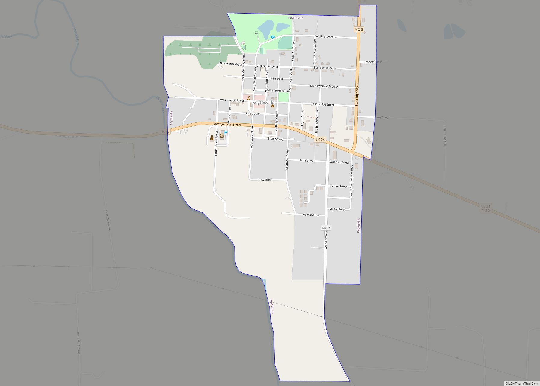
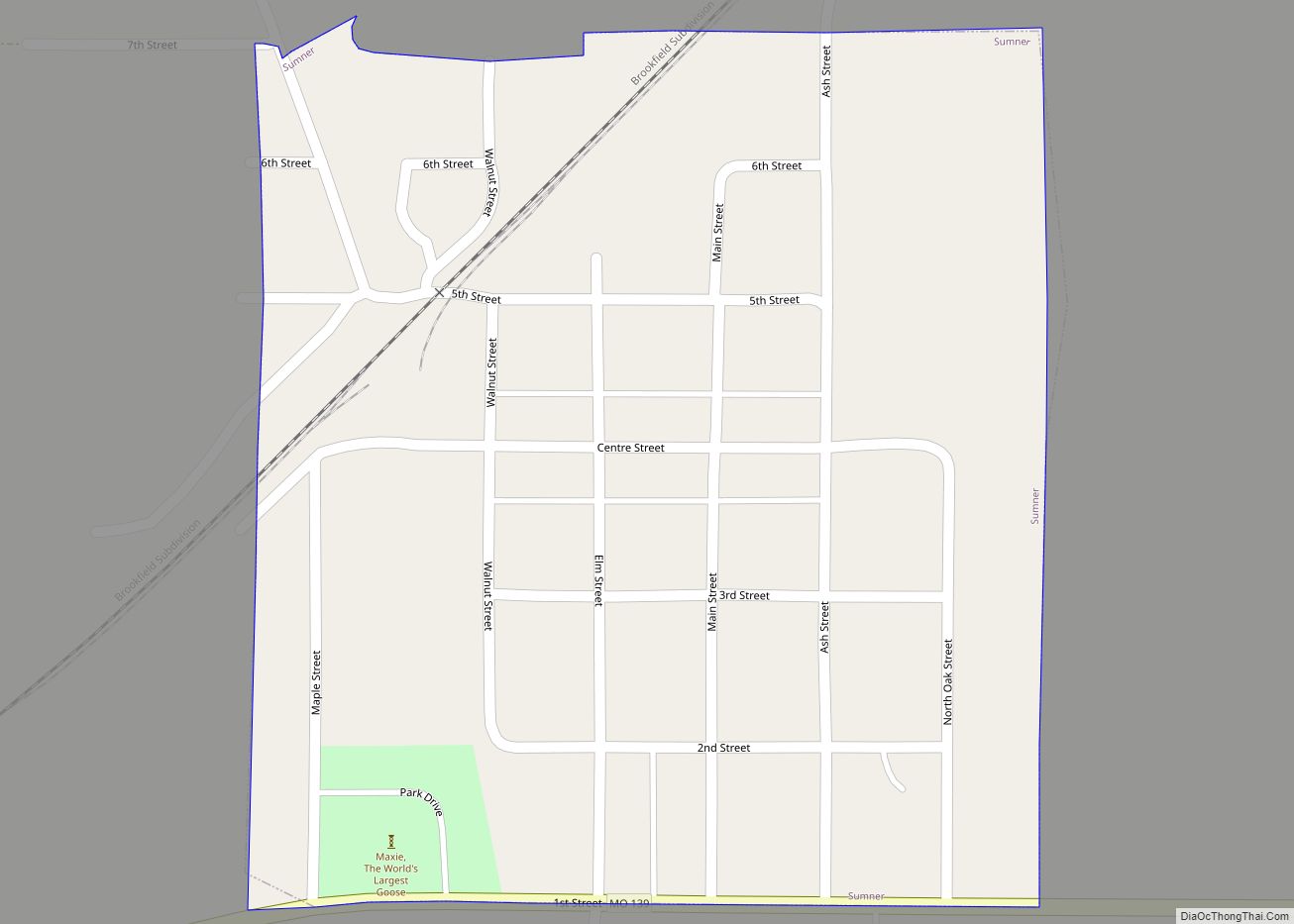
Online Interactive Map
Click on ![]() to view map in "full screen" mode.
to view map in "full screen" mode.
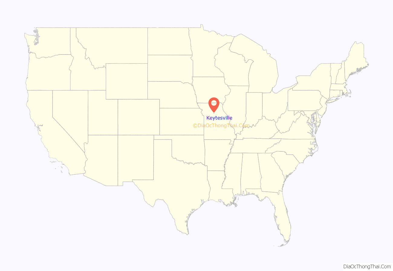
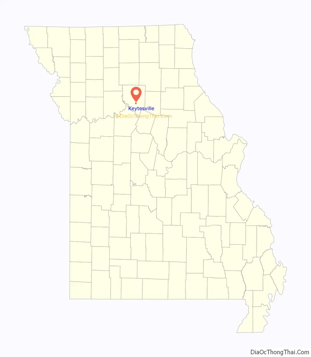
Keytesville location map. Where is Keytesville city?
History
The town is named for James Keyte, an Englishman and Methodist preacher who purchased a large parcel of land in 1830 and, two years later, donated fifty acres of it to Chariton County to establish a seat of county government. Until then, county business had been conducted from “Old Chariton,” a village near the confluence of the Chariton and Missouri Rivers that was plagued by disease-spreading mosquitoes and subject to repeated flooding.
James Keyte constructed the first home in Keytesville, and the first business as well. Both were log structures, with the second doubling as a post office. Keyte also created the town’s first industry when he constructed a mill near his home on Mussel Fork Creek.
The first courthouse was constructed in Keytesville between 1833 and 1834. As a two-story, four-room brick building, it survived until September 20, 1864, when it was burned down by Confederate raiders during the American Civil War.
Isaac Redding added Keytesville’s first hotel in August 1842.
Keytesville was incorporated on February 3, 1868, by the state of Missouri, and incorporated as a Missouri 4th-class city in March 1883.
Confederate raid
On September 20, 1864, Confederate General Samuel Price arrived on the outskirts of Keytesville with a force of 250 men, among them George Todd and other members of Quantrill’s Raiders under the command of Major John Thrailkill. This action was part of Price’s 1864 campaign that extended across the state from eastern Missouri to the Kansas City area. When Thrailkill’s force arrived, Keytesville was defended by a small Union detachment of 35 men from the Missouri militia, commanded by Lieutenant Anthony Pleyer. Many local residents were sympathetic to the Confederate cause. Early on the morning of September 20, under a flag of truce, Thrailkill demanded the surrender of the Union troops, promising fair treatment. Unable to persuade his men to fight, Pleyer surrendered. Price paroled the Union garrison, and six men promptly joined his force. Confederate forces then briefly occupied the town, commandeering supplies from various merchants, burning down the courthouse, and executing Chariton County sheriff Robert Carmon and William Young, a Union scout and alleged spy.
Late 19th century
In February 1866, a contract was awarded for construction of a replacement courthouse, a two-story brick building with cupola. Built at a cost of $40,000, it would serve the county until it was destroyed by fire on August 27, 1973. By the mid-1890s, Keytesville had an estimated population of about 1,100 citizens and two newspapers, the Chariton Courier and Keytesville Signal. Businesses included the Keytesville Roller Mill, a large water-powered grist mill on Mussel Fork Creek; two banks; a building and loan association; two hotels; a distillery; general mercantiles; and restaurants. Because of the town’s location 1.5 mi (2.4 km) north of the Wabash Railroad line, Keytesville merchants encouraged the construction, in 1889, of a streetcar line. Hugo Bartz and J. J. Moore, secured land and financing for the project, which when completed consisted of two miles of track and a large barn for horses and rolling stock, constructed for a cost of $10,000. Two horse-drawn passenger coaches and a large flatcar for freight delivered new arrivals at the Wabash depot to the town.
Keytesville today
The town has a business district, a public library, and chamber of commerce, swimming pool, insurance sales, bank, convenience store, law offices, chiropractor, restaurant, auto repair, agricultural services and medical clinic. The town has various service clubs and organizations, including the Lions Club. There are three sites in Keytesville listed on the National Register of Historic Places: the First Presbyterian Church, the Chariton County Jail and Sheriff’s Residence, and the Redding-Hill House. Price Park has a statue of Sterling Price sculpted by Allen George Newman. A new Chariton County Courthouse was constructed in Keytesville in the summer of 1974 and occupied the following July.
Keytesville Road Map
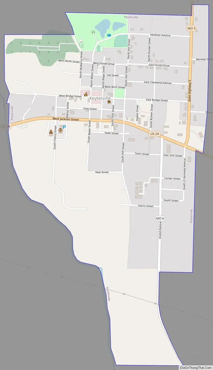
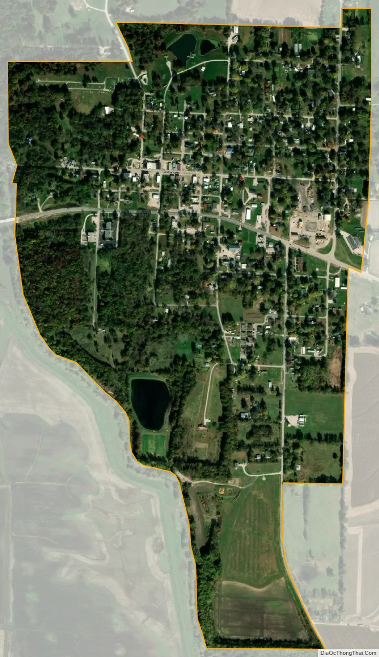
Keytesville city Satellite Map
Geography
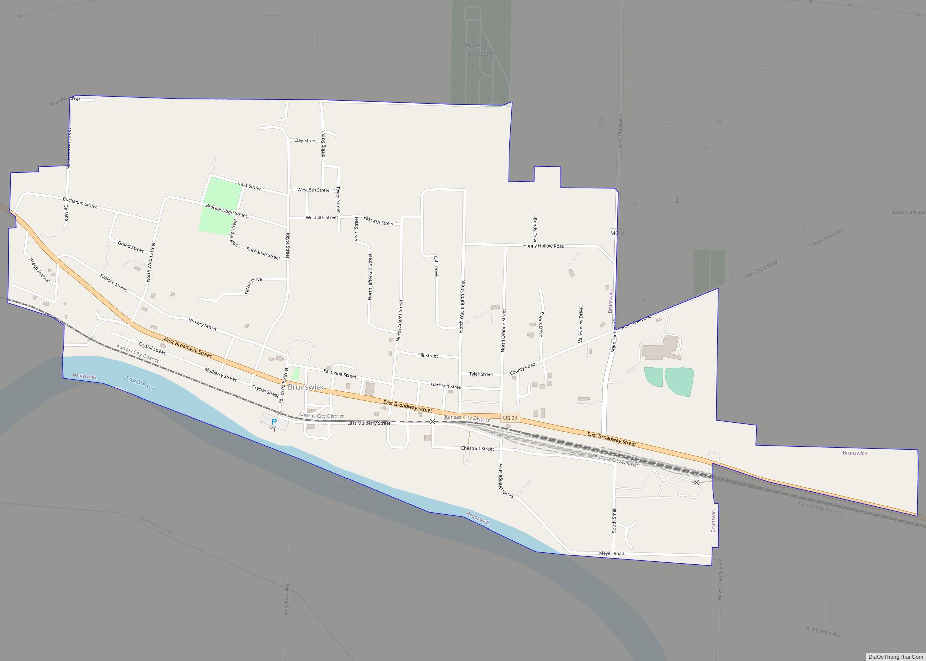
Keytesville is located at the intersection of U.S. Route 24 and Missouri Route 5. It is 10 mi (16 km) east of Brunswick and 30 mi (48 km) west of Moberly.
According to the United States Census Bureau, the city has a total area of 0.78 square miles (2.02 km), of which 0.77 square miles (1.99 km) is land and 0.01 square miles (0.03 km) is water.
See also
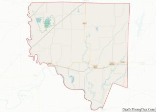
Map of Missouri State and its subdivision:- Adair
- Andrew
- Atchison
- Audrain
- Barry
- Barton
- Bates
- Benton
- Bollinger
- Boone
- Buchanan
- Butler
- Caldwell
- Callaway
- Camden
- Cape Girardeau
- Carroll
- Carter
- Cass
- Cedar
- Chariton
- Christian
- Clark
- Clay
- Clinton
- Cole
- Cooper
- Crawford
- Dade
- Dallas
- Daviess
- De Kalb
- Dent
- Douglas
- Dunklin
- Franklin
- Gasconade
- Gentry
- Greene
- Grundy
- Harrison
- Henry
- Hickory
- Holt
- Howard
- Howell
- Iron
- Jackson
- Jasper
- Jefferson
- Johnson
- Knox
- Laclede
- Lafayette
- Lawrence
- Lewis
- Lincoln
- Linn
- Livingston
- Macon
- Madison
- Maries
- Marion
- McDonald
- Mercer
- Miller
- Mississippi
- Moniteau
- Monroe
- Montgomery
- Morgan
- New Madrid
- Newton
- Nodaway
- Oregon
- Osage
- Ozark
- Pemiscot
- Perry
- Pettis
- Phelps
- Pike
- Platte
- Polk
- Pulaski
- Putnam
- Ralls
- Randolph
- Ray
- Reynolds
- Ripley
- Saint Charles
- Saint Clair
- Saint Francois
- Saint Louis
- Sainte Genevieve
- Saline
- Schuyler
- Scotland
- Scott
- Shannon
- Shelby
- Stoddard
- Stone
- Sullivan
- Taney
- Texas
- Vernon
- Warren
- Washington
- Wayne
- Webster
- Worth
- Wright
- Alabama
- Alaska
- Arizona
- Arkansas
- California
- Colorado
- Connecticut
- Delaware
- District of Columbia
- Florida
- Georgia
- Hawaii
- Idaho
- Illinois
- Indiana
- Iowa
- Kansas
- Kentucky
- Louisiana
- Maine
- Maryland
- Massachusetts
- Michigan
- Minnesota
- Mississippi
- Missouri
- Montana
- Nebraska
- Nevada
- New Hampshire
- New Jersey
- New Mexico
- New York
- North Carolina
- North Dakota
- Ohio
- Oklahoma
- Oregon
- Pennsylvania
- Rhode Island
- South Carolina
- South Dakota
- Tennessee
- Texas
- Utah
- Vermont
- Virginia
- Washington
- West Virginia
- Wisconsin
- Wyoming