Pierce City, formerly Peirce City, is a city in southwest Lawrence and northwest Barry counties, in southwest Missouri, United States. The population was 1,292 at the 2010 census. In 2010, the town annexed property along Route 97 into Barry County to a point just north of U.S. Route 60. It was estimated to be 1,309 by the City of Pierce City as of July 1, 2019.
| Name: | Pierce City city |
|---|---|
| LSAD Code: | 25 |
| LSAD Description: | city (suffix) |
| State: | Missouri |
| County: | Barry County, Lawrence County |
| Elevation: | 1,211 ft (369 m) |
| Total Area: | 1.29 sq mi (3.35 km²) |
| Land Area: | 1.29 sq mi (3.34 km²) |
| Water Area: | 0.01 sq mi (0.01 km²) |
| Total Population: | 1,251 |
| Population Density: | 969.77/sq mi (374.46/km²) |
| ZIP code: | 65723 |
| Area code: | 417 |
| FIPS code: | 2957494 |
| GNISfeature ID: | 2396200 |
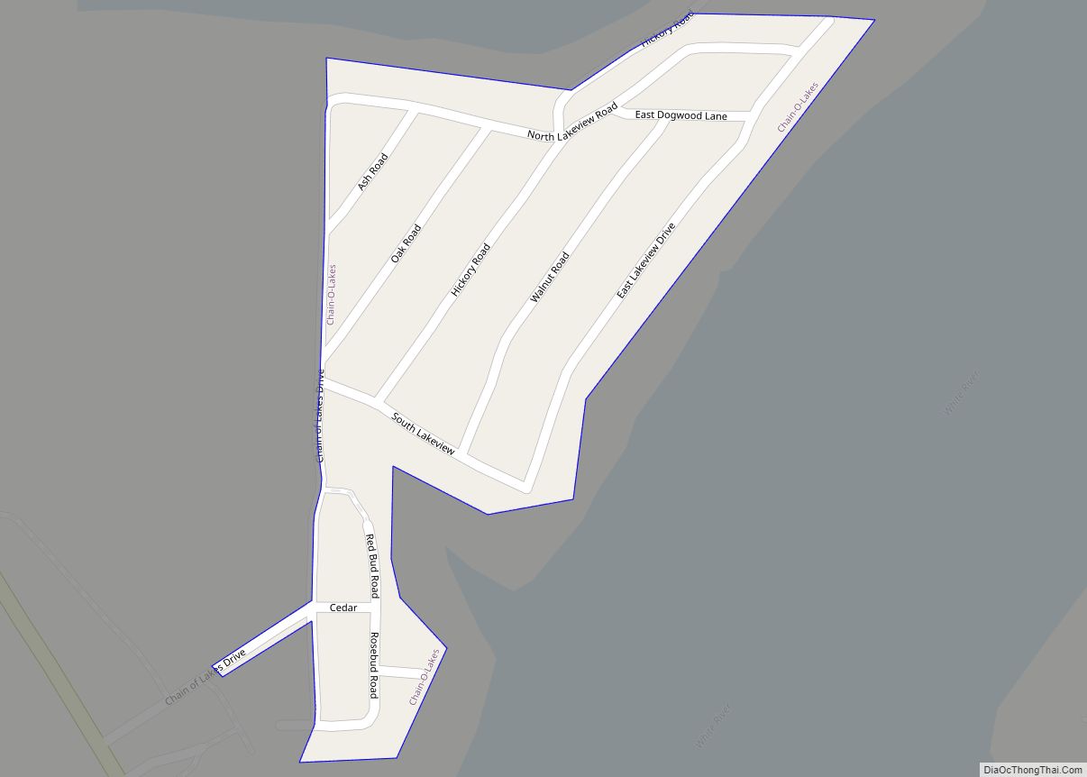
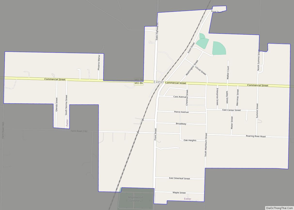
Online Interactive Map
Click on ![]() to view map in "full screen" mode.
to view map in "full screen" mode.
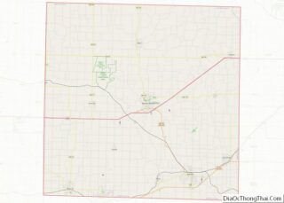
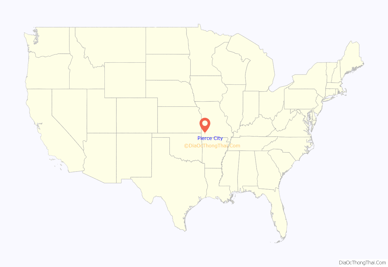
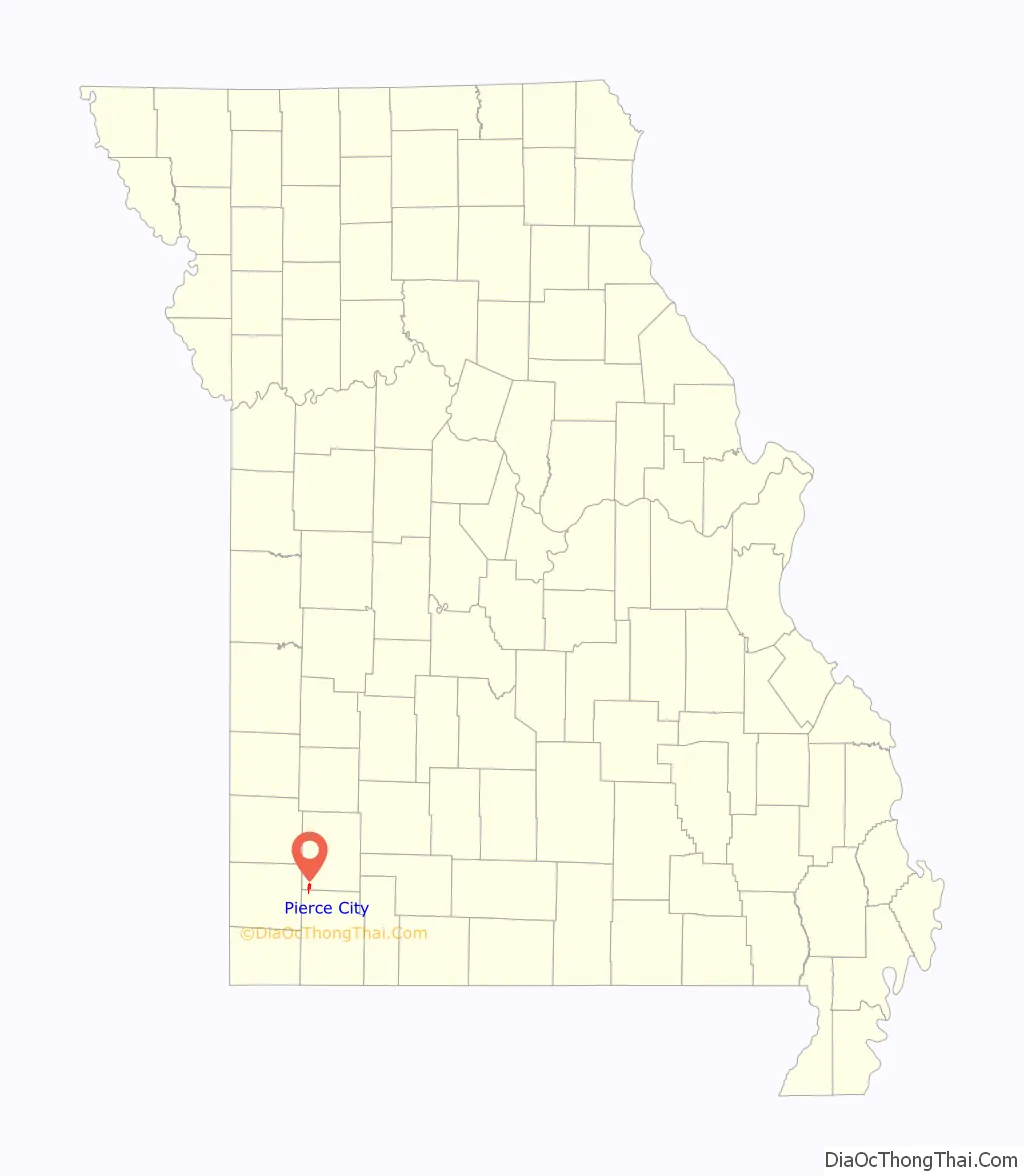
Pierce City location map. Where is Pierce City city?
History
There was once a small village called St. Martha about two and a half miles west of Pierce City. It was surveyed for William Robert Wild on Section 30, Pierce Township, May 9, 1870. Wild committed suicide there on June 8, 1870. Nothing remains of the village.
Founding and spelling
Pierce City was laid out in 1870 as a stop on the Atlantic and Pacific Railroad. It was originally spelled Peirce City, named for Andrew Peirce, Jr. of Boston, president of the St. Louis–San Francisco Railway. The Pierce spelling was used erroneously by the United States Postal Service and adopted officially in the 1930s. A 1982 attempt to revert to Peirce was rejected by the United States Census Bureau.
1901 lynchings and expulsion
On August 19, 1901 a large white mob took three African-American men from jail in Pierce City and lynched them. French and William Godley, and Peter Hampton were suspects in the murder of a young white woman. Two of the men were quite aged and were unlikely suspects; none had a chance at a trial. These are the only recorded lynchings in Lawrence County.
Unrest continued, and the white mob burned five black homes, and drove “30 families into the woods”, affecting the roughly 300 black residents in the town. (It had about 1,000 white residents.) Most of the African Americans lost all their land and property; whites simply took over the empty properties.
This was part of a pattern of violence in southwest Missouri in the early 20th century; there were also large public lynchings in Joplin and Springfield, resulting in many African Americans abandoning the region for less hostile territory. “Monett, Peirce City, Rogers, Ark., and several other towns around here have driven the negros out.” By 1910 only 91 African Americans remained in Lawrence County and their numbers continued to decline. The incident has been considered an act of ethnic cleansing.
In reaction, Mark Twain wrote the essay The United States of Lyncherdom, which was published posthumously.
In the 21st century, some descendants of the people who had been driven out of Pierce City threatened to file a lawsuit for the city’s failure to protect their families and to recover the value of their families’ properties, but none has been filed. There have been other grassroots efforts to acknowledge these crimes and injustices.
Notable buildings
The Lawrence County Bank Building and Pierce City Fire Station, Courthouse and Jail are listed on the National Register of Historic Places.
May 2003 tornado
One of the most notable tornadoes of the May 2003 tornado outbreak sequence was the one that hit in Pierce City. According to reports, nearly all of the buildings in the town were damaged, destroyed, or liable to collapse. Damage was most severe in the historic downtown business district, where approximately 90 percent of the businesses and homes nearby were severely damaged, and they later had to be torn down. A nearby National Guard Armory, regularly used as the town’s storm shelter, sustained heavy damage. J. Dale Taunton was killed; he was one of the several dozen people who had fled to the shelter.
But, outside the main path of the tornado, many Pierce City structures, including homes and the Harold Bell Wright Museum, sustained little or no damage. The Pierce City tornado was rated F3 on the Fujita scale.
Pierce City Road Map
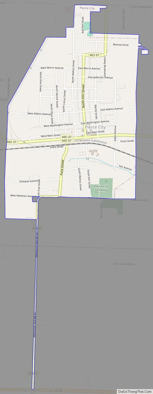
Pierce City city Satellite Map
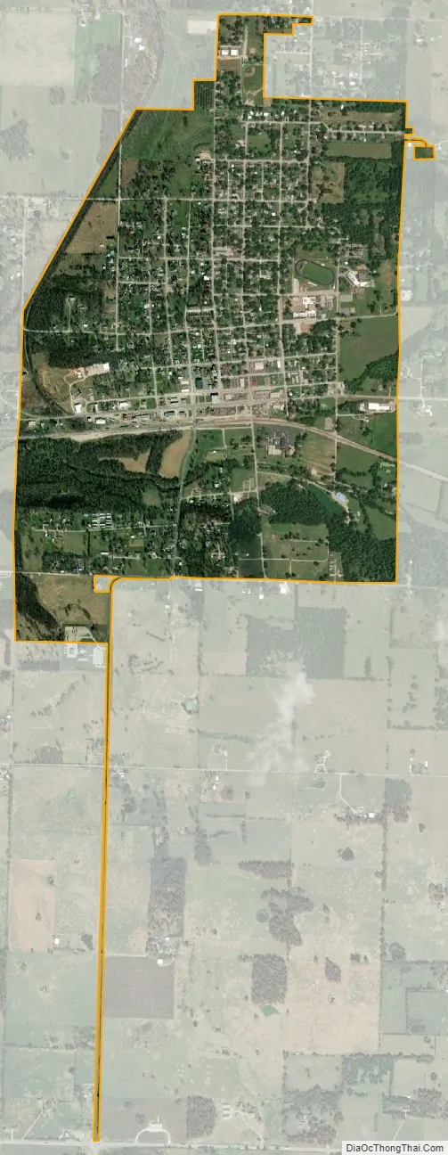
Geography
Pierce City is located in the southwestern corner of Lawrence County at the intersection of Missouri routes 37 and 97. Monett lies four miles to the east. Clear Creek flows through the city.
According to the United States Census Bureau, the city has a total area of 1.28 square miles (3.32 km), of which 1.27 square miles (3.29 km) is land and 0.01 square miles (0.03 km) is water.
See also
Map of Missouri State and its subdivision:- Adair
- Andrew
- Atchison
- Audrain
- Barry
- Barton
- Bates
- Benton
- Bollinger
- Boone
- Buchanan
- Butler
- Caldwell
- Callaway
- Camden
- Cape Girardeau
- Carroll
- Carter
- Cass
- Cedar
- Chariton
- Christian
- Clark
- Clay
- Clinton
- Cole
- Cooper
- Crawford
- Dade
- Dallas
- Daviess
- De Kalb
- Dent
- Douglas
- Dunklin
- Franklin
- Gasconade
- Gentry
- Greene
- Grundy
- Harrison
- Henry
- Hickory
- Holt
- Howard
- Howell
- Iron
- Jackson
- Jasper
- Jefferson
- Johnson
- Knox
- Laclede
- Lafayette
- Lawrence
- Lewis
- Lincoln
- Linn
- Livingston
- Macon
- Madison
- Maries
- Marion
- McDonald
- Mercer
- Miller
- Mississippi
- Moniteau
- Monroe
- Montgomery
- Morgan
- New Madrid
- Newton
- Nodaway
- Oregon
- Osage
- Ozark
- Pemiscot
- Perry
- Pettis
- Phelps
- Pike
- Platte
- Polk
- Pulaski
- Putnam
- Ralls
- Randolph
- Ray
- Reynolds
- Ripley
- Saint Charles
- Saint Clair
- Saint Francois
- Saint Louis
- Sainte Genevieve
- Saline
- Schuyler
- Scotland
- Scott
- Shannon
- Shelby
- Stoddard
- Stone
- Sullivan
- Taney
- Texas
- Vernon
- Warren
- Washington
- Wayne
- Webster
- Worth
- Wright
- Alabama
- Alaska
- Arizona
- Arkansas
- California
- Colorado
- Connecticut
- Delaware
- District of Columbia
- Florida
- Georgia
- Hawaii
- Idaho
- Illinois
- Indiana
- Iowa
- Kansas
- Kentucky
- Louisiana
- Maine
- Maryland
- Massachusetts
- Michigan
- Minnesota
- Mississippi
- Missouri
- Montana
- Nebraska
- Nevada
- New Hampshire
- New Jersey
- New Mexico
- New York
- North Carolina
- North Dakota
- Ohio
- Oklahoma
- Oregon
- Pennsylvania
- Rhode Island
- South Carolina
- South Dakota
- Tennessee
- Texas
- Utah
- Vermont
- Virginia
- Washington
- West Virginia
- Wisconsin
- Wyoming