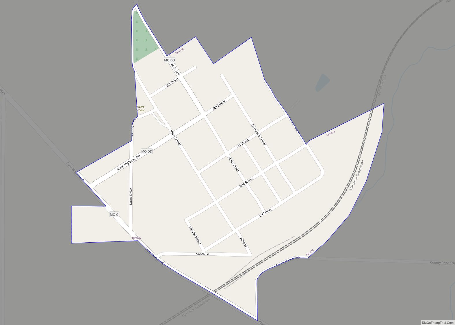
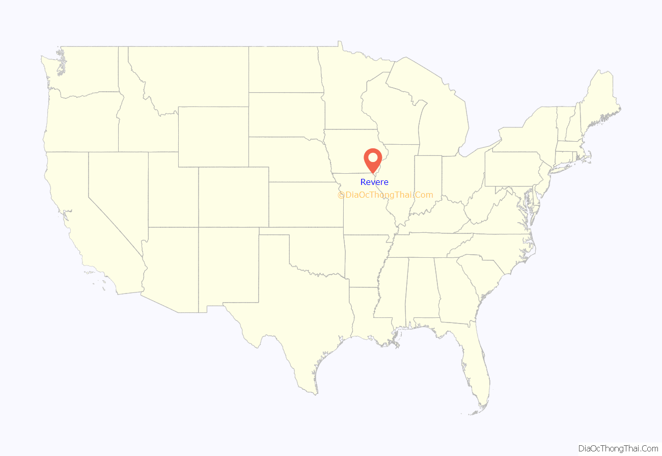
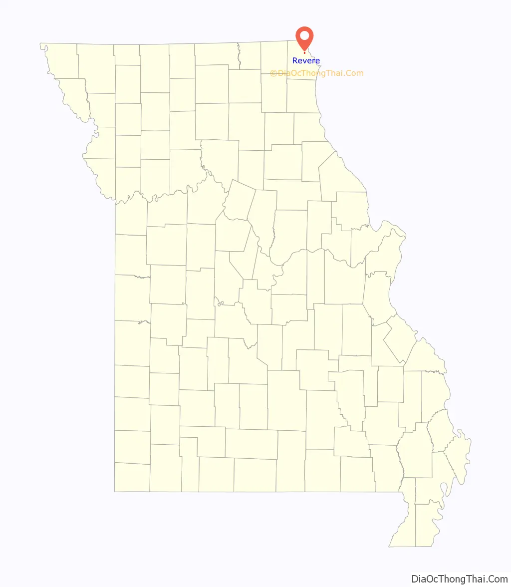
Revere is a city in Clark County, Missouri, United States. As of the 2020 census, its population was 76. It is part of the Fort Madison–Keokuk, IA-MO Micropolitan Statistical Area.
| Name: | Revere town |
|---|---|
| LSAD Code: | 43 |
| LSAD Description: | town (suffix) |
| State: | Missouri |
| County: | Clark County |
| Elevation: | 682 ft (208 m) |
| Total Area: | 0.19 sq mi (0.48 km²) |
| Land Area: | 0.19 sq mi (0.48 km²) |
| Water Area: | 0.00 sq mi (0.00 km²) |
| Total Population: | 76 |
| Population Density: | 408.60/sq mi (157.97/km²) |
| ZIP code: | 63465 |
| Area code: | 660 |
| FIPS code: | 2961292 |
| GNISfeature ID: | 2396874 |
Online Interactive Map
Click on ![]() to view map in "full screen" mode.
to view map in "full screen" mode.
Revere location map. Where is Revere town?
History
Founded on October 22, 1887, by the Santa Fe Railroad, Revere was “probably named in honor of Paul Revere.” During the period prior to 1900, Revere flourished as an intermediate stop for the railroad. In 1898, Revere was incorporated as a city in the 4th class of Missouri.
In 1898, J.H. Talbott of Luray started the Revere Current, a weekly newspaper that consisted of five pages of world and local news including advertisements, train schedule and local markets. Circulation closed on July 18, 1901, when Talbott left for law school.
Located at the former site of the Revere Methodist Church, Ar-Del Park was dedicated on May 30, 1946, as a memorial to Revere natives John Arnold Wallace and Delmar Brown, who died serving their country during World War II. A large boulder with a plaque dedicated to all Clark County veterans is located in the park.
On July 26, 2011, the United States Postal Service announced plans to consider closing the Revere post office as part of a nationwide restructuring plan. On May 9, 2012, it was announced that a new strategy would preserve the nation’s smallest post offices, reversing the earlier plan.
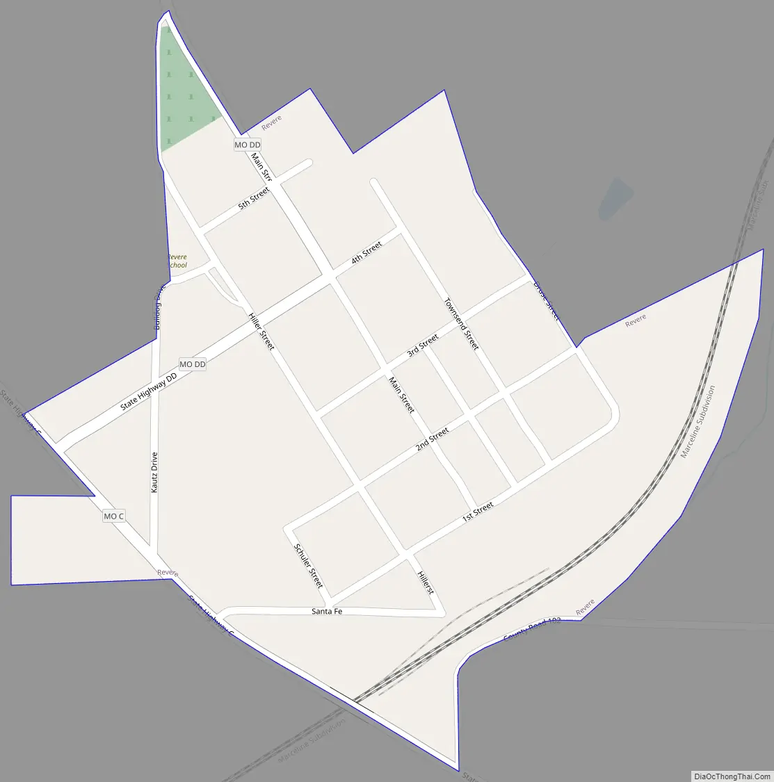
Revere Road Map
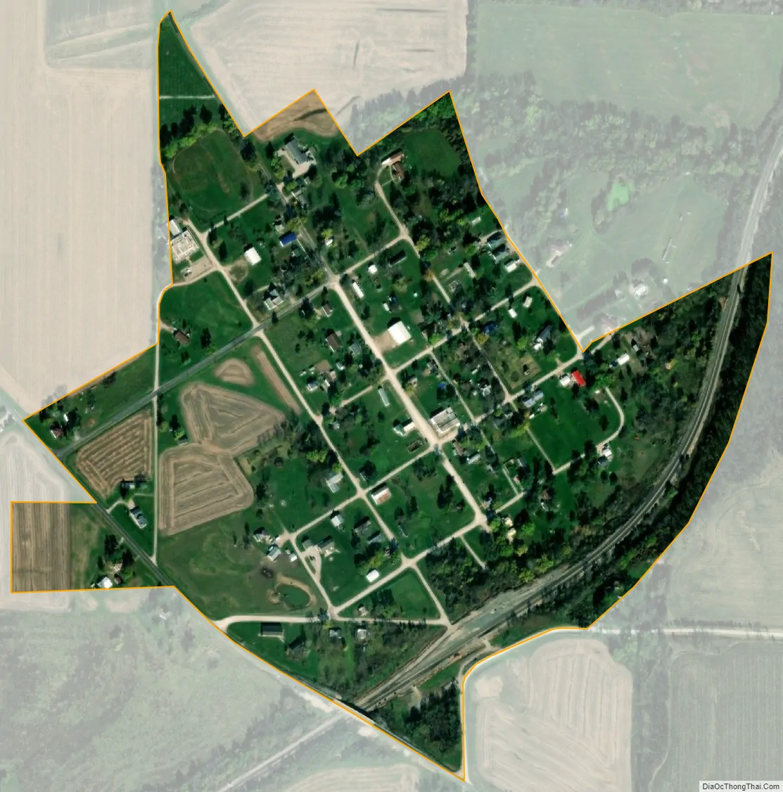
Revere city Satellite Map
Geography
Revere is located in northern Clark County three miles from the Missouri-Iowa state line. The Atchison, Topeka and Santa Fe Railroad passes through the community.
According to the United States Census Bureau, the city has a total area of 0.19 square miles (0.49 km), all land.
See also
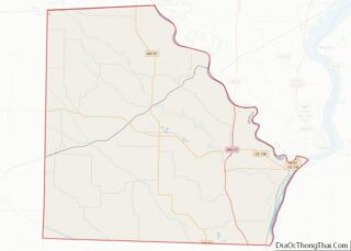
Map of Missouri State and its subdivision:- Adair
- Andrew
- Atchison
- Audrain
- Barry
- Barton
- Bates
- Benton
- Bollinger
- Boone
- Buchanan
- Butler
- Caldwell
- Callaway
- Camden
- Cape Girardeau
- Carroll
- Carter
- Cass
- Cedar
- Chariton
- Christian
- Clark
- Clay
- Clinton
- Cole
- Cooper
- Crawford
- Dade
- Dallas
- Daviess
- De Kalb
- Dent
- Douglas
- Dunklin
- Franklin
- Gasconade
- Gentry
- Greene
- Grundy
- Harrison
- Henry
- Hickory
- Holt
- Howard
- Howell
- Iron
- Jackson
- Jasper
- Jefferson
- Johnson
- Knox
- Laclede
- Lafayette
- Lawrence
- Lewis
- Lincoln
- Linn
- Livingston
- Macon
- Madison
- Maries
- Marion
- McDonald
- Mercer
- Miller
- Mississippi
- Moniteau
- Monroe
- Montgomery
- Morgan
- New Madrid
- Newton
- Nodaway
- Oregon
- Osage
- Ozark
- Pemiscot
- Perry
- Pettis
- Phelps
- Pike
- Platte
- Polk
- Pulaski
- Putnam
- Ralls
- Randolph
- Ray
- Reynolds
- Ripley
- Saint Charles
- Saint Clair
- Saint Francois
- Saint Louis
- Sainte Genevieve
- Saline
- Schuyler
- Scotland
- Scott
- Shannon
- Shelby
- Stoddard
- Stone
- Sullivan
- Taney
- Texas
- Vernon
- Warren
- Washington
- Wayne
- Webster
- Worth
- Wright
- Alabama
- Alaska
- Arizona
- Arkansas
- California
- Colorado
- Connecticut
- Delaware
- District of Columbia
- Florida
- Georgia
- Hawaii
- Idaho
- Illinois
- Indiana
- Iowa
- Kansas
- Kentucky
- Louisiana
- Maine
- Maryland
- Massachusetts
- Michigan
- Minnesota
- Mississippi
- Missouri
- Montana
- Nebraska
- Nevada
- New Hampshire
- New Jersey
- New Mexico
- New York
- North Carolina
- North Dakota
- Ohio
- Oklahoma
- Oregon
- Pennsylvania
- Rhode Island
- South Carolina
- South Dakota
- Tennessee
- Texas
- Utah
- Vermont
- Virginia
- Washington
- West Virginia
- Wisconsin
- Wyoming