Dillsboro is a town in Jackson County, North Carolina, United States. The population was 232 at the 2010 census.
Dillsboro attracts tourists traveling to the Great Smoky Mountains. The Great Smoky Mountains Railroad begins in Dillsboro and follows the Murphy Branch, constructed in the 1880s.
| Name: | Dillsboro town |
|---|---|
| LSAD Code: | 43 |
| LSAD Description: | town (suffix) |
| State: | North Carolina |
| County: | Jackson County |
| Incorporated: | 1889 |
| Elevation: | 1,975 ft (603 m) |
| Total Area: | 0.48 sq mi (1.24 km²) |
| Land Area: | 0.48 sq mi (1.24 km²) |
| Water Area: | 0.00 sq mi (0.00 km²) |
| Total Population: | 213 |
| Population Density: | 445.61/sq mi (172.00/km²) |
| ZIP code: | 28725 |
| Area code: | 828 |
| FIPS code: | 3717180 |
| GNISfeature ID: | 1019975 |
| Website: | www.dillsboronc.info |
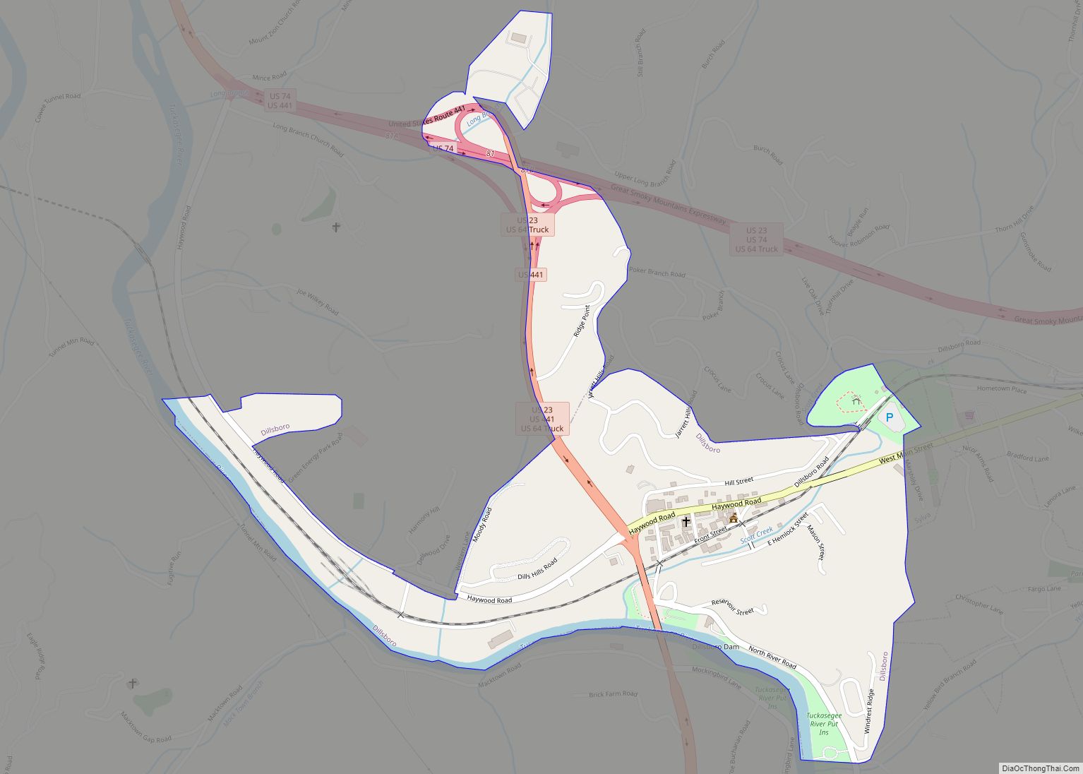
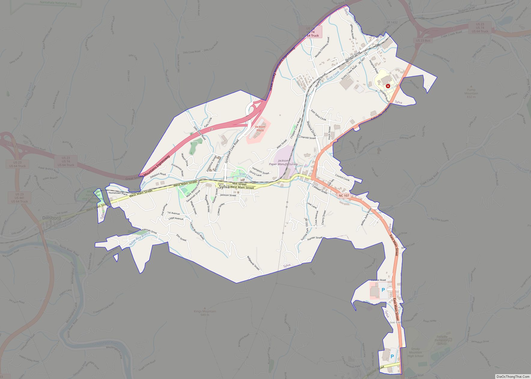
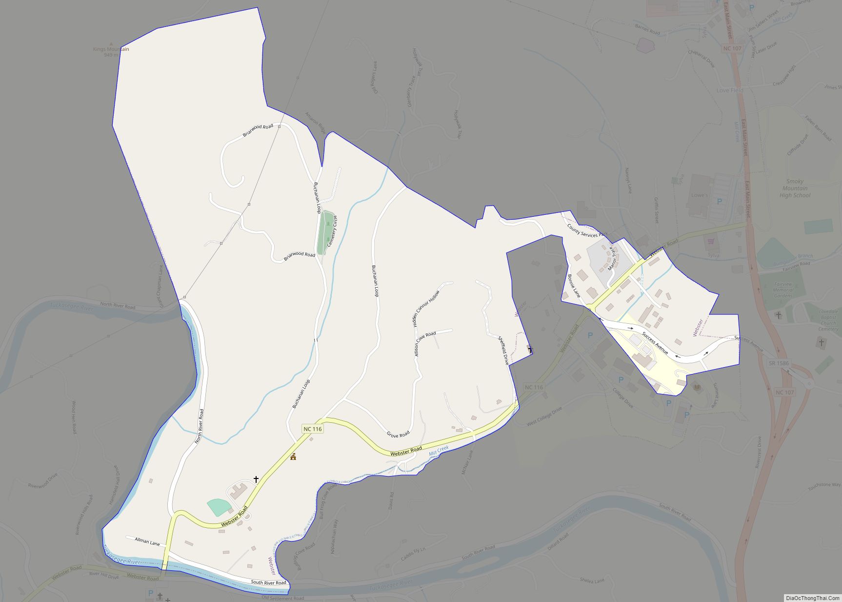
Online Interactive Map
Click on ![]() to view map in "full screen" mode.
to view map in "full screen" mode.
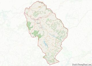
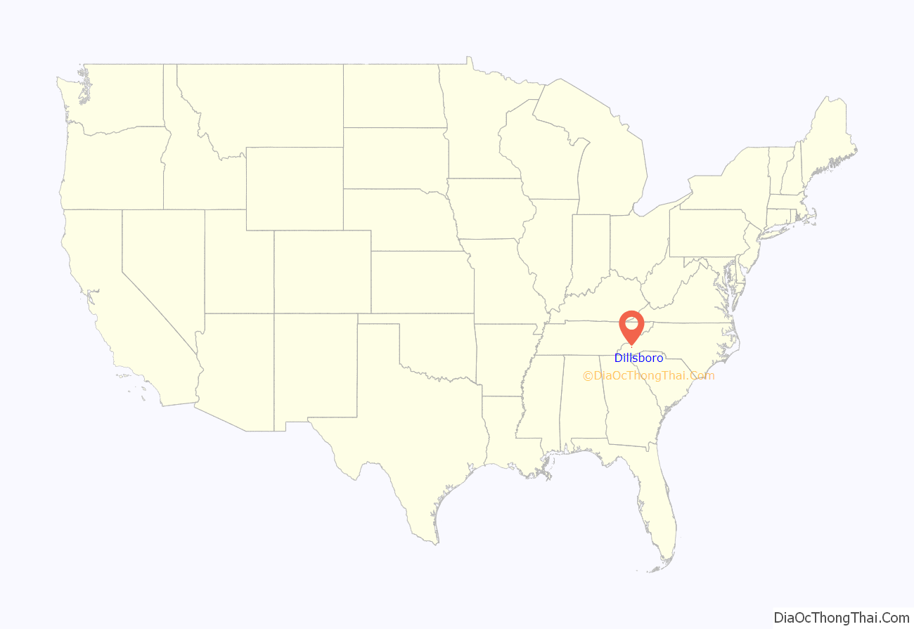
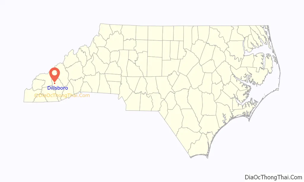
Dillsboro location map. Where is Dillsboro town?
History
Dillsboro was founded when the Murphy Branch Railroad came to the area in the 1880s. In 1882, the first post office in the area opened. Called the Tunnel Post Office, it was named after the nearby Cowee Tunnel. In 1882, the postmaster, William Allen Dills, built a large home on a hill overlooking the Tuckasegee River, later the home of C.J. Harris and now The Riverwood Shops. The unincorporated village was called Depot, New Webster, and Webster Station until the state legislature had its name officially changed to Dillsboro when the village was incorporated as a town in 1889 to honor William Allen Dills, the town’s founder (another source names George W. Dill, an early settler.) One of the oldest buildings in the town dates to the 1870s, before the town was officially founded, now serving as a barber shop. The building is one floor and was built on Front Street when the town was largely farmland. In a relatively short time period, Dillsboro became a thriving town; by 1888, it was the most important town on the Murphy Branch of the Southern Railway in the areas of Industry, with two sawmills, two clay mines, a locust pin company, a corundum crushing plant, a chestnut pole yard, a chestnut corkwood yard, two livery stables, six general stores, a large hotel, and a shoemaker.
A rivalry existed between Sylva and Dillsboro in their early days, as the efforts of one town were matched by the other, and the two towns were very much alike, and the same distance from the then-county seat of Webster. But a flood in 1894 ended the milling operations of the Blue Ridge Lumber Company, and near the turn of the century, two back-to-back floods at a tannery construction site in Dillsboro caused C.J. Harris, the owner, to move the factory to the present site of the Jackson Paper Plant in Sylva.
Dillsboro’s population has declined over the years, mostly due to little new housing being built in the town limits and the fact that many homes are now shops in the downtown area. Since 1975, when Wade W. Wilson became mayor due to many write-in votes, Dillsboro has made a successful effort to restore many older buildings in the town to their original appearance.
In 2012, the Dillsboro Dam and Powerhouse were demolished to restore the Tuckasegee River’s ecosystem.
The Jarrett House and Elias Brendle Monteith House and Outbuildings are listed on the National Register of Historic Places.
Gertrude Dills McKee, first woman elected to the North Carolina State Senate, was a native of Dillsboro; she was the daughter of William Allen Dills.
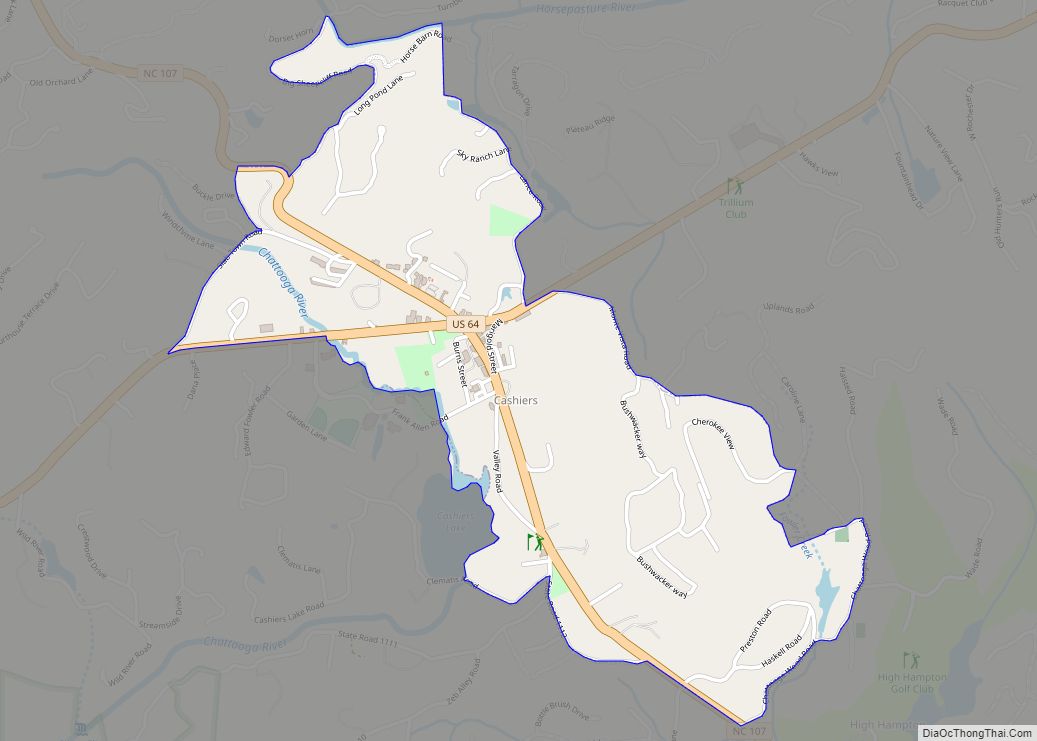
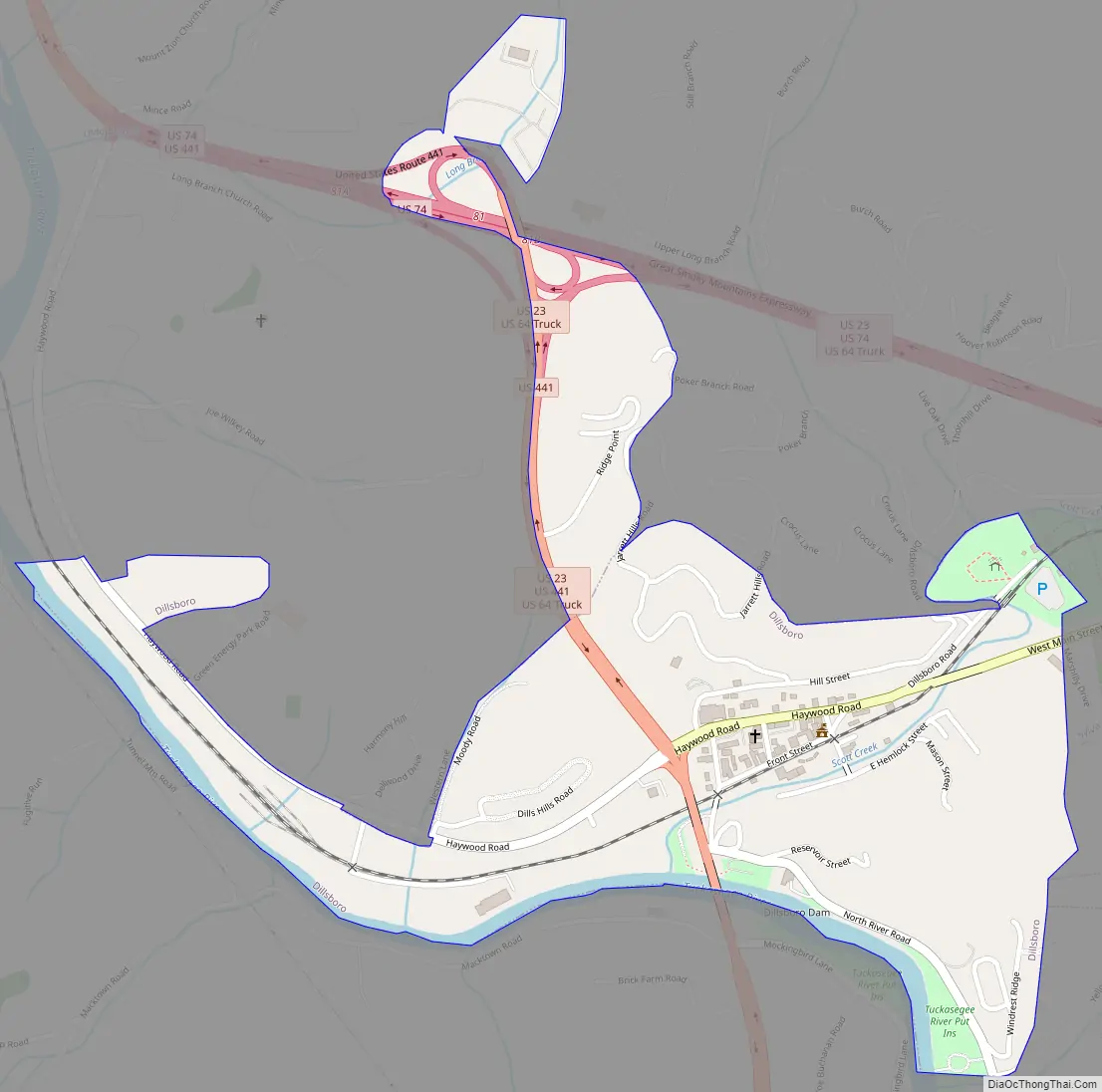
Dillsboro Road Map
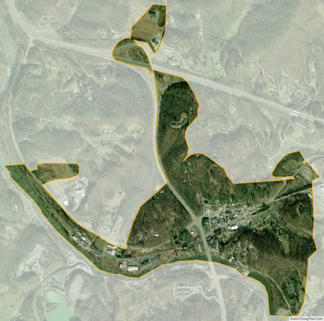
Dillsboro city Satellite Map
Geography
According to the United States Census Bureau, the town has a total area of 0.4 square miles (1.0 km), all land.
See also
Map of North Carolina State and its subdivision:- Alamance
- Alexander
- Alleghany
- Anson
- Ashe
- Avery
- Beaufort
- Bertie
- Bladen
- Brunswick
- Buncombe
- Burke
- Cabarrus
- Caldwell
- Camden
- Carteret
- Caswell
- Catawba
- Chatham
- Cherokee
- Chowan
- Clay
- Cleveland
- Columbus
- Craven
- Cumberland
- Currituck
- Dare
- Davidson
- Davie
- Duplin
- Durham
- Edgecombe
- Forsyth
- Franklin
- Gaston
- Gates
- Graham
- Granville
- Greene
- Guilford
- Halifax
- Harnett
- Haywood
- Henderson
- Hertford
- Hoke
- Hyde
- Iredell
- Jackson
- Johnston
- Jones
- Lee
- Lenoir
- Lincoln
- Macon
- Madison
- Martin
- McDowell
- Mecklenburg
- Mitchell
- Montgomery
- Moore
- Nash
- New Hanover
- Northampton
- Onslow
- Orange
- Pamlico
- Pasquotank
- Pender
- Perquimans
- Person
- Pitt
- Polk
- Randolph
- Richmond
- Robeson
- Rockingham
- Rowan
- Rutherford
- Sampson
- Scotland
- Stanly
- Stokes
- Surry
- Swain
- Transylvania
- Tyrrell
- Union
- Vance
- Wake
- Warren
- Washington
- Watauga
- Wayne
- Wilkes
- Wilson
- Yadkin
- Yancey
- Alabama
- Alaska
- Arizona
- Arkansas
- California
- Colorado
- Connecticut
- Delaware
- District of Columbia
- Florida
- Georgia
- Hawaii
- Idaho
- Illinois
- Indiana
- Iowa
- Kansas
- Kentucky
- Louisiana
- Maine
- Maryland
- Massachusetts
- Michigan
- Minnesota
- Mississippi
- Missouri
- Montana
- Nebraska
- Nevada
- New Hampshire
- New Jersey
- New Mexico
- New York
- North Carolina
- North Dakota
- Ohio
- Oklahoma
- Oregon
- Pennsylvania
- Rhode Island
- South Carolina
- South Dakota
- Tennessee
- Texas
- Utah
- Vermont
- Virginia
- Washington
- West Virginia
- Wisconsin
- Wyoming