Sylva is an incorporated town located in central Jackson County, in the Plott Balsam Mountains of Western North Carolina, United States. As of the 2010 census, the town had a total population of 2,588. It is the county seat, taking over the role from nearby Webster in 1913.
| Name: | Sylva town |
|---|---|
| LSAD Code: | 43 |
| LSAD Description: | town (suffix) |
| State: | North Carolina |
| County: | Jackson County |
| Incorporated: | 1889 |
| Elevation: | 2,036 ft (620 m) |
| Total Area: | 3.17 sq mi (8.21 km²) |
| Land Area: | 3.17 sq mi (8.21 km²) |
| Water Area: | 0.00 sq mi (0.00 km²) 0% |
| Total Population: | 2,578 |
| Population Density: | 812.74/sq mi (313.84/km²) |
| ZIP code: | 28779 |
| Area code: | 828 |
| FIPS code: | 3766500 |
| GNISfeature ID: | 0995798 |
| Website: | www.townofsylva.org |
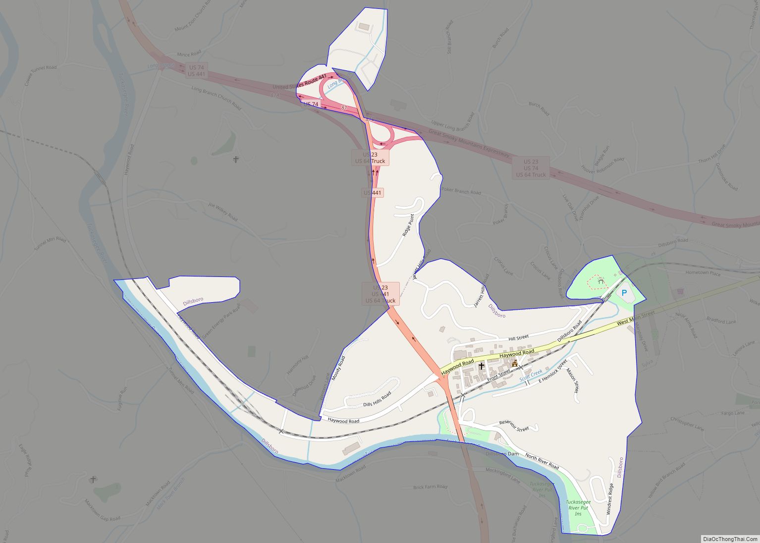
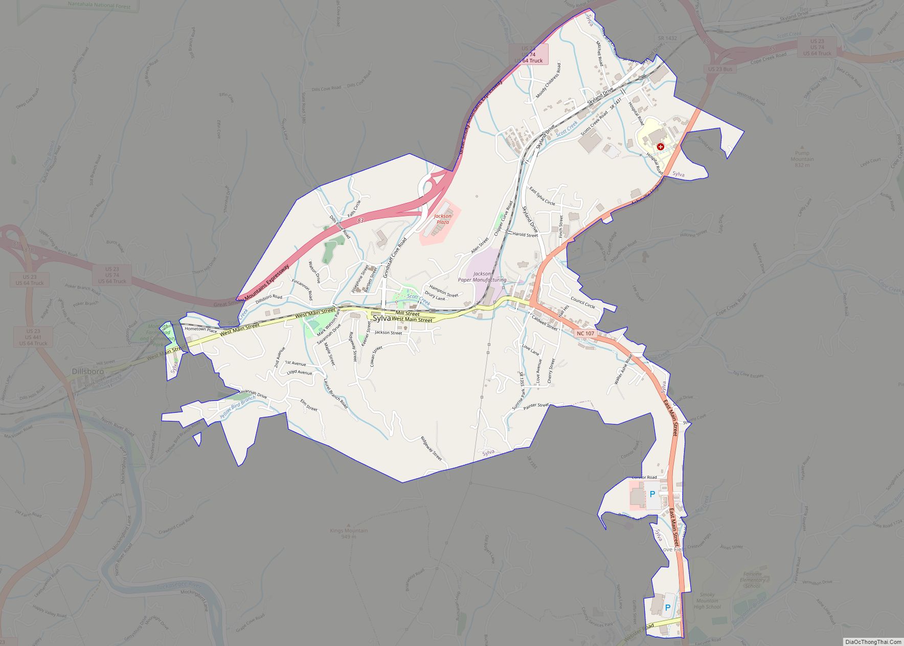
Online Interactive Map
Click on ![]() to view map in "full screen" mode.
to view map in "full screen" mode.
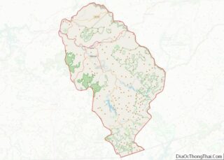
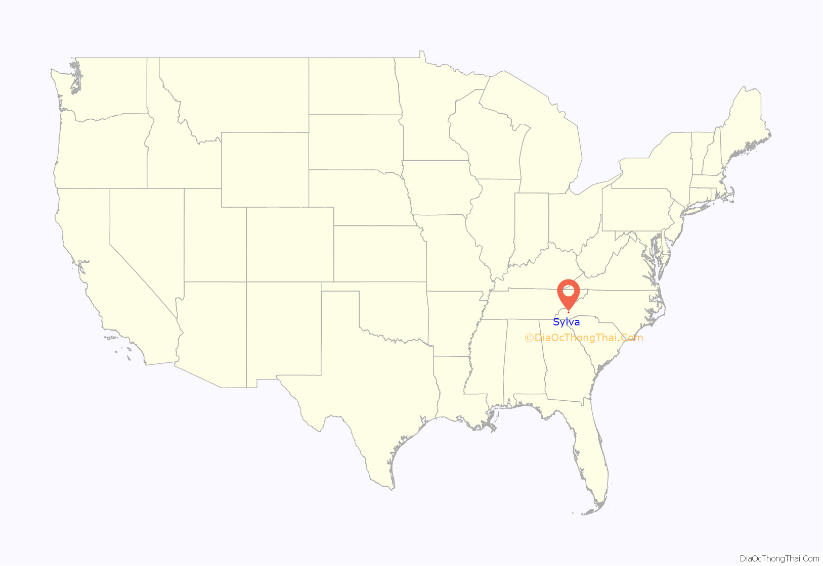
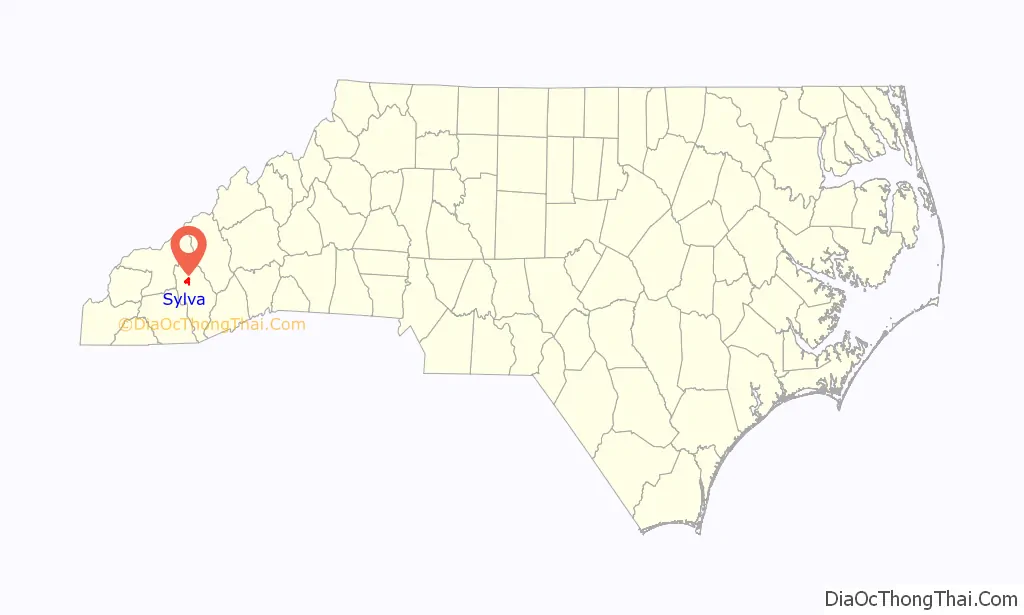
Sylva location map. Where is Sylva town?
History
The town became the county seat in 1913 after the county voted to move the seat from Webster to Sylva, which gained a railroad station. Subsequently, Webster declined, as the railroad had not established a stop in that town. Many businesses followed the court and railroad to Sylva. The Jackson County Courthouse was constructed in 1914 and is located on a hill at the end of Main Street in downtown Sylva. The building no longer serves as the official courthouse; the Justice Center was constructed in 1994 a few blocks away. Since 2011, the Jackson County Courthouse has been the site of the Jackson County Public Library.
The town has the main county high school, Smoky Mountain High School; the county library, county hospital, Justice Center, and two K-8 elementary schools: Scotts Creek east of town, and Fairview located behind the high school. The local newspaper is The Sylva Herald, which was founded in 1926.
Sylva claims that it once had Dills Falls, a 249-foot waterfall, making it the only town in the US that had a waterfall in town limits, until it was destroyed to build the Sylva bypass. However, the waterfall was only approximately 40 feet tall, and was never destroyed. Many towns in the US, and even North Carolina, have waterfalls in their town limits. The town had the first municipally owned swimming pool west of Asheville. The stone and concrete pool was built in 1938 by the WPA during the Great Depression; it was demolished in 1969 to be replaced by the current pool. Thomas Edison and Franklin D. Roosevelt both traveled through Sylva: Edison in 1911 and FDR in 1936 during his presidency.
The Downtown Sylva Historic District, Dr. D. D. Hooper House, and Jackson County Courthouse are listed on the National Register of Historic Places.
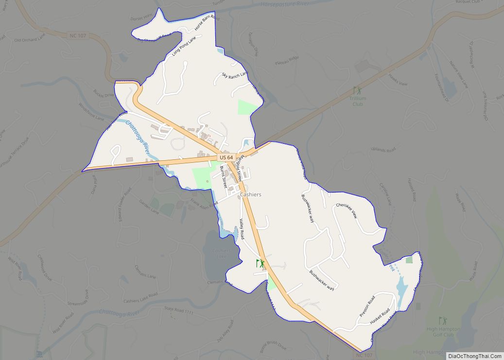
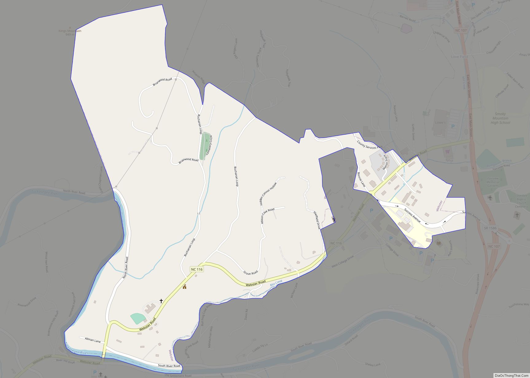
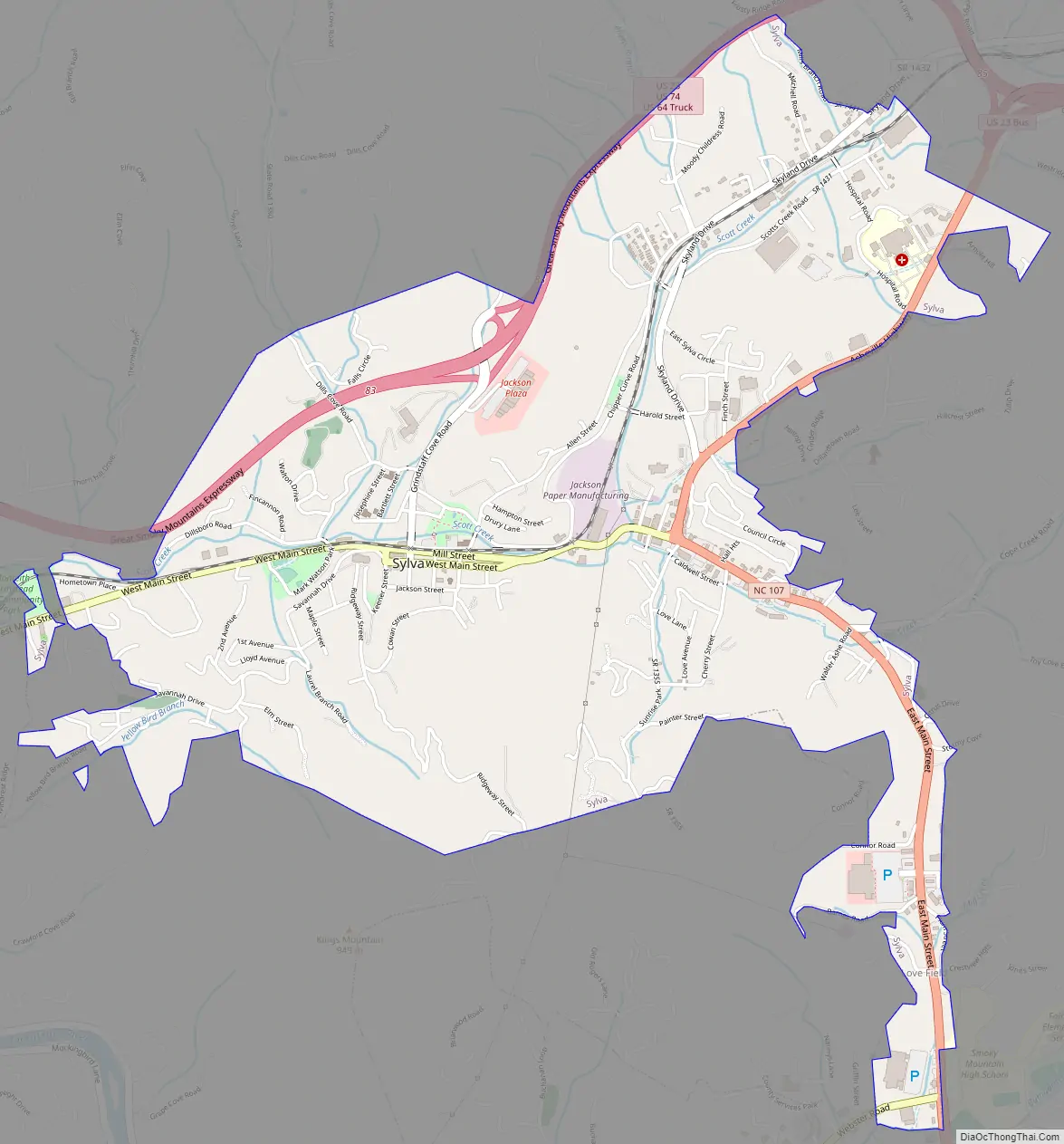
Sylva Road Map
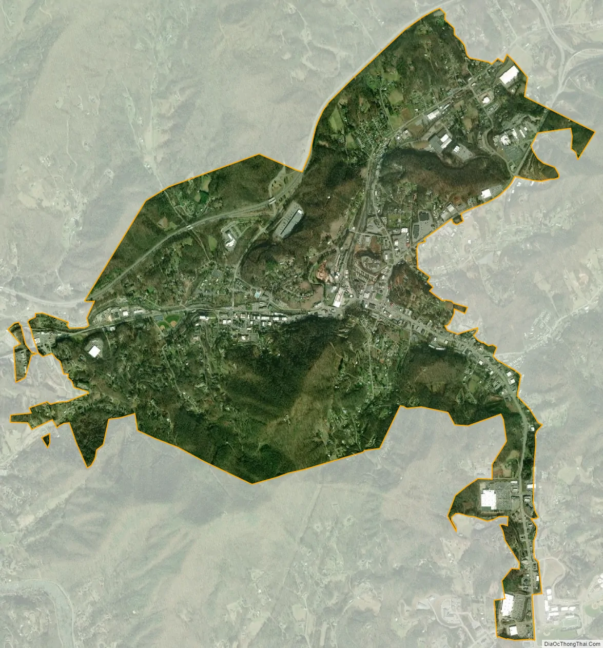
Sylva city Satellite Map
Geography
According to the United States Census Bureau, the town has a total area of 3.2 square miles (8.3 km), all land.
Sylva is close to the Cherokee Indian Reservation (the Eastern band) and the Great Smoky Mountains National Park, both of which are popular, well-known vacation spots.
See also
Map of North Carolina State and its subdivision:- Alamance
- Alexander
- Alleghany
- Anson
- Ashe
- Avery
- Beaufort
- Bertie
- Bladen
- Brunswick
- Buncombe
- Burke
- Cabarrus
- Caldwell
- Camden
- Carteret
- Caswell
- Catawba
- Chatham
- Cherokee
- Chowan
- Clay
- Cleveland
- Columbus
- Craven
- Cumberland
- Currituck
- Dare
- Davidson
- Davie
- Duplin
- Durham
- Edgecombe
- Forsyth
- Franklin
- Gaston
- Gates
- Graham
- Granville
- Greene
- Guilford
- Halifax
- Harnett
- Haywood
- Henderson
- Hertford
- Hoke
- Hyde
- Iredell
- Jackson
- Johnston
- Jones
- Lee
- Lenoir
- Lincoln
- Macon
- Madison
- Martin
- McDowell
- Mecklenburg
- Mitchell
- Montgomery
- Moore
- Nash
- New Hanover
- Northampton
- Onslow
- Orange
- Pamlico
- Pasquotank
- Pender
- Perquimans
- Person
- Pitt
- Polk
- Randolph
- Richmond
- Robeson
- Rockingham
- Rowan
- Rutherford
- Sampson
- Scotland
- Stanly
- Stokes
- Surry
- Swain
- Transylvania
- Tyrrell
- Union
- Vance
- Wake
- Warren
- Washington
- Watauga
- Wayne
- Wilkes
- Wilson
- Yadkin
- Yancey
- Alabama
- Alaska
- Arizona
- Arkansas
- California
- Colorado
- Connecticut
- Delaware
- District of Columbia
- Florida
- Georgia
- Hawaii
- Idaho
- Illinois
- Indiana
- Iowa
- Kansas
- Kentucky
- Louisiana
- Maine
- Maryland
- Massachusetts
- Michigan
- Minnesota
- Mississippi
- Missouri
- Montana
- Nebraska
- Nevada
- New Hampshire
- New Jersey
- New Mexico
- New York
- North Carolina
- North Dakota
- Ohio
- Oklahoma
- Oregon
- Pennsylvania
- Rhode Island
- South Carolina
- South Dakota
- Tennessee
- Texas
- Utah
- Vermont
- Virginia
- Washington
- West Virginia
- Wisconsin
- Wyoming