Fearrington Village is a residential development and census-designated place (CDP) in Chatham County, North Carolina, United States. The population was 2,339 at the 2010 census, up from 903 in 2000. Its name is phonetically pronounced FAIR-ington, not FEAR-ington as the spelling might indicate. The CDP occupies what was formerly the area of the unincorporated community of Farrington. It is a mixed-use community located on farmland dating back to the 18th century in Pittsboro, North Carolina. The community is located about 15 minutes from Chapel Hill, a half-hour from Durham and 45 minutes from Raleigh.
| Name: | Fearrington Village CDP |
|---|---|
| LSAD Code: | 57 |
| LSAD Description: | CDP (suffix) |
| State: | North Carolina |
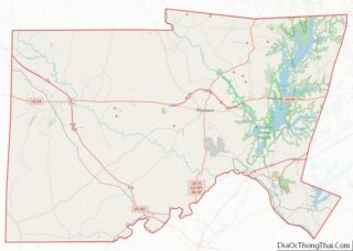
| County: | Chatham County |
| Elevation: | 344 ft (105 m) |
| Total Area: | 1.79 sq mi (4.64 km²) |
| Land Area: | 1.79 sq mi (4.63 km²) |
| Water Area: | 0.00 sq mi (0.01 km²) |
| Total Population: | 2,557 |
| Population Density: | 1,431.69/sq mi (552.70/km²) |
| ZIP code: | 27312 |
| Area code: | 919 and 984 |
| FIPS code: | 3722982 |
| GNISfeature ID: | 1867428 |
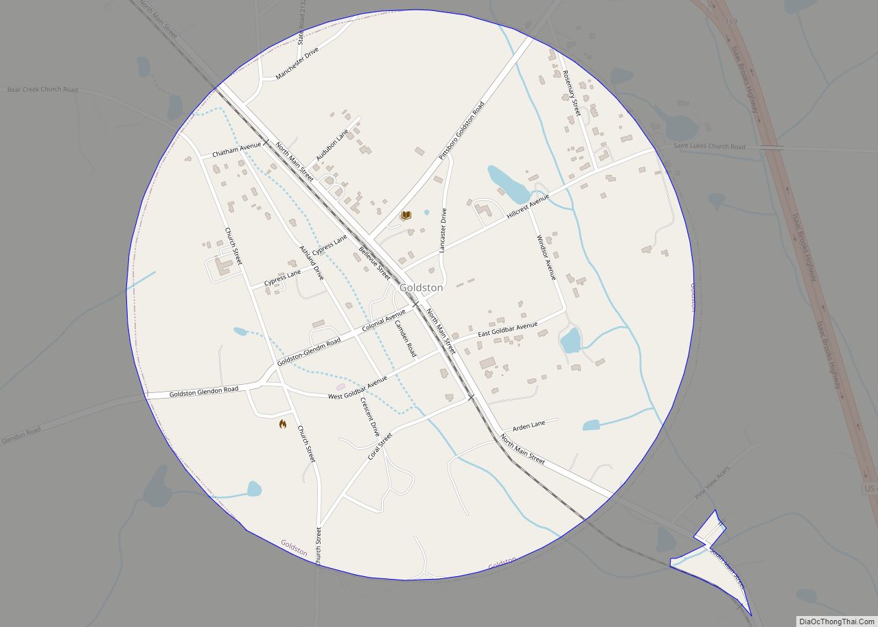
Online Interactive Map
Click on ![]() to view map in "full screen" mode.
to view map in "full screen" mode.
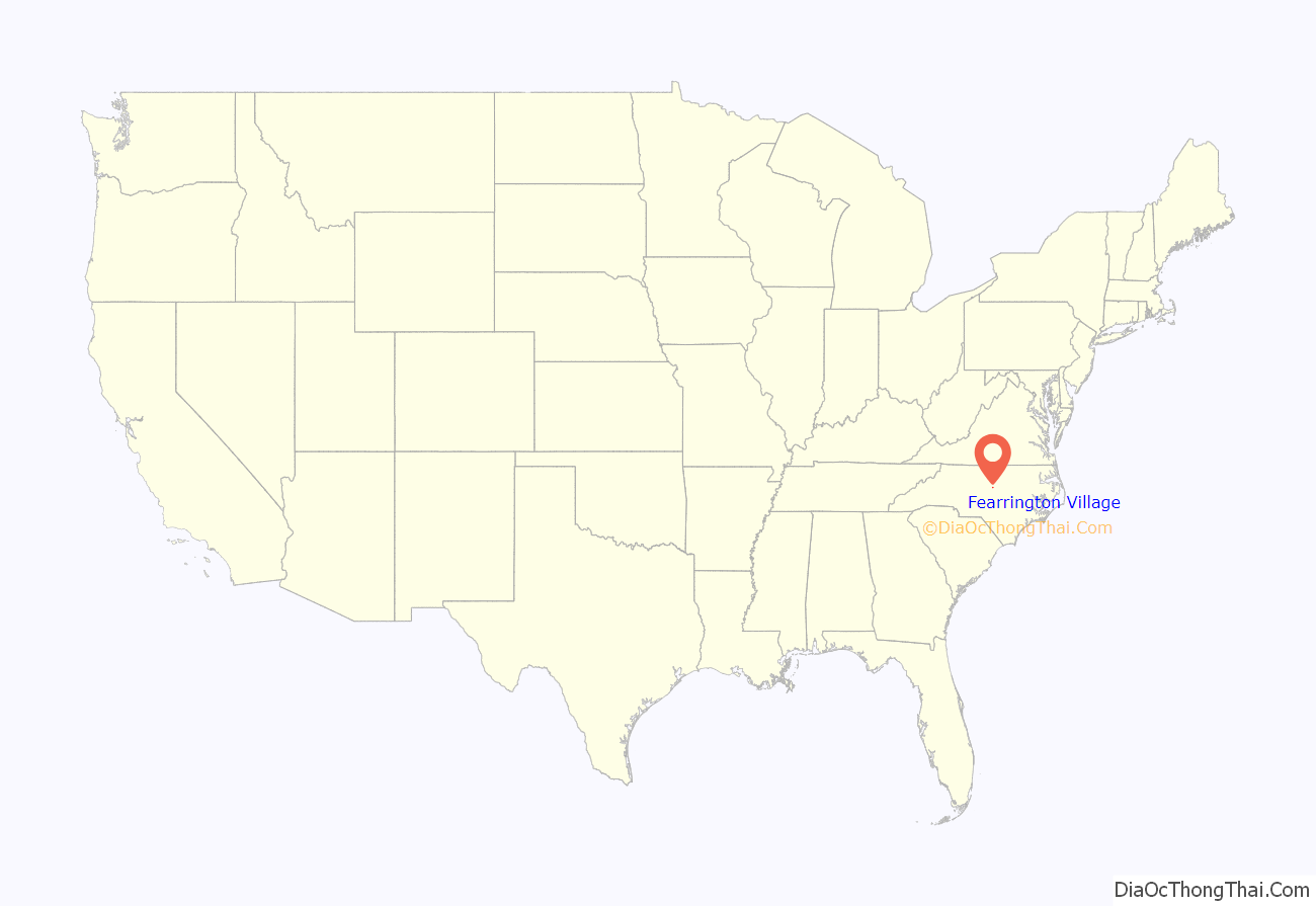
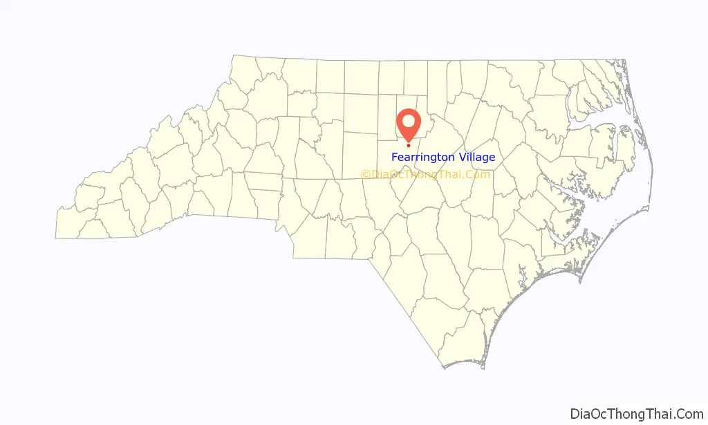
Fearrington Village location map. Where is Fearrington Village CDP?
History
The community began in 1974 when R.B. Fitch and his late wife Jenny purchased the two-centuries old dairy farm from Jesse Fearrington. Jesse inherited the 640 acre farm that was purchased for 100 shillings in 1786 from John Oldham by his great-great-great grandfather, William Cole. They named the community Fearrington to honor the stewardship of Jesse and his forebears.
Located midway between Chapel Hill and Pittsboro along U.S. 15-501 in Chatham County, Fearrington currently occupies about 1,200 acres (4.9 km). The Fitches slowly began to craft a unique community from the rolling pastures and wooded acres of the farm, where residents would enjoy dining, relaxing, shopping and living.
The Fitches aimed to recreate the smaller villages of England and modeled the Fearrington Village Center after those hamlets long before the term “mixed-use community” joined the lexicon. They wanted to create a “coming together place” where one could pick up daily necessities, have lunch with friends, and enjoy an English garden setting.
Over the last 30 years the community has grown to include over 1800 residents, an award-winning country inn and restaurant (The Fearrington House), a cafe & bar, chocolate and wine shop, an independent bookstore, a home décor shop, plants and garden art shop and more. Belted Galloway cows, the village’s iconic mascot, were added to the farm in 1983.
The Fearrington House Country Inn is one of only two AAA five-diamond facilities in the state, earning the Five Diamond designation 15 years in a row, more times than any other accommodation in the Carolinas. The Inn is also North Carolina’s only five-star hotel, according to Mobil Travel Guide’s annual rankings.
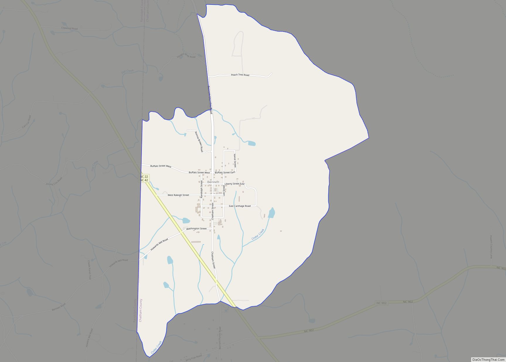
Fearrington Village Road Map
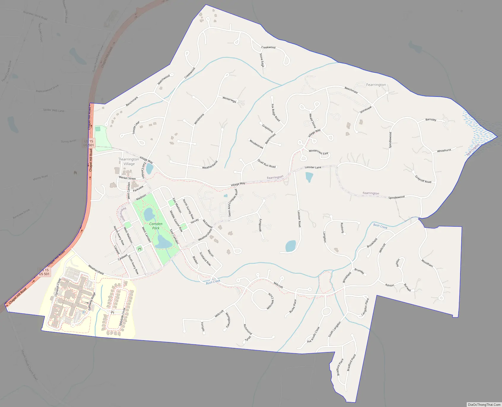
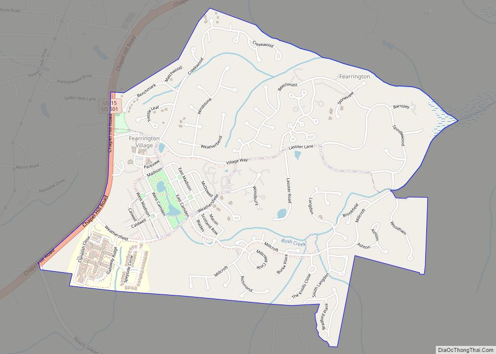
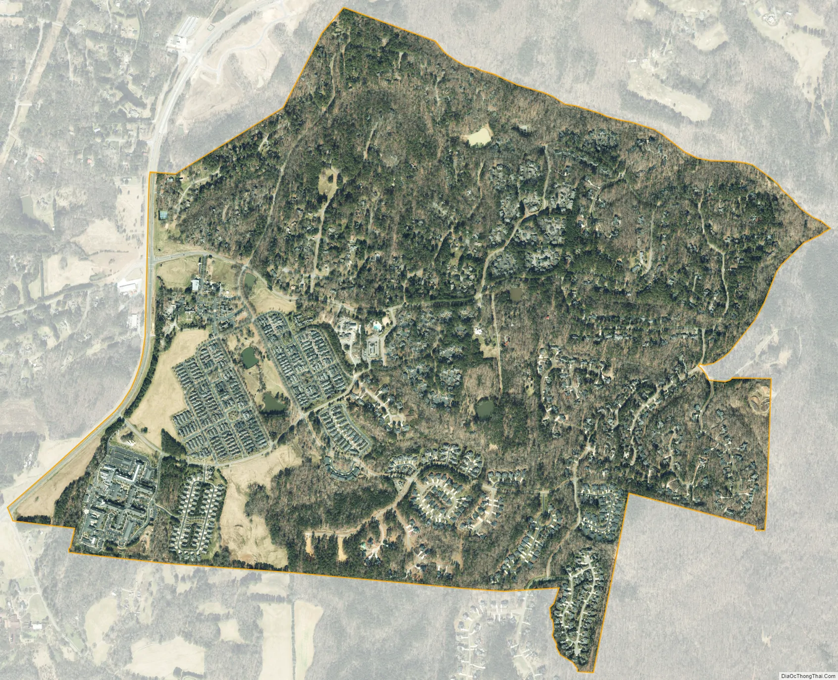
Fearrington Village city Satellite Map
Geography
Fearrington Village is located in northeastern Chatham County at 35°48′15″N 79°5′0″W / 35.80417°N 79.08333°W / 35.80417; -79.08333 (35.804190, -79.083195). U.S. Routes 15 and 501 form the northwestern edge of the community, leading north 8 miles (13 km) to Chapel Hill and south 8 miles (13 km) to Pittsboro, the Chatham County seat.
According to the United States Census Bureau, the CDP has a total area of 1.8 square miles (4.6 km), of which 0.004 square miles (0.01 km), or 0.32%, is water.
See also
Map of North Carolina State and its subdivision:- Alamance
- Alexander
- Alleghany
- Anson
- Ashe
- Avery
- Beaufort
- Bertie
- Bladen
- Brunswick
- Buncombe
- Burke
- Cabarrus
- Caldwell
- Camden
- Carteret
- Caswell
- Catawba
- Chatham
- Cherokee
- Chowan
- Clay
- Cleveland
- Columbus
- Craven
- Cumberland
- Currituck
- Dare
- Davidson
- Davie
- Duplin
- Durham
- Edgecombe
- Forsyth
- Franklin
- Gaston
- Gates
- Graham
- Granville
- Greene
- Guilford
- Halifax
- Harnett
- Haywood
- Henderson
- Hertford
- Hoke
- Hyde
- Iredell
- Jackson
- Johnston
- Jones
- Lee
- Lenoir
- Lincoln
- Macon
- Madison
- Martin
- McDowell
- Mecklenburg
- Mitchell
- Montgomery
- Moore
- Nash
- New Hanover
- Northampton
- Onslow
- Orange
- Pamlico
- Pasquotank
- Pender
- Perquimans
- Person
- Pitt
- Polk
- Randolph
- Richmond
- Robeson
- Rockingham
- Rowan
- Rutherford
- Sampson
- Scotland
- Stanly
- Stokes
- Surry
- Swain
- Transylvania
- Tyrrell
- Union
- Vance
- Wake
- Warren
- Washington
- Watauga
- Wayne
- Wilkes
- Wilson
- Yadkin
- Yancey
- Alabama
- Alaska
- Arizona
- Arkansas
- California
- Colorado
- Connecticut
- Delaware
- District of Columbia
- Florida
- Georgia
- Hawaii
- Idaho
- Illinois
- Indiana
- Iowa
- Kansas
- Kentucky
- Louisiana
- Maine
- Maryland
- Massachusetts
- Michigan
- Minnesota
- Mississippi
- Missouri
- Montana
- Nebraska
- Nevada
- New Hampshire
- New Jersey
- New Mexico
- New York
- North Carolina
- North Dakota
- Ohio
- Oklahoma
- Oregon
- Pennsylvania
- Rhode Island
- South Carolina
- South Dakota
- Tennessee
- Texas
- Utah
- Vermont
- Virginia
- Washington
- West Virginia
- Wisconsin
- Wyoming