Franklinton is a town in Franklin County, North Carolina, United States. The population was 2,456 at the 2020 census.
| Name: | Franklinton town |
|---|---|
| LSAD Code: | 43 |
| LSAD Description: | town (suffix) |
| State: | North Carolina |
| County: | Franklin County |
| Incorporated: | December 20, 1842 |
| Elevation: | 410 ft (120 m) |
| Total Area: | 2.41 sq mi (4.52 km²) |
| Land Area: | 2.40 sq mi (4.50 km²) |
| Water Area: | 0.01 sq mi (0.02 km²) |
| Total Population: | 2,456 |
| Population Density: | 1,413.93/sq mi (545.81/km²) |
| ZIP code: | 27525 |
| Area code: | 919 and 984 |
| FIPS code: | 3724720 |
| GNISfeature ID: | 1020357 |
| Website: | https://www.franklintonnc.us |
Online Interactive Map
Click on ![]() to view map in "full screen" mode.
to view map in "full screen" mode.
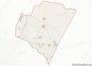
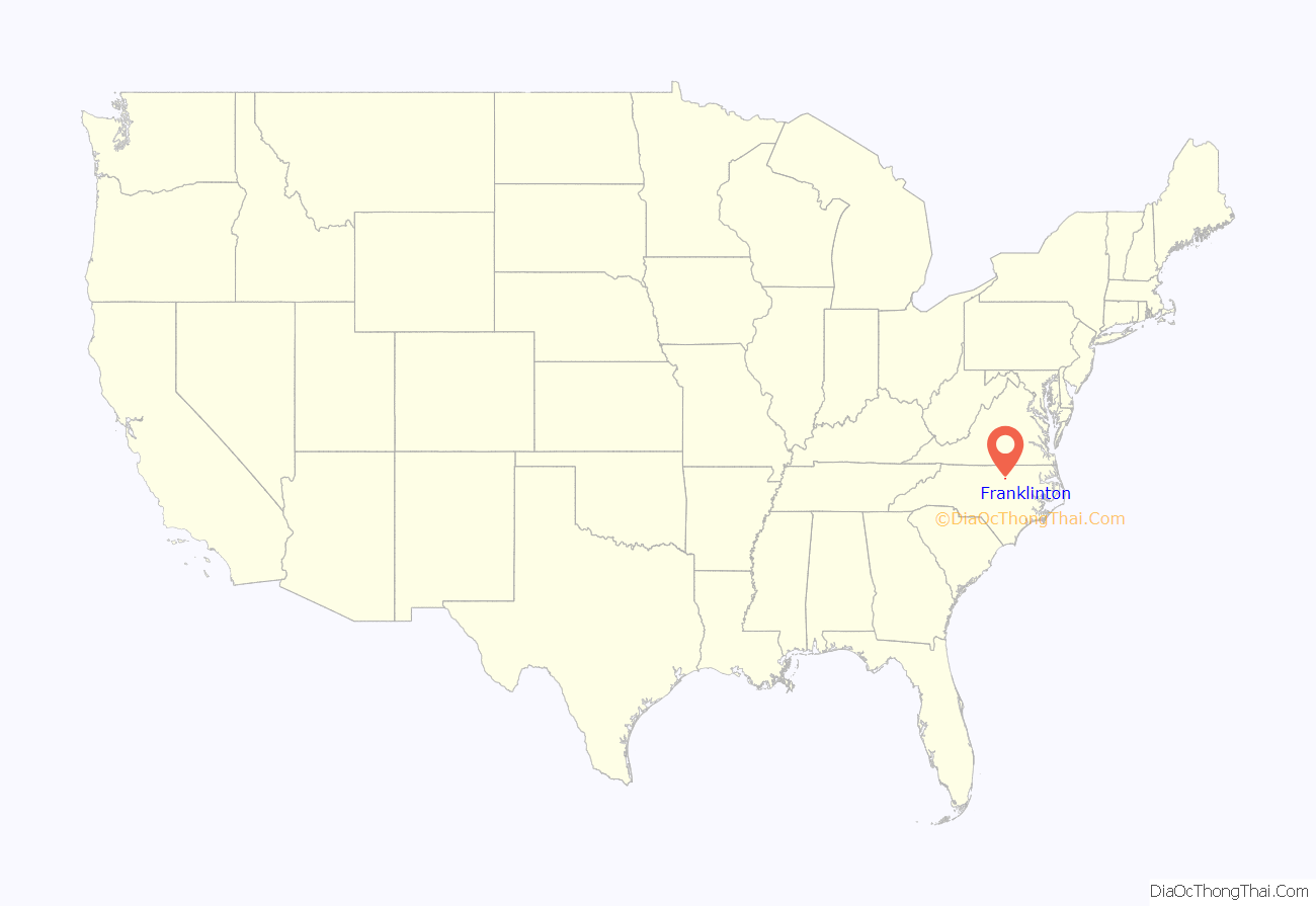
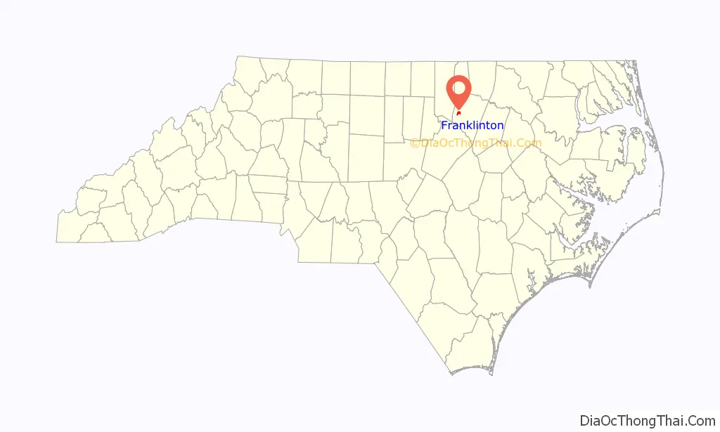
Franklinton location map. Where is Franklinton town?
History
Franklinton, was established as Franklin Depot in 1839 on land owned by Shemuel Kearney (1791–1860), son of Crawford Kearney and Nancy White. A home constructed by grandfather Shemuel Kearney (1734–1808) was originally located south of town and is currently the second oldest residence in Franklin County, built in 1759. The building was purchased in 2009 and moved to nearby Louisburg for restoration. Franklin Depot changed its name to Franklinton in 1842 when the town was incorporated. Like Franklin County, Franklinton was named for Benjamin Franklin.
According to many locals, Trinity College, originally located in Trinity, was initially planned and approved to be moved to Franklinton in 1889. Generous offers though by local businessmen Washington Duke and Julian S. Carr brought the college to the city of Durham in 1892. This well known school is now called Duke University. A source from the University Archives states that nearby Raleigh was actually the initial approved bidder. This does not mean Franklinton wasn’t included as a possible site even though no other bidding communities are mentioned. The citizens of Raleigh offered land now occupied by North Carolina State University and pledged $35,000.00 for a new building which was quickly approved by the Methodist Conference for Trinity College. It eventually lost to a higher bid of $85,000.00 plus donations in 1890.
In December 1919, an African-American veteran of World War I named Powell Green got involved in an altercation with a white man named R.M. Brown over smoking in the movie theater, and Green allegedly killed Brown. The police arrested Green, but then a lynch mob seized him, pulled him behind a car for two miles, and hung him from a tree.
Franklinton was once home to Albion Academy, a co-educational African-American school started by clergyman Moses A. Hopkins in 1879. Once a State Normal & Industrial School (trade school), it eventually became a graded school and later merged with the B.F. Person School in 1957 to become B.F. Person-Albion High School. When schools were fully integrated, the upper grades consolidated with Franklinton High School in 1969. Mary Little was the first African-American teacher to begin teaching at the newly integrated Franklinton High School, who taught there till her death in 1984. The B.F. Person-Albion High School was renamed Franklinton Elementary School.
Also located in Franklinton is the historic Sterling Cotton Mill, founded by Samuel C. Vann and first opened in 1895. Remaining in the Vann family for many years, the mill was purchased in 1972 by Union Underwear Company, manufacturers of Fruit of the Loom fabric products. Sterling Cotton Mill eventually closed in 1991. It was placed on the National Register of Historic Places in 1996.
Burlington Industries, another well known textile and fabric maker at the time, had a facility located in Franklinton known as Vamoco Mills. It closed in 1989, and was demolished in 2007. A third mill was also located in Franklinton which has since closed.
On June 10, 1946, former heavyweight champion Jack Johnson died in a car crash on U.S. Highway 1 in Franklinton.
On April 4, 1963, the entire town of Franklinton was threatened by a large wildfire which consumed roughly 9,500 acres (38 km) of woodlands and destroyed several homes north and west of town. A similar incident occurred on February 10, 2008, covering practically the same area (though not as widespread), about 1,000 acres (4.0 km). There were a couple homes which were damaged during that event. U.S. Highway 1 was temporarily closed adjacent to the affected area while firefighters battled the fires. No injuries were reported. High winds and dry conditions were factors in both incidents.
In 1996 Franklinton, North Carolina became the home of Opio Holy Spirit Academy a private school providing an academic arena for both academically gifted and students who face academic challenges from grades k-12. The school was established and directed by Lenora E. Attles-Allen a former elementary school teacher from Boston, Massachusetts. Allen’s work became known and respected in Wake, Granville, Vance, and Franklin counties as well as her dedication to the Franklin County Community Restitution Program. Opio Holy Spirit Academy closed its doors for the last time after the final High School commencement ceremony in 2012.
Charles Draughn III was elected to the mayoral position of Franklinton for 8 years, from 1987 to 1995. He is currently working with family law. He was followed in office by Larry Kearney from 1995 to 2003, Jenny McGhee Edwards from 2003 to 2007 and Elic Senter from 2007 to 2015. Current Mayor Art Wright was elected in 2015.
Franklinton has been a Tree City USA community since 1985.
In addition to the Sterling Cotton Mill, the Franklinton Depot, Dr. J. H. Harris House, Shemuel Kearney House, C.L. and Bessie G. McGhee House, Person-McGhee Farm, Dr. J. A. Savage House, and Aldridge H. Vann House are listed on the National Register of Historic Places. All properties are privately owned and should be respected.
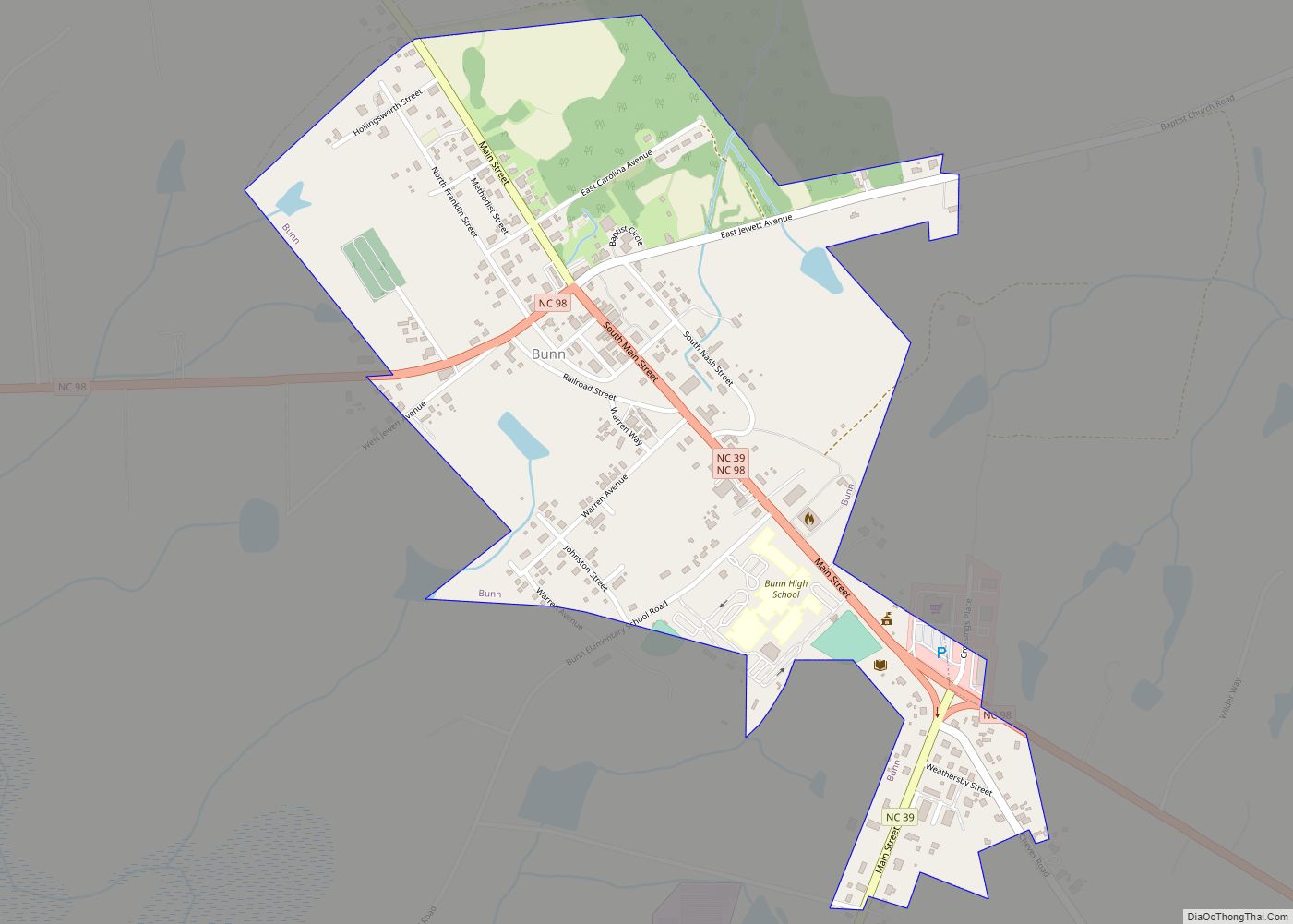
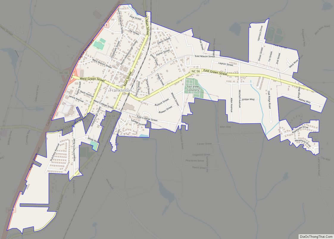
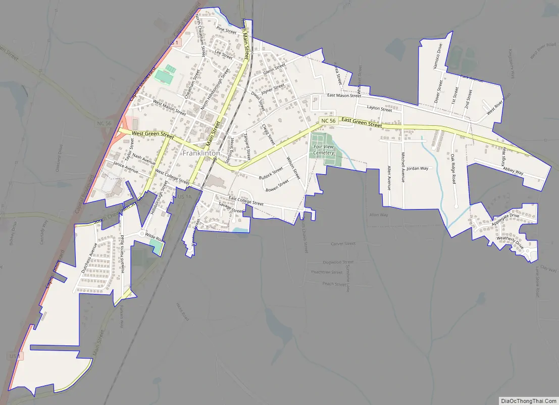
Franklinton Road Map
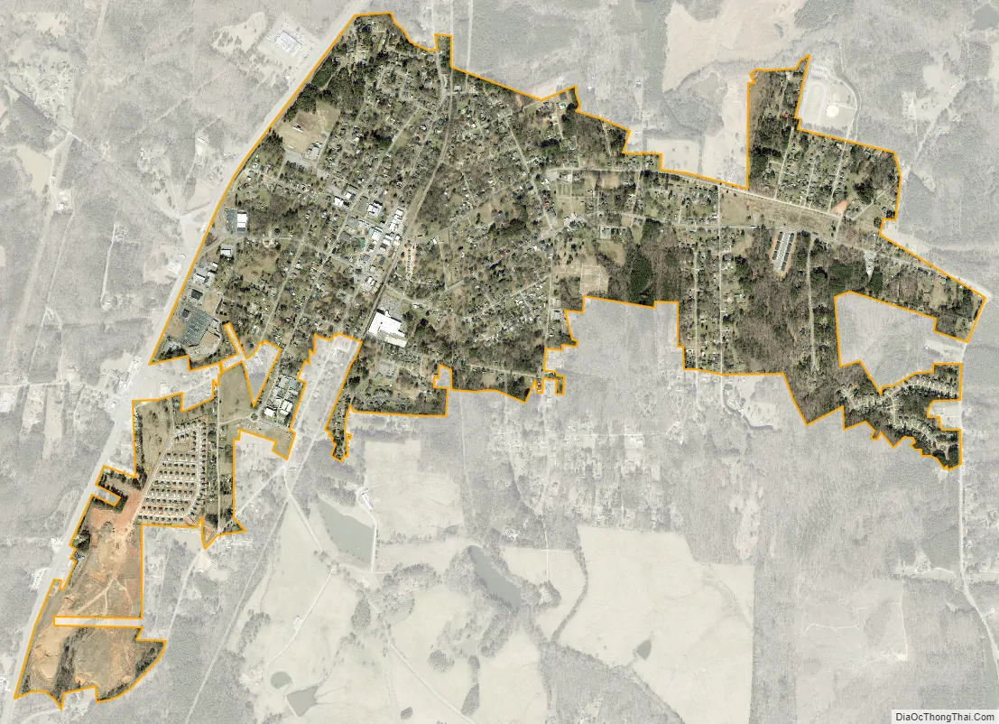
Franklinton city Satellite Map
Geography
Franklinton is located at 36°6′9″N 78°27′11″W / 36.10250°N 78.45306°W / 36.10250; -78.45306 (36.102635, −78.453157).
According to the United States Census Bureau, the town has a total area of 1.6 square miles (4.1 km), all land.
The center of town is at Main Street (U.S. Highway 1A) and Mason Street. Green Street (N.C. Highway 56) passes just south of that point and U.S. Highway 1 bypasses Franklinton to the west. The town is located approximately 30 miles (48 km) northeast of Raleigh, North Carolina and 4 miles (6.4 km) south of the Tar River.
A railway operated by CSX Transportation currently passes through Franklinton, which is part of the old Seaboard Coast Line Railroad “S-Line”. There was also a spur off this line which ran 10 miles (16 km) east from Franklinton to Louisburg, originally built in 1884 by the Louisburg Railroad and leased to the Raleigh & Gaston Railroad as a branch line. The two lines were taken over by Seaboard Air Line Railroad in 1900. From 1985 to 1988, the Franklin County Railroad operated the branch line from Franklinton to Louisburg. The section was sold to the North Carolina Department of Transportation in 1990 and the tracks removed a few years later.
See also
Map of North Carolina State and its subdivision:- Alamance
- Alexander
- Alleghany
- Anson
- Ashe
- Avery
- Beaufort
- Bertie
- Bladen
- Brunswick
- Buncombe
- Burke
- Cabarrus
- Caldwell
- Camden
- Carteret
- Caswell
- Catawba
- Chatham
- Cherokee
- Chowan
- Clay
- Cleveland
- Columbus
- Craven
- Cumberland
- Currituck
- Dare
- Davidson
- Davie
- Duplin
- Durham
- Edgecombe
- Forsyth
- Franklin
- Gaston
- Gates
- Graham
- Granville
- Greene
- Guilford
- Halifax
- Harnett
- Haywood
- Henderson
- Hertford
- Hoke
- Hyde
- Iredell
- Jackson
- Johnston
- Jones
- Lee
- Lenoir
- Lincoln
- Macon
- Madison
- Martin
- McDowell
- Mecklenburg
- Mitchell
- Montgomery
- Moore
- Nash
- New Hanover
- Northampton
- Onslow
- Orange
- Pamlico
- Pasquotank
- Pender
- Perquimans
- Person
- Pitt
- Polk
- Randolph
- Richmond
- Robeson
- Rockingham
- Rowan
- Rutherford
- Sampson
- Scotland
- Stanly
- Stokes
- Surry
- Swain
- Transylvania
- Tyrrell
- Union
- Vance
- Wake
- Warren
- Washington
- Watauga
- Wayne
- Wilkes
- Wilson
- Yadkin
- Yancey
- Alabama
- Alaska
- Arizona
- Arkansas
- California
- Colorado
- Connecticut
- Delaware
- District of Columbia
- Florida
- Georgia
- Hawaii
- Idaho
- Illinois
- Indiana
- Iowa
- Kansas
- Kentucky
- Louisiana
- Maine
- Maryland
- Massachusetts
- Michigan
- Minnesota
- Mississippi
- Missouri
- Montana
- Nebraska
- Nevada
- New Hampshire
- New Jersey
- New Mexico
- New York
- North Carolina
- North Dakota
- Ohio
- Oklahoma
- Oregon
- Pennsylvania
- Rhode Island
- South Carolina
- South Dakota
- Tennessee
- Texas
- Utah
- Vermont
- Virginia
- Washington
- West Virginia
- Wisconsin
- Wyoming