McLeansville is an unincorporated community and census-designated place (CDP) in Guilford County, North Carolina, United States. The population was 1,021 at the 2010 census.
| Name: | McLeansville CDP |
|---|---|
| LSAD Code: | 57 |
| LSAD Description: | CDP (suffix) |
| State: | North Carolina |
| County: | Guilford County |
| Elevation: | 748 ft (228 m) |
| Total Area: | 6.21 sq mi (16.08 km²) |
| Land Area: | 6.13 sq mi (15.89 km²) |
| Water Area: | 0.07 sq mi (0.19 km²) |
| Total Population: | 1,113 |
| Population Density: | 181.45/sq mi (70.06/km²) |
| ZIP code: | 27301 |
| Area code: | 336 |
| FIPS code: | 3740460 |
| GNISfeature ID: | 0989614 |
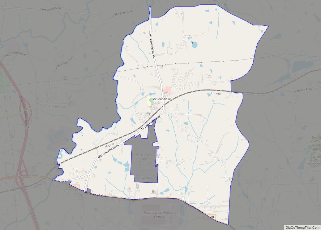
Online Interactive Map
Click on ![]() to view map in "full screen" mode.
to view map in "full screen" mode.
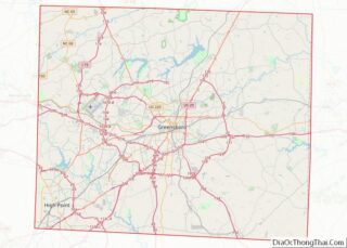
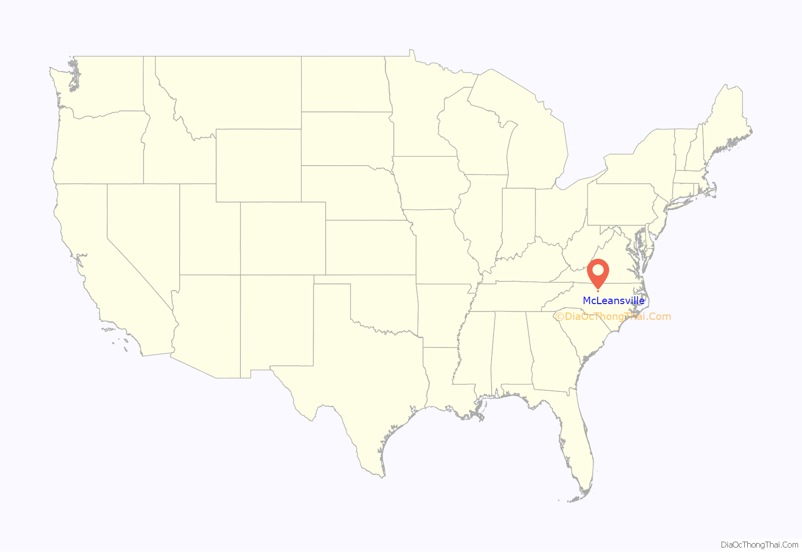
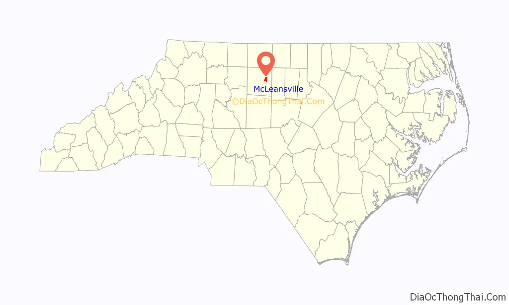
McLeansville location map. Where is McLeansville CDP?
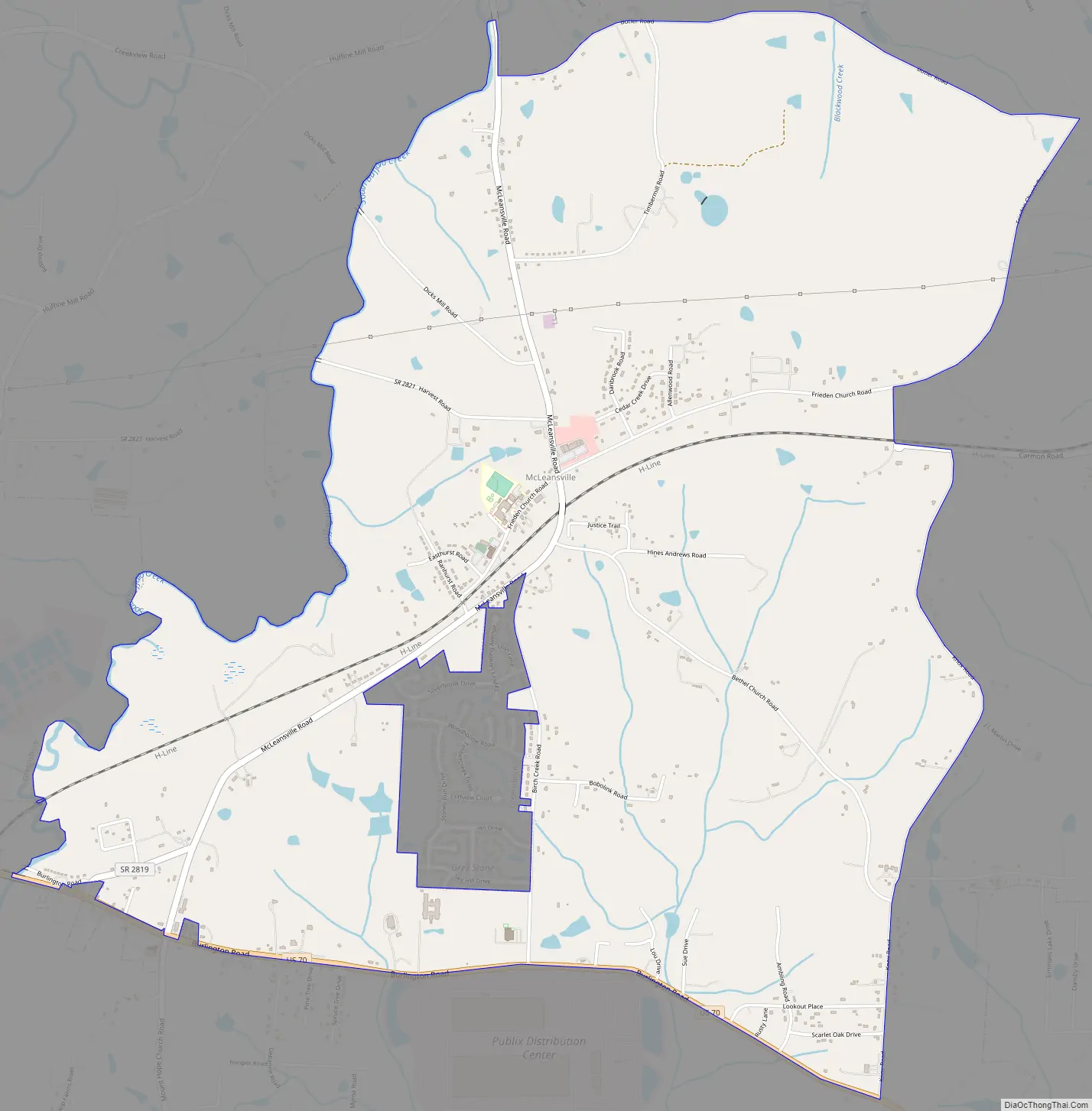
McLeansville Road Map
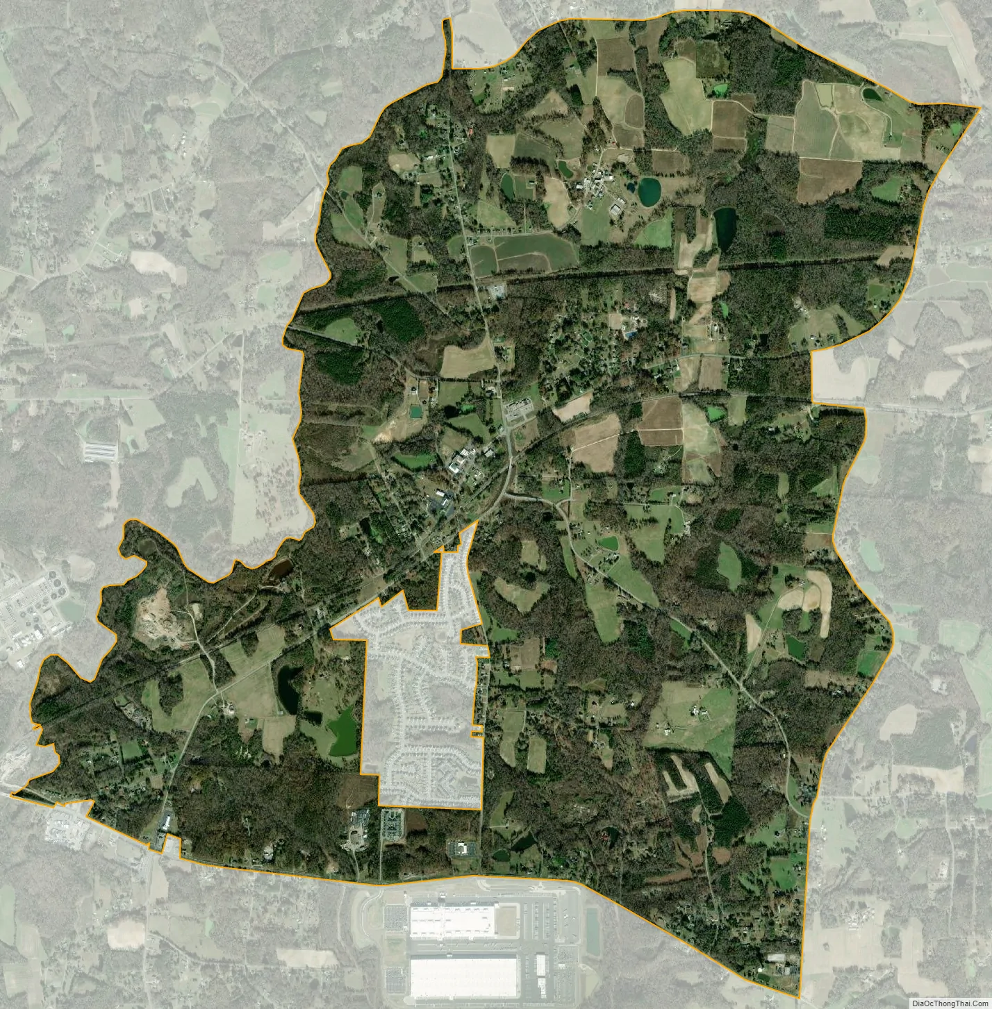
McLeansville city Satellite Map
Geography
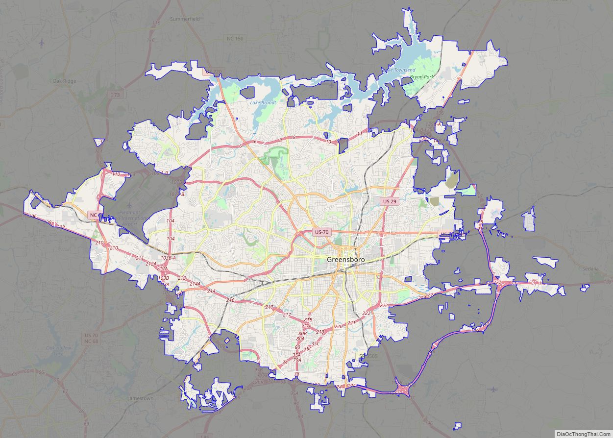
McLeansville is located in eastern Guilford County at 36°06′14″N 79°39′37″W / 36.103751°N 79.660292°W / 36.103751; -79.660292. It is bordered to the west by the city of Greensboro; additionally, an exclave of the city is surrounded by the southern part of the CDP. McLeansville’s center is 9 miles (14 km) east of Greensboro, merely a few blocks north of US 70 (Burlington Road).
According to the United States Census Bureau, the CDP has a total area of 6.3 square miles (16.2 km), of which 6.2 square miles (16.0 km) is land and 0.1 square miles (0.2 km), or 1.23%, is water. South Buffalo Creek forms the western edge of the CDP, flowing north to Buffalo Creek and part of the Reedy Fork Creek–Haw River–Cape Fear River watershed.
The town of McLeansville hosts a grocery store, post office, several small businesses, and several churches. US 70 is the main corridor that links the town to neighboring communities such as Greensboro, Sedalia, Gibsonville, Whitsett and Burlington. Interstate 785 passes thru a small portion of the town, connecting it north to US 29. The town is also home to a Publix Supermarket distribution center, situated along US 70. It was finished in 2022 at an estimated cost of $300 million. Areas bordering the town, particularly to the north, are characterized by rolling farmland, wooded areas, and suburban homes. Several strip malls with grocery stores and other businesses are in the outlying areas. The northern edge of McLeansville is accessible via US 29 and Hicone Road (Exit 136) from Greensboro; here, visitors can access Northeast Guilford Middle and High Schools, as well as Boldmoon Preserve, a passive park that features frontage along Reedy Fork Creek, with nature trails and interpretive signage.
See also
Map of North Carolina State and its subdivision:- Alamance
- Alexander
- Alleghany
- Anson
- Ashe
- Avery
- Beaufort
- Bertie
- Bladen
- Brunswick
- Buncombe
- Burke
- Cabarrus
- Caldwell
- Camden
- Carteret
- Caswell
- Catawba
- Chatham
- Cherokee
- Chowan
- Clay
- Cleveland
- Columbus
- Craven
- Cumberland
- Currituck
- Dare
- Davidson
- Davie
- Duplin
- Durham
- Edgecombe
- Forsyth
- Franklin
- Gaston
- Gates
- Graham
- Granville
- Greene
- Guilford
- Halifax
- Harnett
- Haywood
- Henderson
- Hertford
- Hoke
- Hyde
- Iredell
- Jackson
- Johnston
- Jones
- Lee
- Lenoir
- Lincoln
- Macon
- Madison
- Martin
- McDowell
- Mecklenburg
- Mitchell
- Montgomery
- Moore
- Nash
- New Hanover
- Northampton
- Onslow
- Orange
- Pamlico
- Pasquotank
- Pender
- Perquimans
- Person
- Pitt
- Polk
- Randolph
- Richmond
- Robeson
- Rockingham
- Rowan
- Rutherford
- Sampson
- Scotland
- Stanly
- Stokes
- Surry
- Swain
- Transylvania
- Tyrrell
- Union
- Vance
- Wake
- Warren
- Washington
- Watauga
- Wayne
- Wilkes
- Wilson
- Yadkin
- Yancey
- Alabama
- Alaska
- Arizona
- Arkansas
- California
- Colorado
- Connecticut
- Delaware
- District of Columbia
- Florida
- Georgia
- Hawaii
- Idaho
- Illinois
- Indiana
- Iowa
- Kansas
- Kentucky
- Louisiana
- Maine
- Maryland
- Massachusetts
- Michigan
- Minnesota
- Mississippi
- Missouri
- Montana
- Nebraska
- Nevada
- New Hampshire
- New Jersey
- New Mexico
- New York
- North Carolina
- North Dakota
- Ohio
- Oklahoma
- Oregon
- Pennsylvania
- Rhode Island
- South Carolina
- South Dakota
- Tennessee
- Texas
- Utah
- Vermont
- Virginia
- Washington
- West Virginia
- Wisconsin
- Wyoming