Jamestown is a town in Guilford County, North Carolina, United States. It is a suburb of the nearby cities of Greensboro and High Point. The population was 3,382 at the 2010 census.
| Name: | Jamestown town |
|---|---|
| LSAD Code: | 43 |
| LSAD Description: | town (suffix) |
| State: | North Carolina |
| County: | Guilford County |
| Elevation: | 801 ft (244 m) |
| Total Area: | 3.00 sq mi (7.76 km²) |
| Land Area: | 3.00 sq mi (7.76 km²) |
| Water Area: | 0.00 sq mi (0.00 km²) |
| Total Population: | 3,668 |
| Population Density: | 1,223.89/sq mi (472.56/km²) |
| ZIP code: | 27282 |
| Area code: | 336 |
| FIPS code: | 3734300 |
| GNISfeature ID: | 0987520 |
| Website: | www.jamestown-nc.gov |
Online Interactive Map
Click on ![]() to view map in "full screen" mode.
to view map in "full screen" mode.
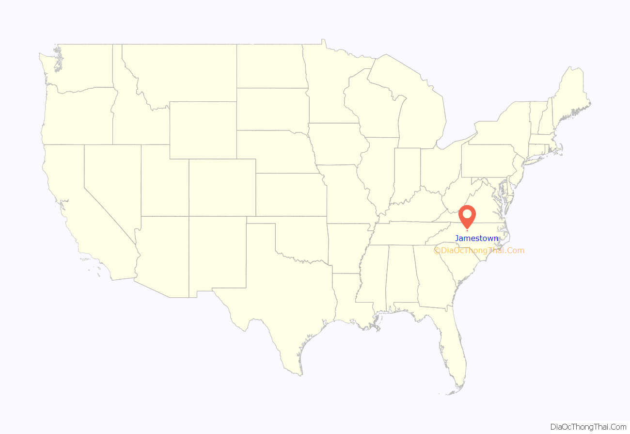
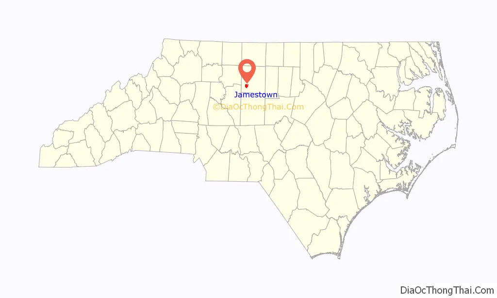
Jamestown location map. Where is Jamestown town?
History
The Keyauwee
As early as 1701, the Keyauwee people were living in a village in this region. They enjoyed the area’s mild climate, abundant natural resources, and the fertile hunting grounds along the Deep and Uwharrie rivers.
Part of a loose confederacy of 20 or more tribes, it is believed that by the 1760s, the Keyauwee had moved south, close to the boundary between the two Carolinas, where they were likely absorbed by the Catawba tribe.
Quaker settlement
By the late 18th century, European settlers came to Jamestown. Many were Quaker families who moved to the area from Pennsylvania in search of productive farmland. Among the original settlers was James Mendenhall, who established a farmstead near present-day Jamestown in 1762. Though Mendenhall moved to Georgia in 1775, his son George remained, and by 1816, he founded the village of Jamestown in honor of his father.
The Mendenhall family, who owned and operated the area’s first grist and lumber mills, also owned much of the town’s original land. Today, High Point City Lake is situated where the original family farmhouse and land was located.
In 1781, during the Revolutionary War, British General Cornwallis’ army camped near the settlement and commandeered provisions from local farms and mills prior to his engagement with Nathanael Greene’s troops at New Garden, in modern-day Greensboro.
19th century
By 1800, Jamestown was a bustling settlement of 150 residents with its own post office, inn and Freemasons’ lodge. Around this same time, gold was discovered near Jamestown, and several mines profited until the California Gold Rush frenzy shut down local efforts.
In 1811, James Mendenhall’s son Richard, a local tanner, built the Mendenhall Plantation homestead, a highlight of any tour of Jamestown today.
In addition to farming and related industries, Jamestown was home to a gun factory, which manufactured a sturdy and accurate muzzle-loading gun known as the “Jamestown Rifle”, the mainstay of Jamestown’s industry through the latter half of the 19th century and a highly prized collectible among gun enthusiasts today.
During the Civil War, Jamestown’s Quakers, who opposed war and violence, attempted to remain neutral. However, the Confederacy demanded that those who were able to make shoes, uniforms, or weapons continue to do so or pay heavy taxes. Records indicate that Confederate President Jefferson Davis and his entourage passed through Jamestown during their hasty retreat to the south after the Civil War ended.
Prior to the war, Jamestown was a known “stop” along the Underground Railroad, which helped fugitive slaves reach freedom in the North. According to local historical records, many Quaker homes in this area had a trap door leading to the basement to help slaves escape. Further, according to records, the Mendenhall and Beard families were instrumental in assisting in emancipation efforts.
Built in 1856, the railroad bisects Jamestown, and still provides a vital link for freight and some passengers between the port cities to the east and interior destinations.
20th century
By April 1947, the North Carolina General Assembly granted Jamestown incorporation. Several months after incorporation, Jamestown adopted zoning districts and began construction of a municipal water and sewer system.
T. C. Ragsdale Sr. served as the town’s first mayor, and Charles P. Turner was the first town manager.
In the 1950s, with a population of approximately 750, the town boasted such improvements as street lighting, water and sewer service, and a fire department.
During the 1960s, Jamestown grew quickly. Several residential neighborhoods sprang from old farmland. An ABC board was formed and a liquor store was constructed, enabling the town to pay off debt incurred for water and sewer lines as well as fund the building of Town Hall in 1967 and the Jamestown Park and Golf Course in 1974.
The Former Jamestown High School, Gardner House, Jamestown Historic District, McCulloch’s Gold Mill, Richard Mendenhall Plantation Buildings, Oakdale Cotton Mill Village, and Ragsdale Farm are listed on the National Register of Historic Places.
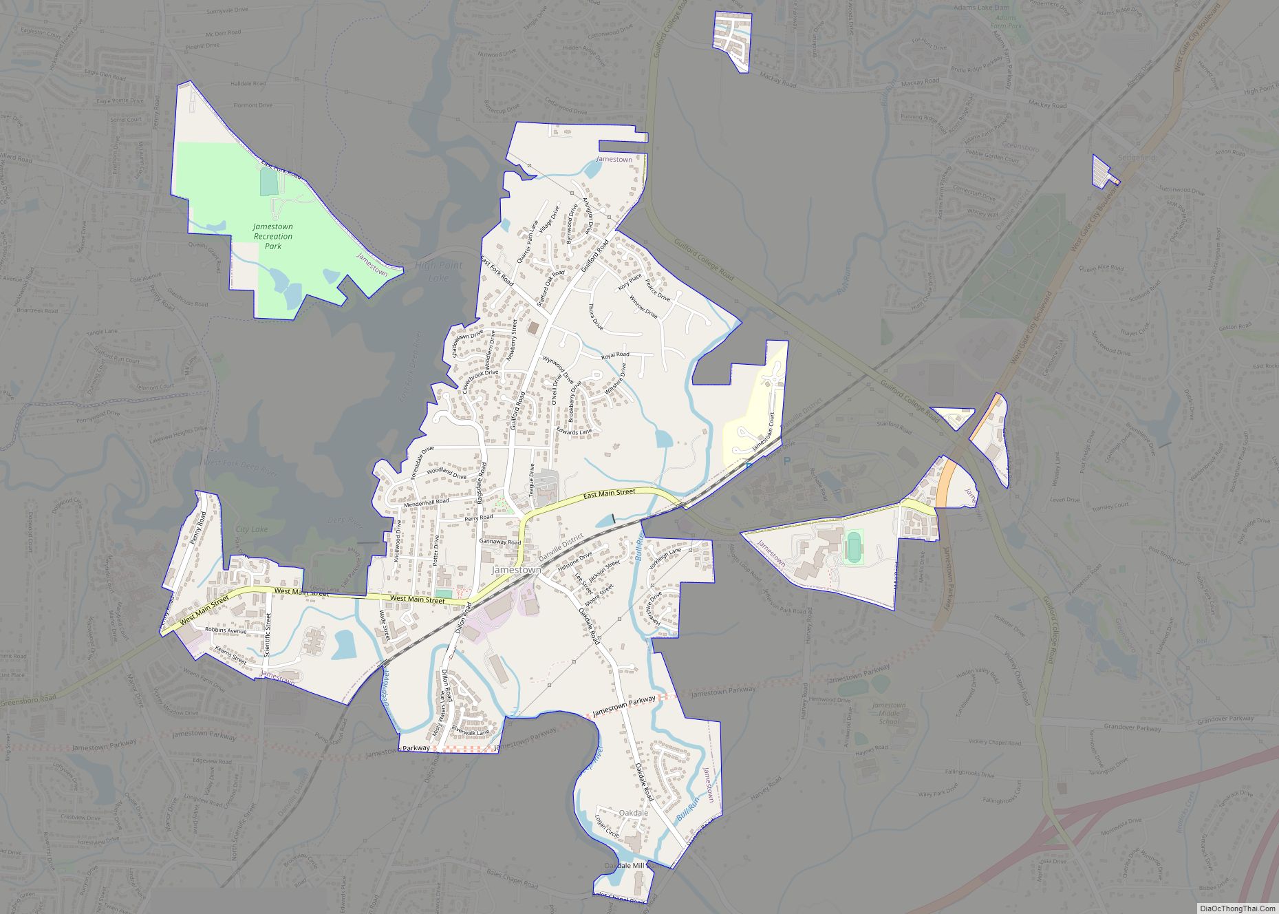
Jamestown Road Map

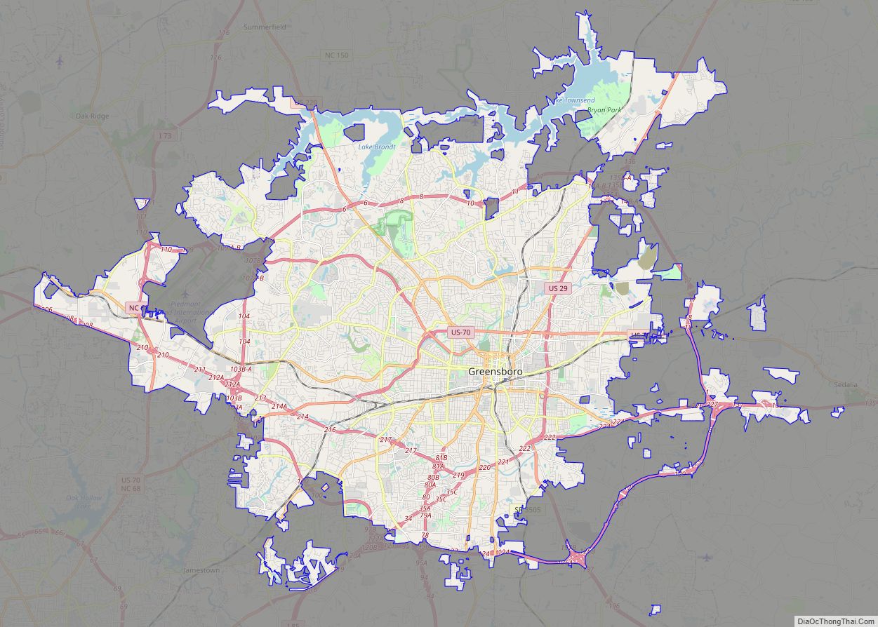
Jamestown city Satellite Map

Geography
Jamestown is located in southwestern Guilford County at 35°59′54″N 79°56′9″W / 35.99833°N 79.93583°W / 35.99833; -79.93583 (35.998221, -79.935733). It is bordered to the west by the city of High Point. Downtown Greensboro is 11 miles (18 km) to the northeast.
Transportation
Interstate 74 bypasses the town, giving the town access to Winston-Salem, Asheboro, and Rockingham. Lexington Road, Greensboro Road, and Main Street all connect the town to Greensboro and High Point. The Jamestown Parkway is a limited-access highway that effectively bypasses Greensboro Road and Main Street, also serving as one of the main routes connecting Greensboro to High Point. The route is mainly four-lanes while having at-grade intersections and grade-separations, though with only one street crossing over the parkway. The route has no actual interchanges with other roads in the town compared to similarly-built routes in the state.
According to the United States Census Bureau, the town has a total area of 2.9 square miles (7.5 km), all land. The Deep River, a tributary of the Cape Fear River, flows through the southern part of the town.
See also
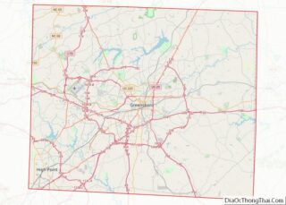
Map of North Carolina State and its subdivision:- Alamance
- Alexander
- Alleghany
- Anson
- Ashe
- Avery
- Beaufort
- Bertie
- Bladen
- Brunswick
- Buncombe
- Burke
- Cabarrus
- Caldwell
- Camden
- Carteret
- Caswell
- Catawba
- Chatham
- Cherokee
- Chowan
- Clay
- Cleveland
- Columbus
- Craven
- Cumberland
- Currituck
- Dare
- Davidson
- Davie
- Duplin
- Durham
- Edgecombe
- Forsyth
- Franklin
- Gaston
- Gates
- Graham
- Granville
- Greene
- Guilford
- Halifax
- Harnett
- Haywood
- Henderson
- Hertford
- Hoke
- Hyde
- Iredell
- Jackson
- Johnston
- Jones
- Lee
- Lenoir
- Lincoln
- Macon
- Madison
- Martin
- McDowell
- Mecklenburg
- Mitchell
- Montgomery
- Moore
- Nash
- New Hanover
- Northampton
- Onslow
- Orange
- Pamlico
- Pasquotank
- Pender
- Perquimans
- Person
- Pitt
- Polk
- Randolph
- Richmond
- Robeson
- Rockingham
- Rowan
- Rutherford
- Sampson
- Scotland
- Stanly
- Stokes
- Surry
- Swain
- Transylvania
- Tyrrell
- Union
- Vance
- Wake
- Warren
- Washington
- Watauga
- Wayne
- Wilkes
- Wilson
- Yadkin
- Yancey
- Alabama
- Alaska
- Arizona
- Arkansas
- California
- Colorado
- Connecticut
- Delaware
- District of Columbia
- Florida
- Georgia
- Hawaii
- Idaho
- Illinois
- Indiana
- Iowa
- Kansas
- Kentucky
- Louisiana
- Maine
- Maryland
- Massachusetts
- Michigan
- Minnesota
- Mississippi
- Missouri
- Montana
- Nebraska
- Nevada
- New Hampshire
- New Jersey
- New Mexico
- New York
- North Carolina
- North Dakota
- Ohio
- Oklahoma
- Oregon
- Pennsylvania
- Rhode Island
- South Carolina
- South Dakota
- Tennessee
- Texas
- Utah
- Vermont
- Virginia
- Washington
- West Virginia
- Wisconsin
- Wyoming