Sedalia is a town in Guilford County, North Carolina, United States. The population was 623 at the 2010 census.
| Name: | Sedalia town |
|---|---|
| LSAD Code: | 43 |
| LSAD Description: | town (suffix) |
| State: | North Carolina |
| County: | Guilford County |
| Elevation: | 702 ft (214 m) |
| Total Area: | 2.01 sq mi (5.20 km²) |
| Land Area: | 2.00 sq mi (5.18 km²) |
| Water Area: | 0.01 sq mi (0.02 km²) |
| Total Population: | 676 |
| Population Density: | 338.17/sq mi (130.55/km²) |
| ZIP code: | 27342 |
| Area code: | 336 |
| FIPS code: | 3760180 |
| GNISfeature ID: | 0994476 |
| Website: | sedalianc.org |
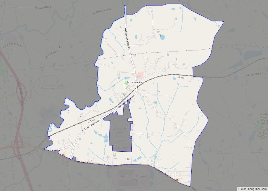
Online Interactive Map
Click on ![]() to view map in "full screen" mode.
to view map in "full screen" mode.
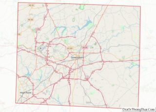
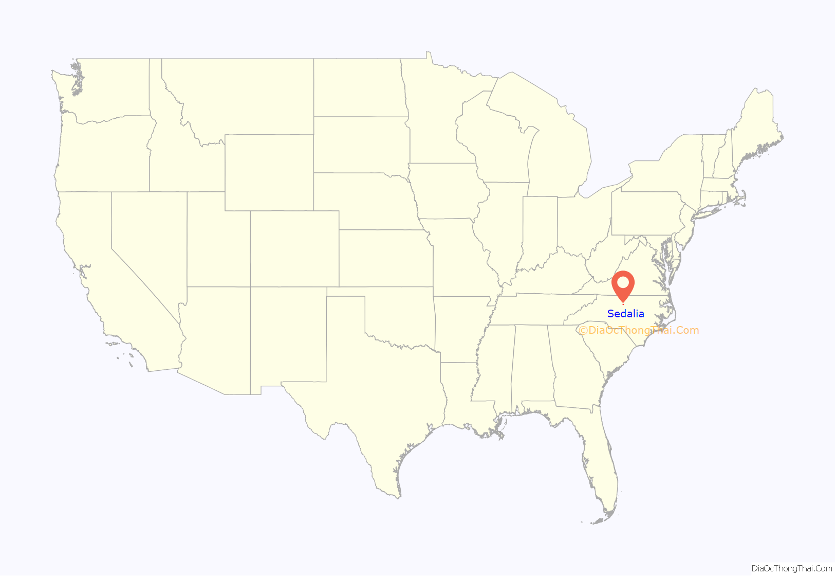
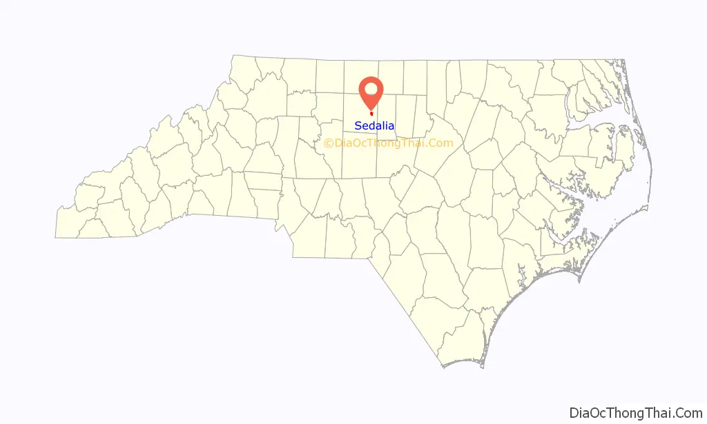
Sedalia location map. Where is Sedalia town?
History
The Dr. Joseph A. McLean House and Palmer Memorial Institute Historic District are listed on the National Register of Historic Places.
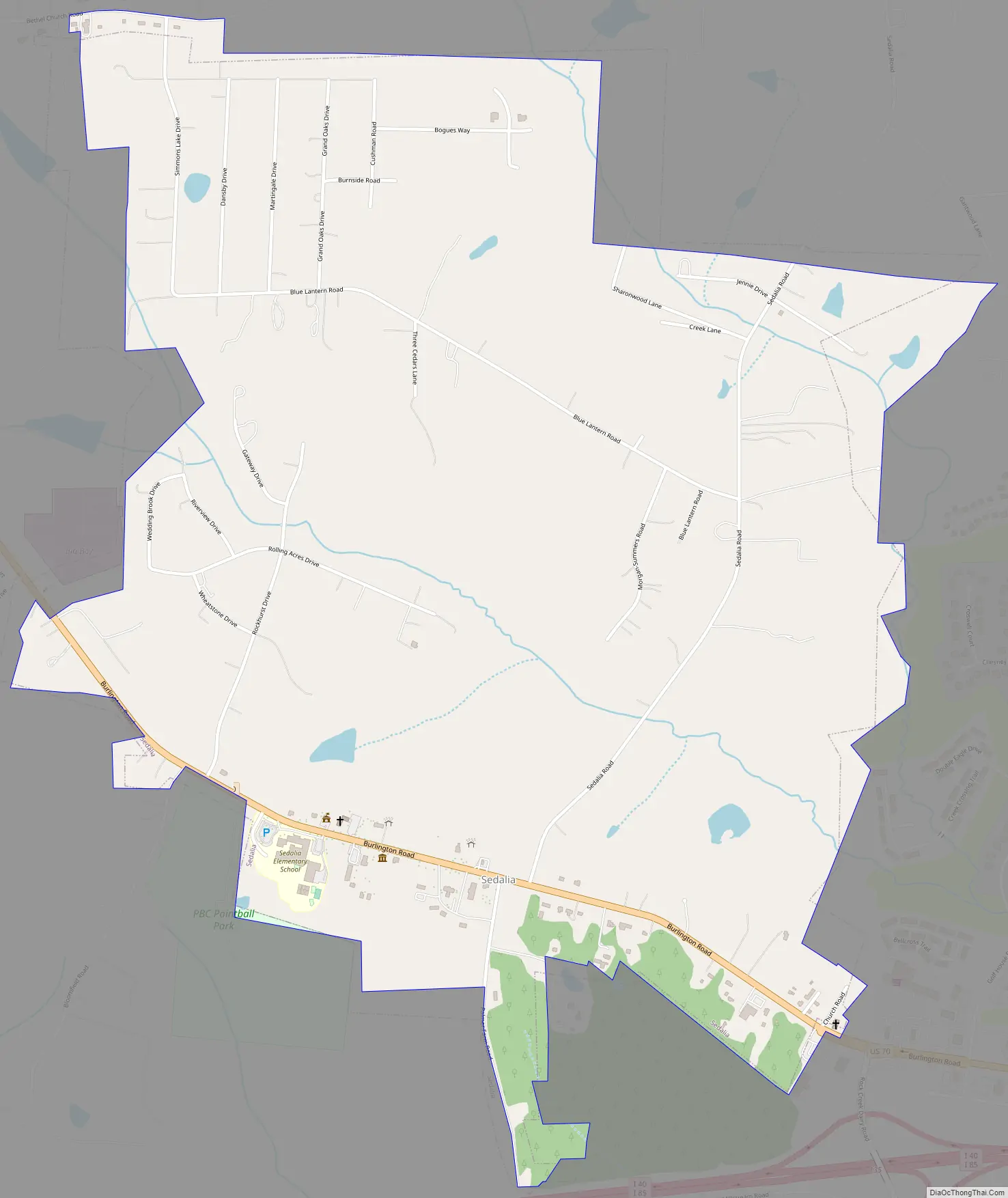
Sedalia Road Map
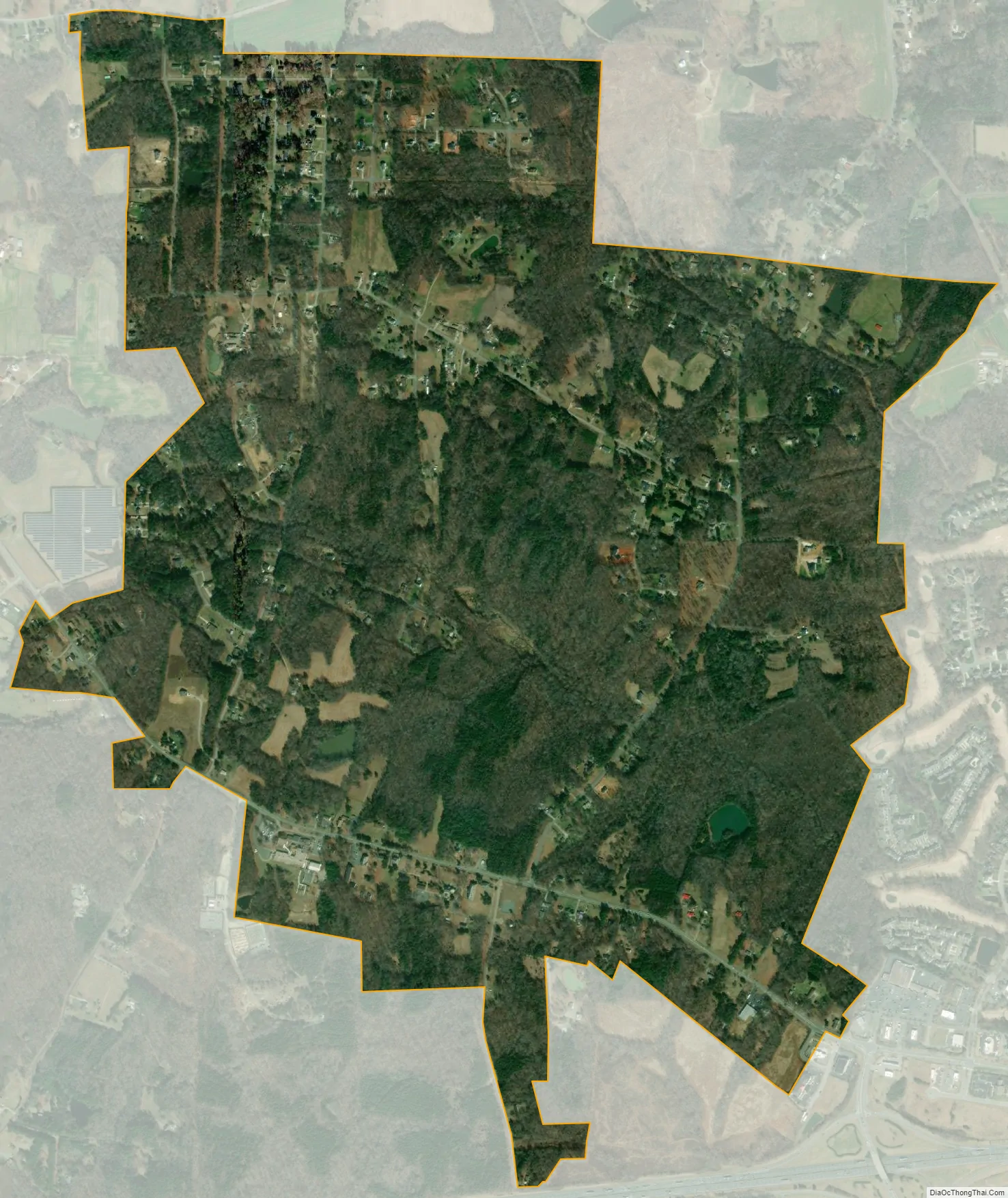
Sedalia city Satellite Map
Geography
Sedalia is located in eastern Guilford County at 36°4′42″N 79°37′39″W / 36.07833°N 79.62750°W / 36.07833; -79.62750 (36.078407, -79.627444). U.S. Route 70 (Burlington Road) passes through the center of the town, leading east 11 miles (18 km) to Burlington and west 11 miles (18 km) to Greensboro. Interstate 40 passes just south of Sedalia, with access from Exit 135 (Rock Creek Dairy Road).
According to the United States Census Bureau, the town has a total area of 2.1 square miles (5.4 km), of which 0.01 square miles (0.02 km), or 0.30%, is water.
See also
Map of North Carolina State and its subdivision:- Alamance
- Alexander
- Alleghany
- Anson
- Ashe
- Avery
- Beaufort
- Bertie
- Bladen
- Brunswick
- Buncombe
- Burke
- Cabarrus
- Caldwell
- Camden
- Carteret
- Caswell
- Catawba
- Chatham
- Cherokee
- Chowan
- Clay
- Cleveland
- Columbus
- Craven
- Cumberland
- Currituck
- Dare
- Davidson
- Davie
- Duplin
- Durham
- Edgecombe
- Forsyth
- Franklin
- Gaston
- Gates
- Graham
- Granville
- Greene
- Guilford
- Halifax
- Harnett
- Haywood
- Henderson
- Hertford
- Hoke
- Hyde
- Iredell
- Jackson
- Johnston
- Jones
- Lee
- Lenoir
- Lincoln
- Macon
- Madison
- Martin
- McDowell
- Mecklenburg
- Mitchell
- Montgomery
- Moore
- Nash
- New Hanover
- Northampton
- Onslow
- Orange
- Pamlico
- Pasquotank
- Pender
- Perquimans
- Person
- Pitt
- Polk
- Randolph
- Richmond
- Robeson
- Rockingham
- Rowan
- Rutherford
- Sampson
- Scotland
- Stanly
- Stokes
- Surry
- Swain
- Transylvania
- Tyrrell
- Union
- Vance
- Wake
- Warren
- Washington
- Watauga
- Wayne
- Wilkes
- Wilson
- Yadkin
- Yancey
- Alabama
- Alaska
- Arizona
- Arkansas
- California
- Colorado
- Connecticut
- Delaware
- District of Columbia
- Florida
- Georgia
- Hawaii
- Idaho
- Illinois
- Indiana
- Iowa
- Kansas
- Kentucky
- Louisiana
- Maine
- Maryland
- Massachusetts
- Michigan
- Minnesota
- Mississippi
- Missouri
- Montana
- Nebraska
- Nevada
- New Hampshire
- New Jersey
- New Mexico
- New York
- North Carolina
- North Dakota
- Ohio
- Oklahoma
- Oregon
- Pennsylvania
- Rhode Island
- South Carolina
- South Dakota
- Tennessee
- Texas
- Utah
- Vermont
- Virginia
- Washington
- West Virginia
- Wisconsin
- Wyoming