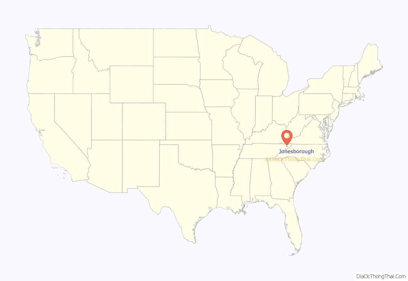
Jonesborough (historically also Jonesboro) is a town in, and the county seat of, Washington County, Tennessee, in the Southeastern United States. Its population was 5,860 as of 2020. It is “Tennessee’s oldest town”.
Jonesborough is part of the Johnson City metropolitan statistical area, which is a component of the Johnson City–Kingsport–Bristol, TN and VA combined statistical area – commonly known as the “Tri-Cities” region.
| Name: | Jonesborough town |
|---|---|
| LSAD Code: | 43 |
| LSAD Description: | town (suffix) |
| State: | Tennessee |
| County: | Washington County |
| Incorporated: | 1779 |
| Elevation: | 1,729 ft (527 m) |
| Total Area: | 5.32 sq mi (13.79 km²) |
| Land Area: | 5.32 sq mi (13.79 km²) |
| Water Area: | 0.00 sq mi (0.00 km²) |
| Total Population: | 5,860 |
| Population Density: | 1,100.68/sq mi (424.98/km²) |
| ZIP code: | 37659 |
| Area code: | 423 |
| FIPS code: | 4738540 |
| GNISfeature ID: | 2405919 |
| Website: | www.jonesborough.com |
Online Interactive Map
Click on ![]() to view map in "full screen" mode.
to view map in "full screen" mode.
Jonesborough location map. Where is Jonesborough town?
History
Located in the far northeast corner of the state, Jonesborough was founded by European Americans in 1779, 17 years before Tennessee became a state and while the area was under the jurisdiction of North Carolina. It was named after North Carolina legislator Willie Jones, who had supported the state’s westward expansion across the Appalachian Mountains.
The town was renamed “Jonesboro” for a period of time, but it took back its historic spelling.
Jonesborough was originally a part of the Washington District. In 1784, it became the capital of the autonomous State of Franklin (ostensibly named after American founding father, Benjamin Franklin). Congress, however, never recognized Franklin, which was reclaimed by North Carolina in late 1788.
Tennessee and other border states into the 1830s were strong centers of abolitionist activity. The Tennessee Manumission Society was founded in 1815. East Tennessee was especially an area of Unionist leanings, made up of subsistence farmers who raised tobacco as a market crop. They had small holdings that also produced family needs. They held relatively few slaves compared to landowners in Middle Tennessee or the plantation areas of the Delta near the Mississippi River. Many became Republicans and continued to vote with that party after the war, when the other two regions of the state were dominated by Democrats.
Elihu Embree of Jonesborough founded the Manumission Intelligencier in 1819; he renamed it as The Emancipator the next year. The town was considered a center of abolitionism. The newspaper is the first American periodical to be dedicated exclusively to the issue of the abolition of slavery.
In the 1840s, the Jonesborough Whig was published here. Its publisher was William G. “Parson” Brownlow, who relocated it from Elizabethton, Tennessee, after about two years, under his own name. Brownlow and rival editor Landon Carter Haynes, who was also a Methodist preacher and circuit rider, brawled in the streets of Jonesborough in May 1840. Over the next several years, the two newspapermen bashed one another in their respective papers, each managing at times to thwart the other’s political ambitions. Haynes left the newspaper business in 1845, and Brownlow, who later was elected as governor, moved the Whig to the larger city of Knoxville in 1849.
From 1865 to 1873 the town was served by The Union Flag. In this period, the Jonesboro Herald & Tribune, and the Jonesboro Tennessee Echo, the latter edited and published by Colonel George E. Gresham, were also published.
Cholera pandemic, 1873
During the summer of 1873, a cholera epidemic spread throughout the Mississippi River system, having originated in New Orleans. Part of the fourth cholera pandemic that started in India and spread west into Europe and across the Atlantic Ocean, it was believed to have been introduced to the Louisiana port by immigrants or other travelers. It spread to river towns visited by steamboats, and among neighboring settlements. None of the towns had adequate sanitation systems.
With a mortality rate of 40 to 60% and no understanding of how the disease was contracted, people dreaded an outbreak. (It was variously attributed to poor diet and miasma.) While residents of Jonesborough heard about cases in Knoxville and Greeneville, which was about 24 miles away and hard hit, their first case was not seen until July 14. Mrs. A. C. Collins died after caring for two refugees from Greeneville, who recovered. The Herald & Tribune had already published a warning about cholera, and many people had left the town for what they thought were healthier locations. The newspaper did not publish again for weeks, as cholera spread rapidly in town.
Of the estimated 75 people left, 30 died by early August and another 30 contracted the disease but survived. Victims included publisher Col. George Gresham, who had devoted himself to caring for victims, and G.C. Thrasher, one of four ministers who also remained in the town during the crisis. The town received help and monies from other localities, and within a month, the disease had mostly run its course. Residents began to return to the depleted town, shaken by the disastrous month.
Modern tourism
Today, Jonesborough attracts heritage tourism because of its status as Tennessee’s oldest town and its rich architectural fabric, protected by local historic preservation efforts. The town’s museum describes the local heritage of small-scale tobacco farming. The historic Chester Inn, built in 1797, still stands in downtown Jonesborough.
The Jonesborough Historic District was listed on the National Register of Historic Places in 1969. The oldest surviving building in the town, the Christopher Taylor House (built in 1777 about a mile outside of the original town limits), was relocated to a lot within the historic district.
Jonesborough is the home of the International Storytelling Center, which holds the annual National Storytelling Festival on the first full weekend in October. The festival builds on the Appalachian cultural tradition of storytelling, and has been drawing people from around the world for more than 35 years. Large tents are pitched in parks around town, and storytellers sit on stages or at the head of the main tent to perform. Occasionally, performances are interrupted for a moment by passing Norfolk Southern Railway trains. Past storytellers included Carmen Agra Deedy, Syd Lieberman, and Kathryn Tucker Windham. The festival inspired the development of a successful storytelling graduate degree program at nearby East Tennessee State University.
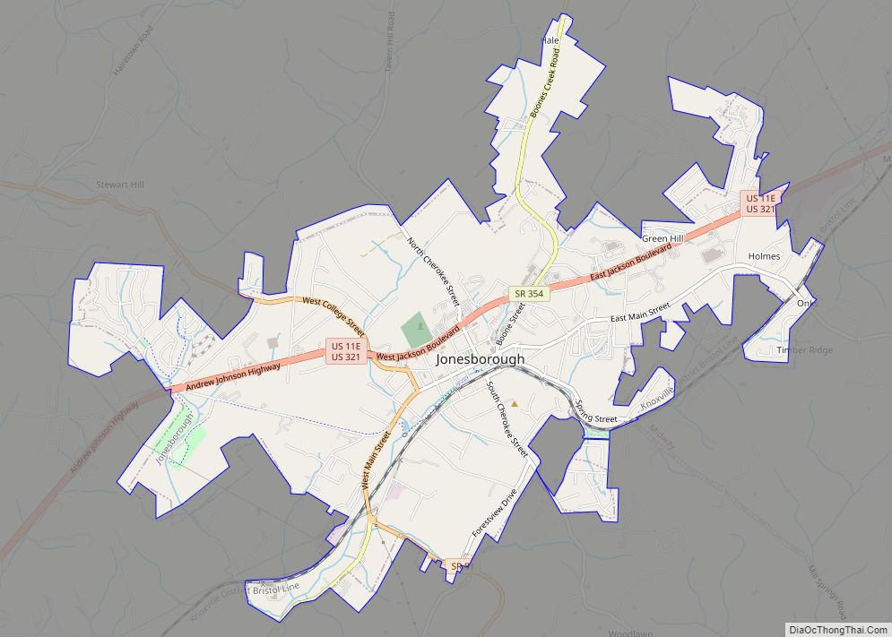
Jonesborough Road Map
Jonesborough city Satellite Map
Geography
Jonesborough is situated in an area where the watershed of the Watauga River meets the watershed of the Nolichucky River. The Watauga passes about 10 miles (16 km) to the northeast of Jonesborough, and the Nolichucky passes roughly 10 miles (16 km) to the southwest. The town’s principle stream, Little Limestone Creek, is part of the Nolichucky watershed.
Jonesborough is surrounded by low hills and elongated ridges that are characteristic of the Appalachian Ridge-and-Valley Province. The main crest of the Appalachians rises just a few miles southeast of Jonesborough.
Jonesborough is centered on the junction of Andrew Johnson Highway (which is part of both U.S. Route 321 and U.S. Route 11E), which connects the town to Greeneville to the southwest and Johnson City to the northeast, and State Route 81, which connects Jonesborough to Interstate 81 to the northwest and Interstate 26 at Erwin to the southeast.
According to the United States Census Bureau, the town has a total area of 4.3 sq mi (11 km), all of it land.
See also
Map of Tennessee State and its subdivision:- Anderson
- Bedford
- Benton
- Bledsoe
- Blount
- Bradley
- Campbell
- Cannon
- Carroll
- Carter
- Cheatham
- Chester
- Claiborne
- Clay
- Cocke
- Coffee
- Crockett
- Cumberland
- Davidson
- Decatur
- DeKalb
- Dickson
- Dyer
- Fayette
- Fentress
- Franklin
- Gibson
- Giles
- Grainger
- Greene
- Grundy
- Hamblen
- Hamilton
- Hancock
- Hardeman
- Hardin
- Hawkins
- Haywood
- Henderson
- Henry
- Hickman
- Houston
- Humphreys
- Jackson
- Jefferson
- Johnson
- Knox
- Lake
- Lauderdale
- Lawrence
- Lewis
- Lincoln
- Loudon
- Macon
- Madison
- Marion
- Marshall
- Maury
- McMinn
- McNairy
- Meigs
- Monroe
- Montgomery
- Moore
- Morgan
- Obion
- Overton
- Perry
- Pickett
- Polk
- Putnam
- Rhea
- Roane
- Robertson
- Rutherford
- Scott
- Sequatchie
- Sevier
- Shelby
- Smith
- Stewart
- Sullivan
- Sumner
- Tipton
- Trousdale
- Unicoi
- Union
- Van Buren
- Warren
- Washington
- Wayne
- Weakley
- White
- Williamson
- Wilson
- Alabama
- Alaska
- Arizona
- Arkansas
- California
- Colorado
- Connecticut
- Delaware
- District of Columbia
- Florida
- Georgia
- Hawaii
- Idaho
- Illinois
- Indiana
- Iowa
- Kansas
- Kentucky
- Louisiana
- Maine
- Maryland
- Massachusetts
- Michigan
- Minnesota
- Mississippi
- Missouri
- Montana
- Nebraska
- Nevada
- New Hampshire
- New Jersey
- New Mexico
- New York
- North Carolina
- North Dakota
- Ohio
- Oklahoma
- Oregon
- Pennsylvania
- Rhode Island
- South Carolina
- South Dakota
- Tennessee
- Texas
- Utah
- Vermont
- Virginia
- Washington
- West Virginia
- Wisconsin
- Wyoming
