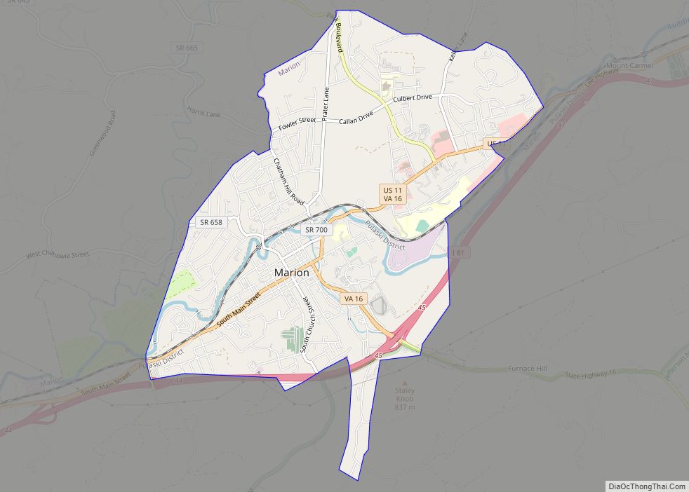
Marion is a town in, and the county seat of, Smyth County, Virginia, United States. It is positioned upon Interstate 81, in the Blue Ridge portion of the Southern Appalachian mountains in Southwest Virginia. The town is named for American Revolutionary War officer Francis Marion. The town limits had a population of approximately 6,000, per 2020 Census estimates. However, together with the neighborhoods, an additional 9,000 residents residing in unincorporated Smyth County have Marion mailing addresses, granting the Marion, VA ZIP code (24354) a total population of about 14,500, which is around half of the county’s total population.
| Name: | Marion town |
|---|---|
| LSAD Code: | 43 |
| LSAD Description: | town (suffix) |
| State: | Virginia |
| County: | Smyth County |
| Elevation: | 2,500 ft (800 m) |
| Land Area: | 5.13 sq mi (10.69 km²) |
| Water Area: | 0.03 sq mi (0.08 km²) |
| Population Density: | 1,347.31/sq mi (537.98/km²) |
| ZIP code: | 24354 |
| Area code: | 276 |
| FIPS code: | 5149464 |
| GNISfeature ID: | 1498513 |
| Website: | www.marionva.org |
Online Interactive Map
Click on ![]() to view map in "full screen" mode.
to view map in "full screen" mode.
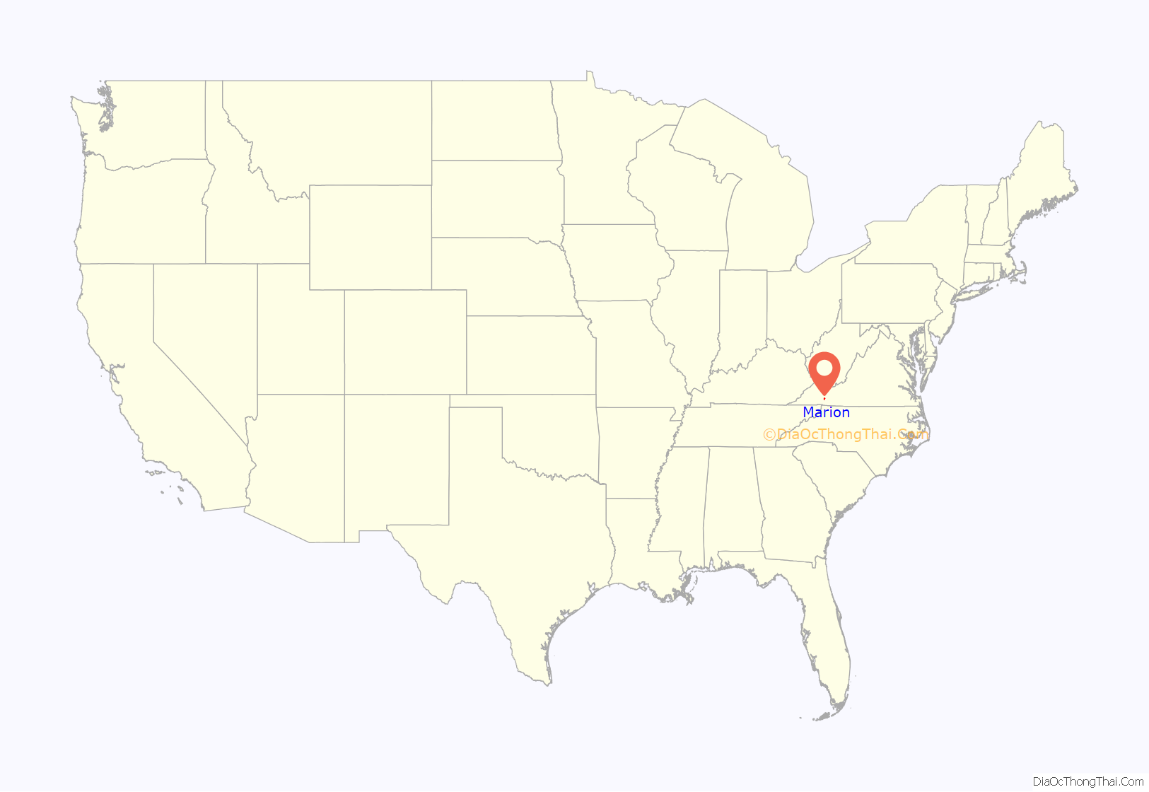
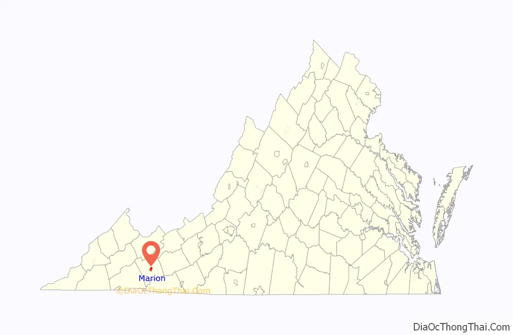
Marion location map. Where is Marion town?
History
Marion College, a two-year Lutheran women’s college, operated from 1873 to 1967. Marion Hall, constructed in 1968 and named in honor of Francis Marion, is a residence hall at Roanoke College.
Marion is also home to Southwestern Virginia Mental Health Institute.
Marion is the birthplace of the soft drink Mountain Dew. Although Mountain Dew was first marketed under that name in Knoxville, TN, the original soft drink’s formula changed drastically from Knoxville’s formula to the syrup mixture that constitutes today’s drink, which is Marion’s version. In 1961, the rights to Mountain Dew were purchased by the Marion-based Tip Corporation. The Mountain Dew flavor was reworked by Marion resident William H. “Bill” Jones. Due to the success of the revised formulation, the Pepsi Corporation purchased the Tip Corporation in 1964. Marion also hosted the Mountain Dew Festival for more than 50 years.
Back of the Dragon, a segment of SR16 popular among motorcycle and sports car enthusiasts for its sharp turns and scenic overlooks, begins in Marion, Virginia.
R. T. Greer and Company, Henderson Building, Hotel Lincoln, Hungry Mother State Park Historic District, Lincoln Theatre, Marion Historic District, Marion Male Academy, Norfolk & Western Railway Depot, Preston House, and the Abijah Thomas House are listed on the National Register of Historic Places.
Marion Road Map
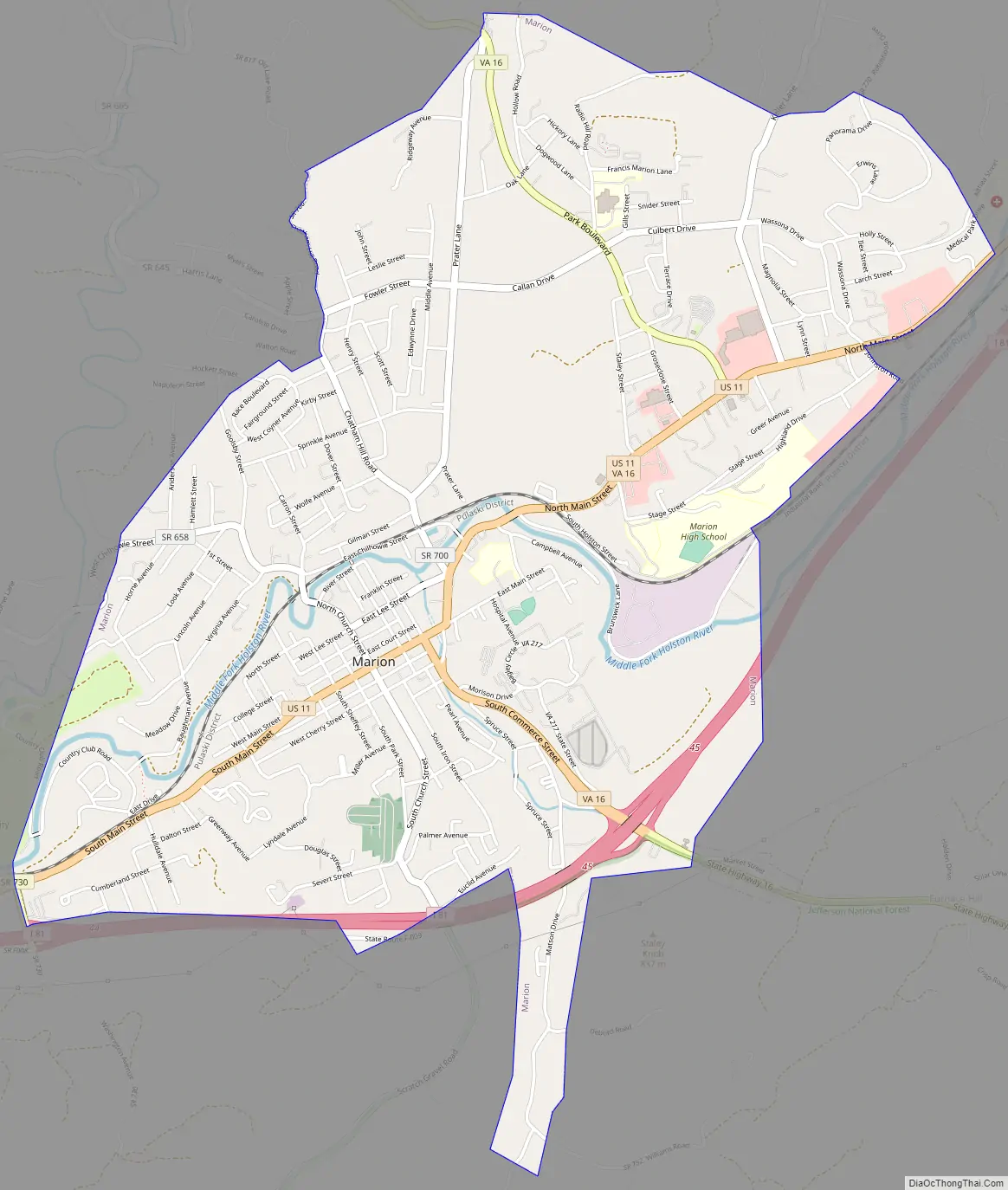
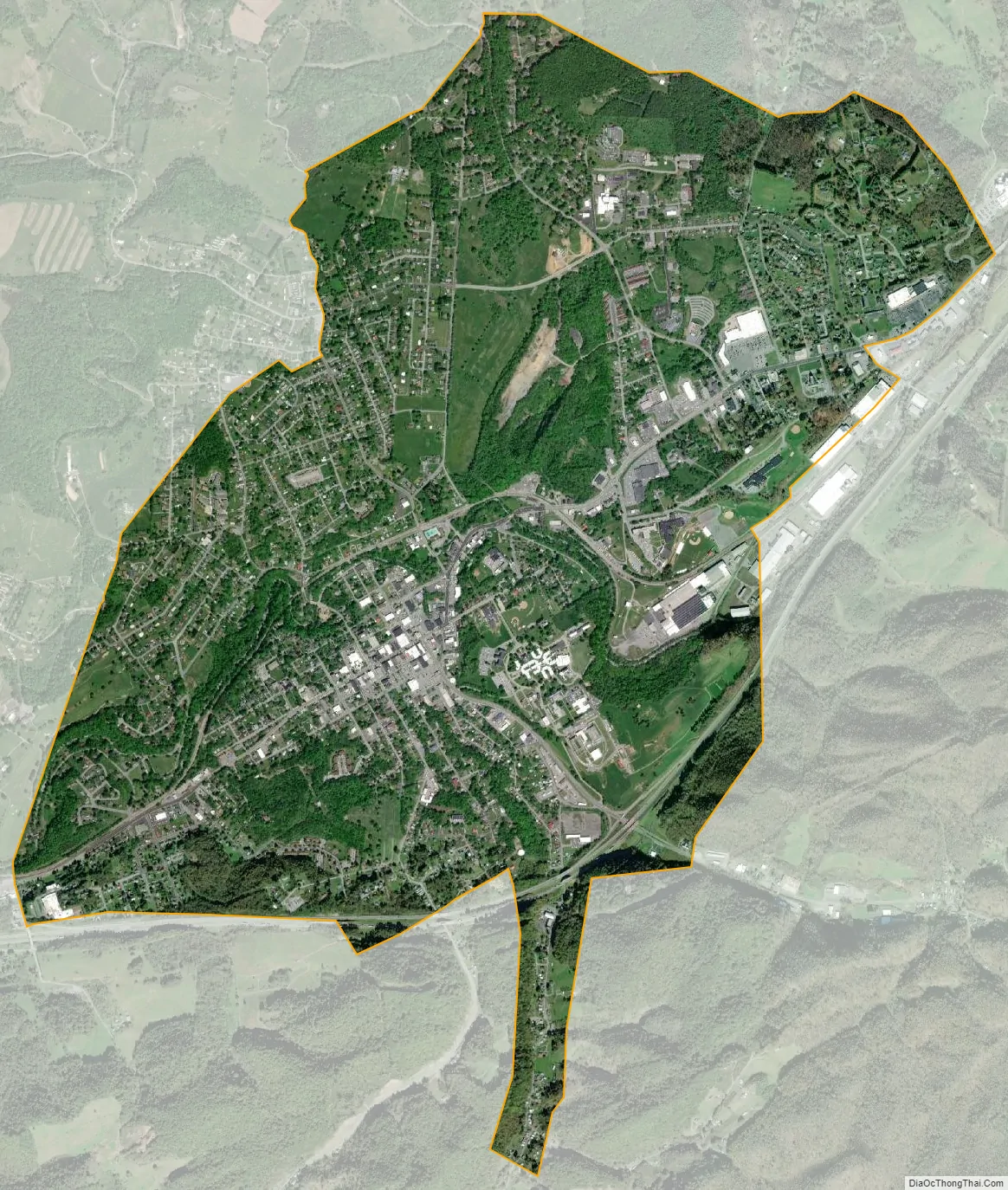
Marion city Satellite Map
Geography
Marion, Virginia is the location of two large side-by-side ground storage water tower tanks, which are separately labeled “HOT” (in red letters) and “COLD” (in blue). The landmarks, positioned just off of Marion exit 47, are visible to both north and south bound Interstate 81 traffic lanes.
Marion is located at 36°50′N 81°31′W / 36.833°N 81.517°W / 36.833; -81.517 (36.8370, −81.5165).
According to the United States Census Bureau, the town has a total area of 5.2 square miles (10.7 km), all of it land.
Marion is home to Hungry Mother State Park, one of the six original Virginia State Parks from the 1930s.
See also
Map of Virginia State and its subdivision:- Accomack
- Albemarle
- Alexandria
- Alleghany
- Amelia
- Amherst
- Appomattox
- Arlington
- Augusta
- Bath
- Bedford
- Bedford City
- Bland
- Botetourt
- Bristol
- Brunswick
- Buchanan
- Buckingham
- Buena Vista
- Campbell
- Caroline
- Carroll
- Charles City
- Charlotte
- Charlottesville
- Chesapeake
- Chesterfield
- Clarke
- Clifton Forge City
- Colonial Heights
- Covington
- Craig
- Culpeper
- Cumberland
- Danville
- Dickenson
- Dinwiddie
- Emporia
- Essex
- Fairfax
- Fairfax City
- Falls Church
- Fauquier
- Floyd
- Fluvanna
- Franklin
- Frederick
- Fredericksburg
- Galax
- Giles
- Gloucester
- Goochland
- Grayson
- Greene
- Greensville
- Halifax
- Hampton
- Hanover
- Harrisonburg
- Henrico
- Henry
- Highland
- Hopewell
- Isle of Wight
- James City
- King and Queen
- King George
- King William
- Lancaster
- Lee
- Lexington
- Loudoun
- Louisa
- Lunenburg
- Lynchburg
- Madison
- Manassas
- Manassas Park
- Martinsville
- Mathews
- Mecklenburg
- Middlesex
- Montgomery
- Nelson
- New Kent
- Newport News
- Norfolk
- Northampton
- Northumberland
- Norton
- Nottoway
- Orange
- Page
- Patrick
- Petersburg
- Pittsylvania
- Poquoson
- Portsmouth
- Powhatan
- Prince Edward
- Prince George
- Prince William
- Pulaski
- Radford
- Rappahannock
- Richmond
- Roanoke
- Roanoke City
- Rockbridge
- Rockingham
- Russell
- Salem
- Scott
- Shenandoah
- Smyth
- Southampton
- Spotsylvania
- Stafford
- Staunton
- Suffolk
- Surry
- Sussex
- Tazewell
- Virginia Beach
- Warren
- Washington
- Waynesboro
- Westmoreland
- Williamsburg
- Winchester
- Wise
- Wythe
- York
- Alabama
- Alaska
- Arizona
- Arkansas
- California
- Colorado
- Connecticut
- Delaware
- District of Columbia
- Florida
- Georgia
- Hawaii
- Idaho
- Illinois
- Indiana
- Iowa
- Kansas
- Kentucky
- Louisiana
- Maine
- Maryland
- Massachusetts
- Michigan
- Minnesota
- Mississippi
- Missouri
- Montana
- Nebraska
- Nevada
- New Hampshire
- New Jersey
- New Mexico
- New York
- North Carolina
- North Dakota
- Ohio
- Oklahoma
- Oregon
- Pennsylvania
- Rhode Island
- South Carolina
- South Dakota
- Tennessee
- Texas
- Utah
- Vermont
- Virginia
- Washington
- West Virginia
- Wisconsin
- Wyoming