Grayslake is a village in Lake County, Illinois, United States. It is located in the Chicago metropolitan area, about 40 miles (64 km) north of Chicago’s downtown, 14 miles (23 km) west of Lake Michigan, and 15 miles (24 km) south of the Wisconsin border. The village’s population at the 2020 census was 21,248.
Grayslake is home to the College of Lake County, Grayslake North High School, Grayslake Central High School, the University Center of Lake County and the Lake County Fairgrounds. There are tentative plans to develop a lifestyle shopping center on the previous location of the Lake County Fairgrounds. At the south end of Grayslake, there are plans for a 641-acre (259 ha) development containing light industry, office space and residential space.
| Name: | Grayslake village |
|---|---|
| LSAD Code: | 47 |
| LSAD Description: | village (suffix) |
| State: | Illinois |
| County: | Lake County |
| Incorporated: | 1895 |
| Total Area: | 11.13 sq mi (28.81 km²) |
| Land Area: | 10.90 sq mi (28.23 km²) |
| Water Area: | 0.23 sq mi (0.58 km²) |
| Total Population: | 21,248 |
| Population Density: | 1,949.18/sq mi (752.61/km²) |
| Area code: | 847 |
| FIPS code: | 1731121 |
| Website: | villageofgrayslake.com |
Online Interactive Map
Click on ![]() to view map in "full screen" mode.
to view map in "full screen" mode.
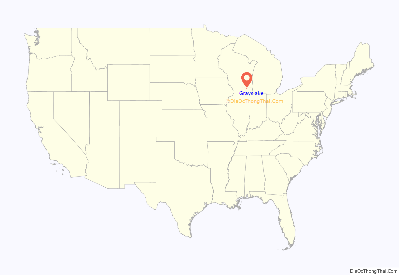
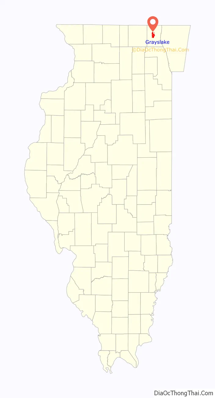
Grayslake location map. Where is Grayslake village?
History
Early history
In 1840, Massachusetts-born William M. Gray settled along the then-unnamed Grays Lake. Other farmers trickled into the area in 1840s. Gray moved to Waukegan in 1845.
In 1880, the Wisconsin Central Railroad built a line from Fond du Lac, Wisconsin, to Chicago that passed by the east side of Grays Lake. In 1886, the railroad built a station there, naming it Grayslake. The village incorporated in 1895.
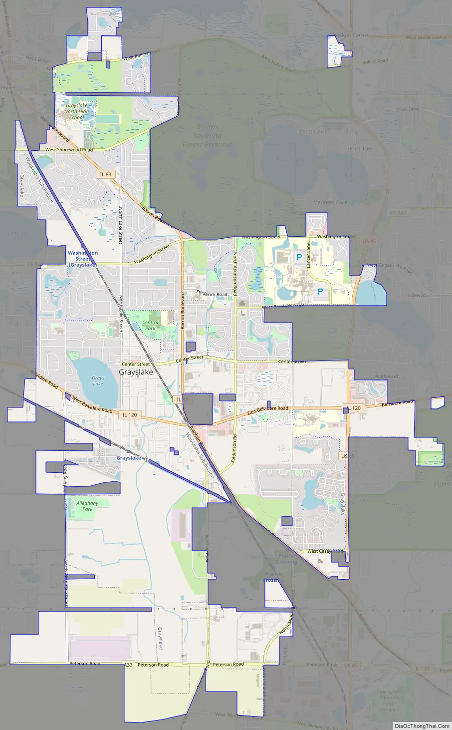
Grayslake Road Map
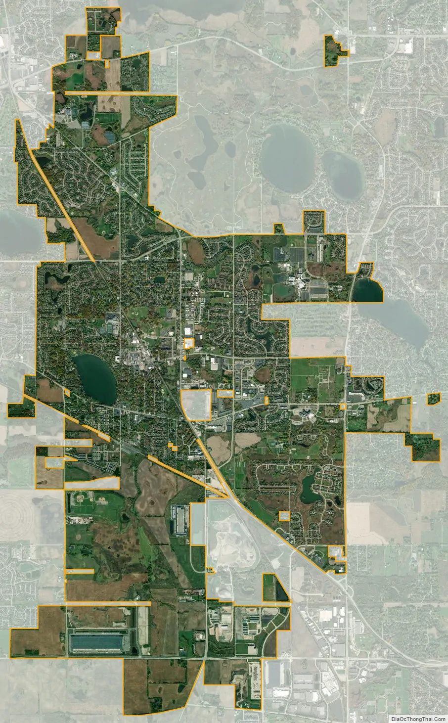
Grayslake city Satellite Map
Geography
Grayslake is located at 42°20′54″N 88°1′57″W / 42.34833°N 88.03250°W / 42.34833; -88.03250 (42.348271, -88.032428), in central Lake County. Neighboring communities include Libertyville, Mundelein, Round Lake Park, Hainesville, Round Lake Beach, Lindenhurst, Third Lake, Gages Lake and Wildwood. Grayslake is predominantly within the boundaries of Avon Township, with a small portion in Fremont Township.
According to the 2010 census, Grayslake has a total area of 10.078 square miles (26.10 km), of which 9.87 square miles (25.56 km) (or 97.94%) is land and 0.208 square miles (0.54 km) (or 2.06%) is water.
Lakes
Grays Lake is located in the center of the village and is bounded by Route 120, Lake Street, Harvey Avenue, and Alleghany Road.
Portions of Highland Lake (Illinois) are located within Grayslake.
Major streets
- U.S. Route 45
- Barron Boulevard/Ivanhoe Road
- Belvidere Road
- Buckley Road
See also
Map of Illinois State and its subdivision:- Adams
- Alexander
- Bond
- Boone
- Brown
- Bureau
- Calhoun
- Carroll
- Cass
- Champaign
- Christian
- Clark
- Clay
- Clinton
- Coles
- Cook
- Crawford
- Cumberland
- De Kalb
- De Witt
- Douglas
- Dupage
- Edgar
- Edwards
- Effingham
- Fayette
- Ford
- Franklin
- Fulton
- Gallatin
- Greene
- Grundy
- Hamilton
- Hancock
- Hardin
- Henderson
- Henry
- Iroquois
- Jackson
- Jasper
- Jefferson
- Jersey
- Jo Daviess
- Johnson
- Kane
- Kankakee
- Kendall
- Knox
- La Salle
- Lake
- Lake Michigan
- Lawrence
- Lee
- Livingston
- Logan
- Macon
- Macoupin
- Madison
- Marion
- Marshall
- Mason
- Massac
- McDonough
- McHenry
- McLean
- Menard
- Mercer
- Monroe
- Montgomery
- Morgan
- Moultrie
- Ogle
- Peoria
- Perry
- Piatt
- Pike
- Pope
- Pulaski
- Putnam
- Randolph
- Richland
- Rock Island
- Saint Clair
- Saline
- Sangamon
- Schuyler
- Scott
- Shelby
- Stark
- Stephenson
- Tazewell
- Union
- Vermilion
- Wabash
- Warren
- Washington
- Wayne
- White
- Whiteside
- Will
- Williamson
- Winnebago
- Woodford
- Alabama
- Alaska
- Arizona
- Arkansas
- California
- Colorado
- Connecticut
- Delaware
- District of Columbia
- Florida
- Georgia
- Hawaii
- Idaho
- Illinois
- Indiana
- Iowa
- Kansas
- Kentucky
- Louisiana
- Maine
- Maryland
- Massachusetts
- Michigan
- Minnesota
- Mississippi
- Missouri
- Montana
- Nebraska
- Nevada
- New Hampshire
- New Jersey
- New Mexico
- New York
- North Carolina
- North Dakota
- Ohio
- Oklahoma
- Oregon
- Pennsylvania
- Rhode Island
- South Carolina
- South Dakota
- Tennessee
- Texas
- Utah
- Vermont
- Virginia
- Washington
- West Virginia
- Wisconsin
- Wyoming


