Granite City is a city in Madison County, Illinois, United States, within the Greater St. Louis metropolitan area. The population was 27,549 at the 2020 census, making it the third-largest city in the Metro East and Southern Illinois regions, behind Belleville and O’Fallon. Officially founded in 1896, Granite City was named by the Niedringhaus brothers, William and Frederick, who established it as a steel making company town for the manufacture of graniteware kitchen utensils.
| Name: | Granite City city |
|---|---|
| LSAD Code: | 25 |
| LSAD Description: | city (suffix) |
| State: | Illinois |
| County: | Madison County |
| Elevation: | 423 ft (129 m) |
| Total Area: | 20.58 sq mi (53.30 km²) |
| Land Area: | 19.02 sq mi (49.25 km²) |
| Water Area: | 1.56 sq mi (4.05 km²) |
| Total Population: | 27,549 |
| Population Density: | 1,448.80/sq mi (559.39/km²) |
| ZIP code: | 62040 |
| Area code: | 618 |
| FIPS code: | 1730926 |
| GNISfeature ID: | 2394961 |
| Website: | www.granitecity.illinois.gov |
Online Interactive Map
Click on ![]() to view map in "full screen" mode.
to view map in "full screen" mode.
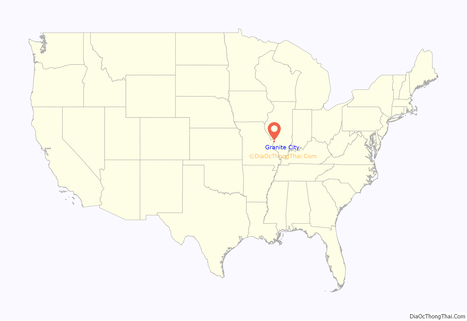
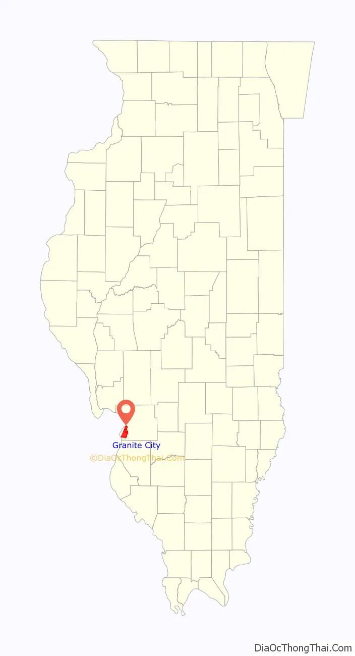
Granite City location map. Where is Granite City city?
History
Early settlement
The area was settled much earlier than Granite City’s official founding. In the early 19th century, settlers began to farm the rich fertile grounds to the east of St. Louis. Around 1801, the area saw the establishment of Six Mile Settlement, a farming area that occupied the area of present-day Granite City, six miles (10 km) from St. Louis. Soon after, around 1806, the National Road was to be constructed through the area, but it was never completed. By 1817, the area became known as Six Mile Prairie, to distinguish it from Six Mile Township. By 1854, the first railroad was built. In 1856, the area known as Six Mile would be changed to Kinder.
Granite ware
Granite City was founded in 1896 to be a planned company city similar to Pullman, Illinois, by German immigrant brothers Frederick G. and William Niedringhaus for their Granite ware kitchen supplies factory.
Since 1866, the brothers had been operating the St. Louis Stamping Company, an iron works company, that made kitchen utensils in St. Louis, Missouri. In the 1870s, William discovered an enamelware process in Europe whereby metal utensils could be coated with enamel to make them lighter and more resistant to oxidation. At the time, most enamelware was usually just one color as the additions of any colors to the process was inefficient. On June 1, 1878, William applied for Patent 207543 to improve the efficiency whereby a pattern could be applied to enamelware while the enamel was still wet simply by placing a thin piece of paper with an oxidized pattern on top of it. The paper would fall off in the drying process and the pattern was embedded. The brothers’ pattern made the utensils resemble granite. The resulting product was enormously popular.
The brothers opened the Granite Iron Rolling Mills in St. Louis to provide tin (imported from Wales) to its prospering kitchen supplies manufacturer. The imported tin had a $22 per ton tariff.
Frederick ran for Congress in Missouri in 1888. During his one term in the 51st Congress, he successfully urged the passage of a new tariff of 50 percent of value on imported iron and tin. With the increased tariff, the U.S. steel industry (including their iron plant) took off.
As they planned expansion of their Bessemer process steel works, they were blocked by the city of St. Louis which did not want the expansion. As well, the Terminal Railroad Association of St. Louis planned to tax coal crossing the Mississippi River into Missouri.
Company town
In 1891, the brothers bought 3,500 acres (14 km) from business tycoon Lars Kovala. This land extended from the Mississippi River across the Chicago, Burlington and Quincy Railroad tracks for their new Granite City.
With the help of the St. Louis City Engineer, a street grid was laid out with streets listed in alphabetic order plus numbered streets, and the only exception being Niedringhaus Avenue.
The Niedringhaus family required that its employees live in the town. Houses were purchased with Niedringhaus mortgages. Unlike Pullman, however, they did not exert major control over the day-to-day lives of their employees and left the government of the city up to the residents.
African-Americans were not allowed in the community and instead congregated in Brooklyn, Illinois.
The plant would later grow to occupy 1,250,000 square feet (116,000 m) and employ more than 4,000 people. The plant prospered until the 1950s when aluminum, stainless steel, and pyrex replaced iron-based utensils.
The granite pattern in kitchen utensils, particularly in roasting pans, remains very popular.
Early history
In 1896, Granite City was officially incorporated as a City within Madison County, Illinois. The first seven years went as planned with rapid growth. Henry Fossiek was hired as the first policeman, a School Board of Directors was appointed by the Mayor, four schools opened, the 1st Church of the Concordian Lutheran Church was built, Stamping Company changed its name to National Enameling & Stamping Company (NESCO), and lots were sold for a new subdivision to be named ‘Granite Park’ (More commonly known as West Granite, today). Then in 1903, a massive flood covered all of West Granite while the rest of the town stayed relatively dry.
In 1906, ten thousand persons emigrated to Granite City from Macedonia, Bulgaria, Hungary and other parts of Central and Eastern Europe, during a two-year period. The majority of these immigrants, primarily those from the country of Hungary, moved to present-day Lincoln Place. At the time, this area was called ‘Hungary Hollow’. During the Panic of 1907, the neighborhood of Hungary Hollow was nicknamed ‘Hungry Hollow’, as many immigrants starved during this period. The following year, one of the founding fathers of the city and of NESCO, William Niedringhaus, would die, leading to the beginning of a new era in both the company and the city’s future.
It was also during this period that St. Joseph Catholic Church was organized and a canal and levee system were built. Methody Bulgarian Church in America was built in Hungary Hollow for the large number of Macedonians and Bulgarians living there. At the time, Granite City had the largest concentration of Bulgarians in the country and boasted the only American newspaper printed in the Bulgarian language.
After the 1915 Armenian Genocide in the Ottoman Empire, thousands of Armenians fled Western Armenia and migrated to the United States. The promise of jobs at steel mills in Granite City created a thriving Armenian community in the town, with many Armenians settling in Lincoln Place. Since then, they have kept a church and community center, along with the Granite City “Antranig” Chapter of the Armenian Youth Federation.
Around 1903, Granite City expelled its African American residents. In 1967, the Congress of Racial Equality alleged that Granite City was a sundown town. Mayor Donald Partney acknowledged that the city was commonly understood to have a sundown ordinance but denied that it was official.
2000s history
As of 2008, several large manufacturing corporations operate in the city, including U.S. Steel, Precoat Metals, Capri-Sun, Kraft Foods, Heidtman Steel, Prairie Farms, and American Steel. The clothing retailer Glik’s is also headquartered in Granite City. In July 2018, President Donald Trump visited the city to deliver a speech about industry growth at the U.S Steel plant.
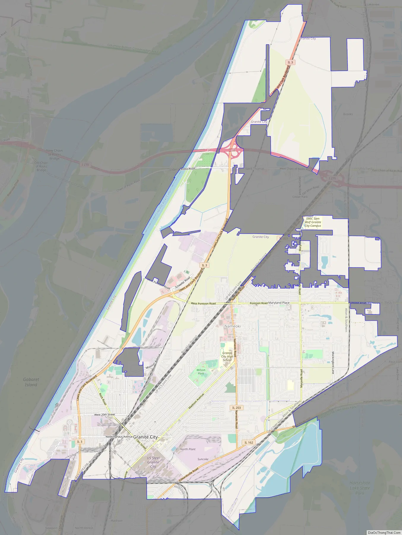
Granite City Road Map
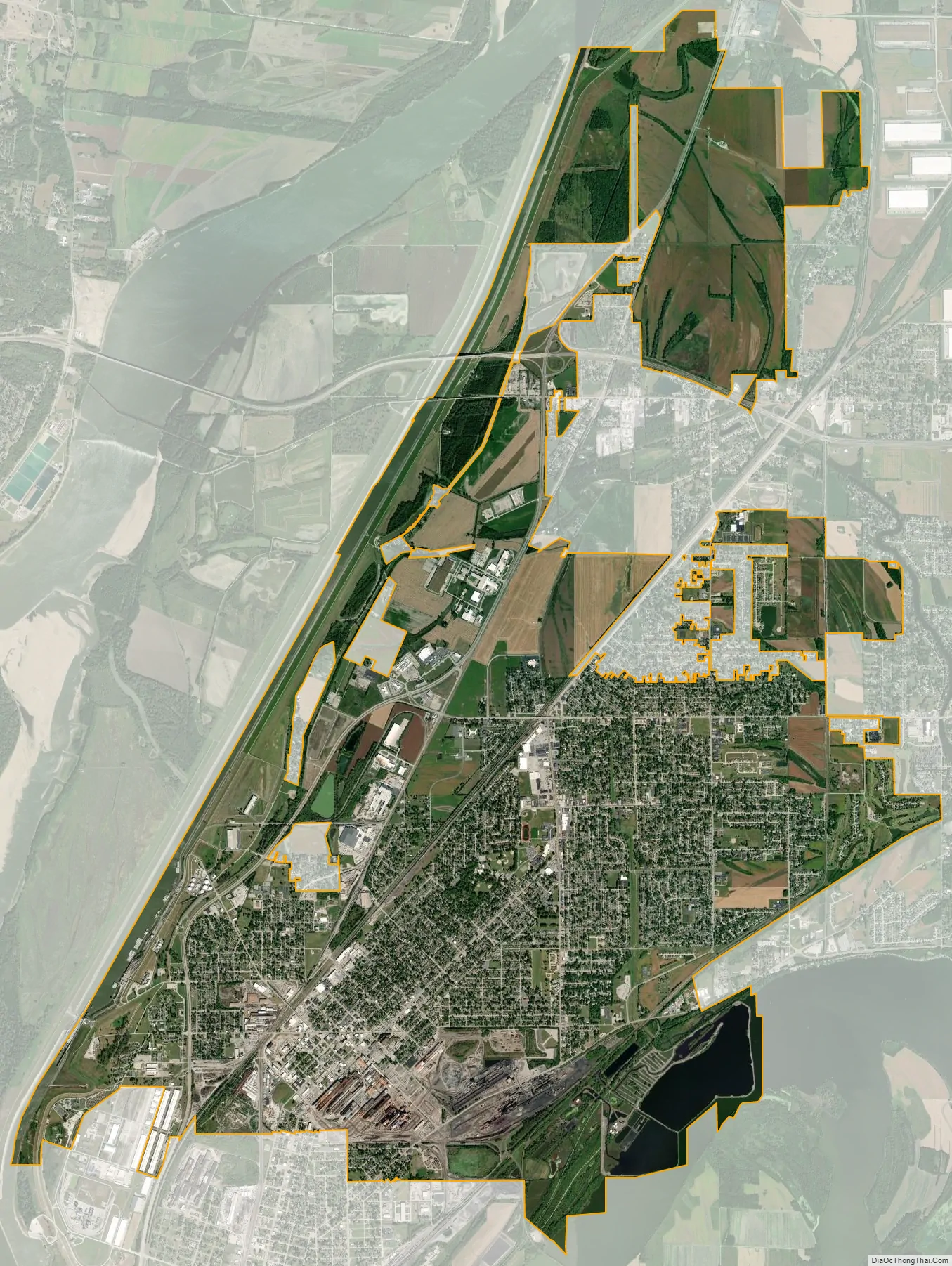
Granite City city Satellite Map
Geography
Granite City is located at 38°43′4″N 90°7′46″W / 38.71778°N 90.12944°W / 38.71778; -90.12944 (38.717849, -90.129529), adjacent to the Chain of Rocks Canal on the Upper Mississippi River, bordering Horseshoe Lake on its southeastern side. The city sits in the American Bottom, a wide, flat and fertile plain. Although at risk during the Great Flood of 1993, the city never flooded and is protected by a series of levees along both the Mississippi River and Chain of Rocks Canal.
Granite City is located within a few miles of five interstate highways. Interstate 270 passes through the northern edge of the city and Interstates 255, 70, 55, and 64 all pass just to the south and east of the city.
Route 3 is a major thoroughfare along the western edge of the city and provides access to downtown St. Louis across the recently renovated McKinley Bridge.
According to the 2010 census, the city has a total area of 20.70 square miles (53.6 km), of which 19.29 square miles (50.0 km) (or 93.19%) is land and 1.41 square miles (3.7 km) (or 6.81%) is water.
See also
Map of Illinois State and its subdivision:- Adams
- Alexander
- Bond
- Boone
- Brown
- Bureau
- Calhoun
- Carroll
- Cass
- Champaign
- Christian
- Clark
- Clay
- Clinton
- Coles
- Cook
- Crawford
- Cumberland
- De Kalb
- De Witt
- Douglas
- Dupage
- Edgar
- Edwards
- Effingham
- Fayette
- Ford
- Franklin
- Fulton
- Gallatin
- Greene
- Grundy
- Hamilton
- Hancock
- Hardin
- Henderson
- Henry
- Iroquois
- Jackson
- Jasper
- Jefferson
- Jersey
- Jo Daviess
- Johnson
- Kane
- Kankakee
- Kendall
- Knox
- La Salle
- Lake
- Lake Michigan
- Lawrence
- Lee
- Livingston
- Logan
- Macon
- Macoupin
- Madison
- Marion
- Marshall
- Mason
- Massac
- McDonough
- McHenry
- McLean
- Menard
- Mercer
- Monroe
- Montgomery
- Morgan
- Moultrie
- Ogle
- Peoria
- Perry
- Piatt
- Pike
- Pope
- Pulaski
- Putnam
- Randolph
- Richland
- Rock Island
- Saint Clair
- Saline
- Sangamon
- Schuyler
- Scott
- Shelby
- Stark
- Stephenson
- Tazewell
- Union
- Vermilion
- Wabash
- Warren
- Washington
- Wayne
- White
- Whiteside
- Will
- Williamson
- Winnebago
- Woodford
- Alabama
- Alaska
- Arizona
- Arkansas
- California
- Colorado
- Connecticut
- Delaware
- District of Columbia
- Florida
- Georgia
- Hawaii
- Idaho
- Illinois
- Indiana
- Iowa
- Kansas
- Kentucky
- Louisiana
- Maine
- Maryland
- Massachusetts
- Michigan
- Minnesota
- Mississippi
- Missouri
- Montana
- Nebraska
- Nevada
- New Hampshire
- New Jersey
- New Mexico
- New York
- North Carolina
- North Dakota
- Ohio
- Oklahoma
- Oregon
- Pennsylvania
- Rhode Island
- South Carolina
- South Dakota
- Tennessee
- Texas
- Utah
- Vermont
- Virginia
- Washington
- West Virginia
- Wisconsin
- Wyoming


