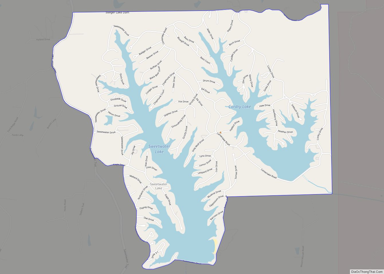
Cordry Sweetwater Lakes is a census-designated place (CDP) in Hamblen Township, Brown County, in the U.S. state of Indiana. The population was 1,128 at the 2010 census. Sweetwater Lake is 260 acres in size.
| Name: | Cordry Sweetwater Lakes CDP |
|---|---|
| LSAD Code: | 57 |
| LSAD Description: | CDP (suffix) |
| State: | Indiana |
| County: | Brown County |
| Elevation: | 879 ft (268 m) |
| Total Area: | 3.30 sq mi (8.56 km²) |
| Land Area: | 2.67 sq mi (6.91 km²) |
| Water Area: | 0.64 sq mi (1.66 km²) |
| Total Population: | 1,274 |
| Population Density: | 477.87/sq mi (184.48/km²) |
| ZIP code: | 46164 |
| Area code: | 812 & 930 |
| FIPS code: | 1815115 |
| GNISfeature ID: | 2629877 |
| Website: | www.cordrysweetwater.org |
Online Interactive Map
Click on ![]() to view map in "full screen" mode.
to view map in "full screen" mode.
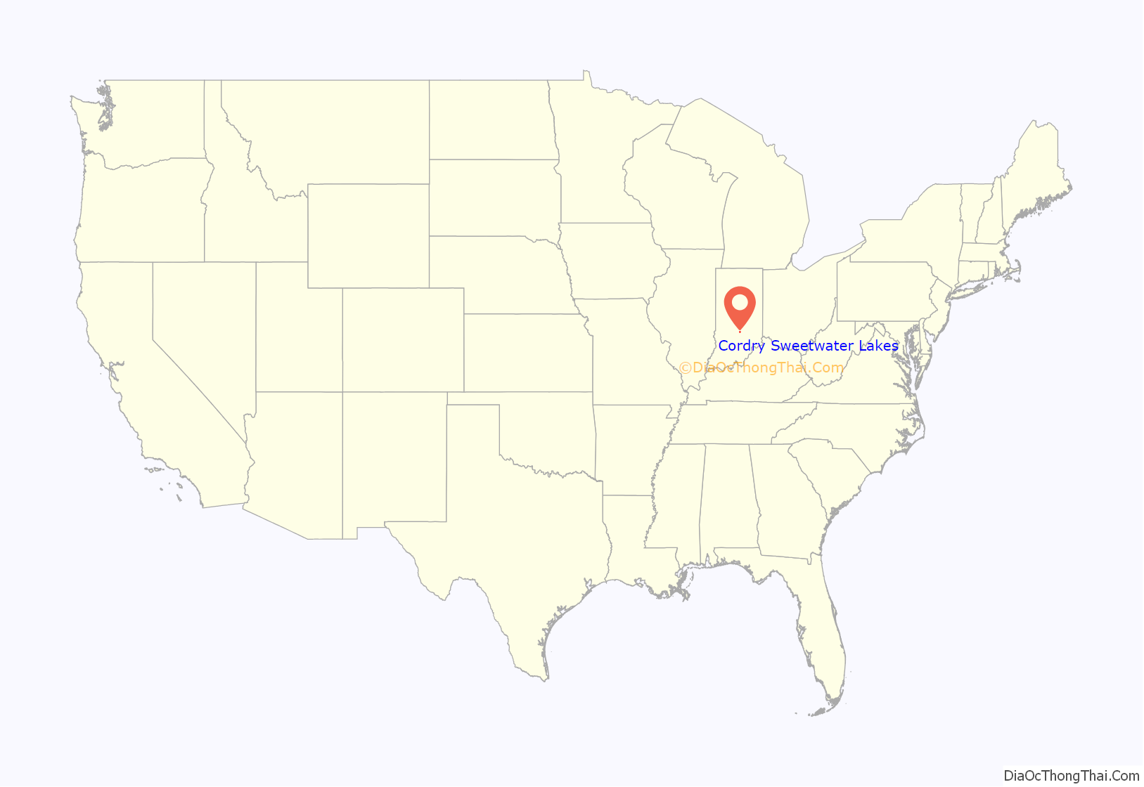
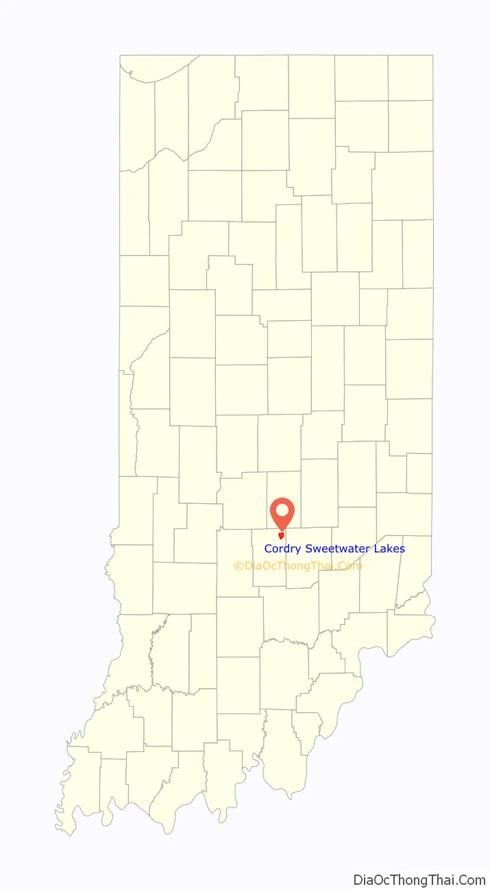
Cordry Sweetwater Lakes location map. Where is Cordry Sweetwater Lakes CDP?
History
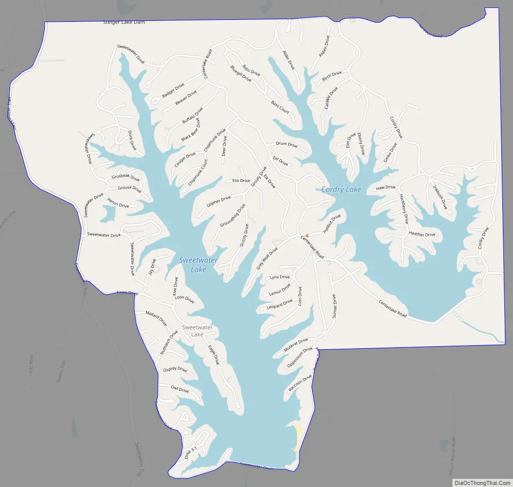
Cordry Sweetwater Lakes had its start in the 1960s with the completion of the Cordry and Sweetwater dams. The dams impounded the Cordry and Sweetwater lakes, around which property developers built up the community.
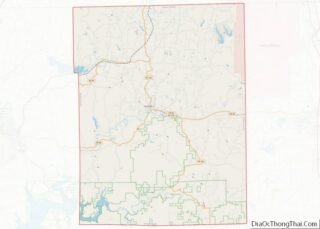
Cordry Sweetwater Lakes Road Map
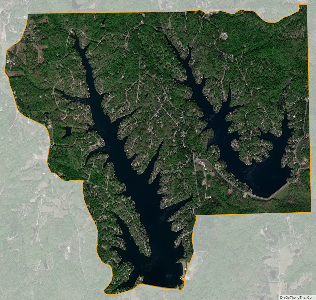
Cordry Sweetwater Lakes city Satellite Map
Geography
Cordry Sweetwater Lakes is located in northeastern Brown County at 39°17′47″N 85°56′57″W / 39.29639°N 85.94917°W / 39.29639; -85.94917 (39.296284, -85.949220). It consists of a residential community surrounding two reservoirs, Cordry Lake and Sweetwater Lake.
According to the United States Census Bureau, the CDP has a total area of 3.4 square miles (8.8 km), of which 2.7 square miles (7.1 km) is land and 0.66 square miles (1.7 km), or 18.94%, is water.
See also
Map of Indiana State and its subdivision:- Adams
- Allen
- Bartholomew
- Benton
- Blackford
- Boone
- Brown
- Carroll
- Cass
- Clark
- Clay
- Clinton
- Crawford
- Daviess
- De Kalb
- Dearborn
- Decatur
- Delaware
- Dubois
- Elkhart
- Fayette
- Floyd
- Fountain
- Franklin
- Fulton
- Gibson
- Grant
- Greene
- Hamilton
- Hancock
- Harrison
- Hendricks
- Henry
- Howard
- Huntington
- Jackson
- Jasper
- Jay
- Jefferson
- Jennings
- Johnson
- Knox
- Kosciusko
- LaGrange
- Lake
- Lake Michigan
- LaPorte
- Lawrence
- Madison
- Marion
- Marshall
- Martin
- Miami
- Monroe
- Montgomery
- Morgan
- Newton
- Noble
- Ohio
- Orange
- Owen
- Parke
- Perry
- Pike
- Porter
- Posey
- Pulaski
- Putnam
- Randolph
- Ripley
- Rush
- Saint Joseph
- Scott
- Shelby
- Spencer
- Starke
- Steuben
- Sullivan
- Switzerland
- Tippecanoe
- Tipton
- Union
- Vanderburgh
- Vermillion
- Vigo
- Wabash
- Warren
- Warrick
- Washington
- Wayne
- Wells
- White
- Whitley
- Alabama
- Alaska
- Arizona
- Arkansas
- California
- Colorado
- Connecticut
- Delaware
- District of Columbia
- Florida
- Georgia
- Hawaii
- Idaho
- Illinois
- Indiana
- Iowa
- Kansas
- Kentucky
- Louisiana
- Maine
- Maryland
- Massachusetts
- Michigan
- Minnesota
- Mississippi
- Missouri
- Montana
- Nebraska
- Nevada
- New Hampshire
- New Jersey
- New Mexico
- New York
- North Carolina
- North Dakota
- Ohio
- Oklahoma
- Oregon
- Pennsylvania
- Rhode Island
- South Carolina
- South Dakota
- Tennessee
- Texas
- Utah
- Vermont
- Virginia
- Washington
- West Virginia
- Wisconsin
- Wyoming