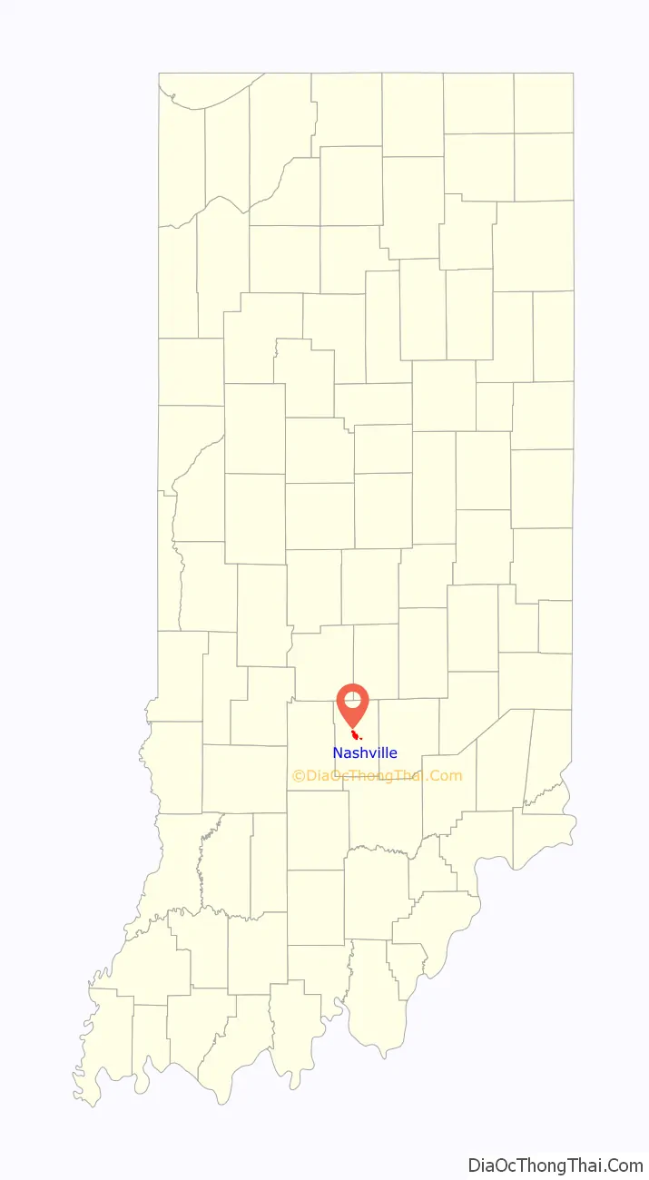
Nashville is a town in Washington Township, Brown County, Indiana, United States. The population was 803 at the 2010 census. The town is the county seat of Brown County and is the county’s only incorporated town. The town is best known as the center of the Brown County Art Colony and as a tourist destination.
| Name: | Nashville town |
|---|---|
| LSAD Code: | 43 |
| LSAD Description: | town (suffix) |
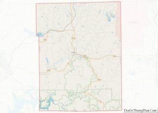
| State: | Indiana |
| County: | Brown County |
| Elevation: | 597.18 ft (182.02 m) |
| Total Area: | 1.61 sq mi (4.16 km²) |
| Land Area: | 1.60 sq mi (4.15 km²) |
| Water Area: | 0.01 sq mi (0.01 km²) |
| Total Population: | 1,256 |
| Population Density: | 784.02/sq mi (302.72/km²) |
| ZIP code: | 47448 |
| Area code: | 812 |
| FIPS code: | 1852038 |
| GNISfeature ID: | 0439943 |
| Website: | http://townofnashville.org/ |
Online Interactive Map
Click on ![]() to view map in "full screen" mode.
to view map in "full screen" mode.
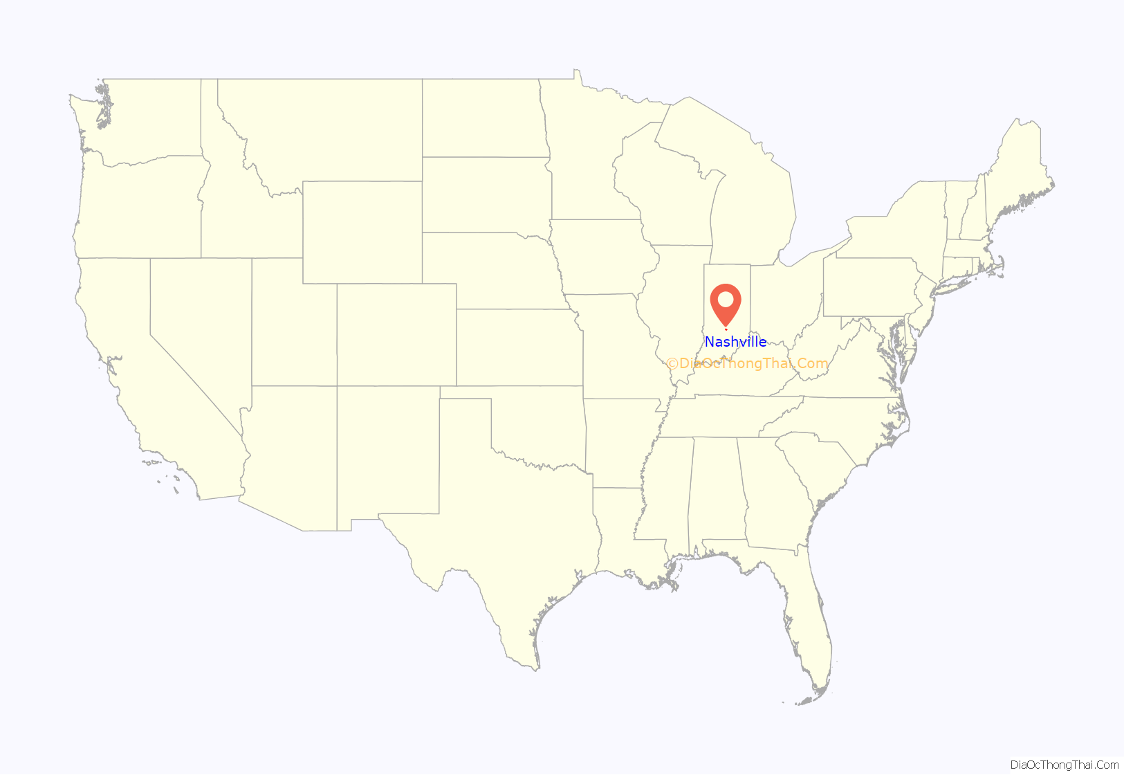
Nashville location map. Where is Nashville town?
History
Settlement of land in and around Nashville began with the acquisition of land from native populations under the 1809 Treaty of Fort Wayne. This was expanded with more acquisitions under the 1818 Treaty of St. Mary’s. Founded in 1836 by county agent Banner C. Brummett, it was first named Jacksonburg. The population of the entire county was estimated to be 150 in 1830. The first Nashville courthouse was constructed in 1837 and a jail was added in the same year. By 1840, area population had grown to 2,364. The town was officially incorporated in 1872. By the turn of the century, heavy logging in the area had caused significant deforestation which resulted in dramatic erosion problems.
In the early twentieth century, a number of artists settled in the area, most notably T. C. Steele, the American Impressionist painter. These artists were the basis for the Brown County Art Colony, which continues to this day as the Brown County Art Guild.
The Brown County Courthouse Historic District and F.P. Taggart Store are listed on the National Register of Historic Places.
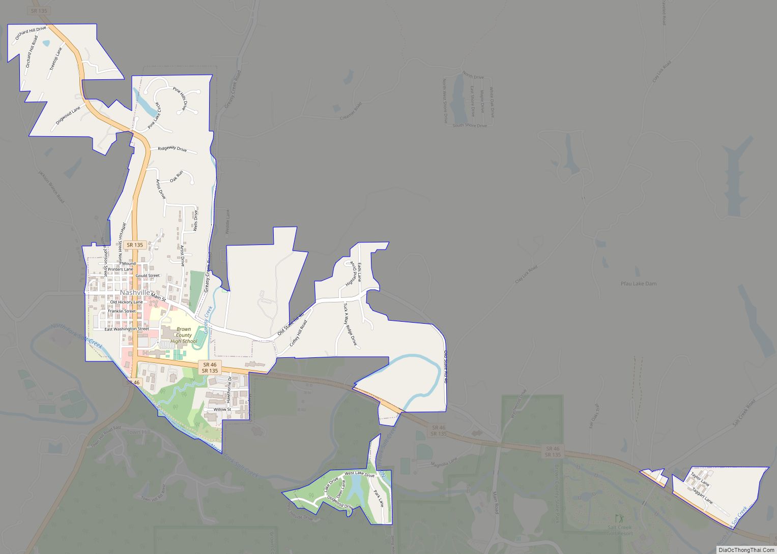
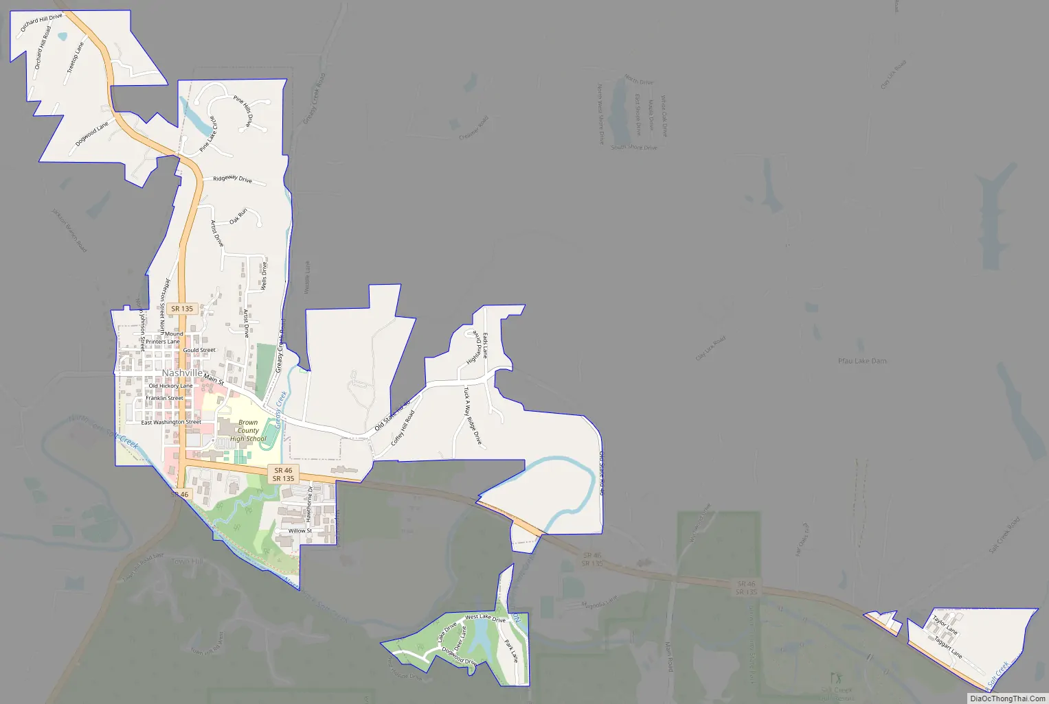
Nashville Road Map
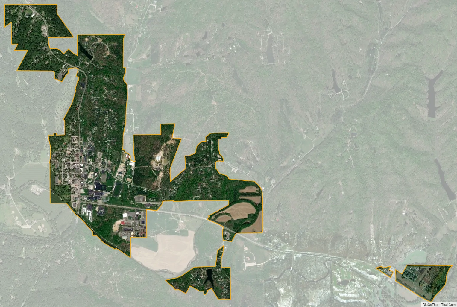
Nashville city Satellite Map
Geography
According to the 2010 census, Nashville has a total area of 1.01 square miles (2.62 km), all land.
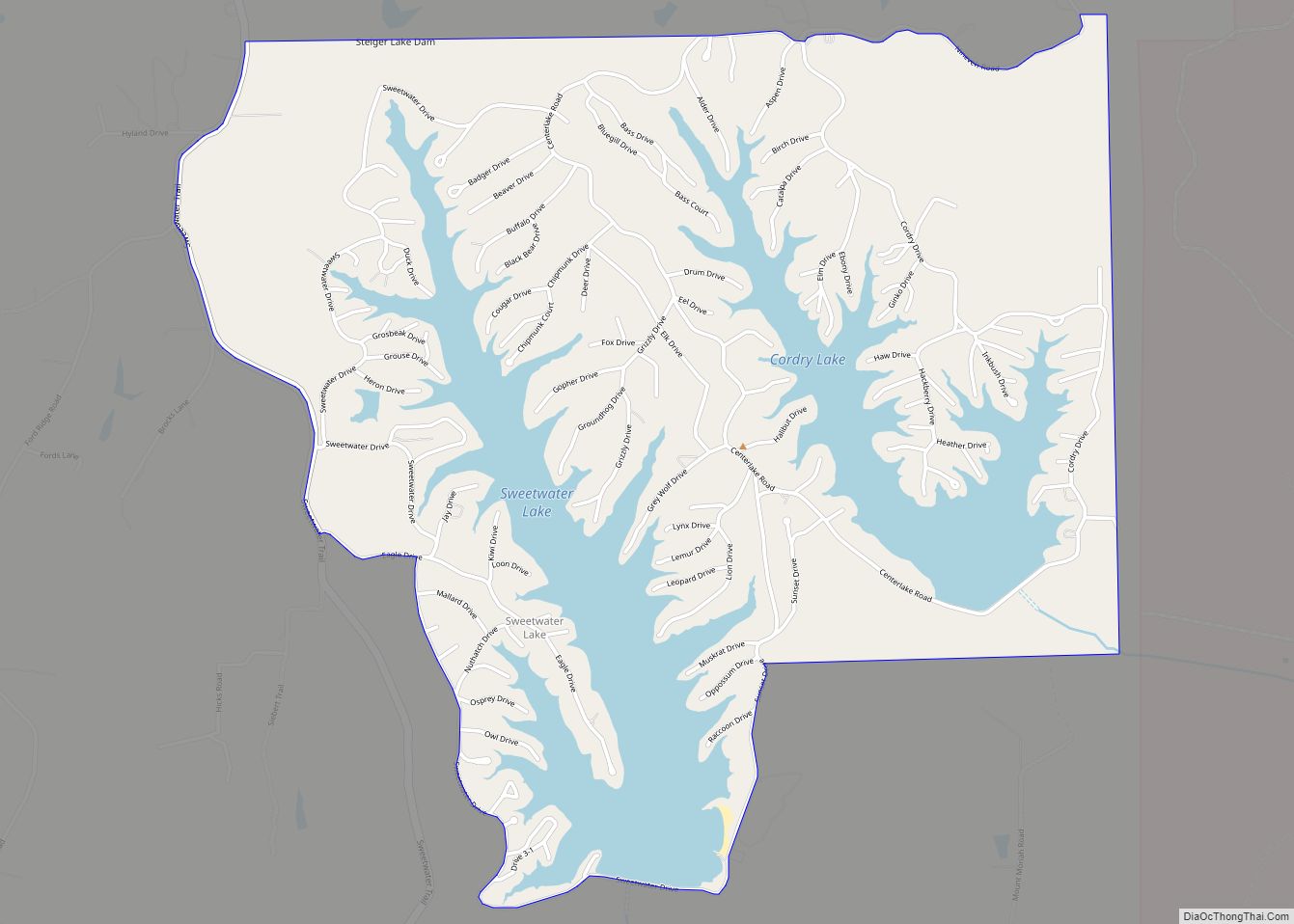
Nashville’s rolling hills, ridges, and valleys are a story of the north fork of Salt Creek. The surrounding hills are made of sandstone, siltstone and shale. These sedimentary rocks were laid down in an ancient river delta named the Borden delta, similar to the current Mississippi River delta. Salt Creek (south), Greasy Creek (east), and Jackson Branch Creek (west) have cut down through the surrounding terrain to give Nashville its rolling hills. Lake Monroe, the largest lake in Indiana, was constructed by damming Salt Creek south of Bloomington.
Climate
The climate in this area is characterized by hot, humid summers and generally mild to cool winters. According to the Köppen Climate Classification system, Nashville has a humid subtropical climate, abbreviated “Cfa” on climate maps.
See also
Map of Indiana State and its subdivision:- Adams
- Allen
- Bartholomew
- Benton
- Blackford
- Boone
- Brown
- Carroll
- Cass
- Clark
- Clay
- Clinton
- Crawford
- Daviess
- De Kalb
- Dearborn
- Decatur
- Delaware
- Dubois
- Elkhart
- Fayette
- Floyd
- Fountain
- Franklin
- Fulton
- Gibson
- Grant
- Greene
- Hamilton
- Hancock
- Harrison
- Hendricks
- Henry
- Howard
- Huntington
- Jackson
- Jasper
- Jay
- Jefferson
- Jennings
- Johnson
- Knox
- Kosciusko
- LaGrange
- Lake
- Lake Michigan
- LaPorte
- Lawrence
- Madison
- Marion
- Marshall
- Martin
- Miami
- Monroe
- Montgomery
- Morgan
- Newton
- Noble
- Ohio
- Orange
- Owen
- Parke
- Perry
- Pike
- Porter
- Posey
- Pulaski
- Putnam
- Randolph
- Ripley
- Rush
- Saint Joseph
- Scott
- Shelby
- Spencer
- Starke
- Steuben
- Sullivan
- Switzerland
- Tippecanoe
- Tipton
- Union
- Vanderburgh
- Vermillion
- Vigo
- Wabash
- Warren
- Warrick
- Washington
- Wayne
- Wells
- White
- Whitley
- Alabama
- Alaska
- Arizona
- Arkansas
- California
- Colorado
- Connecticut
- Delaware
- District of Columbia
- Florida
- Georgia
- Hawaii
- Idaho
- Illinois
- Indiana
- Iowa
- Kansas
- Kentucky
- Louisiana
- Maine
- Maryland
- Massachusetts
- Michigan
- Minnesota
- Mississippi
- Missouri
- Montana
- Nebraska
- Nevada
- New Hampshire
- New Jersey
- New Mexico
- New York
- North Carolina
- North Dakota
- Ohio
- Oklahoma
- Oregon
- Pennsylvania
- Rhode Island
- South Carolina
- South Dakota
- Tennessee
- Texas
- Utah
- Vermont
- Virginia
- Washington
- West Virginia
- Wisconsin
- Wyoming