Middletown is a town in northwest Henry County, Indiana, United States. The population was 2,322 at the 2010 census.
| Name: | Middletown town |
|---|---|
| LSAD Code: | 43 |
| LSAD Description: | town (suffix) |
| State: | Indiana |
| County: | Henry County |
| Elevation: | 978 ft (298 m) |
| Total Area: | 1.16 sq mi (3.01 km²) |
| Land Area: | 1.16 sq mi (3.00 km²) |
| Water Area: | 0.00 sq mi (0.01 km²) |
| Total Population: | 2,255 |
| Population Density: | 1,943.92/sq mi (750.86/km²) |
| ZIP code: | 47356 |
| Area code: | 765 |
| FIPS code: | 1849014 |
| GNISfeature ID: | 0439117 |
| Website: | http://www.middletownin.com/ |
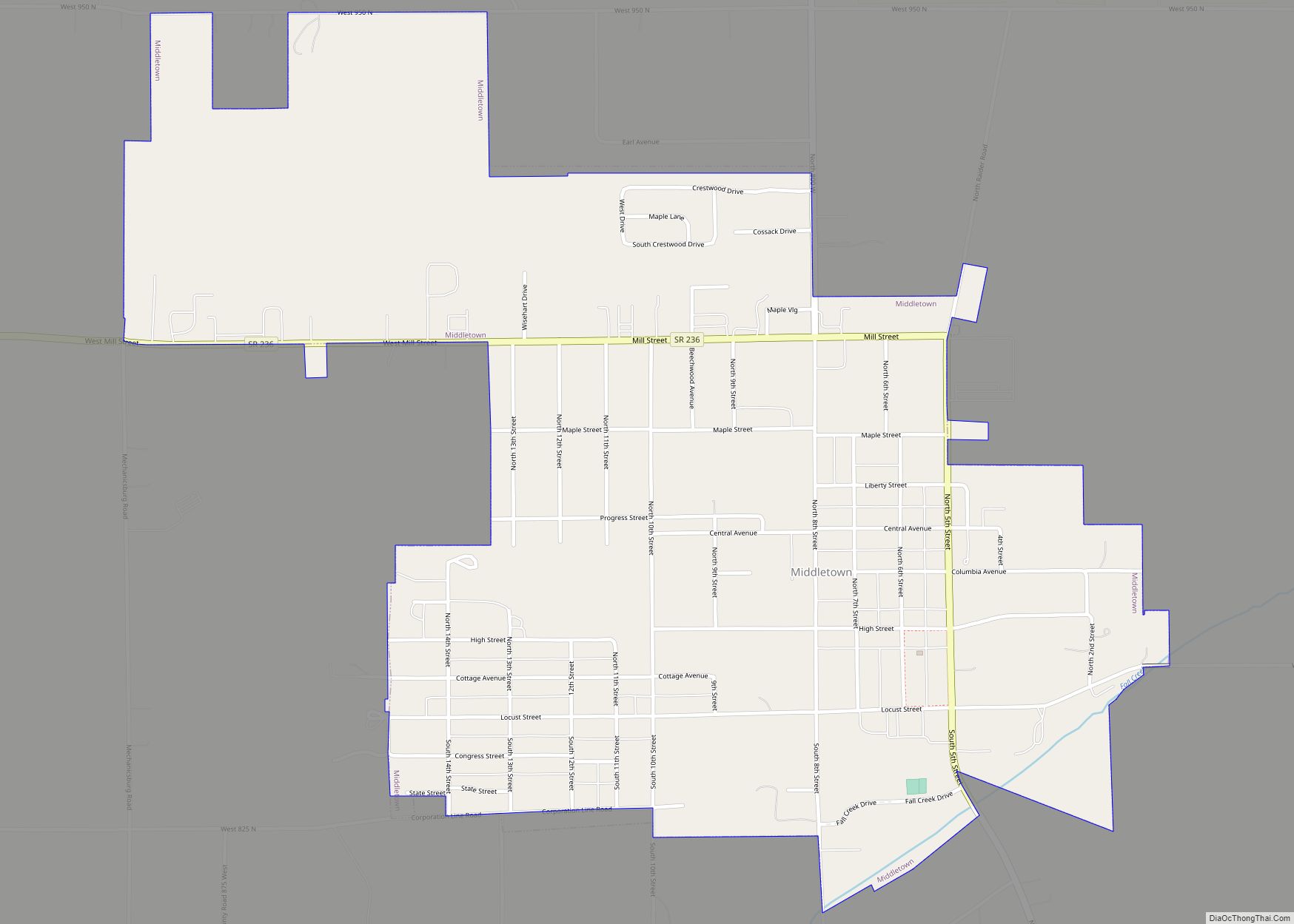
Online Interactive Map
Click on ![]() to view map in "full screen" mode.
to view map in "full screen" mode.
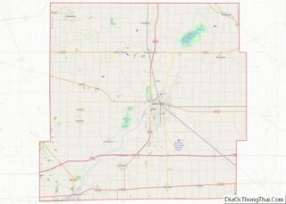
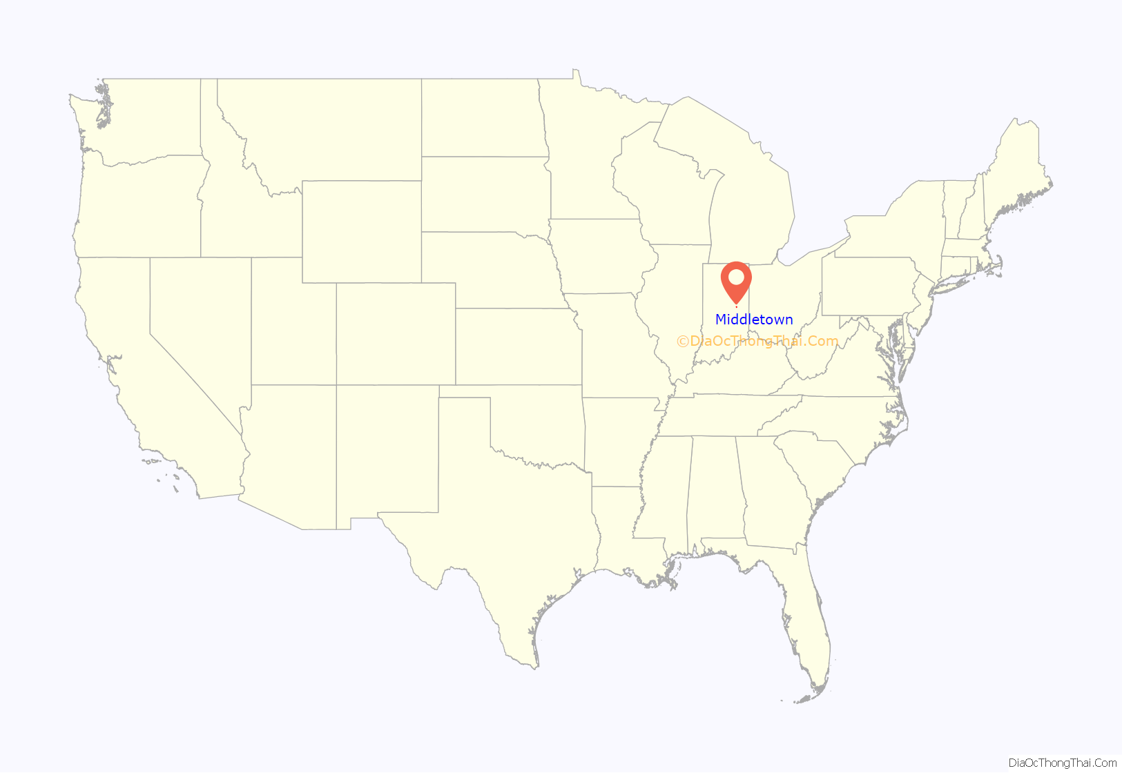
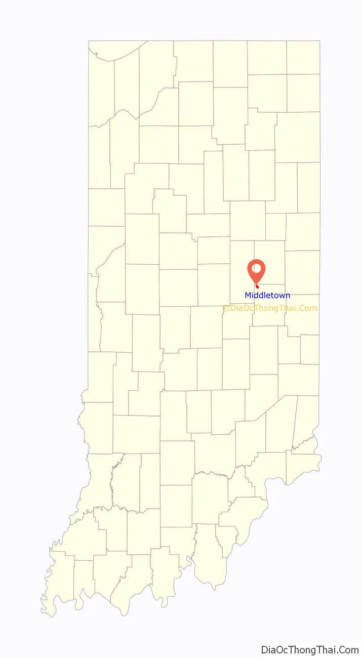
Middletown location map. Where is Middletown town?
History
Middletown was platted in 1829. The town’s name is locational, for it lies halfway between New Castle and Anderson. A post office was established at Middletown in 1830. Middletown was incorporated as a town in 1840.
The John W. Hedrick House and Middletown Commercial Historic District are listed on the National Register of Historic Places.
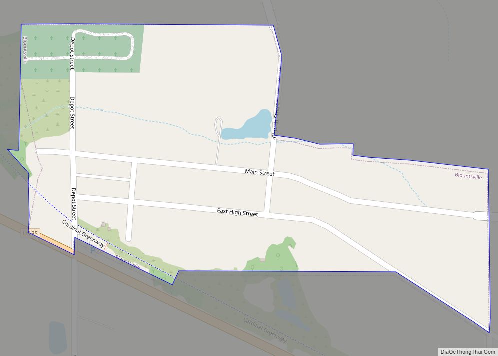
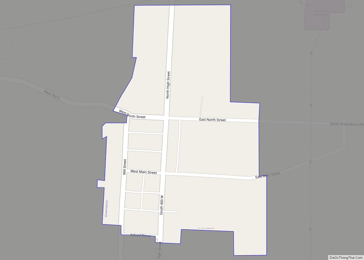
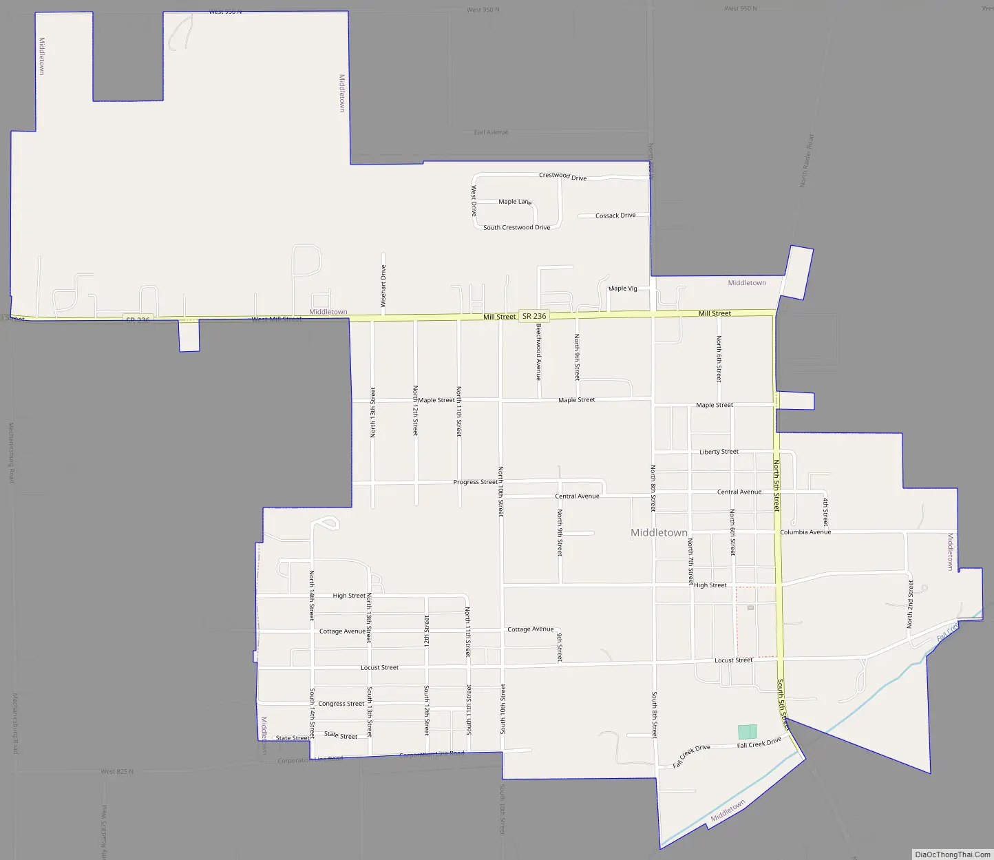
Middletown Road Map
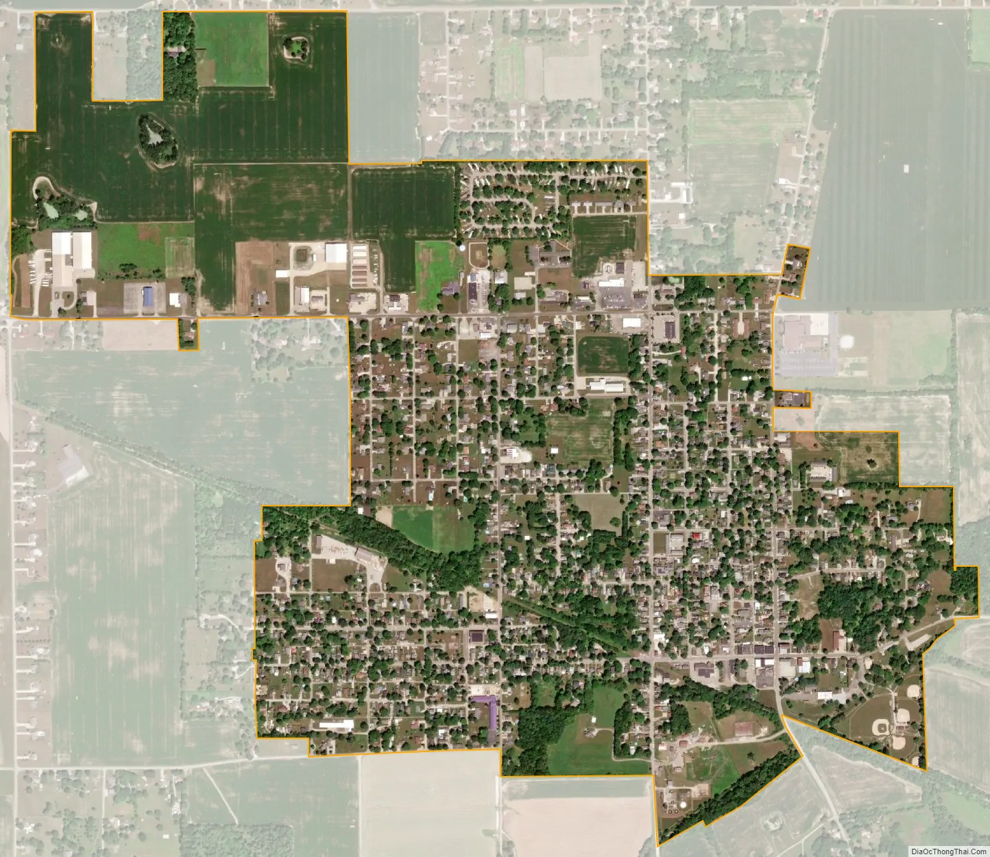
Middletown city Satellite Map
Geography
Middletown is located at 40°3′26″N 85°32′28″W / 40.05722°N 85.54111°W / 40.05722; -85.54111 (40.057094, -85.541098).
According to the 2010 census, Middletown has a total area of 1.16 square miles (3.00 km), all land.
See also
Map of Indiana State and its subdivision:- Adams
- Allen
- Bartholomew
- Benton
- Blackford
- Boone
- Brown
- Carroll
- Cass
- Clark
- Clay
- Clinton
- Crawford
- Daviess
- De Kalb
- Dearborn
- Decatur
- Delaware
- Dubois
- Elkhart
- Fayette
- Floyd
- Fountain
- Franklin
- Fulton
- Gibson
- Grant
- Greene
- Hamilton
- Hancock
- Harrison
- Hendricks
- Henry
- Howard
- Huntington
- Jackson
- Jasper
- Jay
- Jefferson
- Jennings
- Johnson
- Knox
- Kosciusko
- LaGrange
- Lake
- Lake Michigan
- LaPorte
- Lawrence
- Madison
- Marion
- Marshall
- Martin
- Miami
- Monroe
- Montgomery
- Morgan
- Newton
- Noble
- Ohio
- Orange
- Owen
- Parke
- Perry
- Pike
- Porter
- Posey
- Pulaski
- Putnam
- Randolph
- Ripley
- Rush
- Saint Joseph
- Scott
- Shelby
- Spencer
- Starke
- Steuben
- Sullivan
- Switzerland
- Tippecanoe
- Tipton
- Union
- Vanderburgh
- Vermillion
- Vigo
- Wabash
- Warren
- Warrick
- Washington
- Wayne
- Wells
- White
- Whitley
- Alabama
- Alaska
- Arizona
- Arkansas
- California
- Colorado
- Connecticut
- Delaware
- District of Columbia
- Florida
- Georgia
- Hawaii
- Idaho
- Illinois
- Indiana
- Iowa
- Kansas
- Kentucky
- Louisiana
- Maine
- Maryland
- Massachusetts
- Michigan
- Minnesota
- Mississippi
- Missouri
- Montana
- Nebraska
- Nevada
- New Hampshire
- New Jersey
- New Mexico
- New York
- North Carolina
- North Dakota
- Ohio
- Oklahoma
- Oregon
- Pennsylvania
- Rhode Island
- South Carolina
- South Dakota
- Tennessee
- Texas
- Utah
- Vermont
- Virginia
- Washington
- West Virginia
- Wisconsin
- Wyoming