Milan (/ˈmaɪlən, ˈmaɪlæn/ MY-lən, MY-lan) is a town in Franklin and Washington townships, Ripley County, in the U.S. state of Indiana. The population was 1,899 at the 2010 census.
Milan High School won the Indiana state basketball championship against Muncie Central High School in 1954, the victory being significant as Milan was one of the smallest towns to win a state championship in the United States at that time. The 1986 film Hoosiers is based on the story of the 1954 Milan Team.
While it is often claimed that Milan is the subject of a volume of poetry entitled Pop. 359 written in 1941 by Carl Wilson under the pseudonym of Tramp Starr, that book is actually about the nearby town of Moores Hill.
| Name: | Milan town |
|---|---|
| LSAD Code: | 43 |
| LSAD Description: | town (suffix) |
| State: | Indiana |
| County: | Ripley County |
| Elevation: | 991 ft (302 m) |
| Total Area: | 2.02 sq mi (5.24 km²) |
| Land Area: | 1.99 sq mi (5.15 km²) |
| Water Area: | 0.03 sq mi (0.09 km²) |
| Total Population: | 1,823 |
| Population Density: | 916.08/sq mi (353.71/km²) |
| ZIP code: | 47031 |
| Area code: | 812 & 930 |
| FIPS code: | 1849266 |
| GNISfeature ID: | 439132 |
| Website: | http://www.milan-in-gov.net/ |
Online Interactive Map
Click on ![]() to view map in "full screen" mode.
to view map in "full screen" mode.
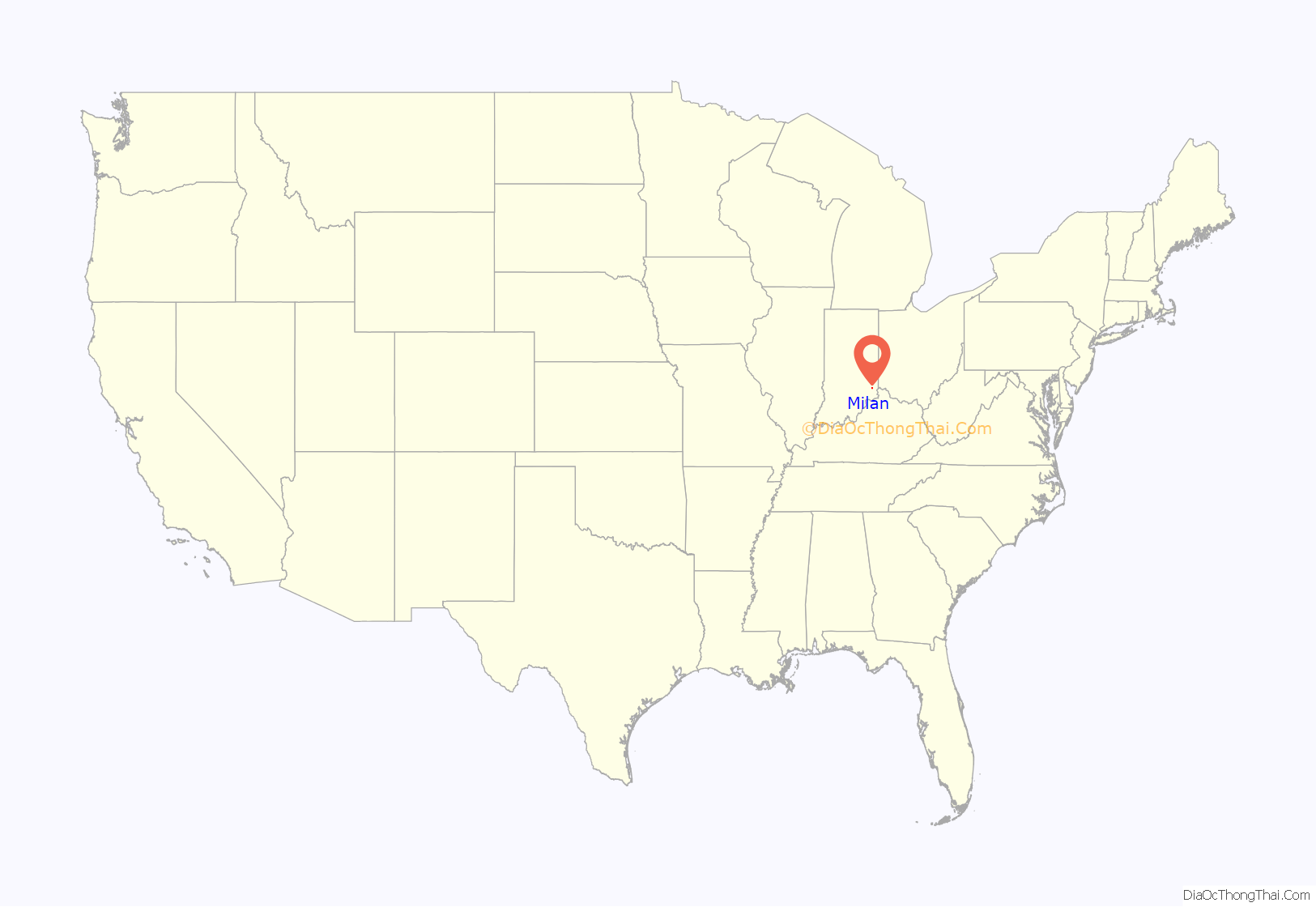
Milan location map. Where is Milan town?
History
Milan was laid out in 1854 when the railroad was extended to that point. The town, like its predecessor Old Milan, was named after Milan in Italy.
Milan Masonic Lodge No. 31 was listed on the National Register of Historic Places in 2013.
Milan Road Map
Milan city Satellite Map
Geography
Milan is located at 39°7′22″N 85°7′50″W / 39.12278°N 85.13056°W / 39.12278; -85.13056 (39.122730, -85.130653).
According to the 2010 census, Milan has a total area of 1.98 square miles (5.13 km), of which 1.95 square miles (5.05 km) (or 98.48%) is land and 0.03 square miles (0.08 km) (or 1.52%) is water.
See also
Map of Indiana State and its subdivision:- Adams
- Allen
- Bartholomew
- Benton
- Blackford
- Boone
- Brown
- Carroll
- Cass
- Clark
- Clay
- Clinton
- Crawford
- Daviess
- De Kalb
- Dearborn
- Decatur
- Delaware
- Dubois
- Elkhart
- Fayette
- Floyd
- Fountain
- Franklin
- Fulton
- Gibson
- Grant
- Greene
- Hamilton
- Hancock
- Harrison
- Hendricks
- Henry
- Howard
- Huntington
- Jackson
- Jasper
- Jay
- Jefferson
- Jennings
- Johnson
- Knox
- Kosciusko
- LaGrange
- Lake
- Lake Michigan
- LaPorte
- Lawrence
- Madison
- Marion
- Marshall
- Martin
- Miami
- Monroe
- Montgomery
- Morgan
- Newton
- Noble
- Ohio
- Orange
- Owen
- Parke
- Perry
- Pike
- Porter
- Posey
- Pulaski
- Putnam
- Randolph
- Ripley
- Rush
- Saint Joseph
- Scott
- Shelby
- Spencer
- Starke
- Steuben
- Sullivan
- Switzerland
- Tippecanoe
- Tipton
- Union
- Vanderburgh
- Vermillion
- Vigo
- Wabash
- Warren
- Warrick
- Washington
- Wayne
- Wells
- White
- Whitley
- Alabama
- Alaska
- Arizona
- Arkansas
- California
- Colorado
- Connecticut
- Delaware
- District of Columbia
- Florida
- Georgia
- Hawaii
- Idaho
- Illinois
- Indiana
- Iowa
- Kansas
- Kentucky
- Louisiana
- Maine
- Maryland
- Massachusetts
- Michigan
- Minnesota
- Mississippi
- Missouri
- Montana
- Nebraska
- Nevada
- New Hampshire
- New Jersey
- New Mexico
- New York
- North Carolina
- North Dakota
- Ohio
- Oklahoma
- Oregon
- Pennsylvania
- Rhode Island
- South Carolina
- South Dakota
- Tennessee
- Texas
- Utah
- Vermont
- Virginia
- Washington
- West Virginia
- Wisconsin
- Wyoming
