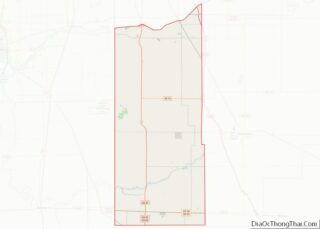
Morocco is a town in Beaver Township, Newton County, in the U.S. state of Indiana. The population was 1,129 at the 2010 census.
| Name: | Morocco town |
|---|---|
| LSAD Code: | 43 |
| LSAD Description: | town (suffix) |
| State: | Indiana |
| County: | Newton County |
| Elevation: | 699 ft (213 m) |
| Total Area: | 1.07 sq mi (2.76 km²) |
| Land Area: | 1.07 sq mi (2.76 km²) |
| Water Area: | 0.00 sq mi (0.00 km²) |
| Total Population: | 1,081 |
| Population Density: | 1,014.07/sq mi (391.68/km²) |
| ZIP code: | 47963 |
| Area code: | 219 |
| FIPS code: | 1851138 |
| GNISfeature ID: | 439442 |
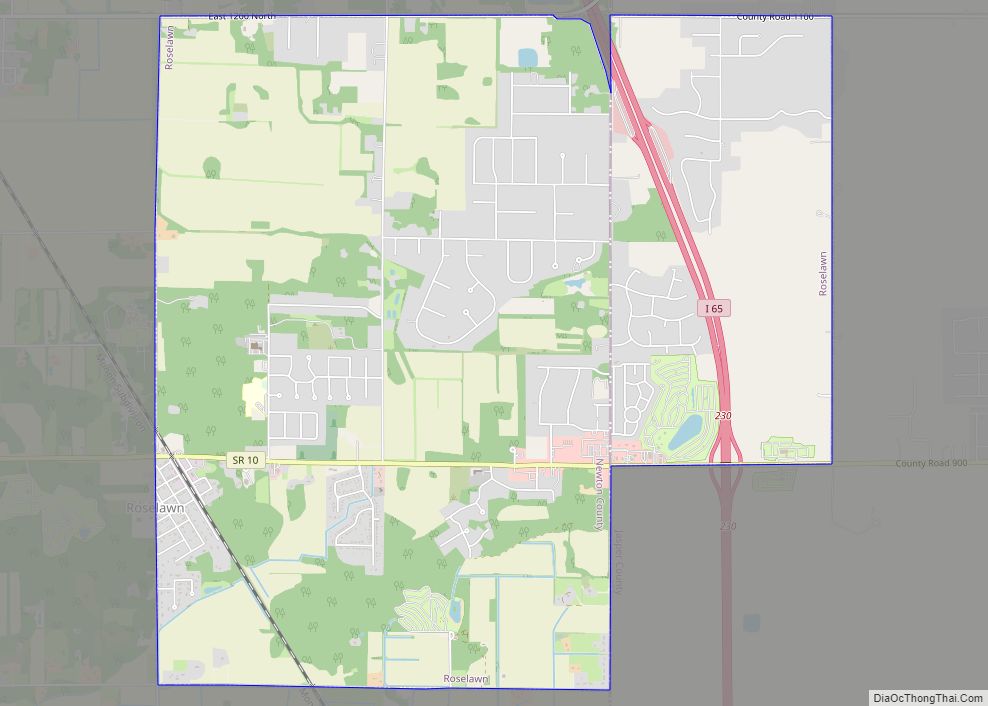
Online Interactive Map
Click on ![]() to view map in "full screen" mode.
to view map in "full screen" mode.
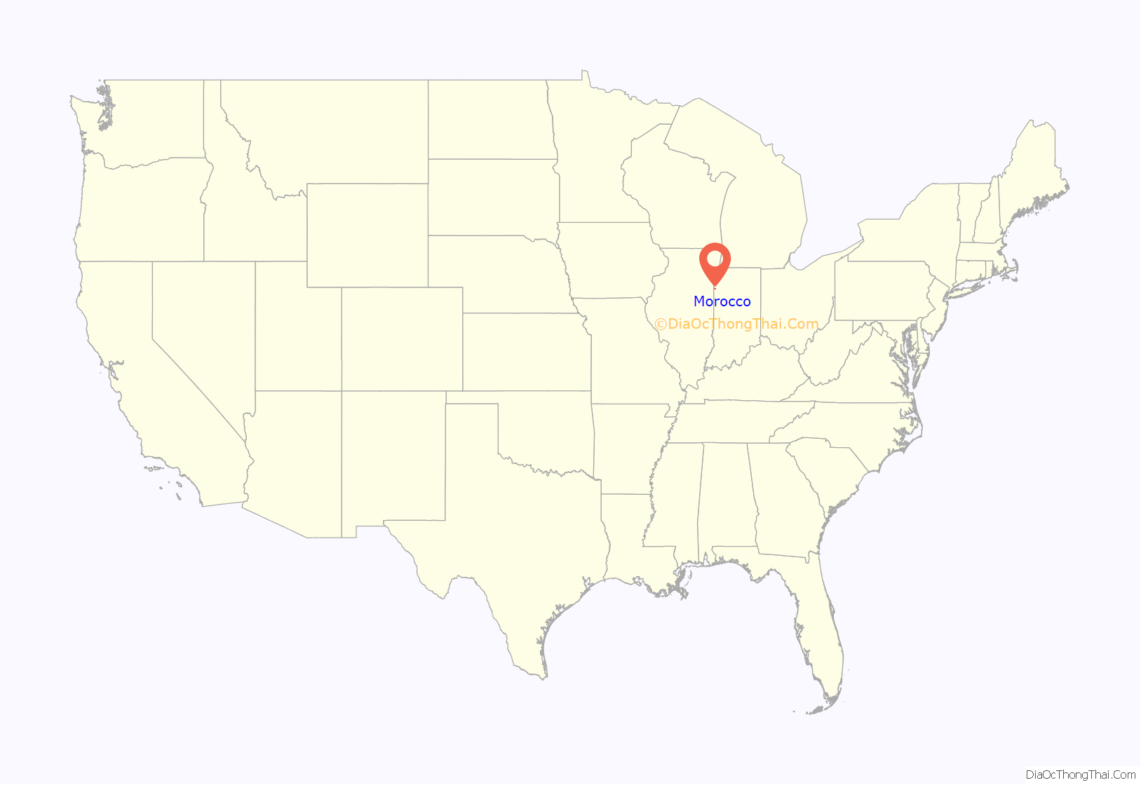
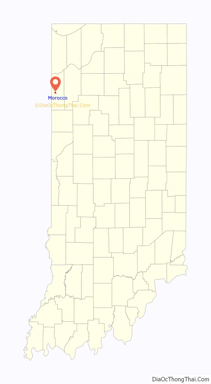
Morocco location map. Where is Morocco town?
History
Morocco was laid out in 1851. The town was named either after Morocco, in North Africa or a traveler’s Moroccan red boots. A post office has been in operation at the town since 1859.
The Scott-Lucas House and Seller’s Standard Station and Pullman Diner are listed on the National Register of Historic Places.
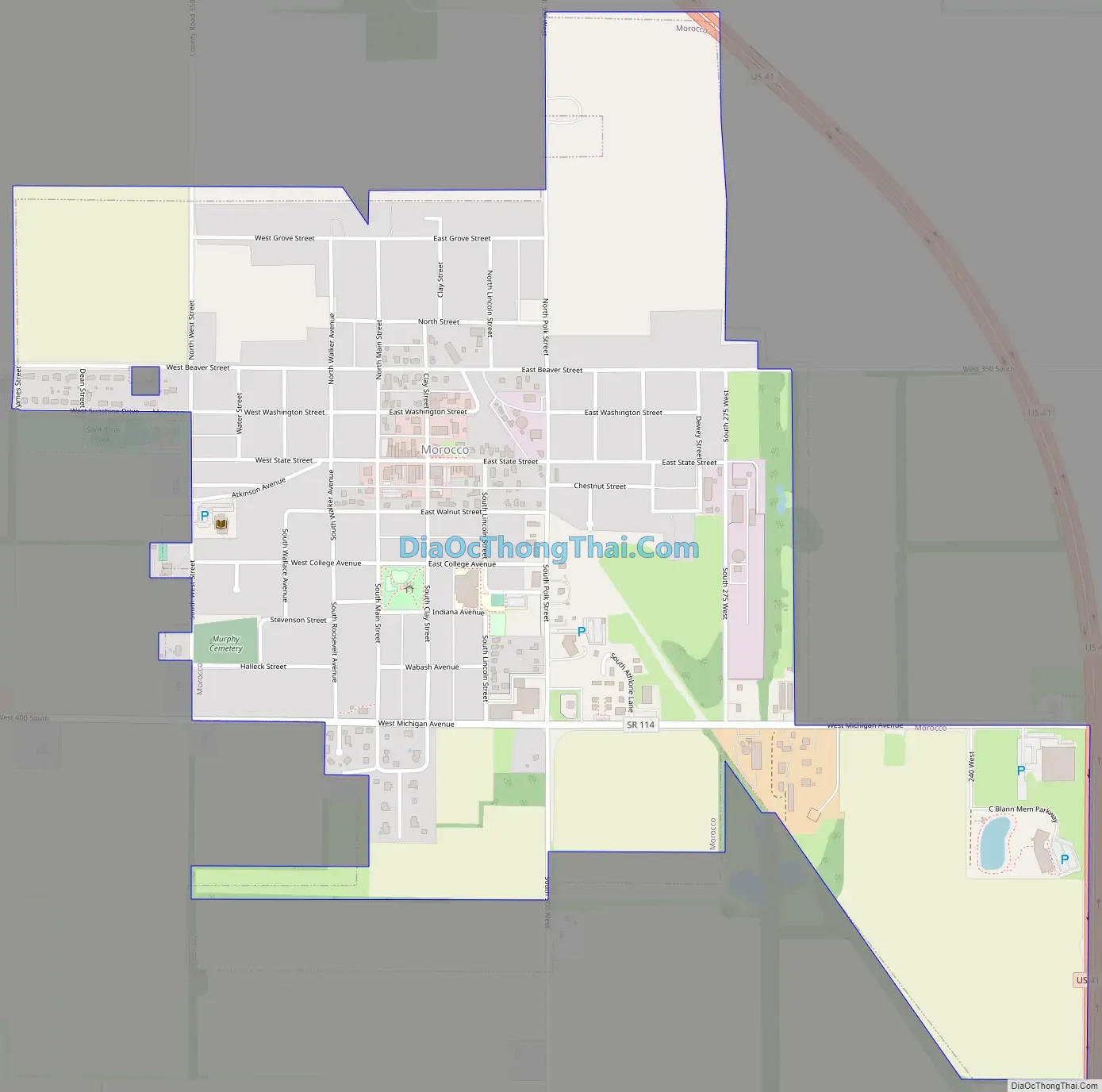
Morocco Road Map
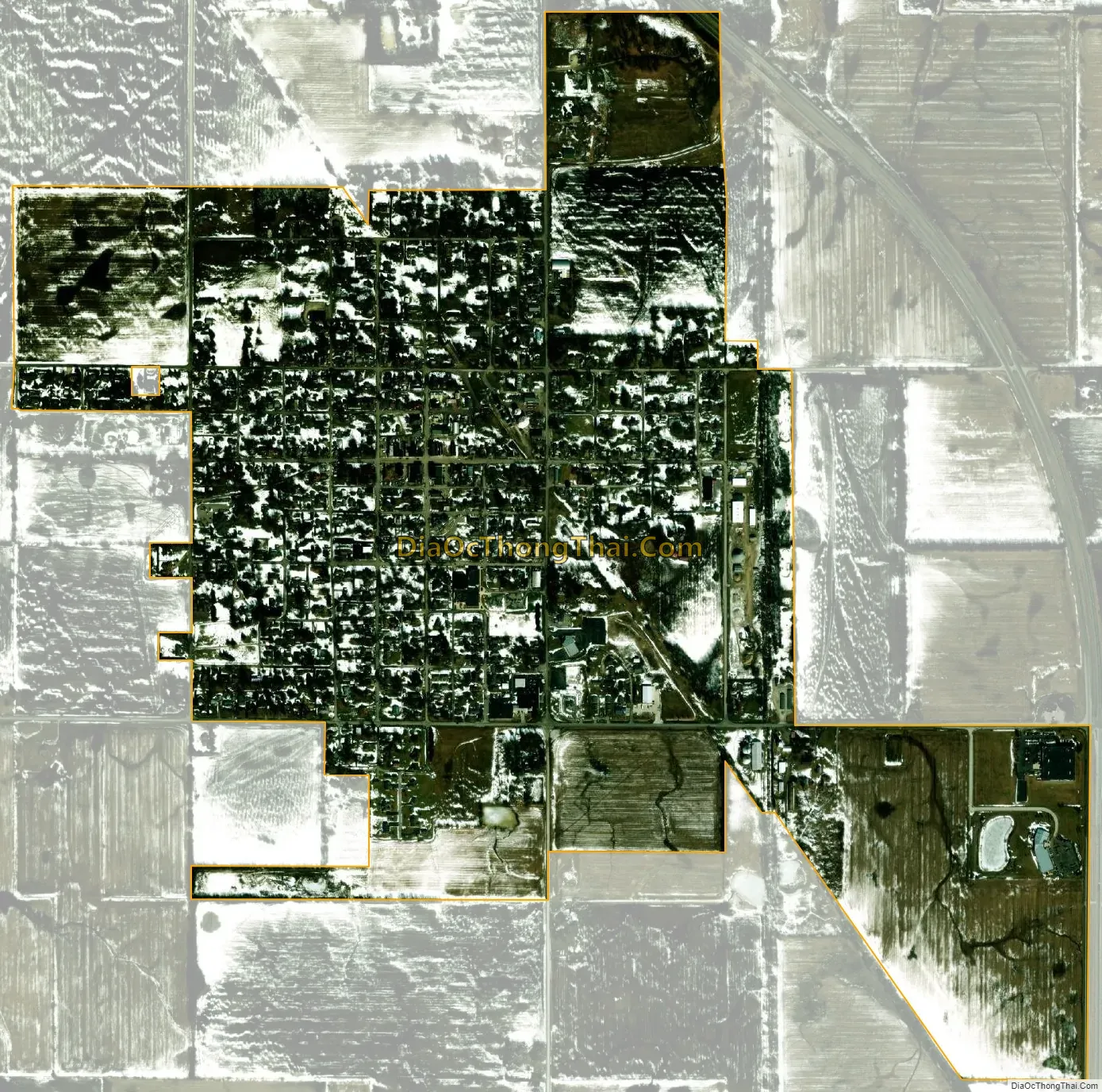
Morocco city Satellite Map
Geography
Morocco is located at 40°56′44″N 87°27′15″W / 40.94556°N 87.45417°W / 40.94556; -87.45417 (40.975650, -87.423193).
According to the 2010 census, Morocco has a total area of 1.13 square miles (2.93 km), all land.
See also
Map of Indiana State and its subdivision:- Adams
- Allen
- Bartholomew
- Benton
- Blackford
- Boone
- Brown
- Carroll
- Cass
- Clark
- Clay
- Clinton
- Crawford
- Daviess
- De Kalb
- Dearborn
- Decatur
- Delaware
- Dubois
- Elkhart
- Fayette
- Floyd
- Fountain
- Franklin
- Fulton
- Gibson
- Grant
- Greene
- Hamilton
- Hancock
- Harrison
- Hendricks
- Henry
- Howard
- Huntington
- Jackson
- Jasper
- Jay
- Jefferson
- Jennings
- Johnson
- Knox
- Kosciusko
- LaGrange
- Lake
- Lake Michigan
- LaPorte
- Lawrence
- Madison
- Marion
- Marshall
- Martin
- Miami
- Monroe
- Montgomery
- Morgan
- Newton
- Noble
- Ohio
- Orange
- Owen
- Parke
- Perry
- Pike
- Porter
- Posey
- Pulaski
- Putnam
- Randolph
- Ripley
- Rush
- Saint Joseph
- Scott
- Shelby
- Spencer
- Starke
- Steuben
- Sullivan
- Switzerland
- Tippecanoe
- Tipton
- Union
- Vanderburgh
- Vermillion
- Vigo
- Wabash
- Warren
- Warrick
- Washington
- Wayne
- Wells
- White
- Whitley
- Alabama
- Alaska
- Arizona
- Arkansas
- California
- Colorado
- Connecticut
- Delaware
- District of Columbia
- Florida
- Georgia
- Hawaii
- Idaho
- Illinois
- Indiana
- Iowa
- Kansas
- Kentucky
- Louisiana
- Maine
- Maryland
- Massachusetts
- Michigan
- Minnesota
- Mississippi
- Missouri
- Montana
- Nebraska
- Nevada
- New Hampshire
- New Jersey
- New Mexico
- New York
- North Carolina
- North Dakota
- Ohio
- Oklahoma
- Oregon
- Pennsylvania
- Rhode Island
- South Carolina
- South Dakota
- Tennessee
- Texas
- Utah
- Vermont
- Virginia
- Washington
- West Virginia
- Wisconsin
- Wyoming