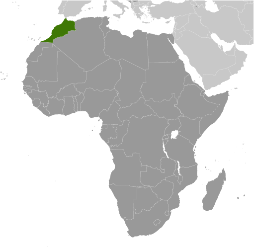
Morocco is a country in the Maghreb Region of North Africa where it covers an area of 710,850 sq. km.
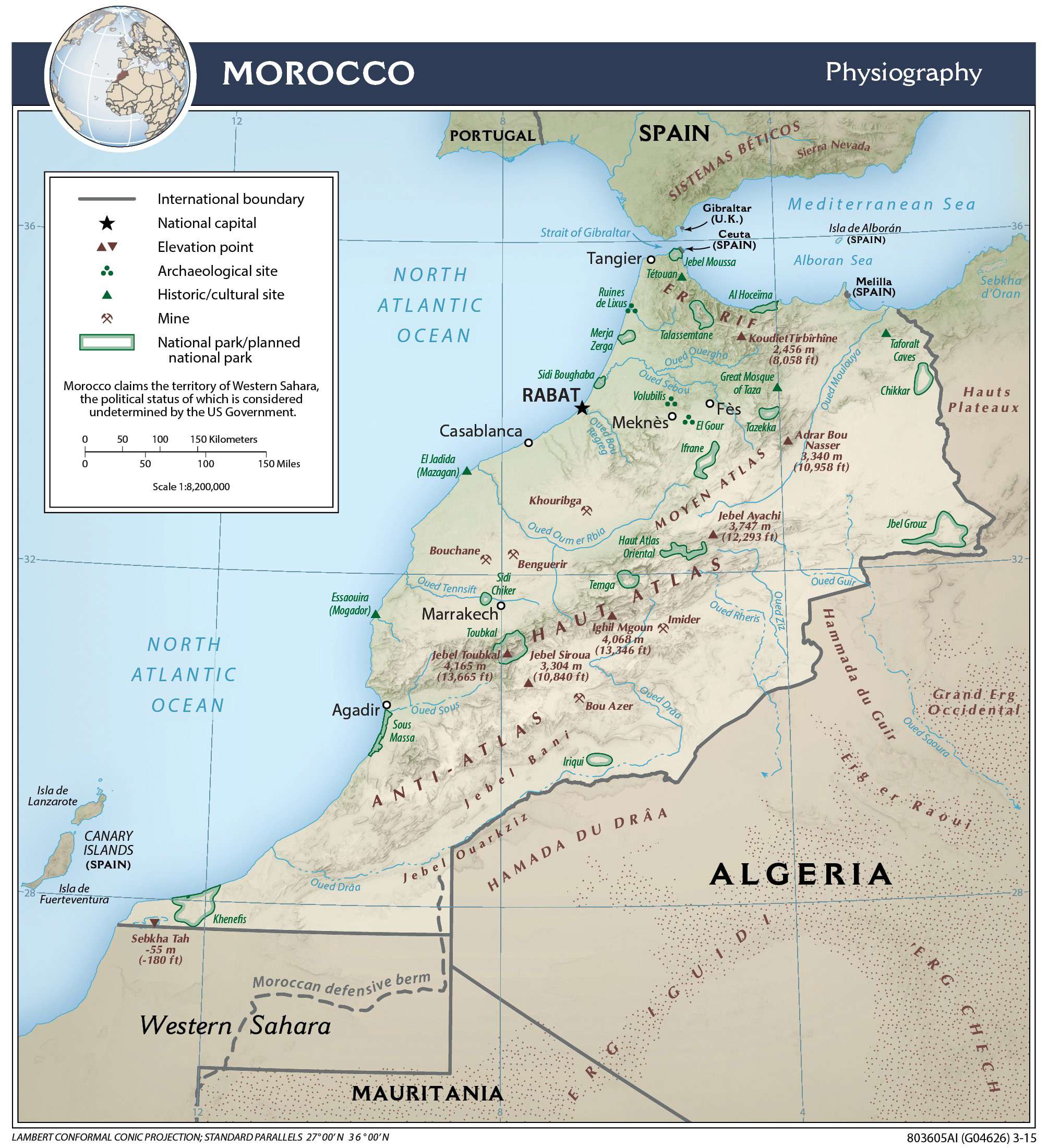
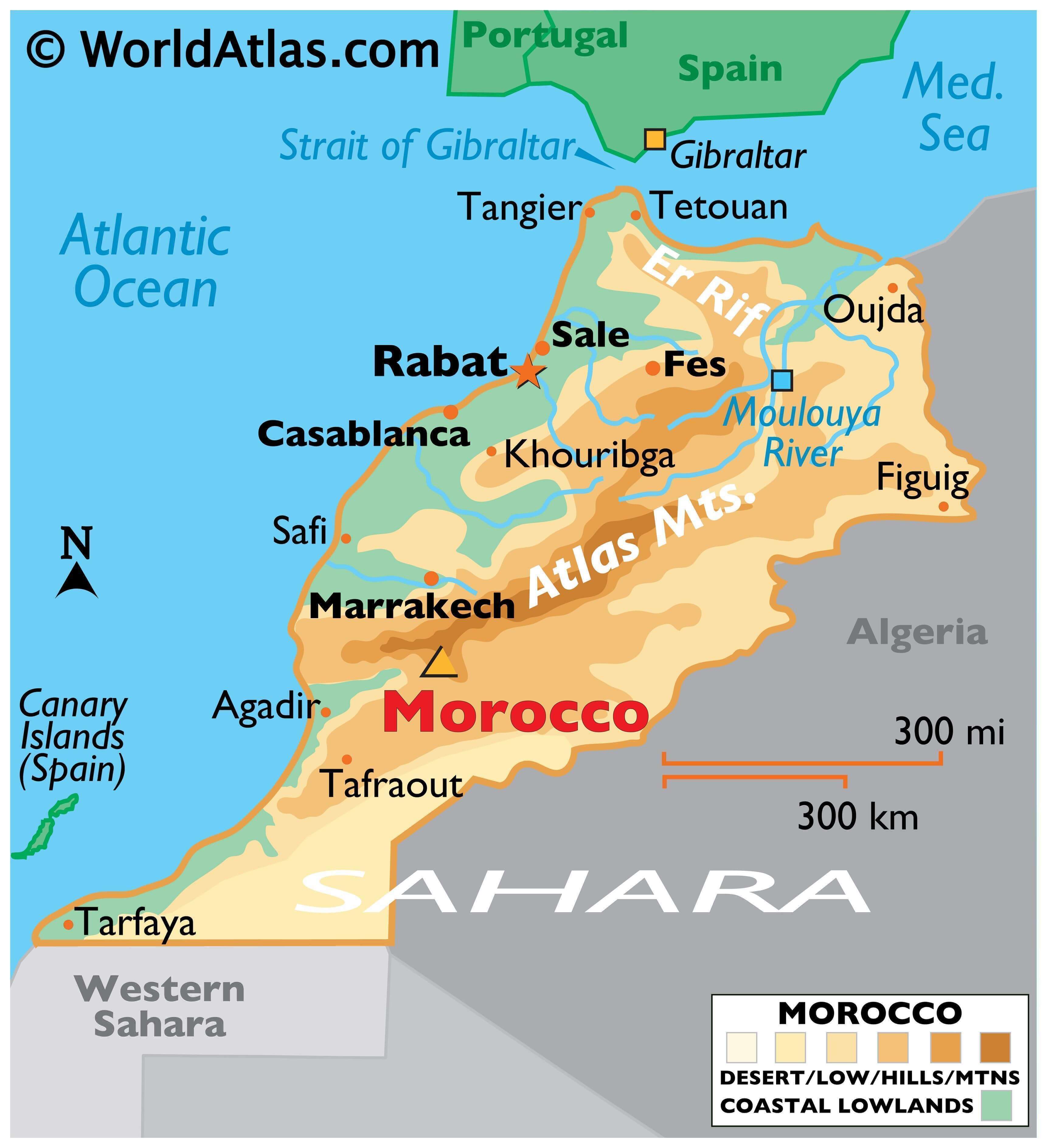
Much of Morocco’s landscape is mountainous with slopes that gradually transition into plateaus and valleys. As observed on the physical map above, the Atlas mountains dominate the central part of the country, while the Rif mountains make up the northern edge.
Jebel Toubkal (marked on the map by a yellow upright triangle) is the highest point of Morocco at 13,664 ft (4,165 m), and is also the highest peak of the Atlas mountains.
The southeastern region of the country is blanketed by the Sahara Desert, the world’s third largest desert at over 3,600,000 square miles (9,400,000 sq. km).
Land degradation is a large issue for Morocco, and many other countries located within the Sahara, as overgrazing of livestock and destruction of vegetation has eroded the soil.
Significant sources of water of Morocco include the Moulouya River, whose source is located in the Atlas Mountains, and flows into the Mediterranean Sea.
The lowest point of the country is Sebkha Tah at -180 ft (-55 m).
| Flag: |  |
|---|---|
| Legal Name: | Kingdom of Morocco |
| Capital Value: | Rabat |
| Official languages: |
|
| Demonym(s): | Moroccan |
| Government: | Unitary parliamentary semi-constitutional monarchy |
| Legislature: | Parliament |
| Total Area: | 446,550 km² |
| Land Area: | 446,300 km² |
| Water Area: | 250 km² |
| Population: | 36,471,769 |
| Density: | 50.0/km (129.5/sq mi) |
| GDP: | $118.73 Billion |
| GDP Per Capita: | $3,204.10 |
| Currency Value: | Moroccan dirhams (MAD) |
| Driving side: | right |
| Calling code: | +212 |
| Internet TLD: | .ma المغرب. |
Explore the fascinating country of Morocco with this interactive map. Discover its stunning landscapes, cities, rivers, lakes, highways, parks, mines, elevation points, and archaeological sites. Get a better understanding of the country’s physical features and regions, as well as its satellite imagery.
Online Interactive Political Map
Click on ![]() to view map in "full screen" mode.
to view map in "full screen" mode.
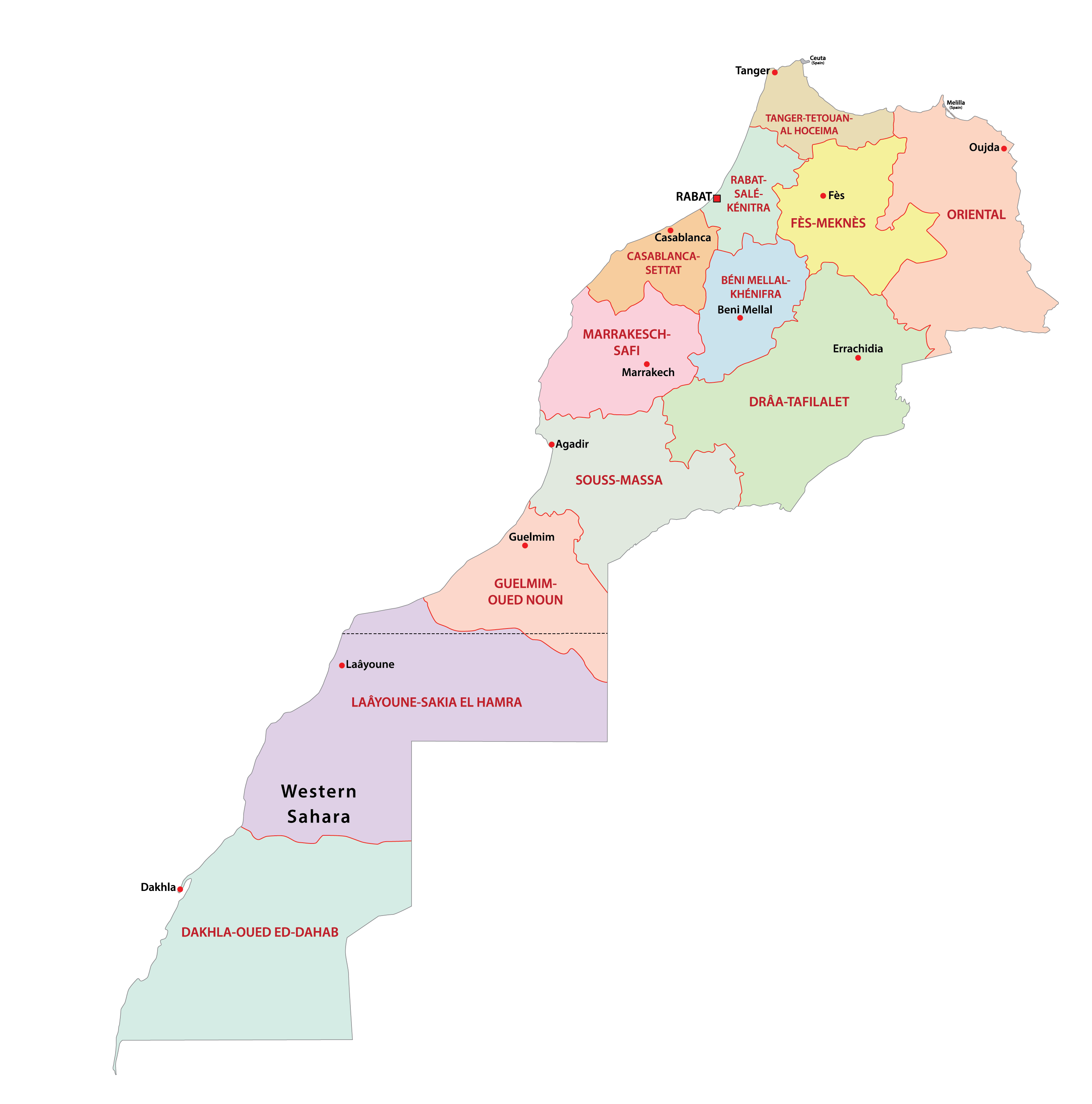
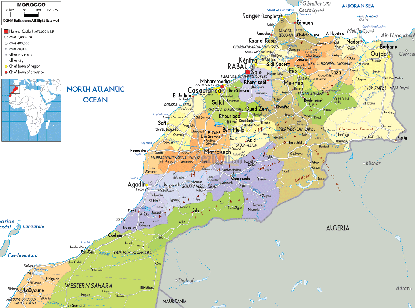
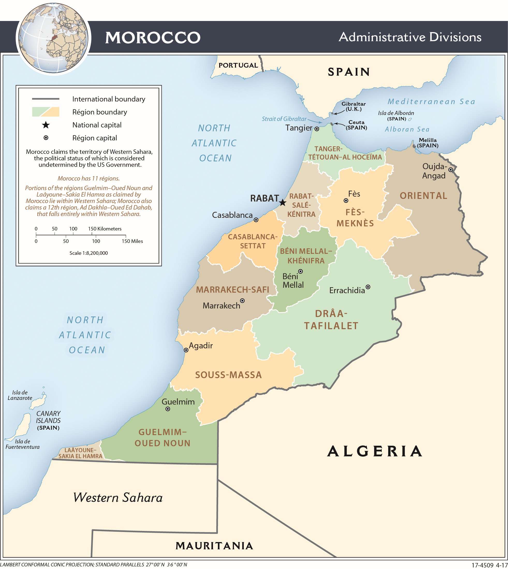
Morocco has 12 administrative divisions called regions. Of these, the Dakhla-Oued Ed-Dahab region lies entirely in the disputed territory of Western Sahara. Two regions, the Laâyoune-Sakia El Hamra and the Guelmim-Oued Noun are located partially in Western Sahara. The 11 regions of Morocco with the exception of the one completely in Western Sahara are Beni Mellal-Khenifra, Casablanca-Settat, Draa-Tafilalet, Fes-Meknes, Guelmim-Oued Noun, Laayoune-Sakia al Hamra, Oriental, Marrakech-Safi, Rabat-Sale-Kenitra, Souss-Massa, and Tanger-Tetouan-Al Hoceima.
The regions are subdivided into 75 prefectures and provinces.
Casablanca, the capital city of Morocco, is located in the Casablanca-Settat Region.
Location Maps
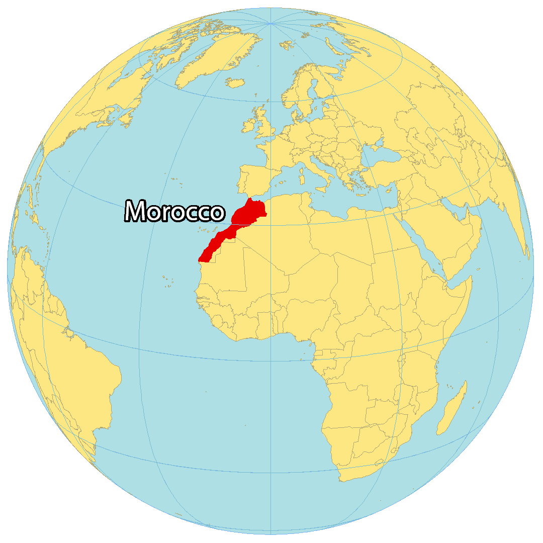
Where is Morocco?
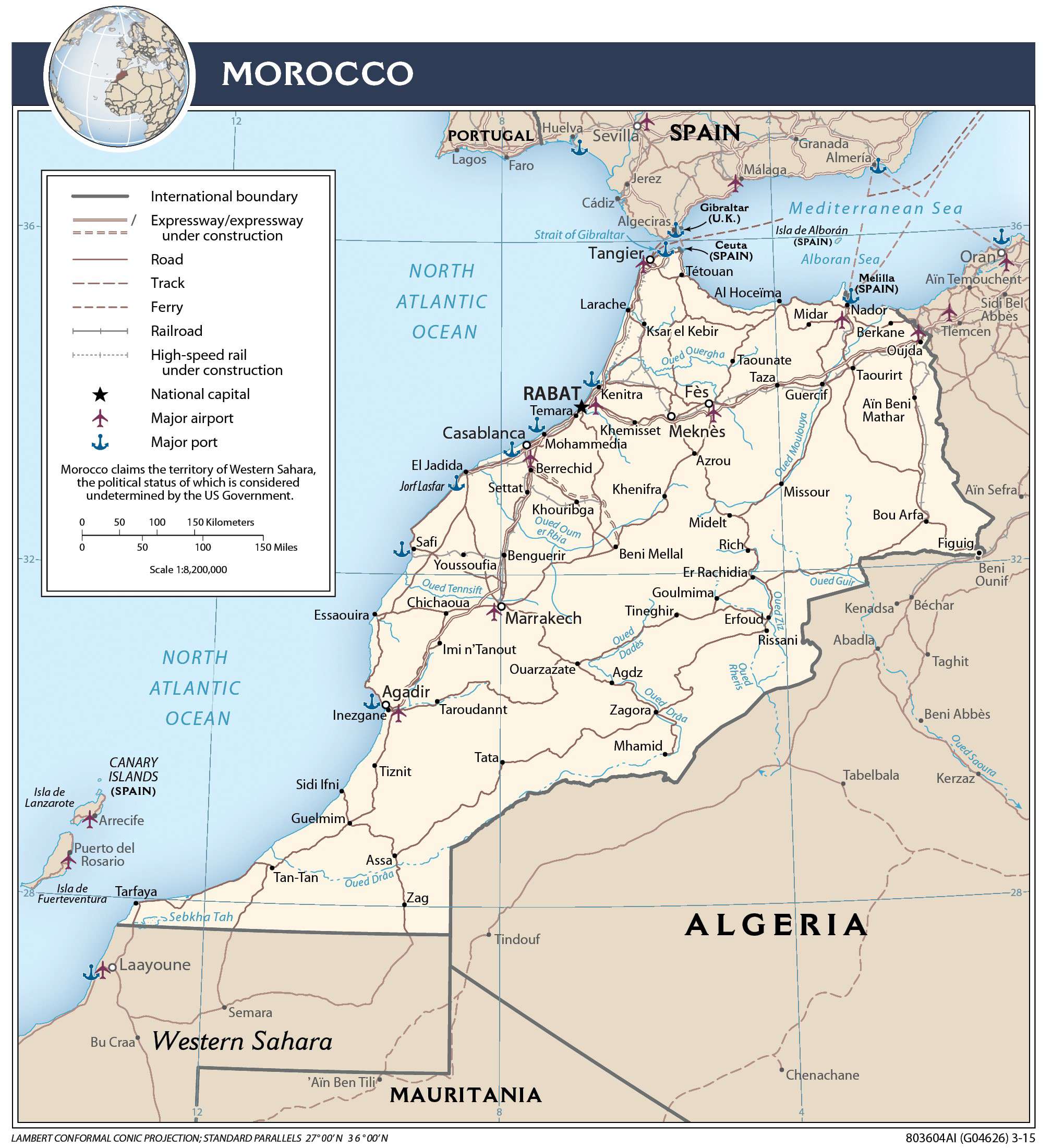
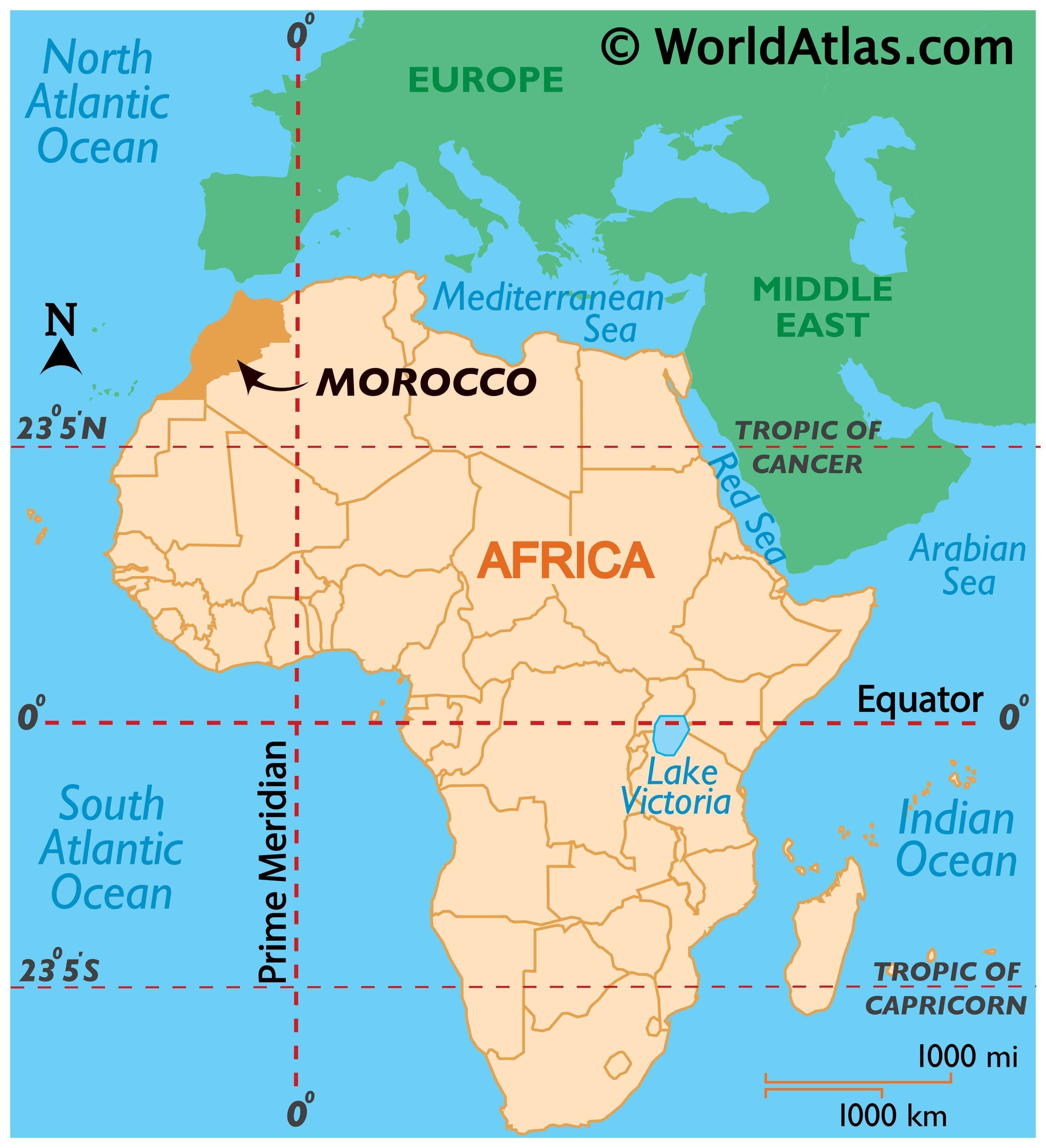
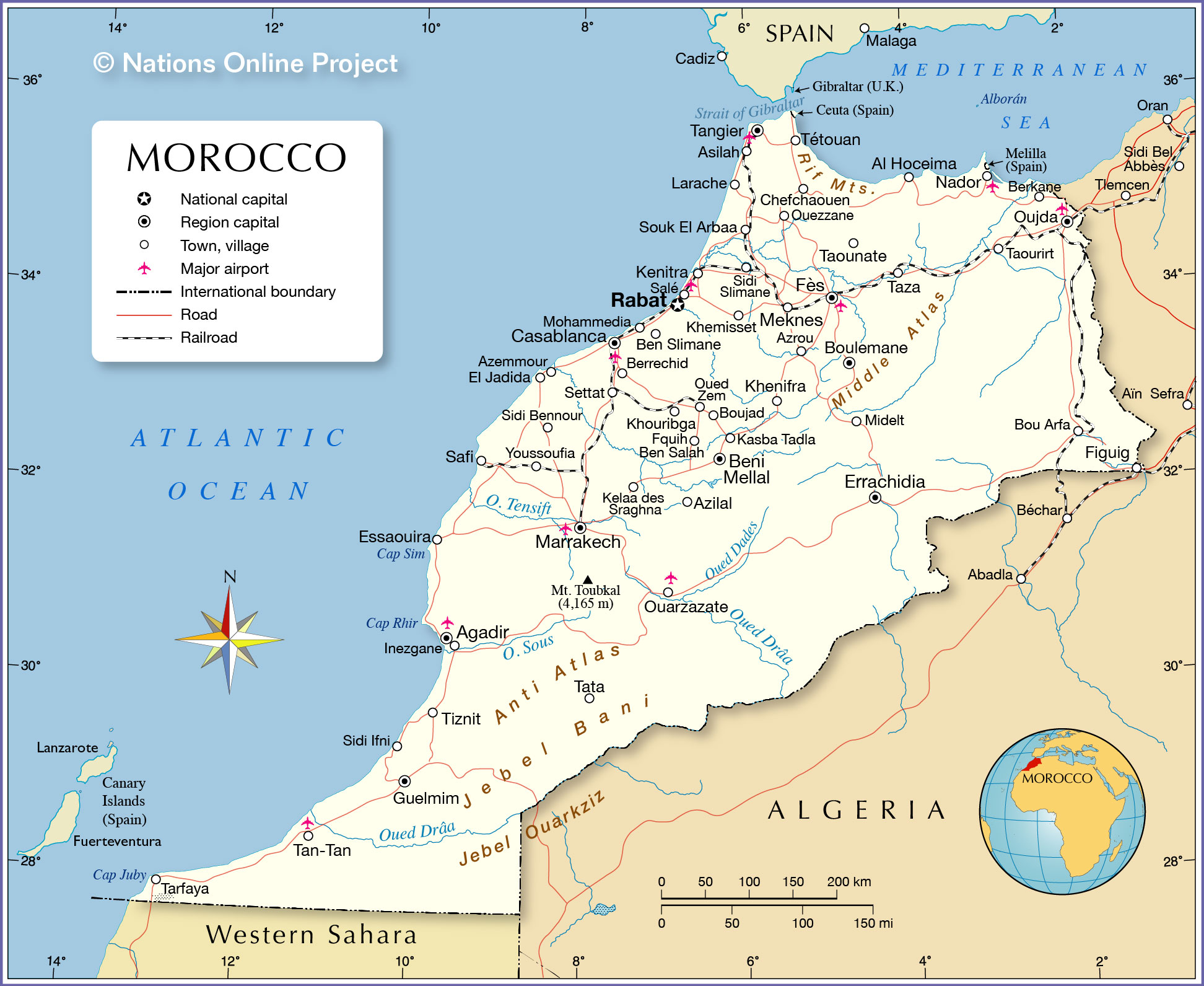
Morocco is situated in Northwestern Africa, with Algeria to the east and the disputed territory of Western Sahara to the south. It is only 13 kilometers away from Spain across the Strait of Gibraltar to the north. Morocco’s coastline on the North Atlantic Ocean is 2380 kilometers (1480 mi) long, while its coastline on the Mediterranean Sea is 820 kilometers (510 mi) long. The capital city of Morocco is Rabat, while the largest city is Casablanca.
High Definition Political Map of Morocco
Morocco Administrative Map
Physical Map of Morocco
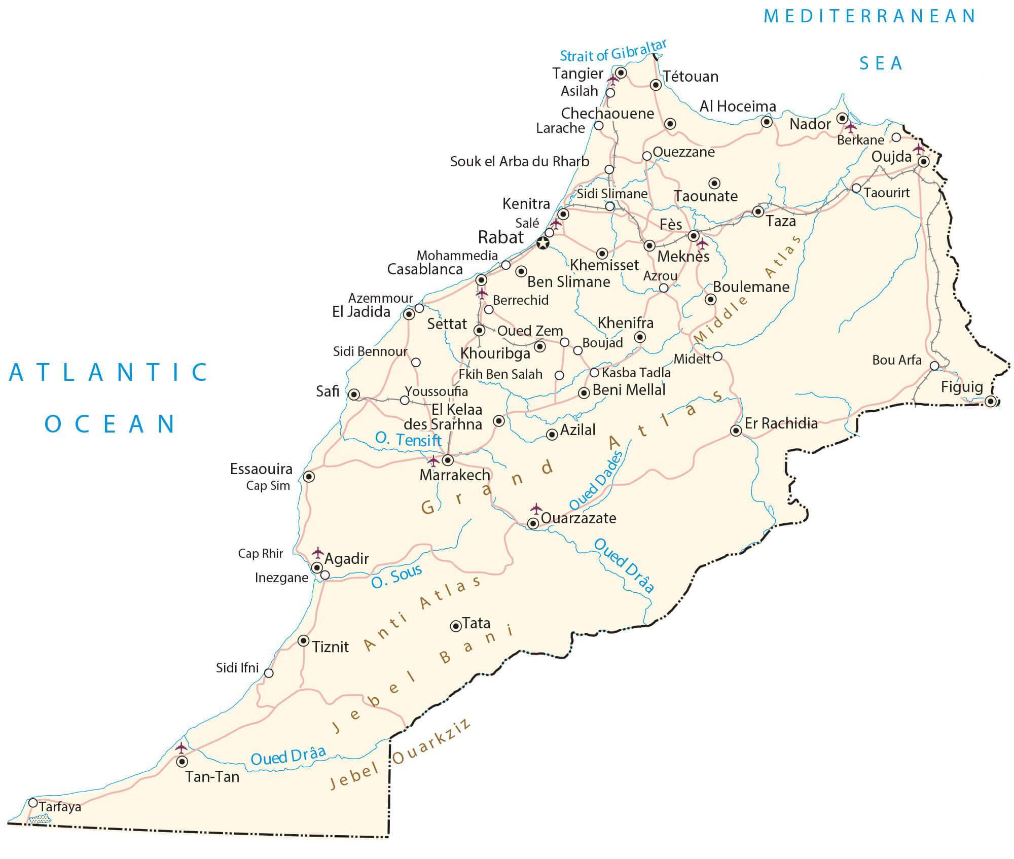
Transportation Map of Morocco