Royal Center is a town in Boone Township, Cass County, Indiana, United States. The population was 861 at the 2010 census.
| Name: | Royal Center town |
|---|---|
| LSAD Code: | 43 |
| LSAD Description: | town (suffix) |
| State: | Indiana |
| County: | Cass County |
| Elevation: | 735 ft (224 m) |
| Total Area: | 0.57 sq mi (1.48 km²) |
| Land Area: | 0.57 sq mi (1.48 km²) |
| Water Area: | 0.00 sq mi (0.00 km²) |
| Total Population: | 802 |
| Population Density: | 1,404.55/sq mi (542.67/km²) |
| ZIP code: | 46978 |
| Area code: | 574 |
| FIPS code: | 1866222 |
| GNISfeature ID: | 0449723 |
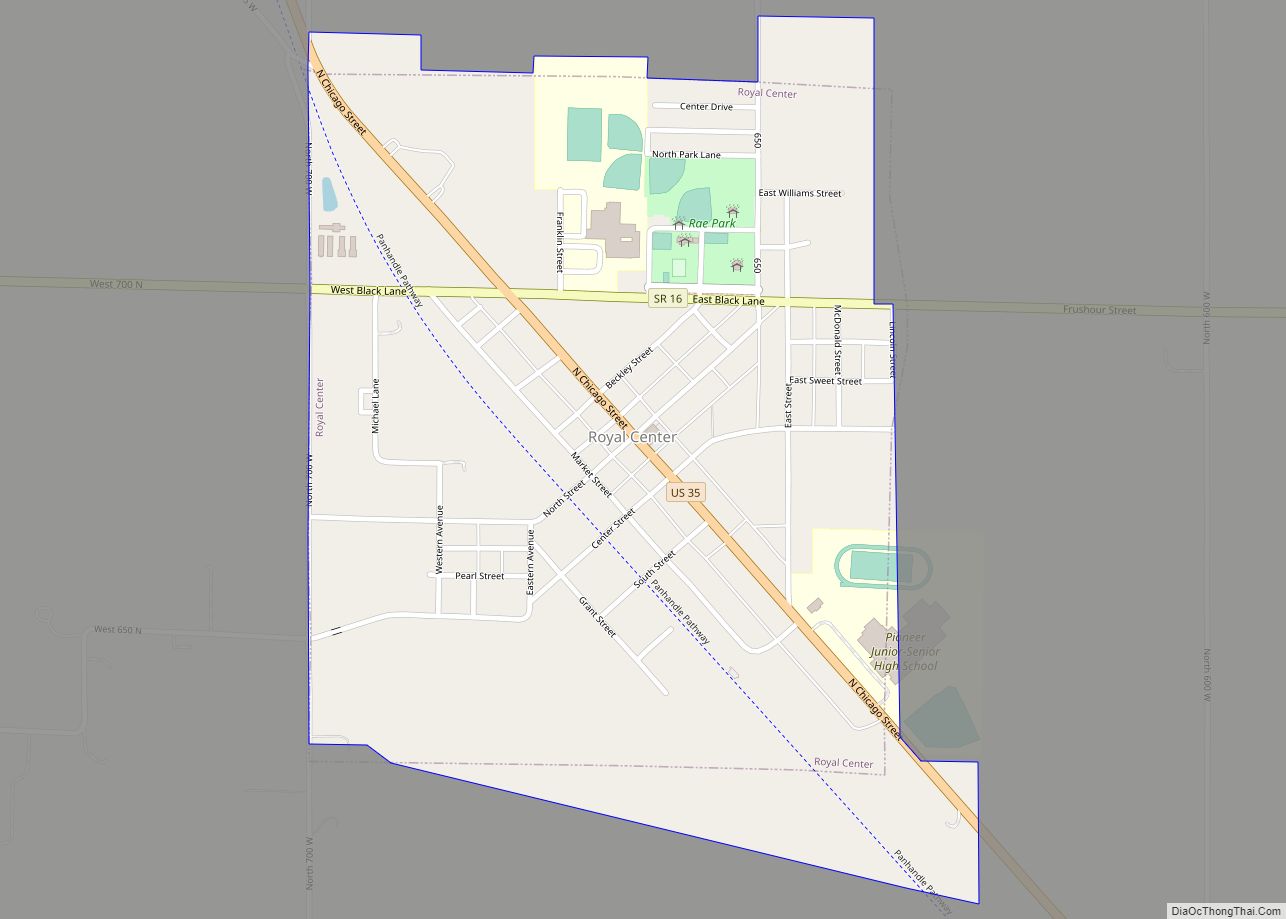
Online Interactive Map
Click on ![]() to view map in "full screen" mode.
to view map in "full screen" mode.
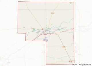
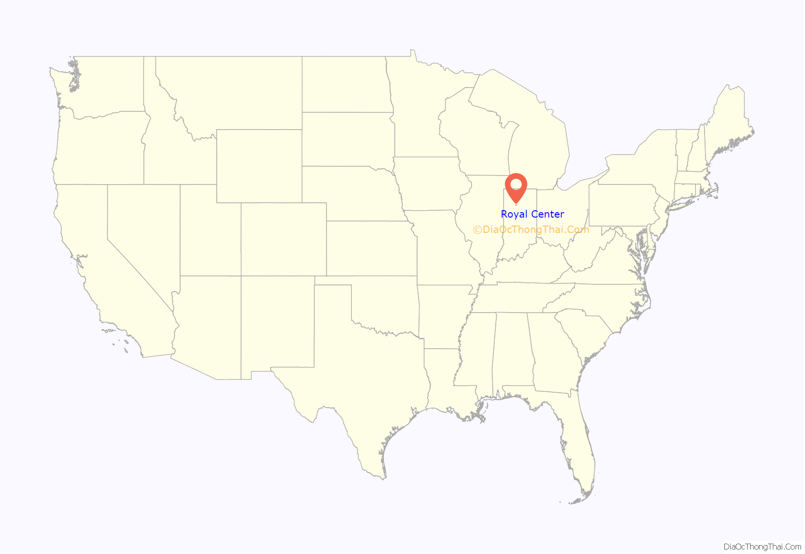
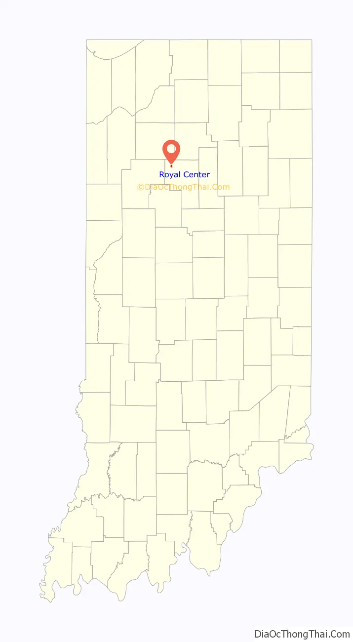
Royal Center location map. Where is Royal Center town?
History
Royal Center had its start in the year 1846 by the building of the Pittsburgh, Cincinnati, Chicago and St. Louis Railroad through that territory. It was supposedly named after a place in New York.
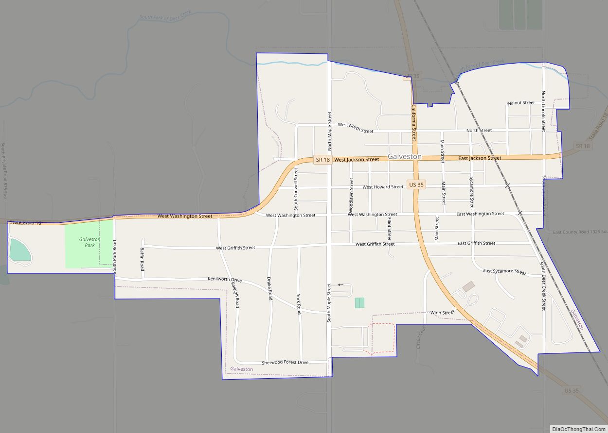
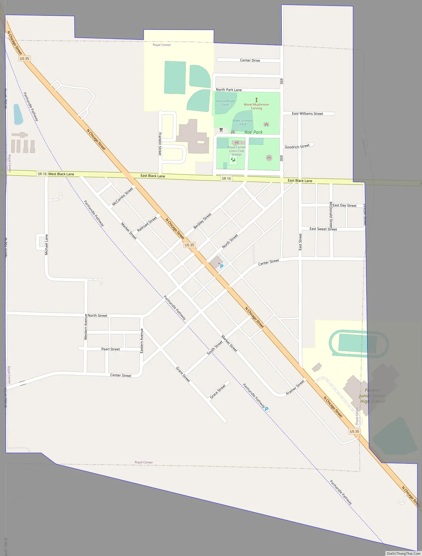
Royal Center Road Map
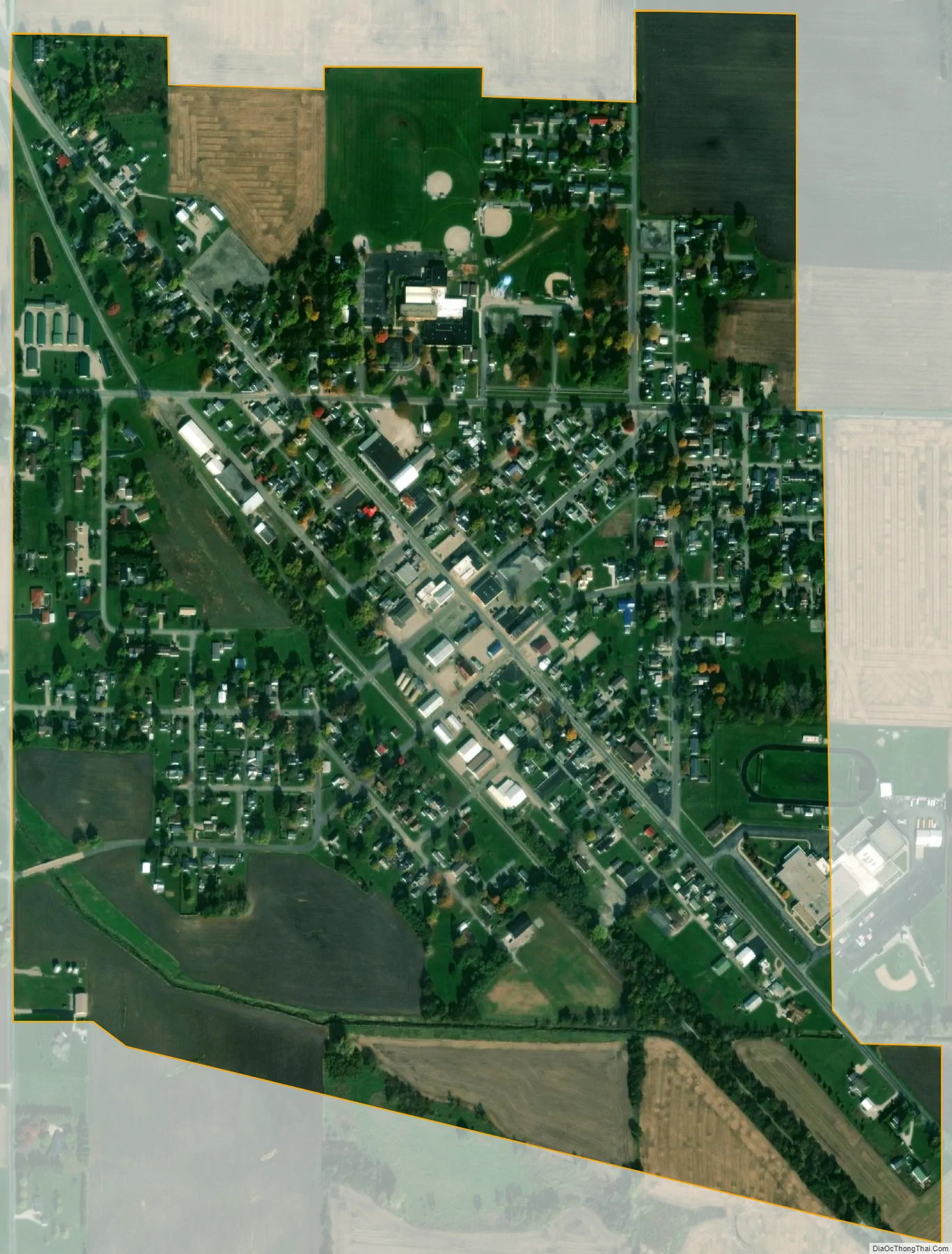
Royal Center city Satellite Map
Geography
Royal Center is located at 40°51′50″N 86°29′59″W / 40.86389°N 86.49972°W / 40.86389; -86.49972 (40.863955, -86.499787).
According to the 2010 census, Royal Center has a total area of 0.6 square miles (1.55 km), all land. Royal Center is the fourth-largest town by population in Cass County, and the third-largest town by land area.
See also
Map of Indiana State and its subdivision:- Adams
- Allen
- Bartholomew
- Benton
- Blackford
- Boone
- Brown
- Carroll
- Cass
- Clark
- Clay
- Clinton
- Crawford
- Daviess
- De Kalb
- Dearborn
- Decatur
- Delaware
- Dubois
- Elkhart
- Fayette
- Floyd
- Fountain
- Franklin
- Fulton
- Gibson
- Grant
- Greene
- Hamilton
- Hancock
- Harrison
- Hendricks
- Henry
- Howard
- Huntington
- Jackson
- Jasper
- Jay
- Jefferson
- Jennings
- Johnson
- Knox
- Kosciusko
- LaGrange
- Lake
- Lake Michigan
- LaPorte
- Lawrence
- Madison
- Marion
- Marshall
- Martin
- Miami
- Monroe
- Montgomery
- Morgan
- Newton
- Noble
- Ohio
- Orange
- Owen
- Parke
- Perry
- Pike
- Porter
- Posey
- Pulaski
- Putnam
- Randolph
- Ripley
- Rush
- Saint Joseph
- Scott
- Shelby
- Spencer
- Starke
- Steuben
- Sullivan
- Switzerland
- Tippecanoe
- Tipton
- Union
- Vanderburgh
- Vermillion
- Vigo
- Wabash
- Warren
- Warrick
- Washington
- Wayne
- Wells
- White
- Whitley
- Alabama
- Alaska
- Arizona
- Arkansas
- California
- Colorado
- Connecticut
- Delaware
- District of Columbia
- Florida
- Georgia
- Hawaii
- Idaho
- Illinois
- Indiana
- Iowa
- Kansas
- Kentucky
- Louisiana
- Maine
- Maryland
- Massachusetts
- Michigan
- Minnesota
- Mississippi
- Missouri
- Montana
- Nebraska
- Nevada
- New Hampshire
- New Jersey
- New Mexico
- New York
- North Carolina
- North Dakota
- Ohio
- Oklahoma
- Oregon
- Pennsylvania
- Rhode Island
- South Carolina
- South Dakota
- Tennessee
- Texas
- Utah
- Vermont
- Virginia
- Washington
- West Virginia
- Wisconsin
- Wyoming