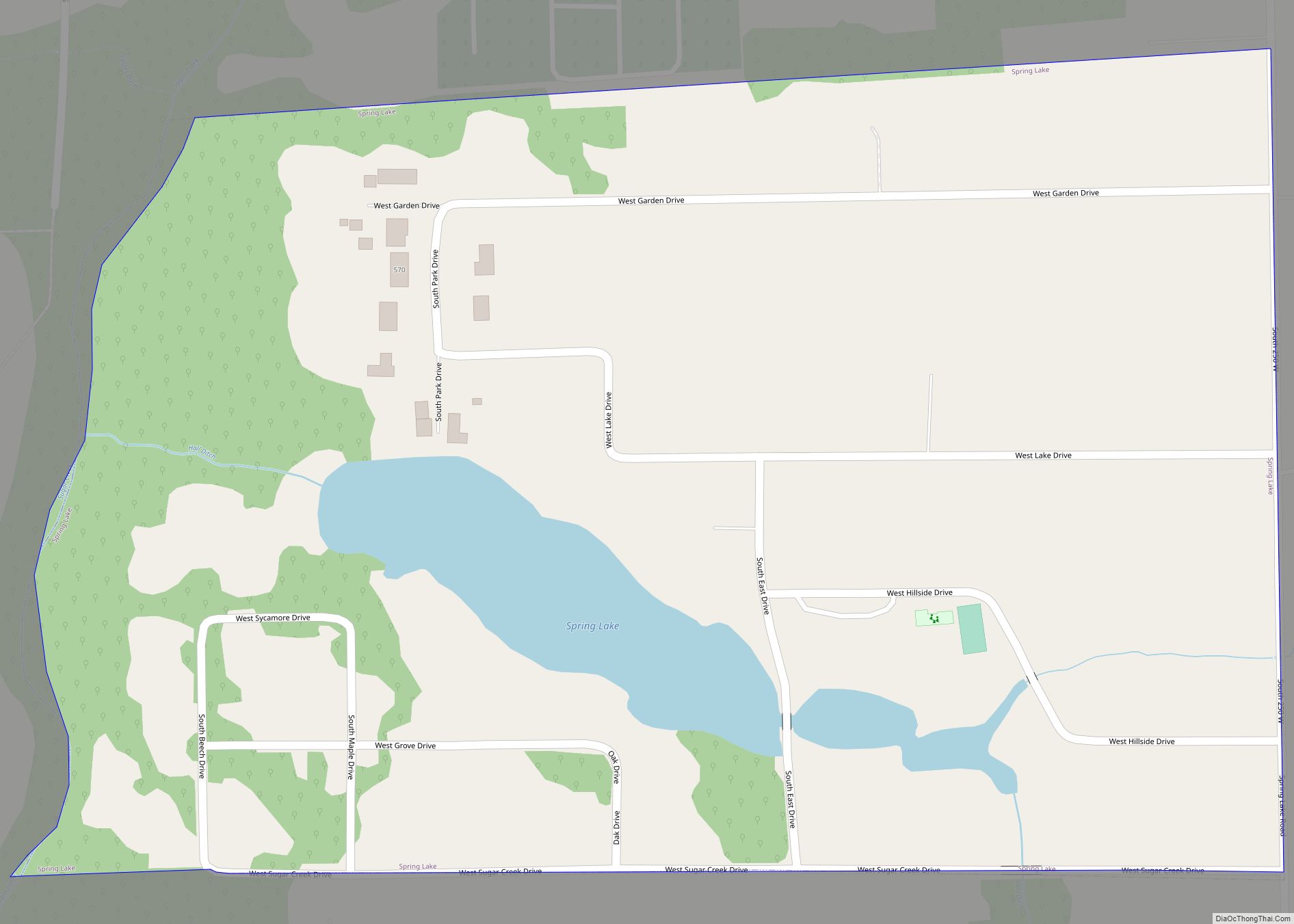
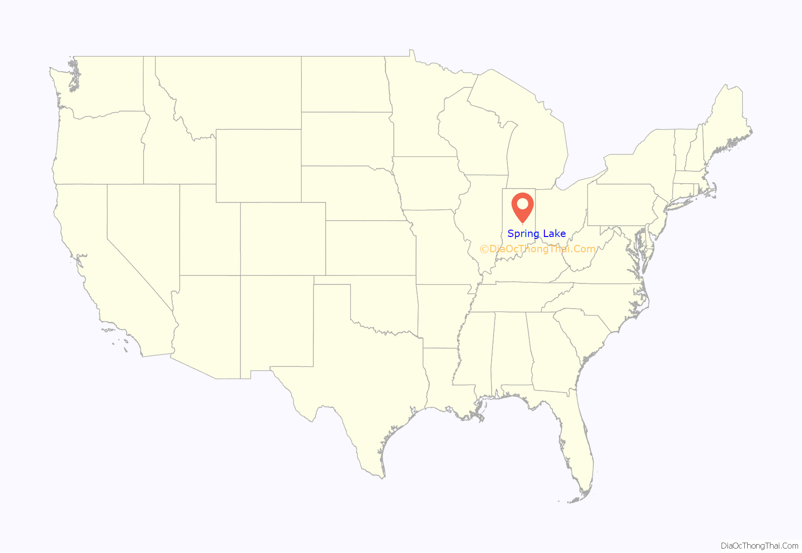
Spring Lake is a town in Sugar Creek Township, Hancock County, Indiana, United States, along Sugar Creek. The population was 218 at the 2010 census.
| Name: | Spring Lake town |
|---|---|
| LSAD Code: | 43 |
| LSAD Description: | town (suffix) |
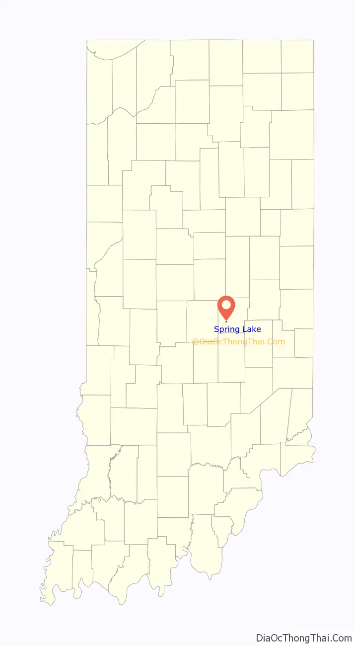
| State: | Indiana |
| County: | Hancock County |
| Elevation: | 850 ft (259 m) |
| Total Area: | 0.16 sq mi (0.42 km²) |
| Land Area: | 0.15 sq mi (0.40 km²) |
| Water Area: | 0.01 sq mi (0.03 km²) |
| Total Population: | 210 |
| Population Density: | 1,372.55/sq mi (531.14/km²) |
| FIPS code: | 1872296 |
| GNISfeature ID: | 0443991 |
| Website: | http://www.springlakein.org/ |
Online Interactive Map
Click on ![]() to view map in "full screen" mode.
to view map in "full screen" mode.
Spring Lake location map. Where is Spring Lake town?
History
Spring Lake is centered on an artificial lake of the same name, which was completed in about 1885. Spring Lake was laid out as a town in 1912.
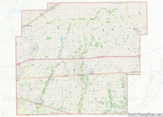
Spring Lake Road Map
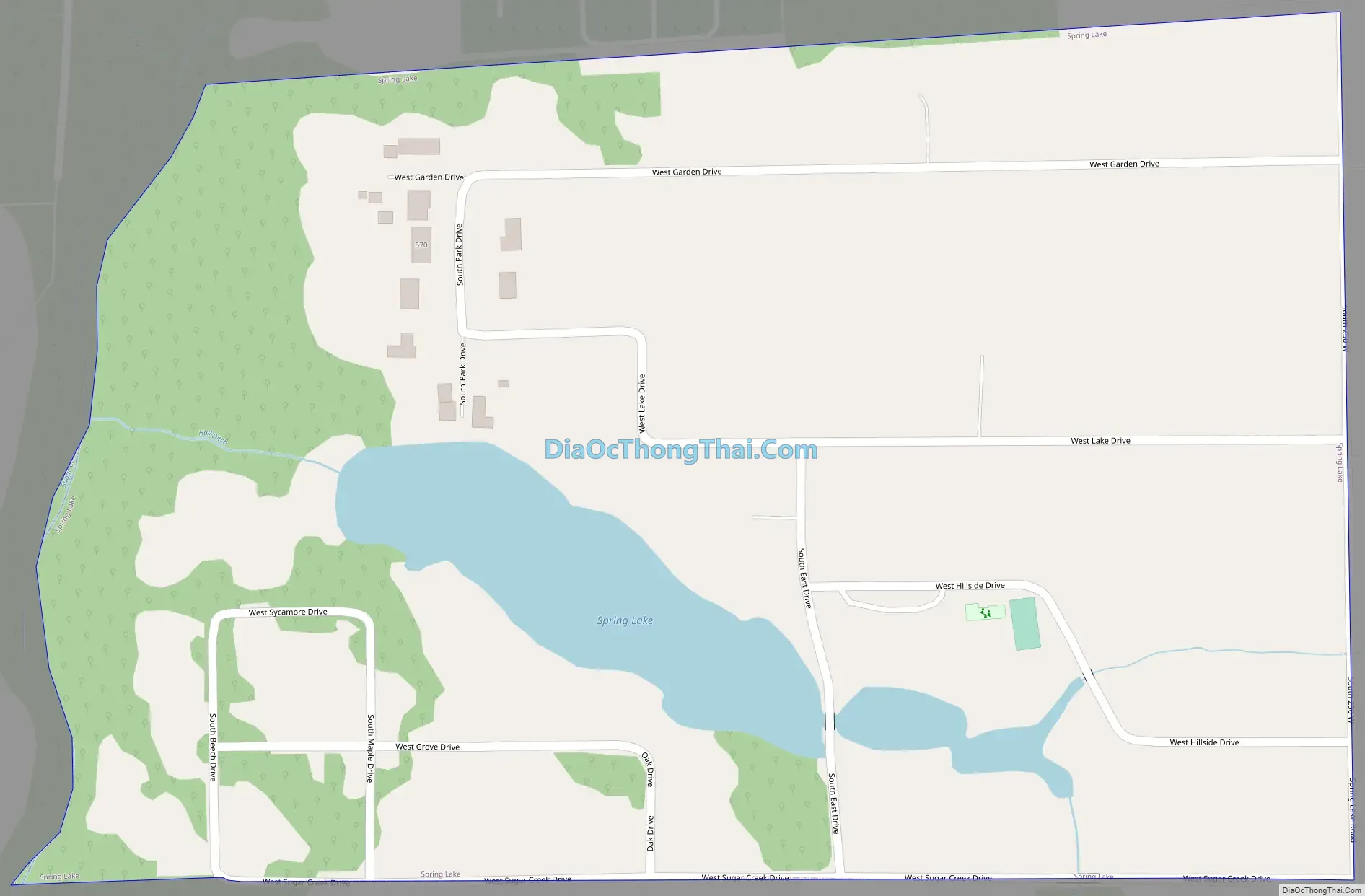
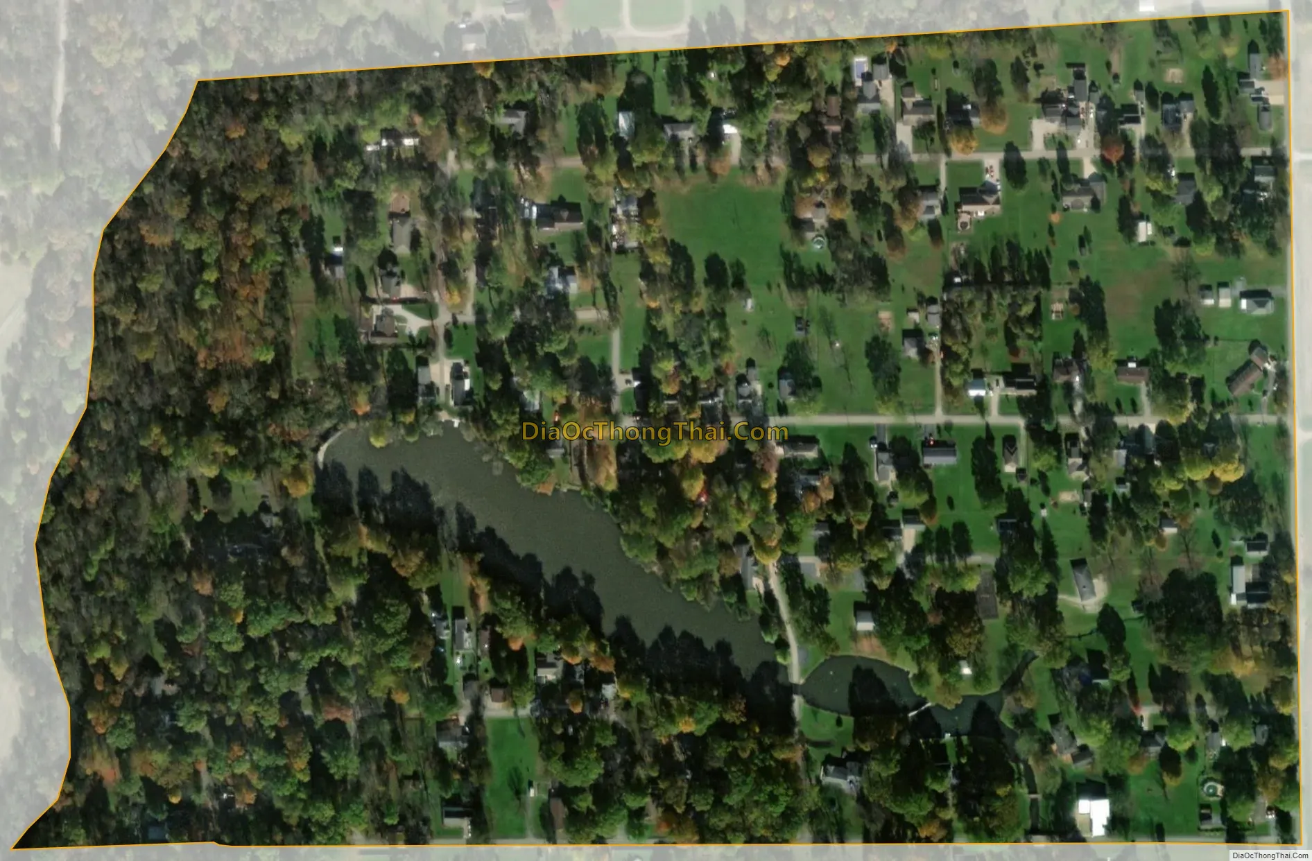
Spring Lake city Satellite Map
Geography
Spring Lake is located at 39°46′37″N 85°51′16″W / 39.77694°N 85.85444°W / 39.77694; -85.85444 (39.776823, -85.854347).
According to the 2010 census, Spring Lake has a total area of 0.161 square miles (0.42 km), of which 0.15 square miles (0.39 km) (or 93.17%) is land and 0.011 square miles (0.03 km) (or 6.83%) is water.
See also
Map of Indiana State and its subdivision:- Adams
- Allen
- Bartholomew
- Benton
- Blackford
- Boone
- Brown
- Carroll
- Cass
- Clark
- Clay
- Clinton
- Crawford
- Daviess
- De Kalb
- Dearborn
- Decatur
- Delaware
- Dubois
- Elkhart
- Fayette
- Floyd
- Fountain
- Franklin
- Fulton
- Gibson
- Grant
- Greene
- Hamilton
- Hancock
- Harrison
- Hendricks
- Henry
- Howard
- Huntington
- Jackson
- Jasper
- Jay
- Jefferson
- Jennings
- Johnson
- Knox
- Kosciusko
- LaGrange
- Lake
- Lake Michigan
- LaPorte
- Lawrence
- Madison
- Marion
- Marshall
- Martin
- Miami
- Monroe
- Montgomery
- Morgan
- Newton
- Noble
- Ohio
- Orange
- Owen
- Parke
- Perry
- Pike
- Porter
- Posey
- Pulaski
- Putnam
- Randolph
- Ripley
- Rush
- Saint Joseph
- Scott
- Shelby
- Spencer
- Starke
- Steuben
- Sullivan
- Switzerland
- Tippecanoe
- Tipton
- Union
- Vanderburgh
- Vermillion
- Vigo
- Wabash
- Warren
- Warrick
- Washington
- Wayne
- Wells
- White
- Whitley
- Alabama
- Alaska
- Arizona
- Arkansas
- California
- Colorado
- Connecticut
- Delaware
- District of Columbia
- Florida
- Georgia
- Hawaii
- Idaho
- Illinois
- Indiana
- Iowa
- Kansas
- Kentucky
- Louisiana
- Maine
- Maryland
- Massachusetts
- Michigan
- Minnesota
- Mississippi
- Missouri
- Montana
- Nebraska
- Nevada
- New Hampshire
- New Jersey
- New Mexico
- New York
- North Carolina
- North Dakota
- Ohio
- Oklahoma
- Oregon
- Pennsylvania
- Rhode Island
- South Carolina
- South Dakota
- Tennessee
- Texas
- Utah
- Vermont
- Virginia
- Washington
- West Virginia
- Wisconsin
- Wyoming