Williams is an unincorporated community and census-designated place in Spice Valley Township, Lawrence County, Indiana, United States. As of the 2010 census, the population was 286.
Williams is situated on the East Fork of the White River. Williams is home to Williams Dam, a hydroelectric dam that once powered the electricity for stone industries across southern Indiana, especially in nearby Bedford and Bloomington.
| Name: | Williams CDP |
|---|---|
| LSAD Code: | 57 |
| LSAD Description: | CDP (suffix) |
| State: | Indiana |
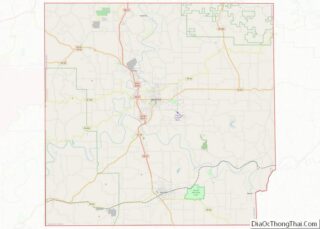
| County: | Lawrence County |
| Elevation: | 574 ft (175 m) |
| Total Area: | 3.58 sq mi (9.27 km²) |
| Land Area: | 3.58 sq mi (9.26 km²) |
| Water Area: | 0.00 sq mi (0.01 km²) |
| Total Population: | 229 |
| Population Density: | 64.06/sq mi (24.73/km²) |
| ZIP code: | 47470 |
| FIPS code: | 1884338 |
| GNISfeature ID: | 451629 |
Online Interactive Map
Click on ![]() to view map in "full screen" mode.
to view map in "full screen" mode.
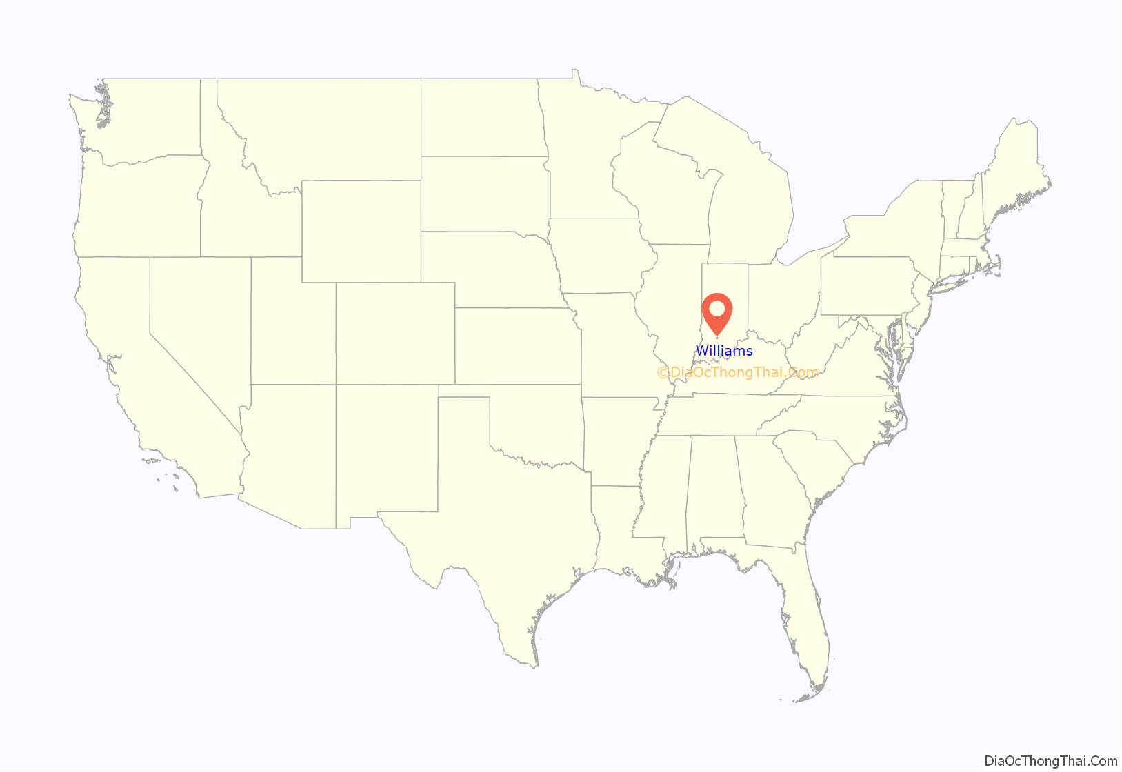
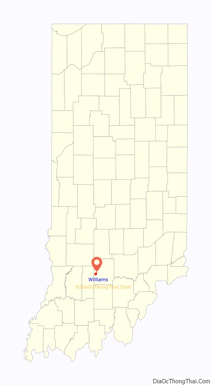
Williams location map. Where is Williams CDP?
History
The Williams post office was established in 1876. Byrd E. Williams was an early postmaster. Williams was platted in 1889. From 1910 to 1911, Williams Dam was being built on the East Fork of the White River. It was finally opened in 1913, giving electricity to stone industries in the region. The dam did this for almost four decades until being decommissioned in the 1950s. Almost 60 years later, Free Flow Power Corp., a startup company from Boston, looked into recommissioning the dam, giving the area a renewable energy power. The corporation planned to spend over $12 million by installing turbines on the plant. That plan was abandoned in 2018.
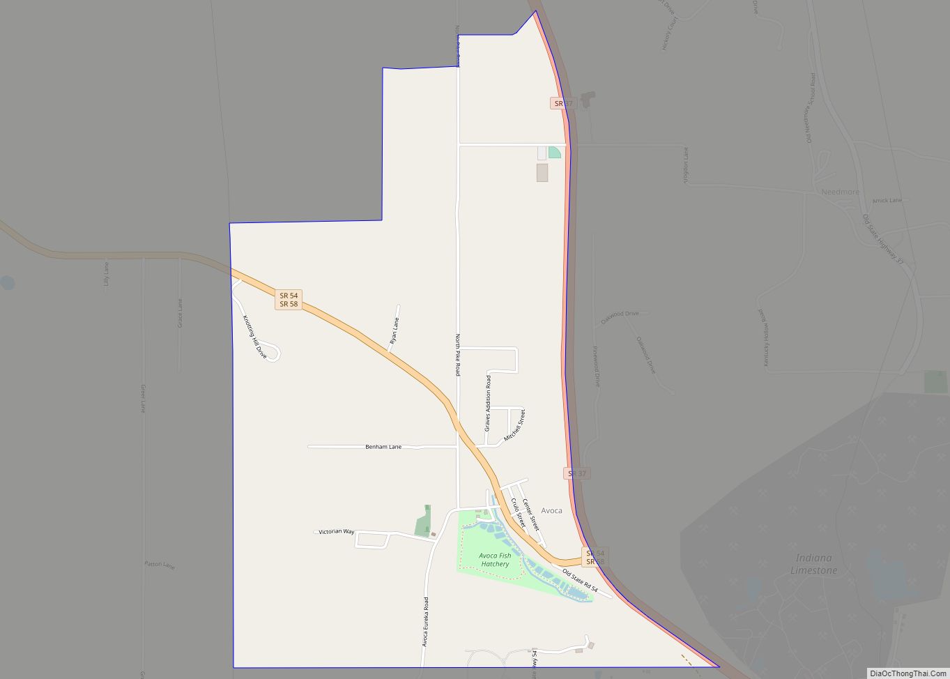
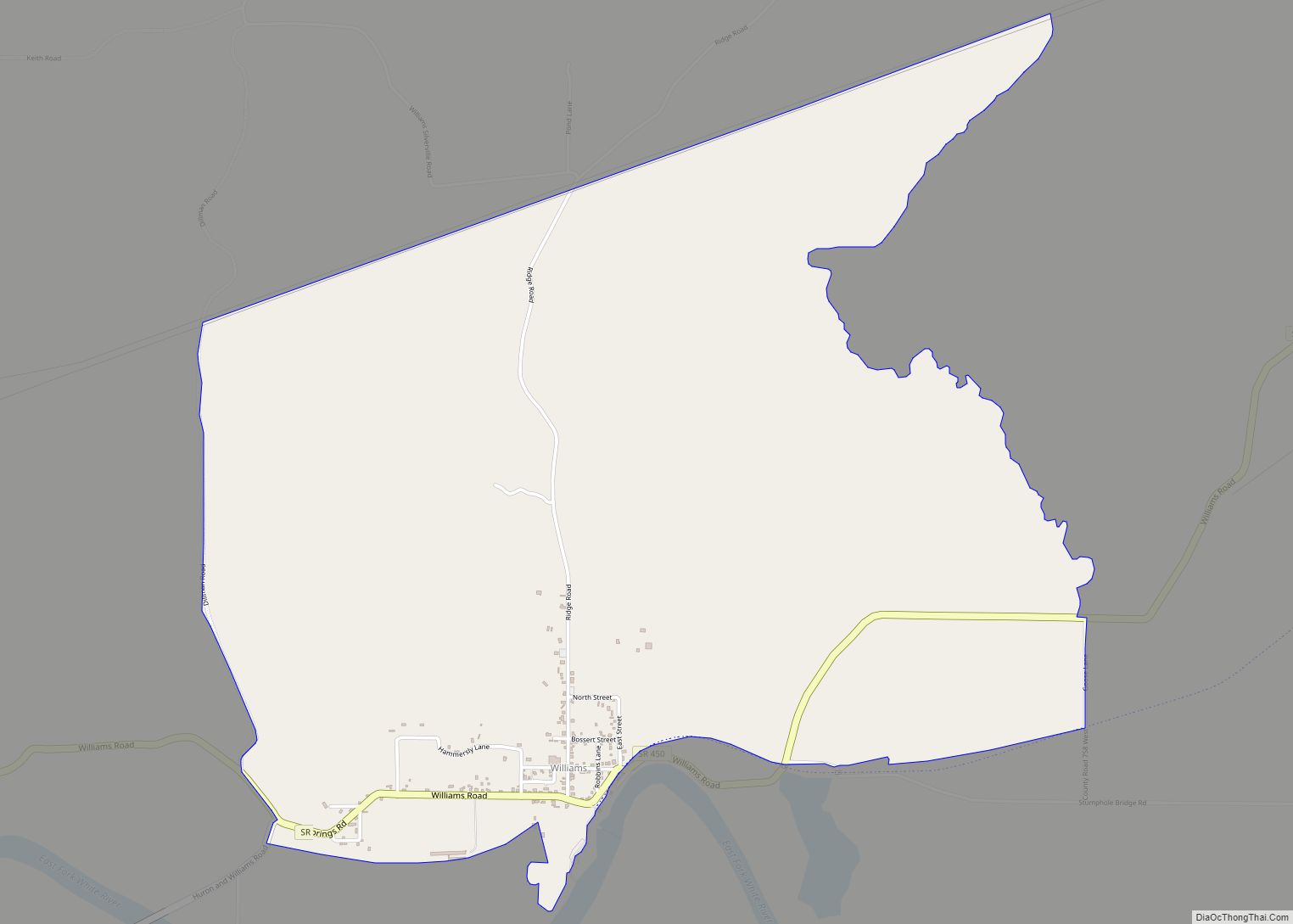
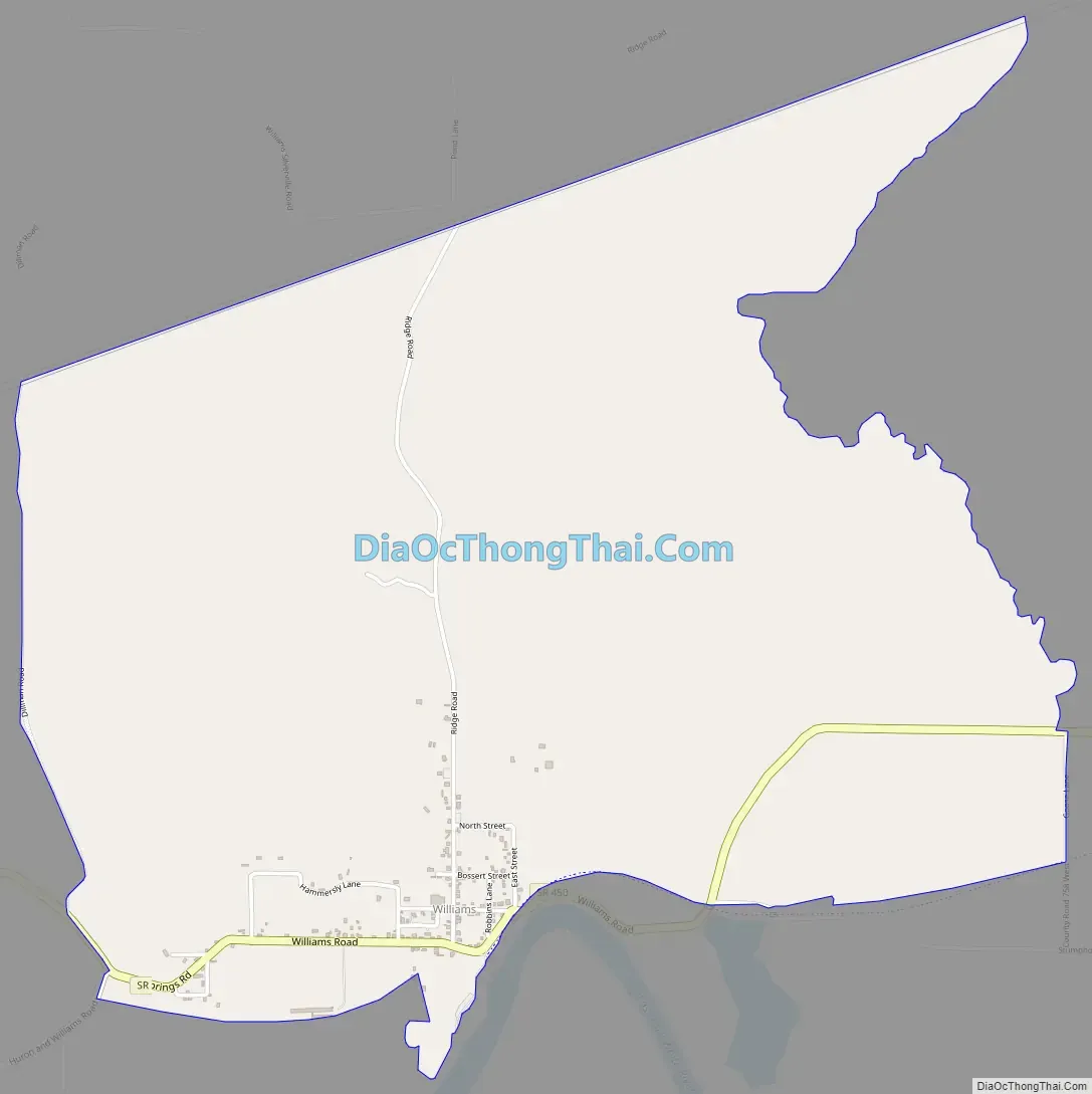
Williams Road Map
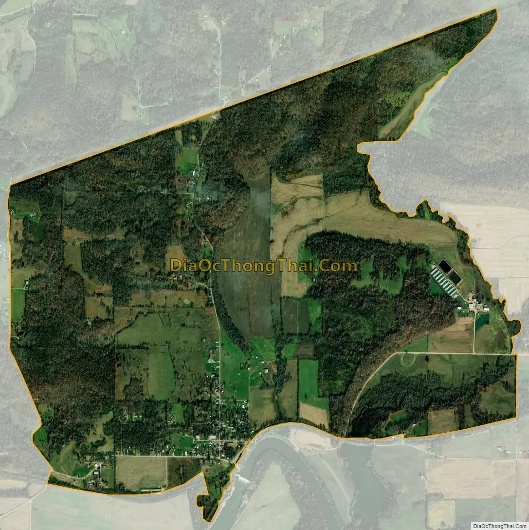
Williams city Satellite Map
Geography
Williams is located in western Lawrence County at 38°48′16″N 86°38′50″W / 38.80444°N 86.64722°W / 38.80444; -86.64722, in the northern part of Spice Valley Township. The census-designated place contains the town center of Williams along Indiana State Road 450, just north of the East Fork of the White River, but includes rural land to the north, east, and west. The CDP extends east to Crooked Creek, west to Dillman Road, and north to a high-tension power line. According to the U.S. Census Bureau, the CDP has a total area of 3.6 square miles (9.3 km), of which 2.01 acres (8,135 m), or 0.09%, are water.
Via SR 450, Williams is 11 miles (18 km) southwest of Bedford, the Lawrence county seat, and 22 miles (35 km) northeast of Loogootee.
See also
Map of Indiana State and its subdivision:- Adams
- Allen
- Bartholomew
- Benton
- Blackford
- Boone
- Brown
- Carroll
- Cass
- Clark
- Clay
- Clinton
- Crawford
- Daviess
- De Kalb
- Dearborn
- Decatur
- Delaware
- Dubois
- Elkhart
- Fayette
- Floyd
- Fountain
- Franklin
- Fulton
- Gibson
- Grant
- Greene
- Hamilton
- Hancock
- Harrison
- Hendricks
- Henry
- Howard
- Huntington
- Jackson
- Jasper
- Jay
- Jefferson
- Jennings
- Johnson
- Knox
- Kosciusko
- LaGrange
- Lake
- Lake Michigan
- LaPorte
- Lawrence
- Madison
- Marion
- Marshall
- Martin
- Miami
- Monroe
- Montgomery
- Morgan
- Newton
- Noble
- Ohio
- Orange
- Owen
- Parke
- Perry
- Pike
- Porter
- Posey
- Pulaski
- Putnam
- Randolph
- Ripley
- Rush
- Saint Joseph
- Scott
- Shelby
- Spencer
- Starke
- Steuben
- Sullivan
- Switzerland
- Tippecanoe
- Tipton
- Union
- Vanderburgh
- Vermillion
- Vigo
- Wabash
- Warren
- Warrick
- Washington
- Wayne
- Wells
- White
- Whitley
- Alabama
- Alaska
- Arizona
- Arkansas
- California
- Colorado
- Connecticut
- Delaware
- District of Columbia
- Florida
- Georgia
- Hawaii
- Idaho
- Illinois
- Indiana
- Iowa
- Kansas
- Kentucky
- Louisiana
- Maine
- Maryland
- Massachusetts
- Michigan
- Minnesota
- Mississippi
- Missouri
- Montana
- Nebraska
- Nevada
- New Hampshire
- New Jersey
- New Mexico
- New York
- North Carolina
- North Dakota
- Ohio
- Oklahoma
- Oregon
- Pennsylvania
- Rhode Island
- South Carolina
- South Dakota
- Tennessee
- Texas
- Utah
- Vermont
- Virginia
- Washington
- West Virginia
- Wisconsin
- Wyoming