Dearborn is a city in Wayne County in the U.S. state of Michigan. At the 2020 census, it had a population of 109,976. Dearborn is the seventh-largest city in Michigan and is home to the largest Muslim population in the United States per capita. It also is home to the largest mosque in the United States.
First settled in the late 18th century by ethnic French farmers in a series of ribbon farms along the Rouge River and the Sauk Trail, the community grew in the 19th century with the establishment of the Detroit Arsenal on the Chicago Road linking Detroit and Chicago. In the 20th century, it developed as a major manufacturing hub for the automotive industry.
Henry Ford was born on a farm and later established an estate in Dearborn, as well as his River Rouge Complex, the largest factory of his Ford empire. He developed mass production of automobiles, and based the world headquarters of the Ford Motor Company here. The city has a campus of the University of Michigan as well as Henry Ford College. The Henry Ford, the United States’ largest indoor-outdoor historic museum complex and Metro Detroit’s leading tourist attraction, is located here.
Dearborn residents are Americans primarily of European or Middle Eastern ancestry, many descendants of 19th and 20th-century immigrants. The primary European ethnicities, as identified by respondents to the census, are German, Polish, Irish, and Italian. Because of new waves of immigration from the Middle East in the late 20th century, the largest ethnic grouping is now composed of descendants of various nationalities of that area: Muslims and Christians from Lebanon and Palestine, as well as immigrants from Syria, Iraq, and Yemen.
| Name: | Dearborn city |
|---|---|
| LSAD Code: | 25 |
| LSAD Description: | city (suffix) |
| State: | Michigan |
| County: | Wayne County |
| Incorporated: | 1893 (village) 1927 (city) |
| Elevation: | 591 ft (180 m) |
| Land Area: | 24.25 sq mi (62.80 km²) |
| Water Area: | 0.27 sq mi (0.69 km²) |
| Population Density: | 4,535.65/sq mi (1,751.25/km²) |
| Area code: | 313 |
| FIPS code: | 2621000 |
| GNISfeature ID: | 0624432 |
Online Interactive Map
Click on ![]() to view map in "full screen" mode.
to view map in "full screen" mode.
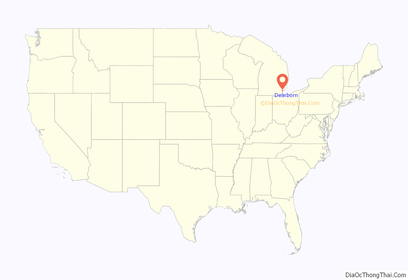
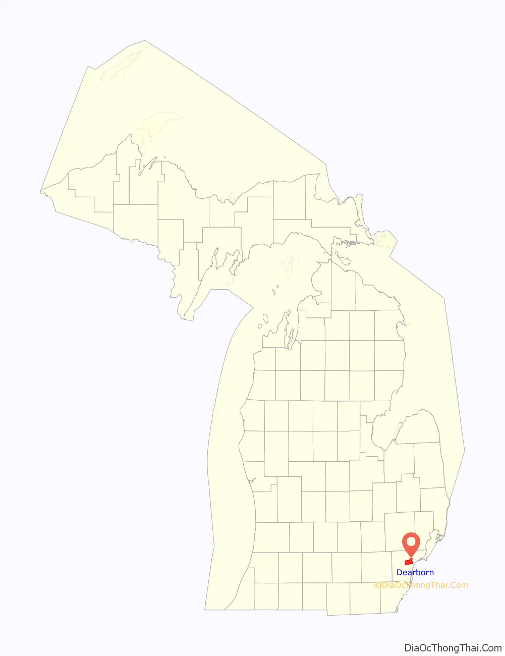
Dearborn location map. Where is Dearborn city?
History
Before European encounter, the area had been inhabited for thousands of years by successive indigenous peoples. Historical tribes belonged mostly to the Algonquian-language family, especially the Council of Three Fires, the Potawatomi and related peoples. In contrast, the Huron (Wyandot) were Iroquoian speaking. French colonists had a trading post at Fort Detroit and a settlement developed there in the colonial period. Another developed on the south side of the Detroit River in what is now southwestern Ontario, near a Huron mission village. French and French-Canadian colonists also established farms at Dearborn in this period. France ceded all of its territory east of the Mississippi River in North America to Great Britain in 1763 after losing to the English in the Seven Years’ War.
Beginning in 1786, after the United States gained independence in the American Revolutionary War, more European Americans entered this region, settling in Detroit and the Dearborn area. With population growth, Dearborn Township was formed in 1833 and the village of Dearbornville in 1836, each named after patriot Henry Dearborn, a general in the American Revolution who later served as Secretary of War under President Thomas Jefferson. The Town of Dearborn was incorporated in 1893. Through much of the 19th century, the area was largely rural and dependent on agriculture.
Stimulated by industrial development in Detroit and within its own limits, in 1927 Dearborn was established as a city. Its current borders result from a 1928 consolidation vote that merged Dearborn and neighboring Fordson (previously known as Springwells), which feared being absorbed into expanding Detroit.
According to historian James W. Loewen, in his book Sundown Towns (2005), Dearborn discouraged African Americans from settling in the city. In the early 20th century, both whites and African Americans migrated to Detroit for industrial jobs. Over time, some city residents relocated in the suburbs. Many of Dearborn’s residents “took pride in the saying, ‘The sun never set on a Negro in Dearborn'”. According to Orville Hubbard, the segregationist mayor of Dearborn from 1942 to 1978, “as far as he was concerned, it was against the law for a Negro to live in his suburb.” Hubbard told the Montgomery Advertiser in the mid-1950s, “Negroes can’t get in here. Every time we hear of a Negro moving in, we respond quicker than you do to a fire.”
The area between Dearborn and Fordson was undeveloped, and still remains so in part. Once farm land, much of this property was bought by Henry Ford for his estate, Fair Lane, and for the Ford Motor Company World Headquarters. Later developments in this corridor were the Ford airport (later converted to the Dearborn Proving Grounds), and other Ford administrative and development facilities.
More recent additions are The Henry Ford (a reconstructed historic village and museum), the Henry Ford Centennial Library, the super-regional shopping mall Fairlane Town Center, and the Ford Performing Arts Center. The open land is planted with sunflowers and often with Ford’s favorite crop of soybeans. The crops are never harvested.
With the growth and achievements of the Arab-American community, they developed and in 2005 opened the Arab American National Museum (AANM), the first museum in the world devoted to Arab-American history and culture. Arab Americans in Dearborn include descendants of Lebanese Christians who immigrated in the early twentieth century to work in the auto industry, as well as more recent Arab immigrants and their descendants from other, primarily Muslim nations.
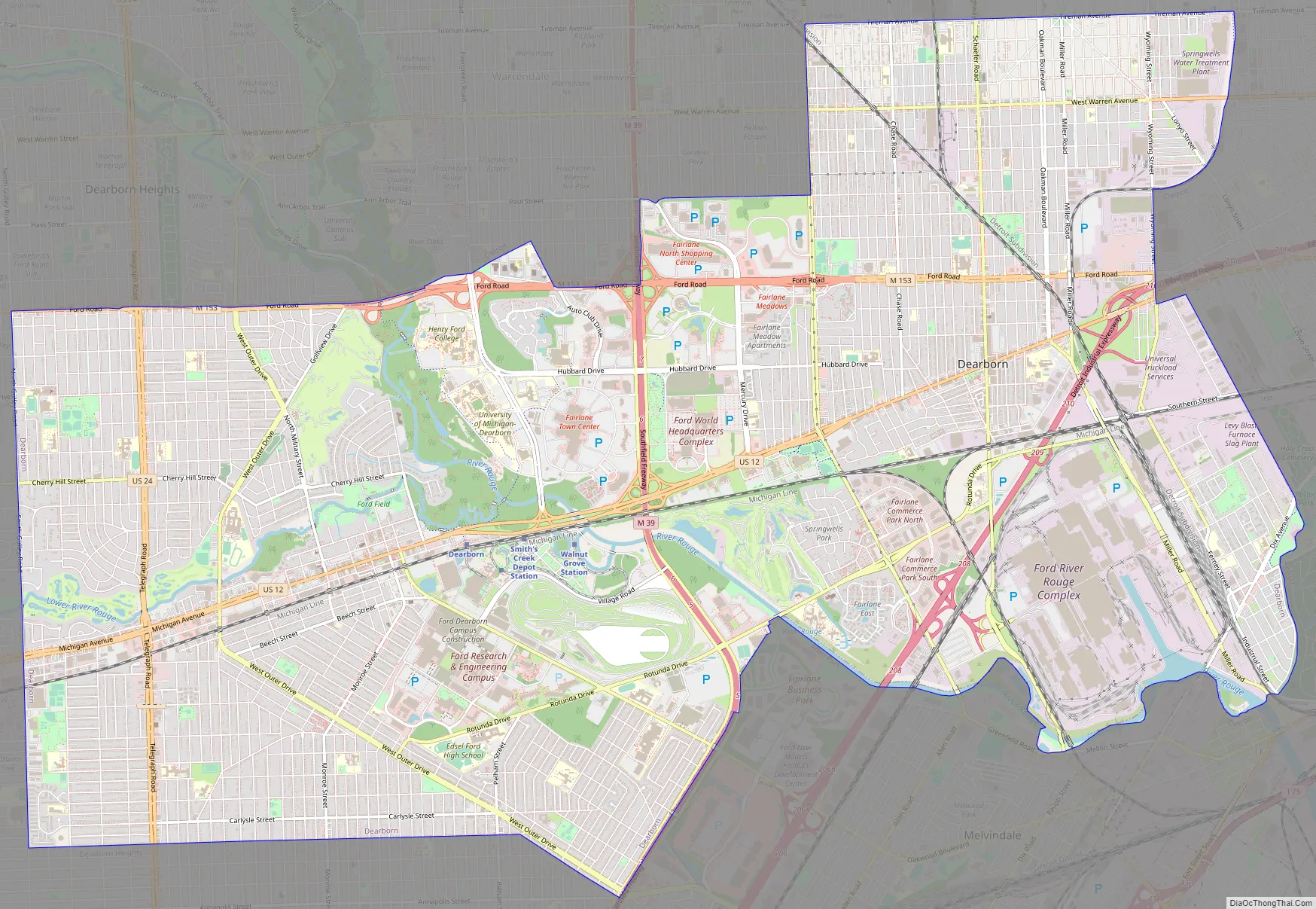
Dearborn Road Map
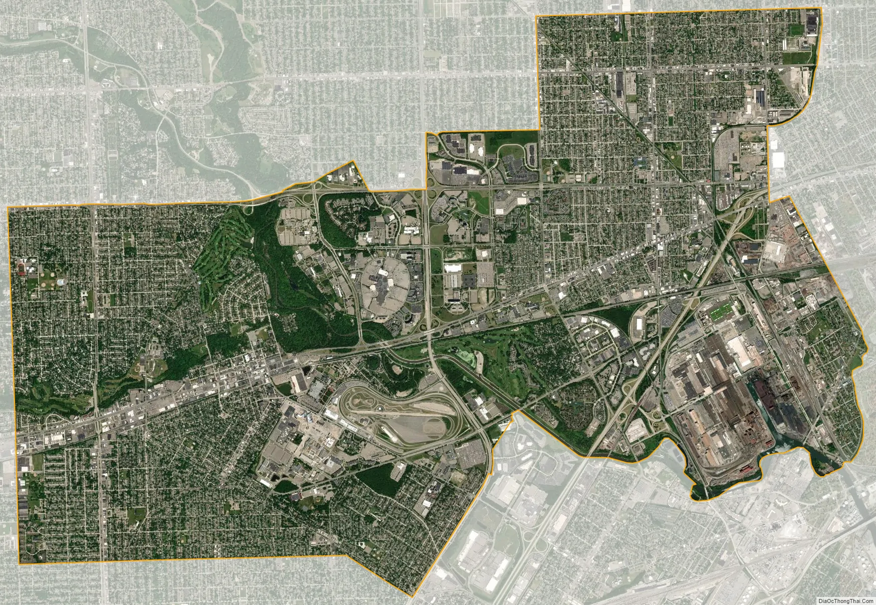
Dearborn city Satellite Map
Geography
According to the United States Census Bureau, the city has a total area of 24.5 square miles (63 km), of which 24.4 square miles (63 km) is land and 0.1 square miles (0.26 km) (0.37%) is water. The city developed on both sides of the Rouge River. An artificial waterfall/low head dam was constructed by Henry Ford on his estate to power its powerhouse. The Upper, Middle, and Lower Branches of the river come together in Dearborn. The river is widened and channeled near the Rouge Plant to allow lake freighter access.
Fordson Island (42°17′38″N 83°08′52″W / 42.29389°N 83.14778°W / 42.29389; -83.14778) is an 8.4 acres (3.4 hectares) island about three miles (5 km) upriver on the River Rouge from its confluence with the Detroit River. Fordson Island is the only major island in a tributary to the Detroit River. The island was created in 1922 when engineers dug a secondary trench to reroute the River Rouge to increase navigability for shipping purposes; businesses needed it to be navigable by the large lake freighters. The island is privately owned, and public access is prohibited. The island is part of the city of Dearborn, which has no frontage along the Detroit River.
Dearborn is among a small number of municipalities that own property in other cities. It owns the 626-acre (2.53 km) Camp Dearborn in Milford, Michigan, which is located 35 miles (56 km) from Dearborn. Dearborn was among an even smaller number of cities that hold property in another state: for a time the city owned the “Dearborn Towers” apartment complex in Clearwater, Florida, but this has been sold. Camp Dearborn is considered part of the city of Dearborn. Revenues generated by camp admissions are incorporated into the city’s budget.
See also
Map of Michigan State and its subdivision:- Alcona
- Alger
- Allegan
- Alpena
- Antrim
- Arenac
- Baraga
- Barry
- Bay
- Benzie
- Berrien
- Branch
- Calhoun
- Cass
- Charlevoix
- Cheboygan
- Chippewa
- Clare
- Clinton
- Crawford
- Delta
- Dickinson
- Eaton
- Emmet
- Genesee
- Gladwin
- Gogebic
- Grand Traverse
- Gratiot
- Hillsdale
- Houghton
- Huron
- Ingham
- Ionia
- Iosco
- Iron
- Isabella
- Jackson
- Kalamazoo
- Kalkaska
- Kent
- Keweenaw
- Lake
- Lake Hurron
- Lake Michigan
- Lake St. Clair
- Lake Superior
- Lapeer
- Leelanau
- Lenawee
- Livingston
- Luce
- Mackinac
- Macomb
- Manistee
- Marquette
- Mason
- Mecosta
- Menominee
- Midland
- Missaukee
- Monroe
- Montcalm
- Montmorency
- Muskegon
- Newaygo
- Oakland
- Oceana
- Ogemaw
- Ontonagon
- Osceola
- Oscoda
- Otsego
- Ottawa
- Presque Isle
- Roscommon
- Saginaw
- Saint Clair
- Saint Joseph
- Sanilac
- Schoolcraft
- Shiawassee
- Tuscola
- Van Buren
- Washtenaw
- Wayne
- Wexford
- Alabama
- Alaska
- Arizona
- Arkansas
- California
- Colorado
- Connecticut
- Delaware
- District of Columbia
- Florida
- Georgia
- Hawaii
- Idaho
- Illinois
- Indiana
- Iowa
- Kansas
- Kentucky
- Louisiana
- Maine
- Maryland
- Massachusetts
- Michigan
- Minnesota
- Mississippi
- Missouri
- Montana
- Nebraska
- Nevada
- New Hampshire
- New Jersey
- New Mexico
- New York
- North Carolina
- North Dakota
- Ohio
- Oklahoma
- Oregon
- Pennsylvania
- Rhode Island
- South Carolina
- South Dakota
- Tennessee
- Texas
- Utah
- Vermont
- Virginia
- Washington
- West Virginia
- Wisconsin
- Wyoming


