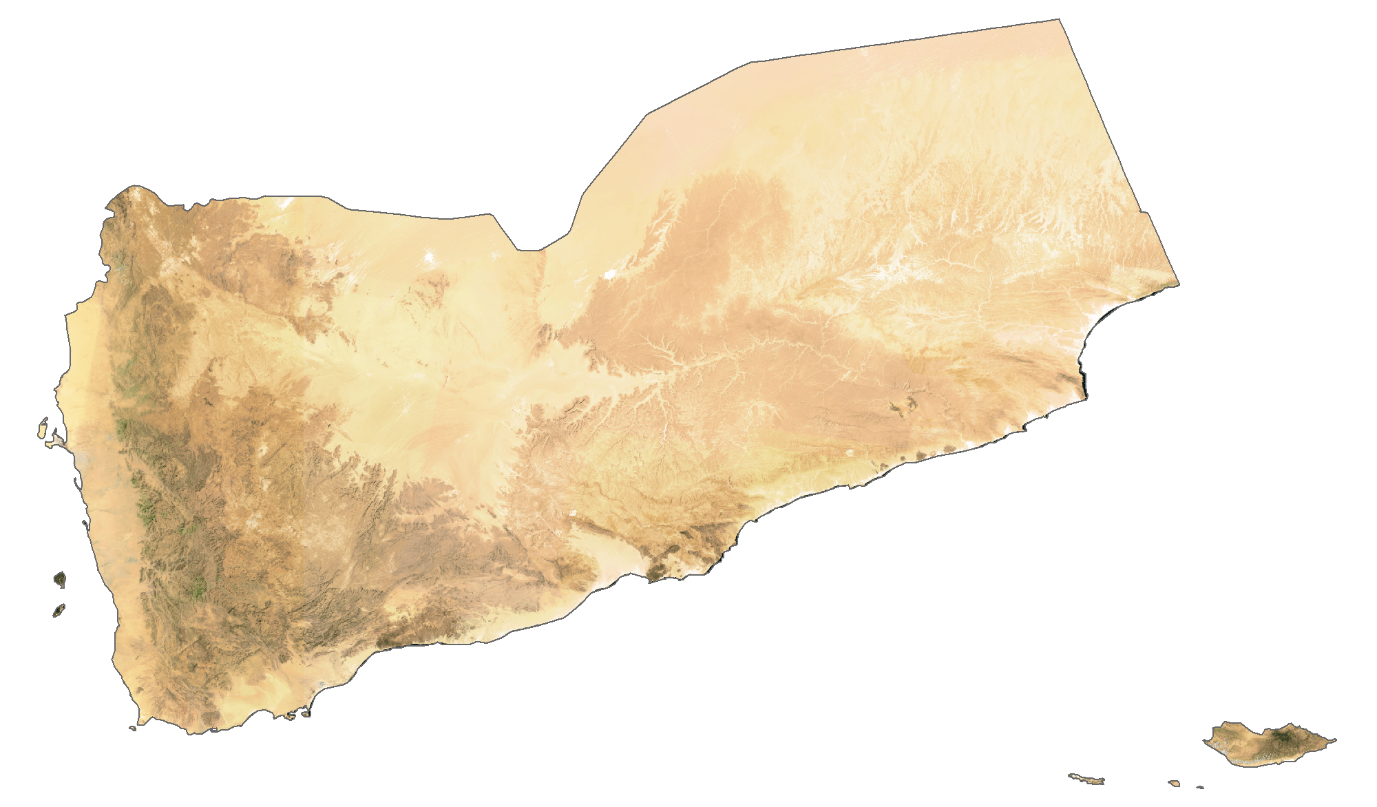
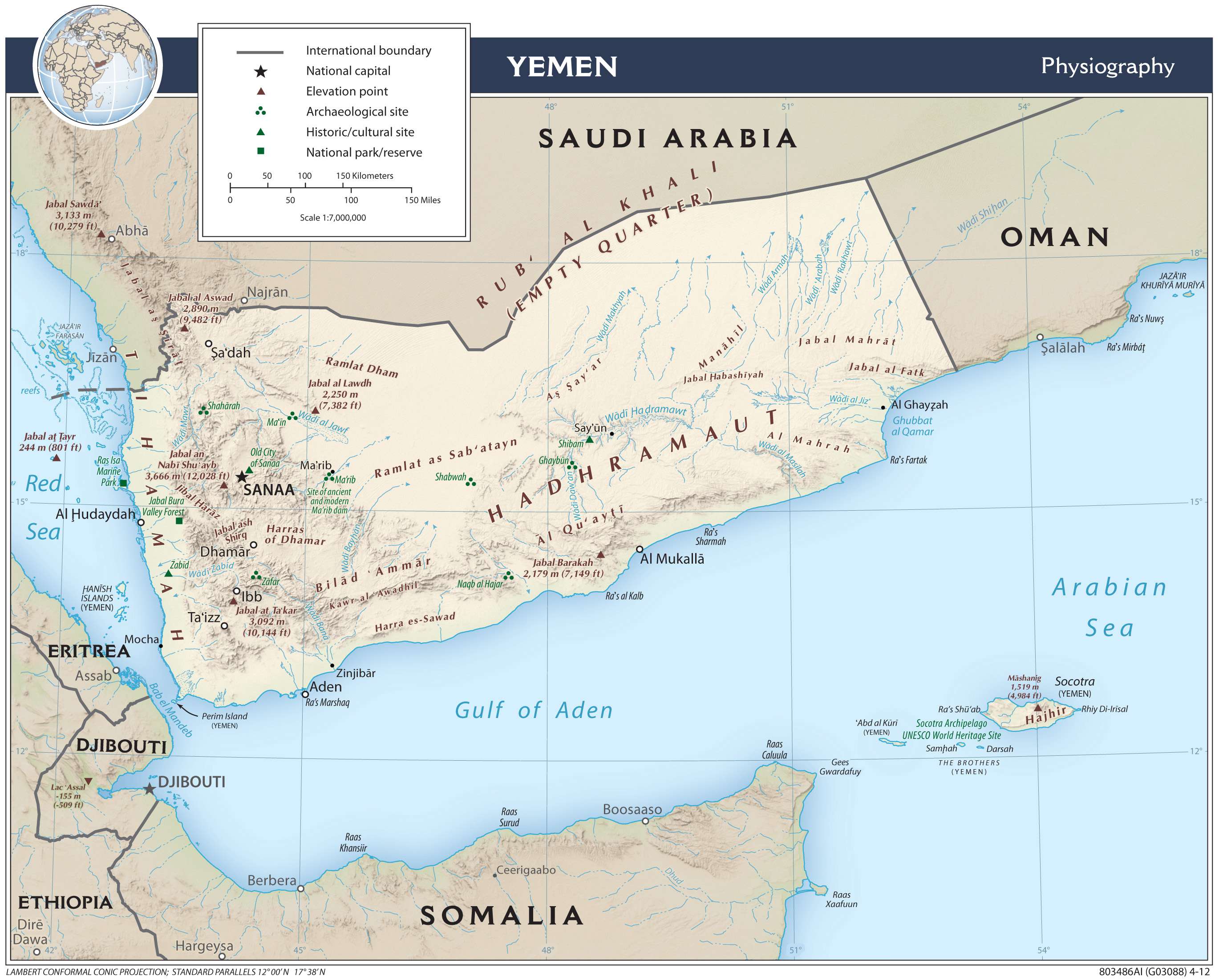
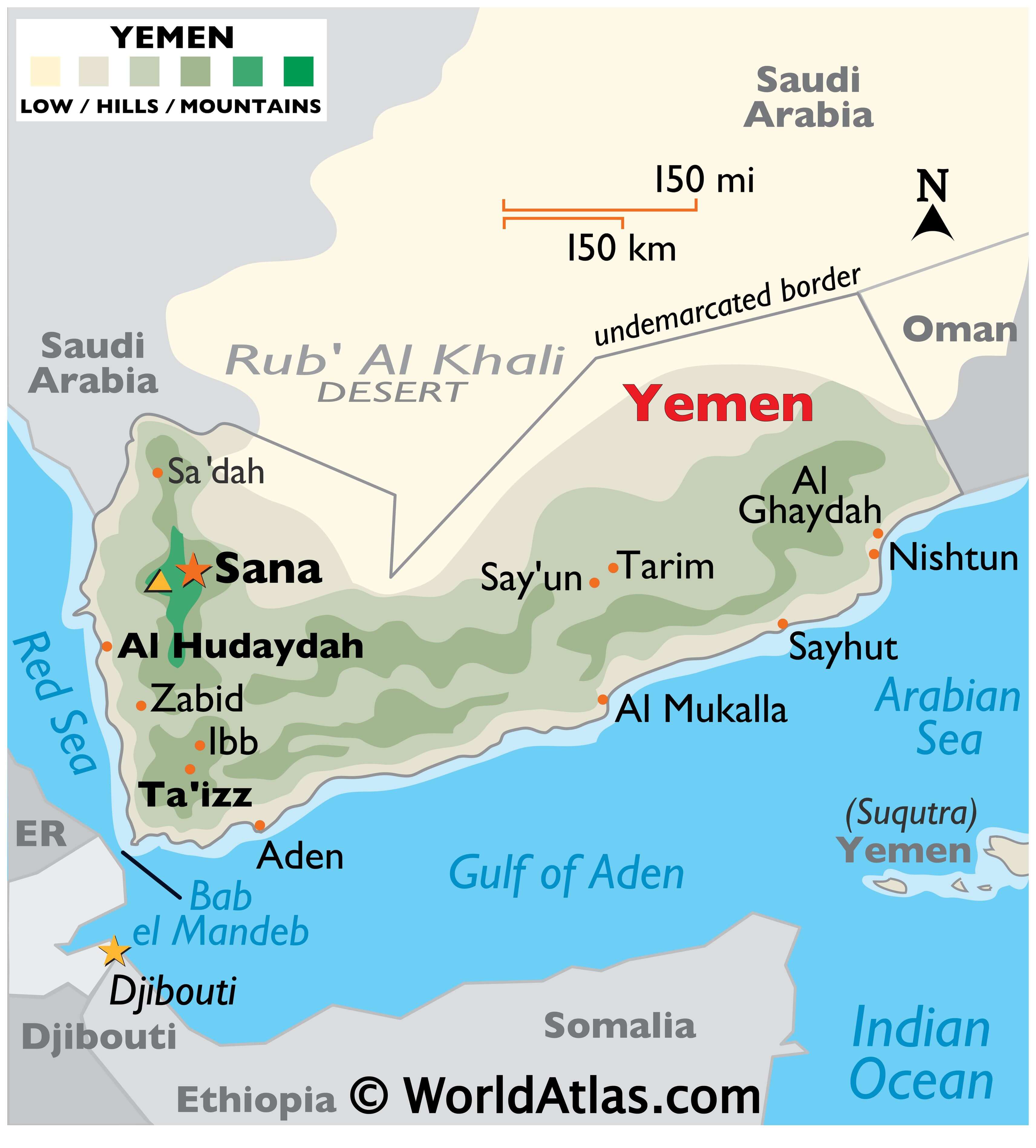
Yemen is a sovereign nation with an area of 527,970 sq. km. Mainland Yemen lies in the Arabian Peninsula of Asia. The country has an extensive coastline of around 2,000 km and over 200 islands. As observed on the physical map of Yemen above, the Socotra Islands are also a part of the country.
Yemen has some of the most fertile lands in the entire Middle East, and yet, for the most part, they’re not developed to their full potential. Along its Red Sea coast, there’s a flat sandy plain that extends the length of the country. The Gulf of Aden coastline is covered by a narrow, rocky, and relatively flat plain, fronted by hills that rise into the rugged mountains, central and west.
To the north of those central mountains, the high desert slopes down through fertile plains into the interior of southern Saudi Arabia, and the endless sands of the Rub’ Al Khali Desert – the famous “Empty Quarter.”
Marked on the map by a yellow upright triangle, Yemen’s highest point is Jabal an Nabi Shu’ayb at 3,760 m.
There are no perennial lakes and rivers, however, in the northern highlands, some river valleys (wadis) and small streams exist (fall and winter) but fade away quickly in the summer heat.
| Flag: |  |
|---|---|
| Legal Name: | Republic of Yemen |
| Capital Value: | Sanaa |
| Official languages: | Arabic |
| Demonym(s): | Yemeni Yemenite |
| Government: | Unitary provisional republic |
| Legislature: | Parliament |
| Total Area: | 527,968 km² |
| Land Area: | 527,968 km² |
| Population: | 29,161,922 |
| Density: | 44.7/km (115.8/sq mi) (160th) |
| GDP: | $27.59 Billion |
| GDP Per Capita: | $968.16 |
| Currency Value: | Yemeni rials (YER) |
| Driving side: | right |
| Calling code: | +967 |
| Internet TLD: | .ye, اليمن. |
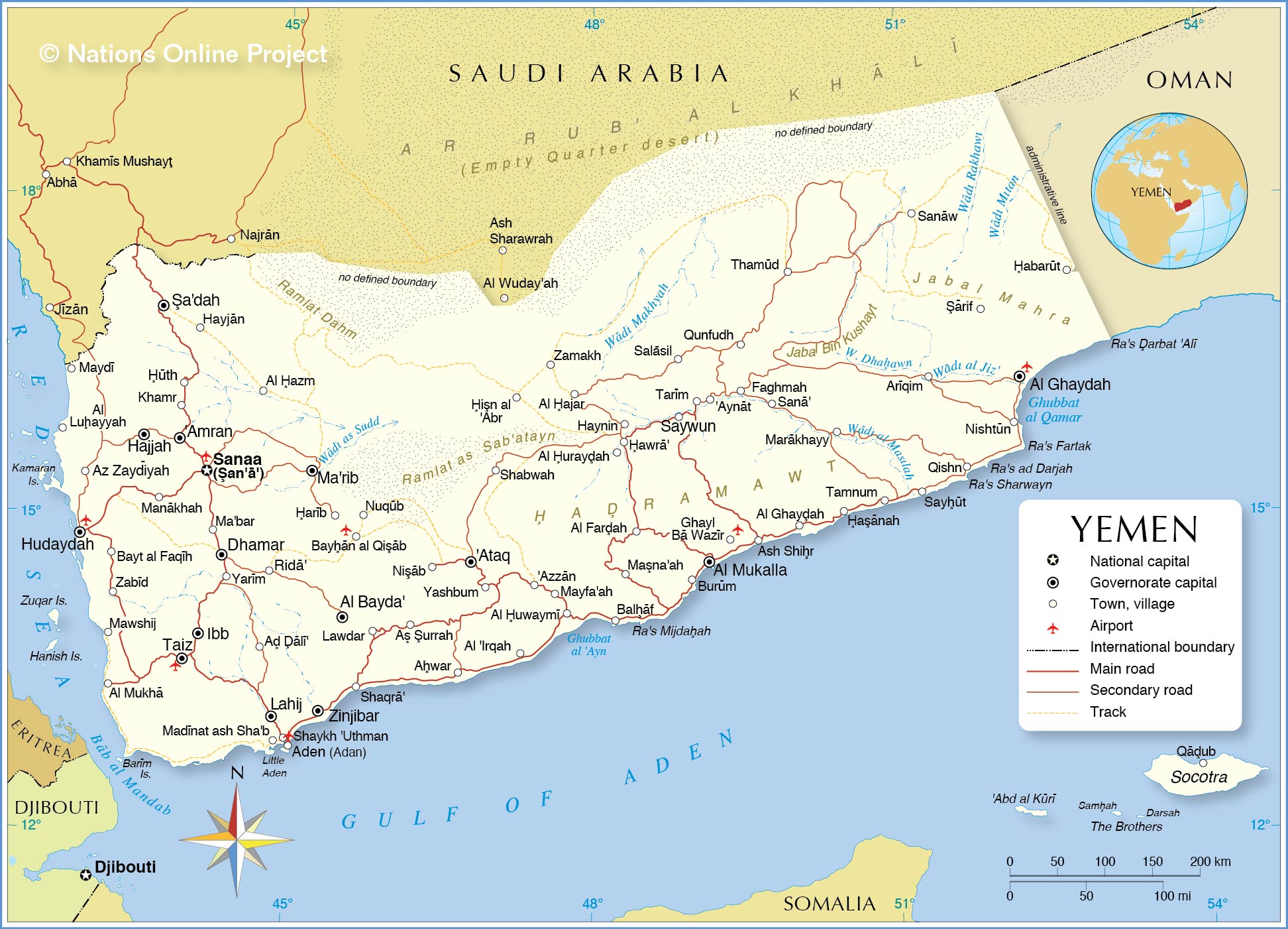
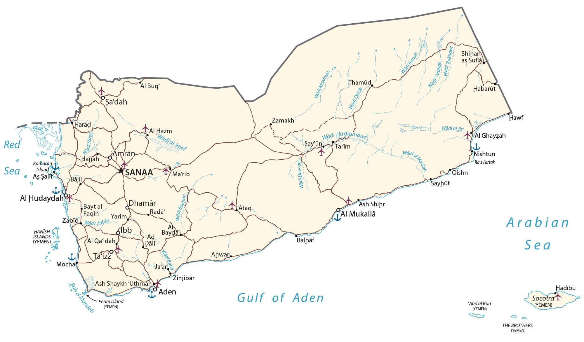
Explore Yemen with this Detailed Map
Discover the beauty of Yemen with this detailed map. This map of Yemen includes cities, towns, highways, roads, lakes, and rivers. It is a great resource for planning a trip to Yemen or gaining a better understanding of the geography of the country. This Yemen map collection includes a physical map, satellite imagery, and an administrative map of Yemen. So don’t wait, explore Yemen today!
Online Interactive Political Map
Click on ![]() to view map in "full screen" mode.
to view map in "full screen" mode.
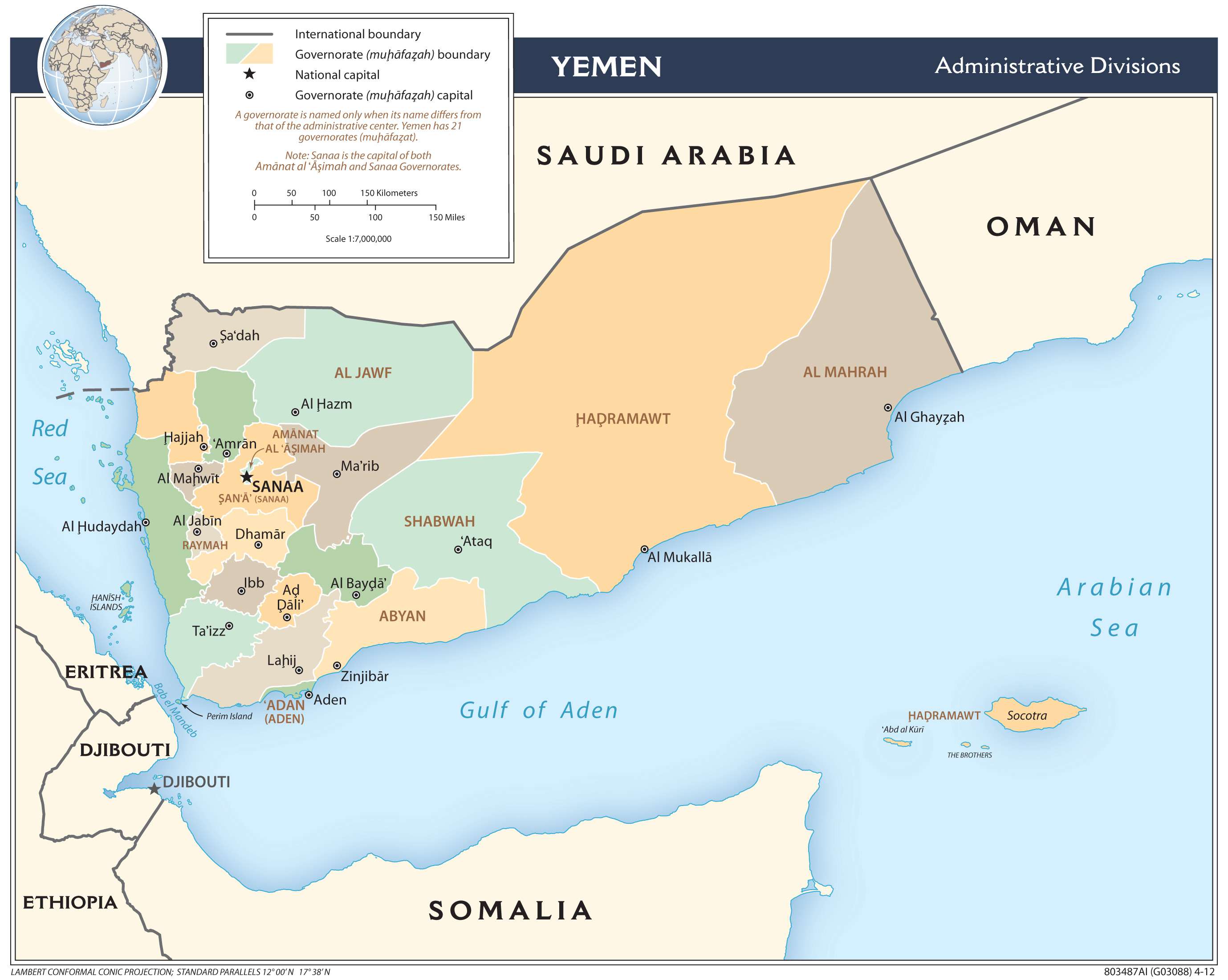
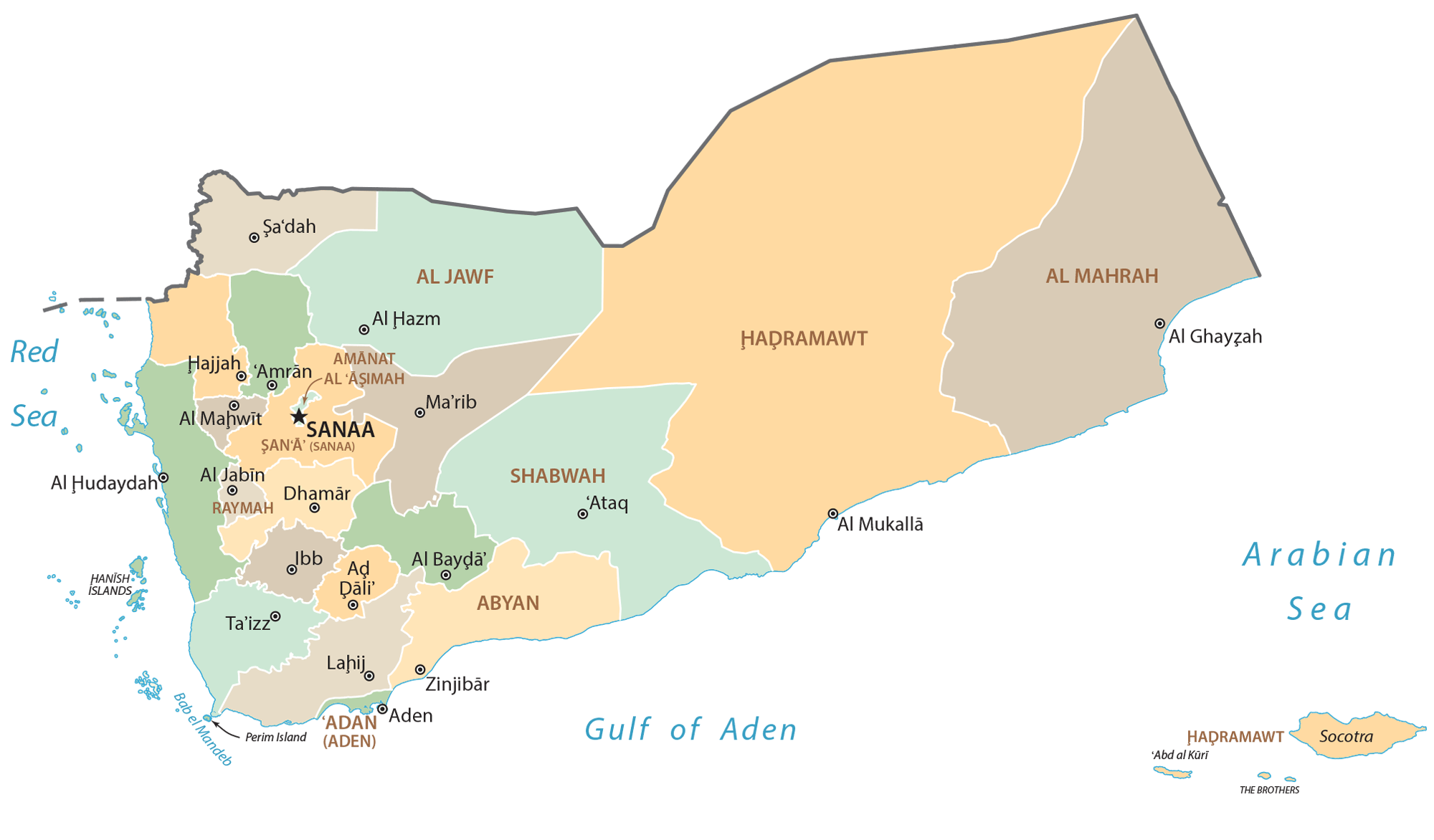
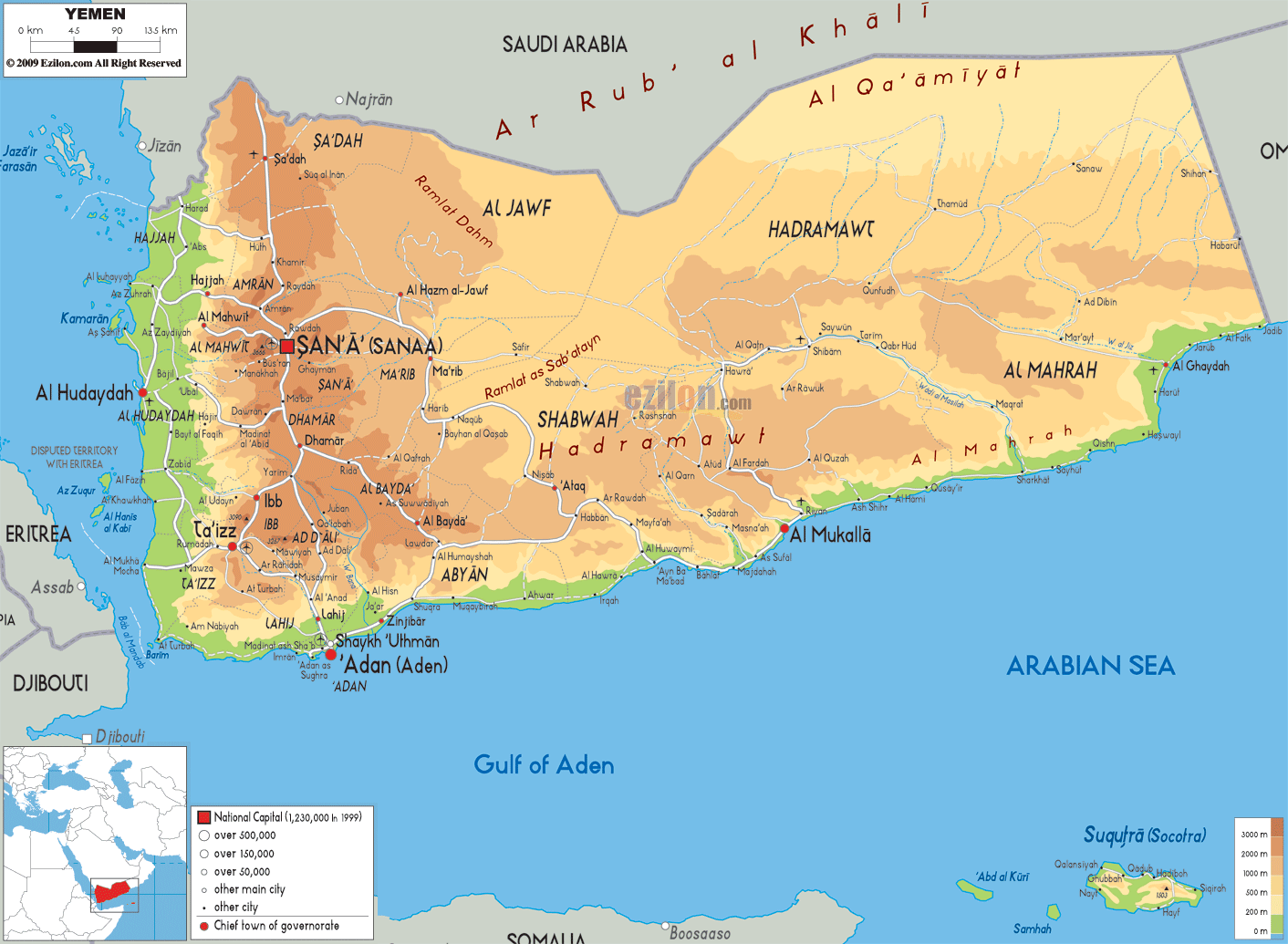
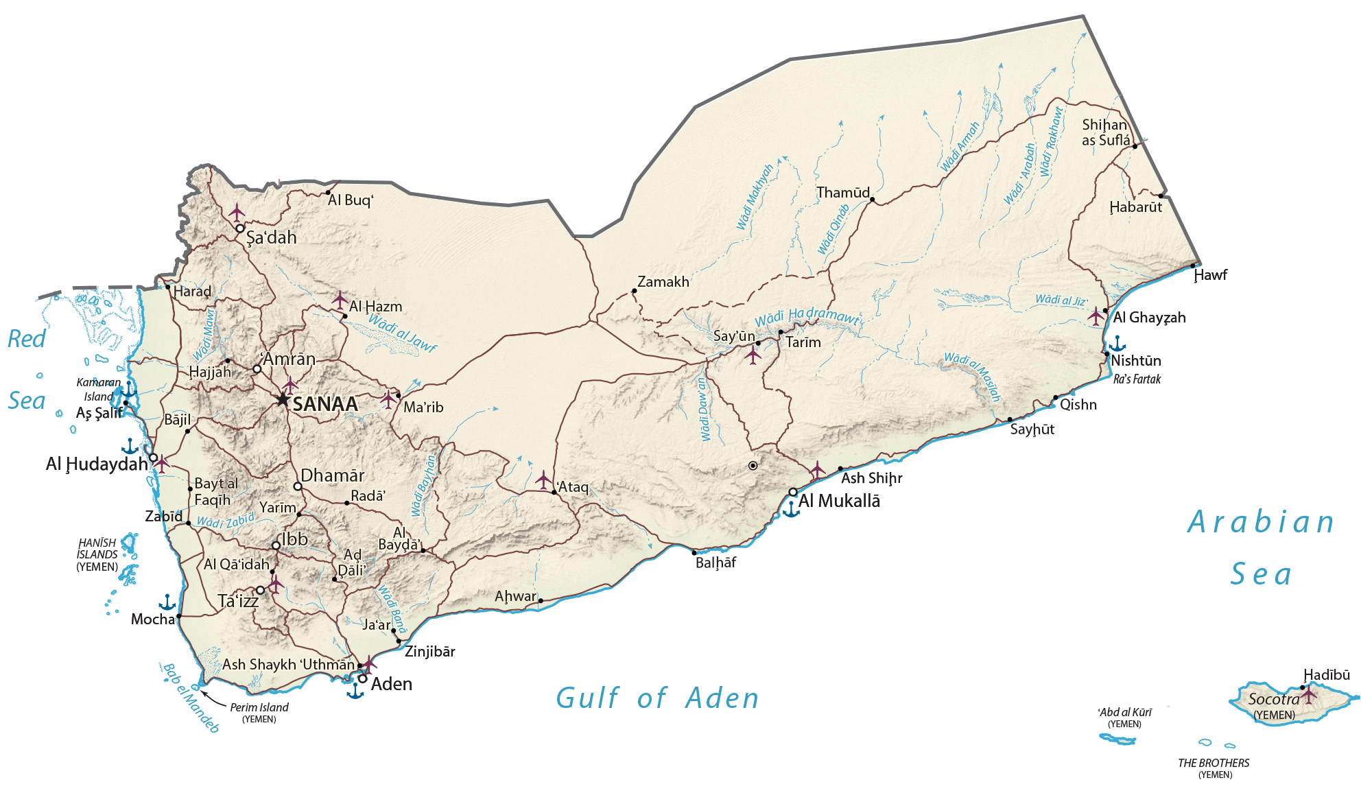
Yemen (officially the Republic of Yemen) is divided into two main administrative divisions. They are known as Governorates (Arabic: muhafazat, singular – muhafazah) and Districts (Arabic: muderiah). Governorates constitute the highest administrative division in Yemen. There are 22 governorates including the capital city – Amanat al Άsmiah (Sanaa City) and Arkhabil Suqutra (Socotra Archipelago).
In alphabetical order, the 22 governorates are – Άdan (Aden), Άmran, Abyan, Ad Dali´, Al Bayda, Al Hudaydah, Al Jawf, Al Mahrah, Al Mahwit, Amanat al Άsmiah (Sanaa City), Arkhabil Suqutra (Socotra Archipelago), Dhamar, Hadramawt, Hajjah, Ibb, Lahij, Ma´rib, Raymah, Sa´dah, San´a (Sanaa), Shabwah, and Ta´izz.
The 22 governorates are further subdivided into 333 districts and smaller subdivisions including 2,210 sub-districts and 38,284 villages.
Sana´a is the largest city in Yemen and the capital of the country.
Location Maps
Where is Yemen?
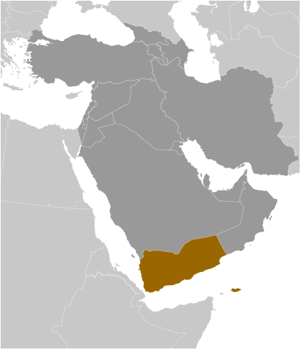
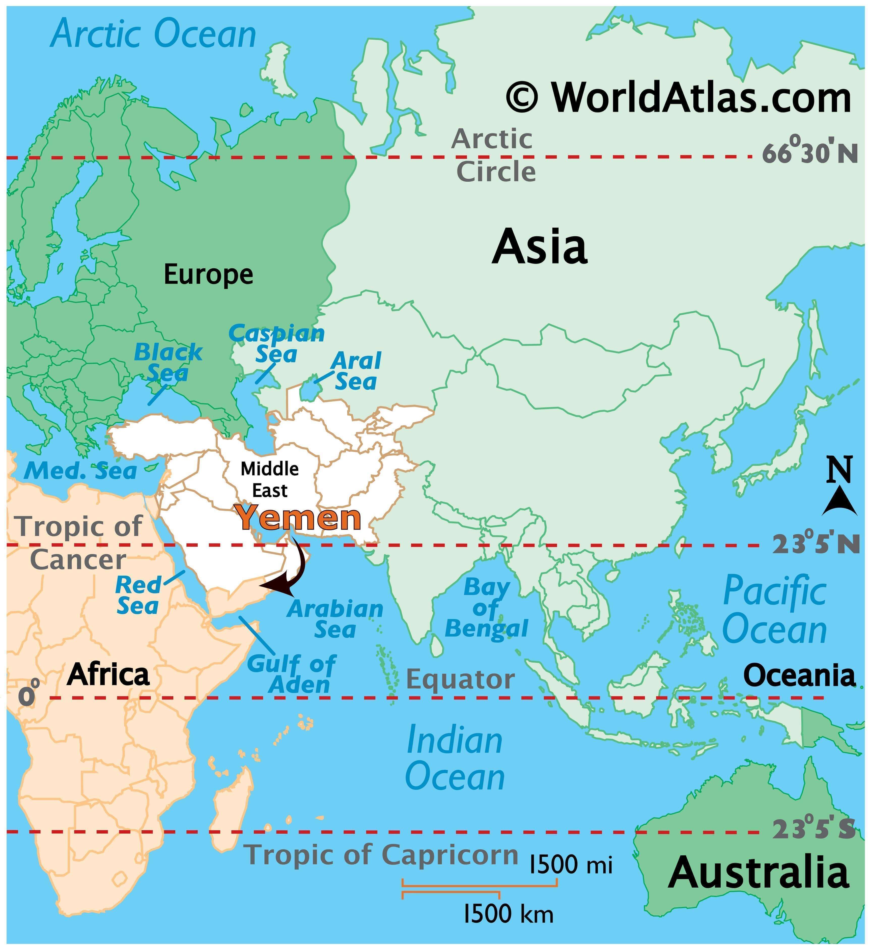
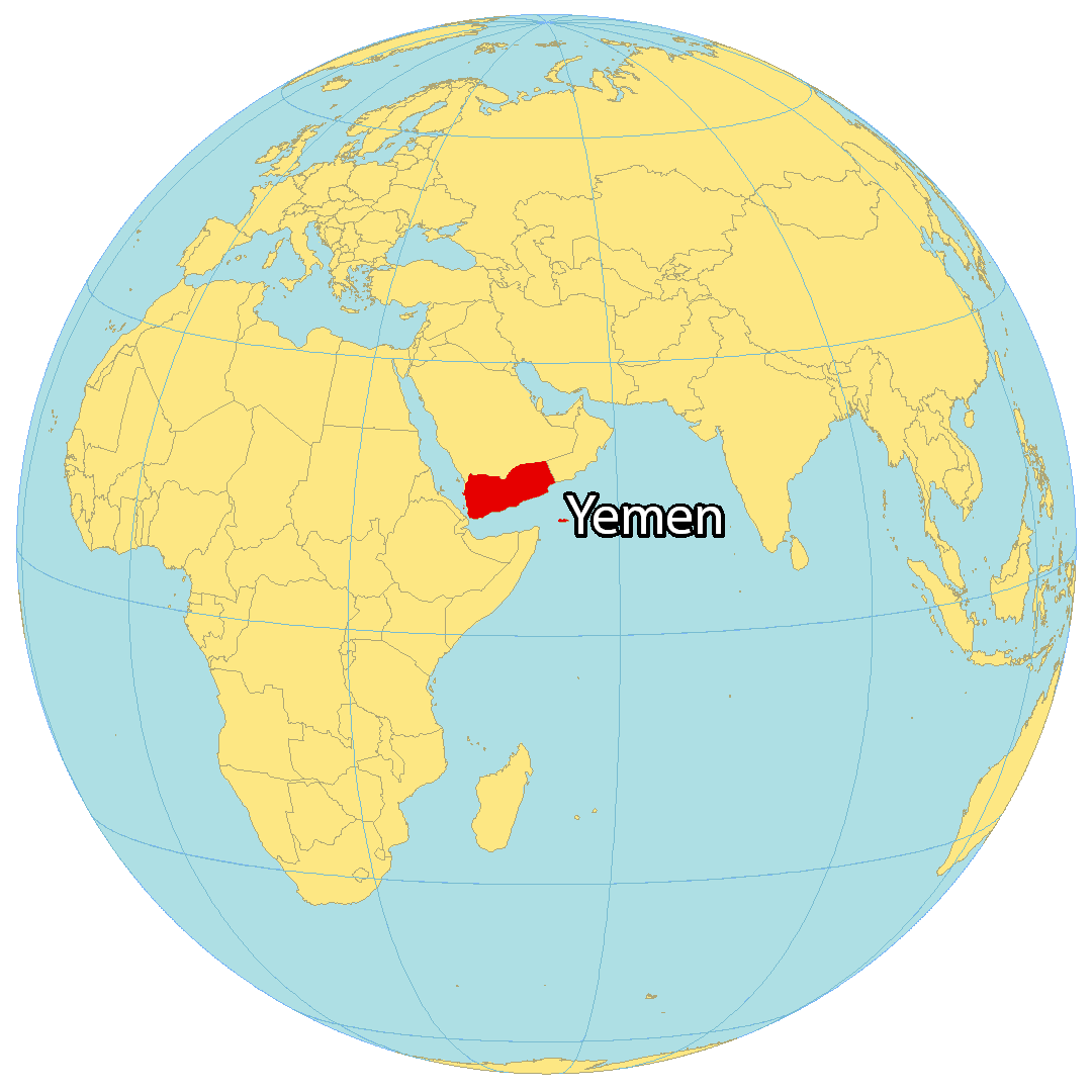
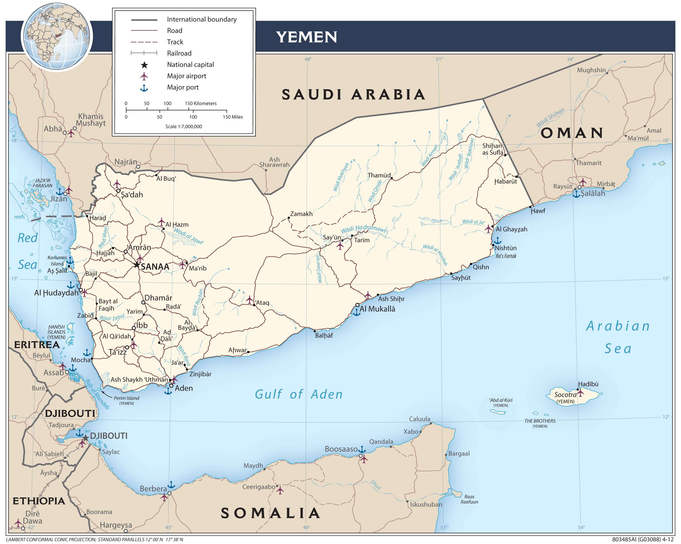
Yemen is located in the Middle East, along the Gulf of Aden to the south and the Red Sea to the west. It borders just 2 countries, Oman to the east and Saudi Arabia to the north. Yemen is known for its ancient kingdoms, large desert, and being the origin of coffee.
Sanaa is the capital and largest city of Yemen. But since 2015, Aden has been the temporary capital and is one of the world’s oldest continuously inhabited cities. Other major cities in Yemen include Al Hudaydah, Ta’izz, and Mukalla.
High Definition Political Map of Yemen
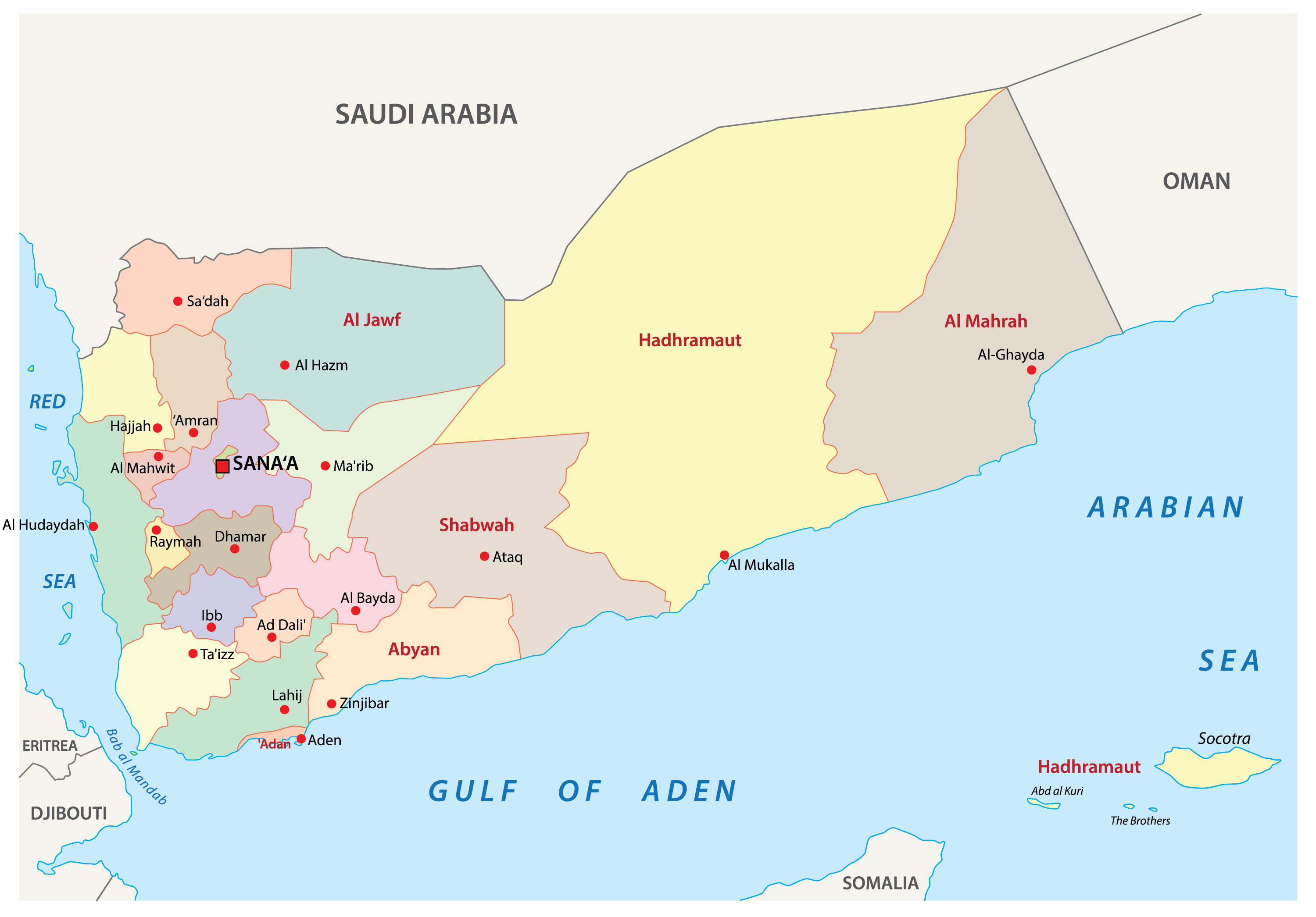
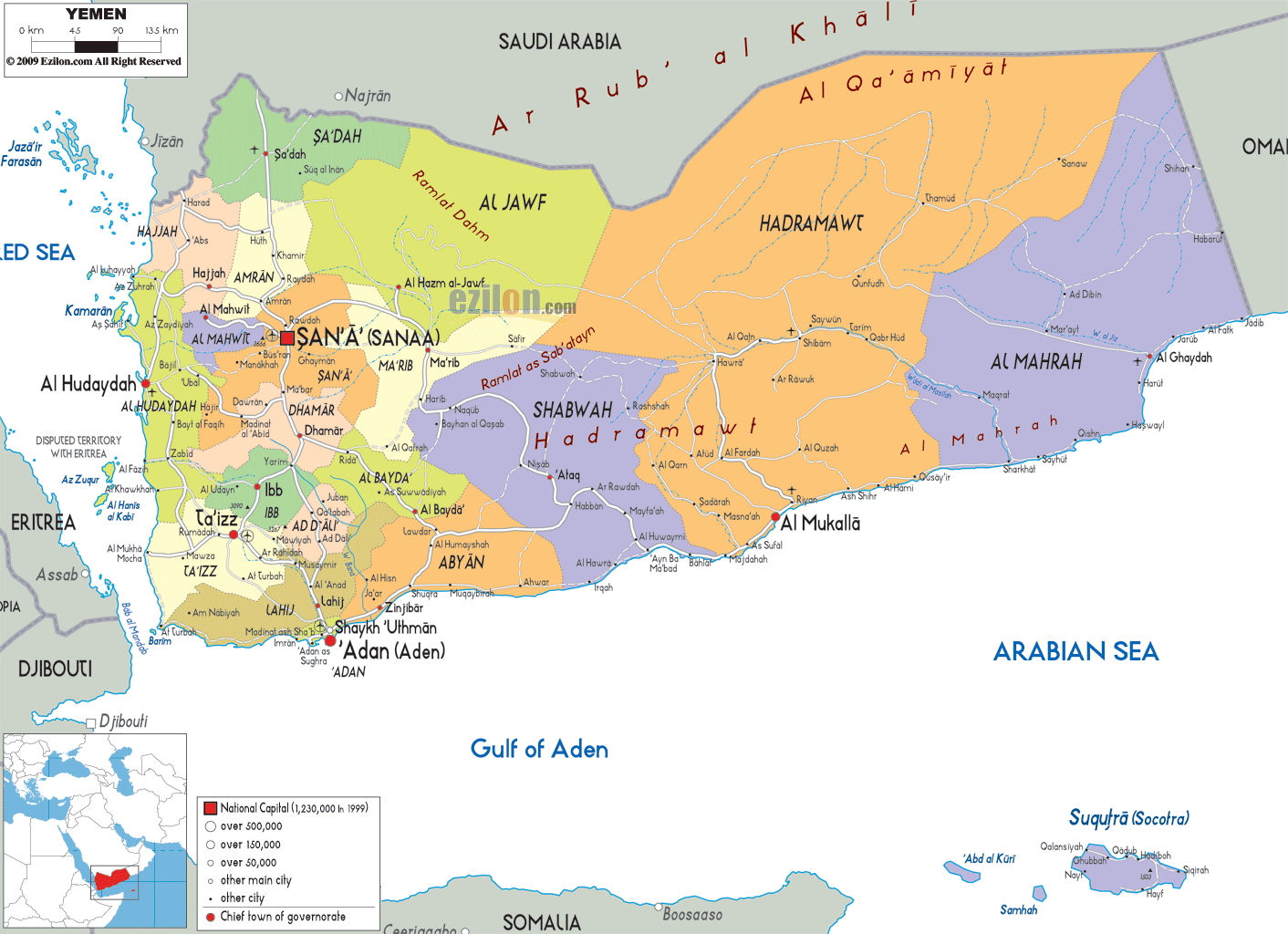
Yemen Administrative Map
Physical Map of Yemen
Transportation Map of Yemen
Yemen Satellite Map