Franklin is a city in Howard County, Missouri, United States. It is located along the Missouri River in the central part of the state. Located in a rural area, the city had a population of 70 at the 2020 census. It is part of the Columbia, Missouri Metropolitan Statistical Area.
As the eastern terminus of the Santa Fe Trail, the community played a major role in the westward expansion of the United States.
| Name: | Franklin city |
|---|---|
| LSAD Code: | 25 |
| LSAD Description: | city (suffix) |
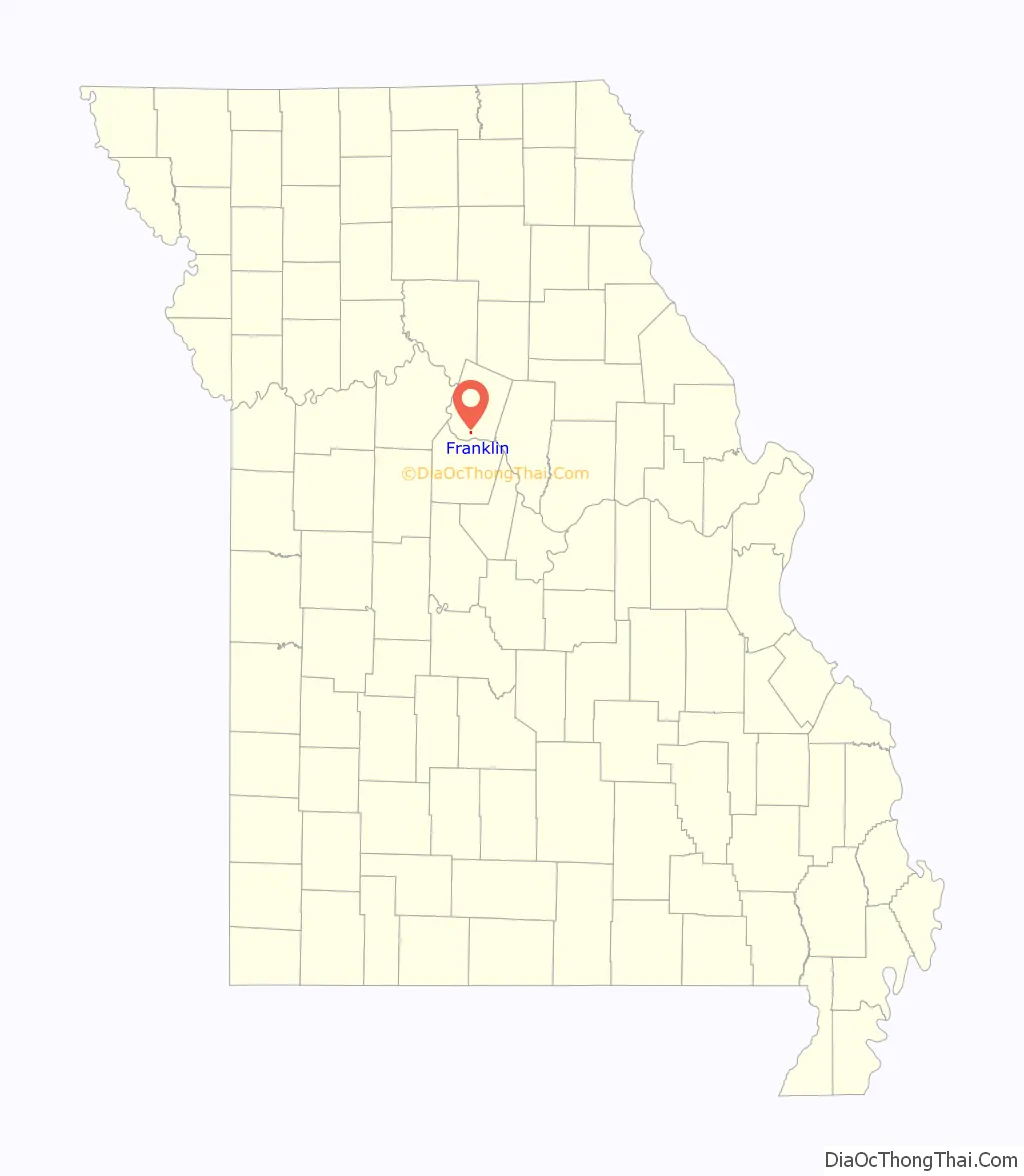
| State: | Missouri |
| County: | Howard County |
| Elevation: | 597 ft (182 m) |
| Total Area: | 0.23 sq mi (0.61 km²) |
| Land Area: | 0.23 sq mi (0.60 km²) |
| Water Area: | 0.00 sq mi (0.01 km²) |
| Total Population: | 70 |
| Population Density: | 303.03/sq mi (117.01/km²) |
| ZIP code: | 65250 |
| Area code: | 660 |
| FIPS code: | 2925624 |
| GNISfeature ID: | 0718163 |
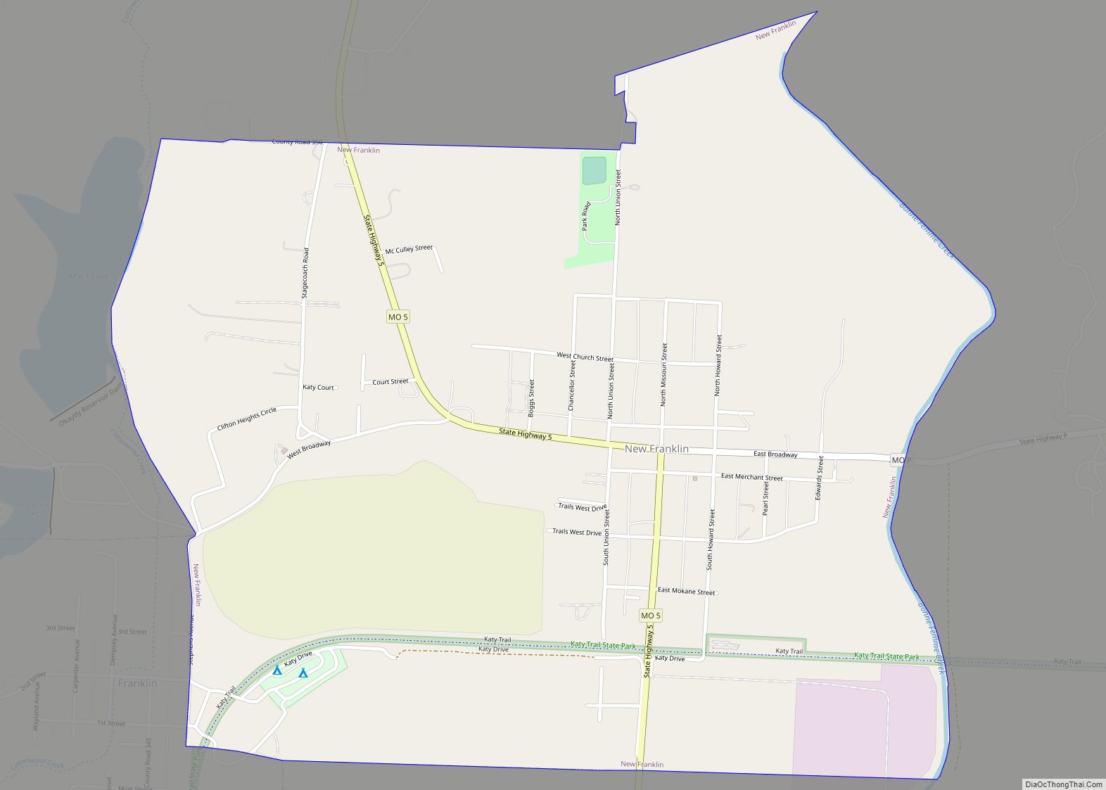
Online Interactive Map
Click on ![]() to view map in "full screen" mode.
to view map in "full screen" mode.
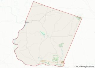
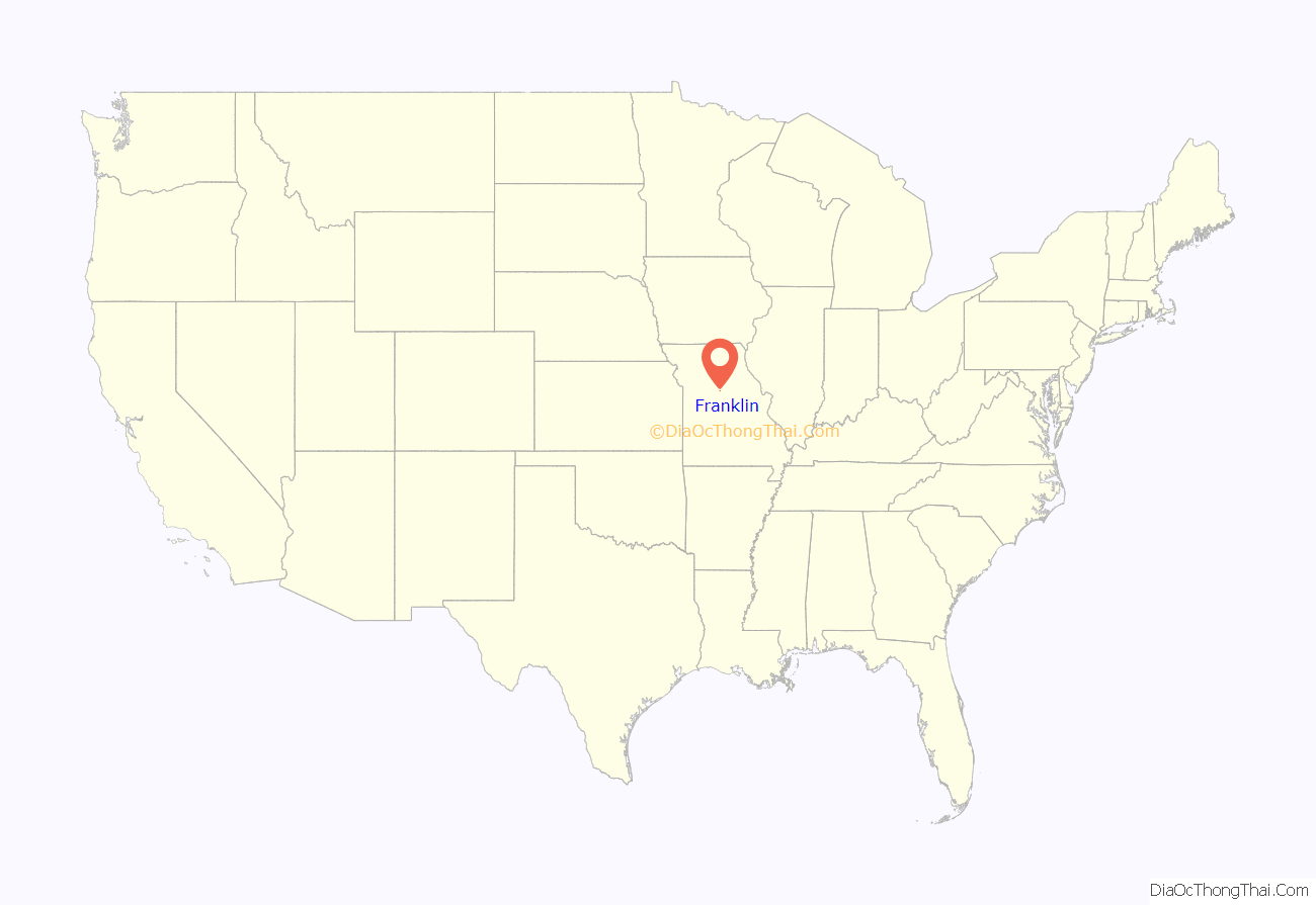
Franklin location map. Where is Franklin city?
History
The town of Franklin was founded by European Americans in 1816 and named for Founding Father Benjamin Franklin of the United States. William Becknell, who is now known as the “Father of the Santa Fe Trail,” lived on a farm a few miles northwest of Franklin. There was a spring near Becknell’s property, Boone Lick Spring.
The spring had saline water and attracted people from St. Louis and points east, who came to distill the water for its salt. They came so often that they created a trail, calling it Boone’s Lick Road. “Boone” refers to Nathan and Daniel Morgan Boone, sons of explorer Daniel Boone. The brothers first operated the saltlick business.
In 1821, William Becknell put a notice in the Missouri Intelligencer, announcing that he was organizing a party to go “westward, for the purpose of trading for horses and mules and catching wild animals of every description.” On September 1, 1821, his party crossed the Missouri River at Arrow Rock and set out along what would become known in a few years as the Santa Fe Trail. There had long been trade along this way: years before the US acquired the Louisiana Purchase, the Chouteau family of St. Louis had been granted a fur trading monopoly with the Spanish at Santa Fe.
But the following year, Becknell searched for a path that would be wide enough for wagons and draft teams, to accommodate more trade. This improvement was integral to the growth of the Santa Fe Trail for use by both traders and the emigrants of the 1830s who moved on by various branches to the territories of the West: the future states of Oregon, California, and Washington.
In 1827, a devastating flood of the Missouri River destroyed much of Franklin. Residents rebuilt a short distance away on higher ground, creating New Franklin, Missouri.
The Cedar Grove was listed on the National Register of Historic Places in 1982.
Kit Carson
Born in Madison County, Kentucky, near the city of Richmond, Kit Carson migrated as a boy with his family to Franklin, where he was raised. Lindsey Carson was a farmer of Scots-Irish descent, who had fought in the Revolutionary War under General Wade Hampton. He had a total of fifteen surviving children: five by his first wife, and ten by Rebecca Robinson, his second wife and Kit’s mother. The Carson family settled on a tract of land owned by the sons of Daniel Boone, who had purchased the land from the Spanish during their brief period of rule here after the Seven Years’ War. This was prior to the United States annexing the territory following its Louisiana Purchase of 1803 from France.
Carson was eight when his father was killed by a falling tree while clearing land. The father’s death reduced the Carson family to a desperate poverty. Young Kit dropped out of school to work on the family farm, and to assist in hunting. At the age of 14, Kit was apprenticed to a saddlemaker (Workman’s Saddleshop) in Franklin. The town was considered the eastern terminus of the Santa Fe Trail, which had opened two years earlier. Many of the customers at the saddleshop were trappers and traders, from whom Kit would hear stirring tales of the Far West. Carson is reported to have found working in the saddle shop to be suffocating: he once said “the business did not suit me, and I concluded to leave”. Around 1826, aged 16, Kit secretly signed on with a large, merchant, Santa Fe-bound caravan in Franklin purportedly wagon mastered by Stephen Turley and Jesse B. Turley, friends from nearby Lamine.
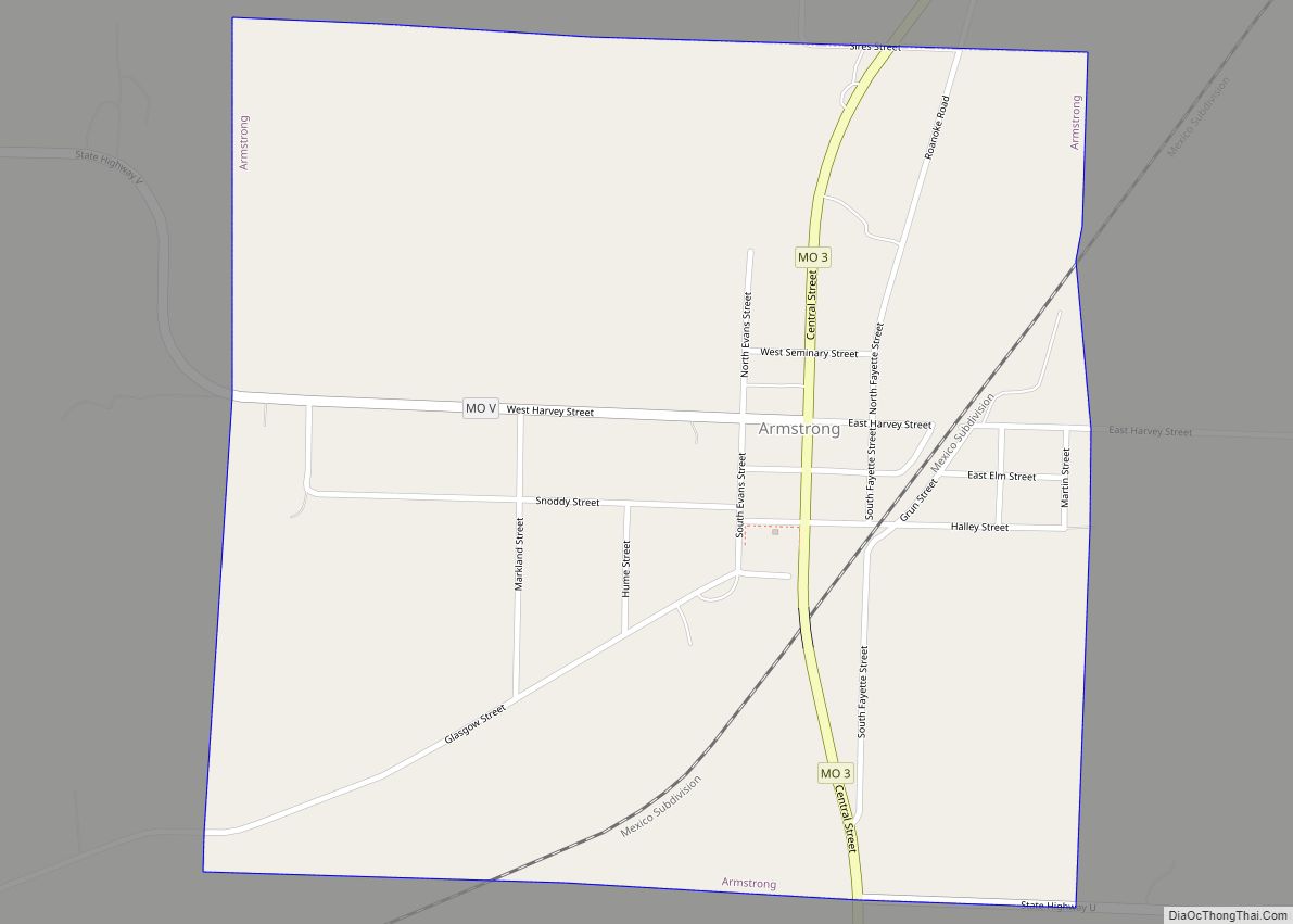
Franklin Road Map
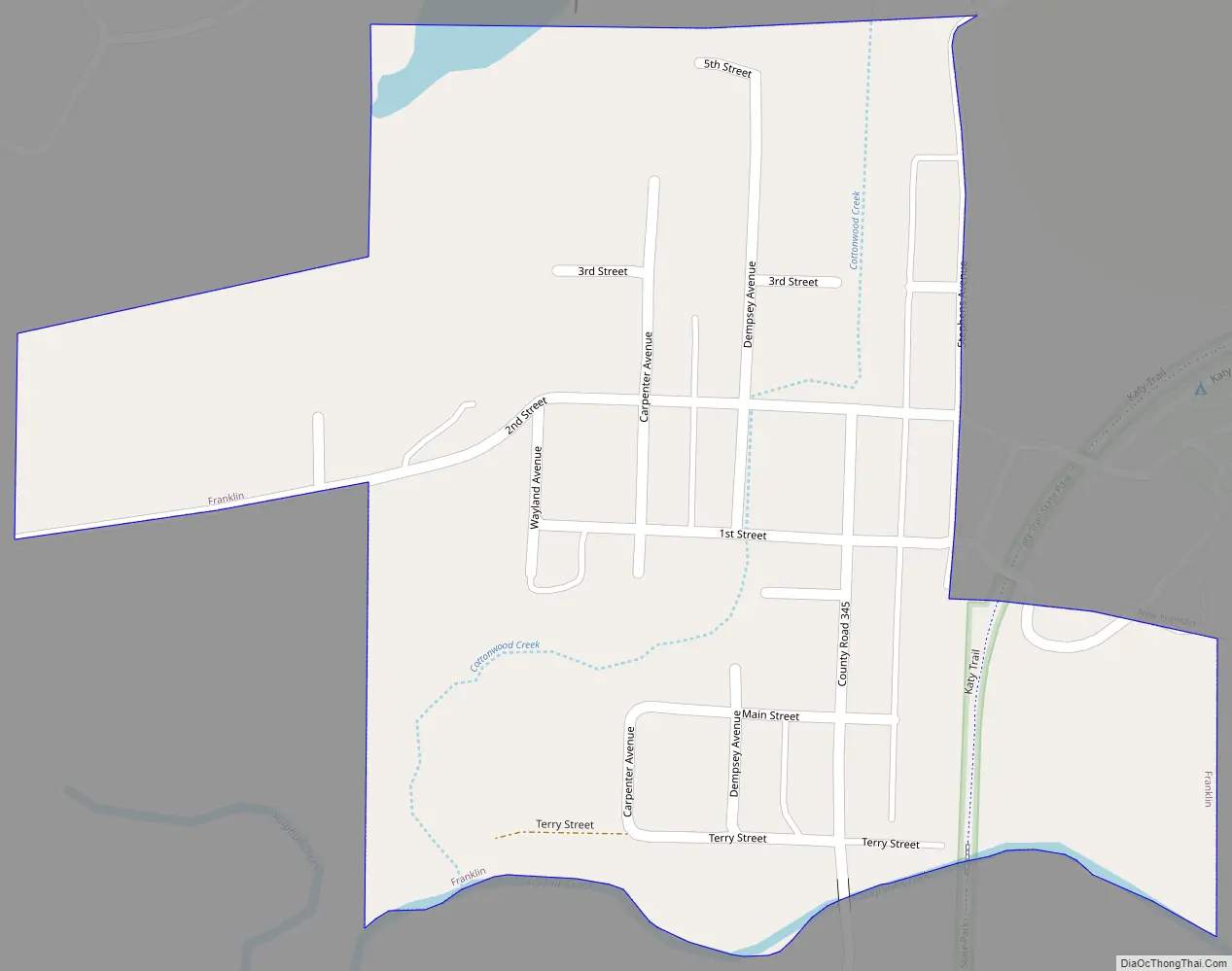
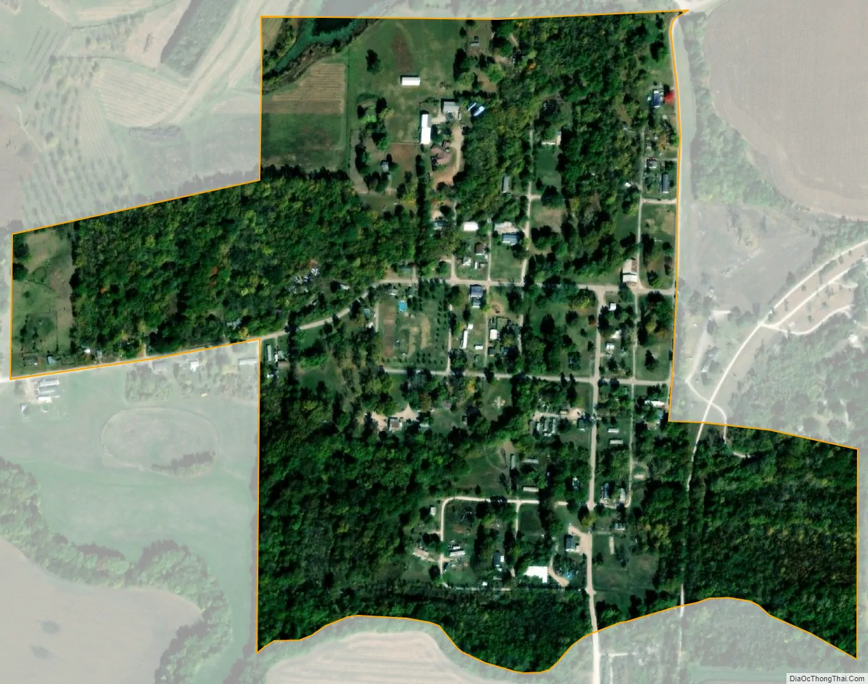
Franklin city Satellite Map
Geography
Franklin is located at 39°0′41″N 92°45′13″W / 39.01139°N 92.75361°W / 39.01139; -92.75361 (39.011316, -92.753747). According to the United States Census Bureau, the city has a total area of 0.23 square miles (0.60 km), all land.
See also
Map of Missouri State and its subdivision:- Adair
- Andrew
- Atchison
- Audrain
- Barry
- Barton
- Bates
- Benton
- Bollinger
- Boone
- Buchanan
- Butler
- Caldwell
- Callaway
- Camden
- Cape Girardeau
- Carroll
- Carter
- Cass
- Cedar
- Chariton
- Christian
- Clark
- Clay
- Clinton
- Cole
- Cooper
- Crawford
- Dade
- Dallas
- Daviess
- De Kalb
- Dent
- Douglas
- Dunklin
- Franklin
- Gasconade
- Gentry
- Greene
- Grundy
- Harrison
- Henry
- Hickory
- Holt
- Howard
- Howell
- Iron
- Jackson
- Jasper
- Jefferson
- Johnson
- Knox
- Laclede
- Lafayette
- Lawrence
- Lewis
- Lincoln
- Linn
- Livingston
- Macon
- Madison
- Maries
- Marion
- McDonald
- Mercer
- Miller
- Mississippi
- Moniteau
- Monroe
- Montgomery
- Morgan
- New Madrid
- Newton
- Nodaway
- Oregon
- Osage
- Ozark
- Pemiscot
- Perry
- Pettis
- Phelps
- Pike
- Platte
- Polk
- Pulaski
- Putnam
- Ralls
- Randolph
- Ray
- Reynolds
- Ripley
- Saint Charles
- Saint Clair
- Saint Francois
- Saint Louis
- Sainte Genevieve
- Saline
- Schuyler
- Scotland
- Scott
- Shannon
- Shelby
- Stoddard
- Stone
- Sullivan
- Taney
- Texas
- Vernon
- Warren
- Washington
- Wayne
- Webster
- Worth
- Wright
- Alabama
- Alaska
- Arizona
- Arkansas
- California
- Colorado
- Connecticut
- Delaware
- District of Columbia
- Florida
- Georgia
- Hawaii
- Idaho
- Illinois
- Indiana
- Iowa
- Kansas
- Kentucky
- Louisiana
- Maine
- Maryland
- Massachusetts
- Michigan
- Minnesota
- Mississippi
- Missouri
- Montana
- Nebraska
- Nevada
- New Hampshire
- New Jersey
- New Mexico
- New York
- North Carolina
- North Dakota
- Ohio
- Oklahoma
- Oregon
- Pennsylvania
- Rhode Island
- South Carolina
- South Dakota
- Tennessee
- Texas
- Utah
- Vermont
- Virginia
- Washington
- West Virginia
- Wisconsin
- Wyoming