Glasgow is a city on the Missouri River mostly in northwest Howard County and extending into the southeast corner of Chariton County in the U.S. state of Missouri. The population was 1,087 at the 2020 census.
The Howard County portion of Glasgow is part of the Columbia, Missouri Metropolitan Statistical Area.
| Name: | Glasgow city |
|---|---|
| LSAD Code: | 25 |
| LSAD Description: | city (suffix) |
| State: | Missouri |
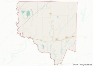
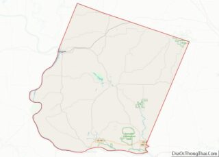
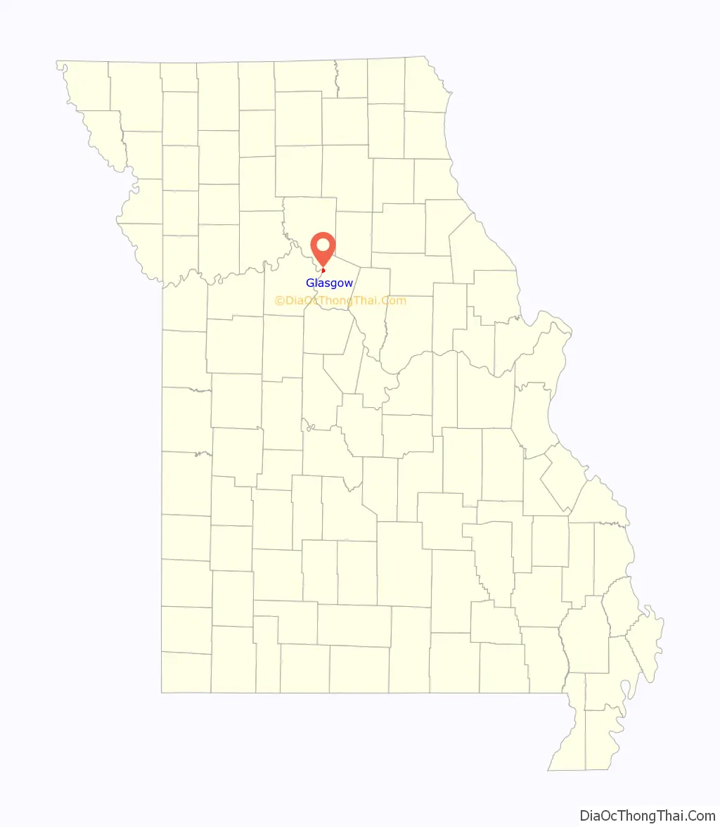
| County: | Chariton County, Howard County |
| Elevation: | 719 ft (219 m) |
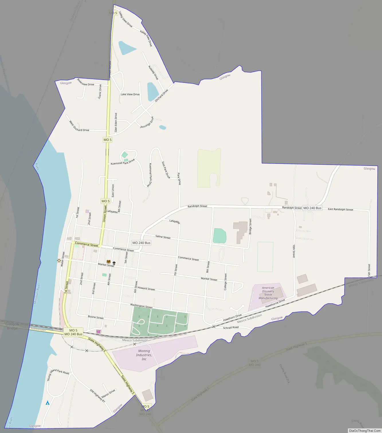
| Total Area: | 1.36 sq mi (3.53 km²) |
| Land Area: | 1.35 sq mi (3.49 km²) |
| Water Area: | 0.01 sq mi (0.04 km²) |
| Total Population: | 1,087 |
| Population Density: | 806.98/sq mi (311.69/km²) |
| ZIP code: | 65254 |
| Area code: | 660 |
| FIPS code: | 2927208 |
| GNISfeature ID: | 2394909 |
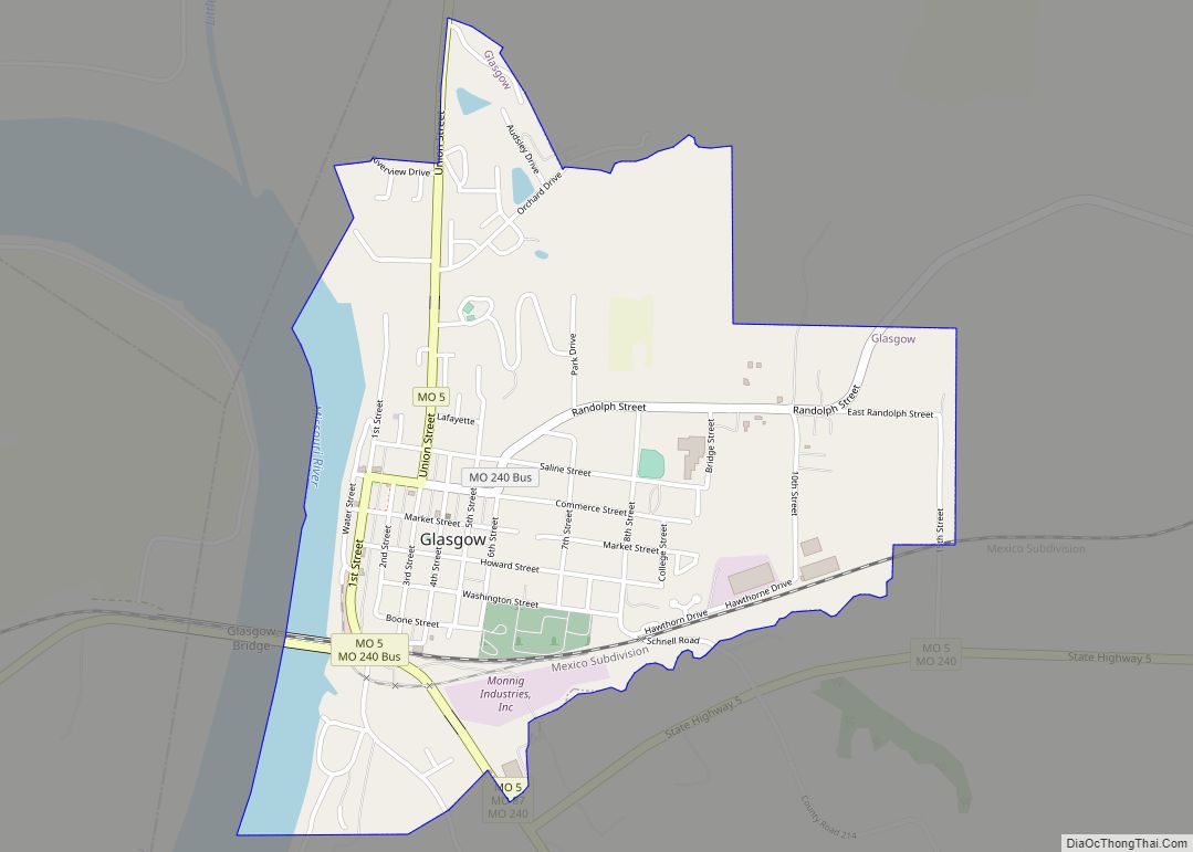
Online Interactive Map
Click on ![]() to view map in "full screen" mode.
to view map in "full screen" mode.
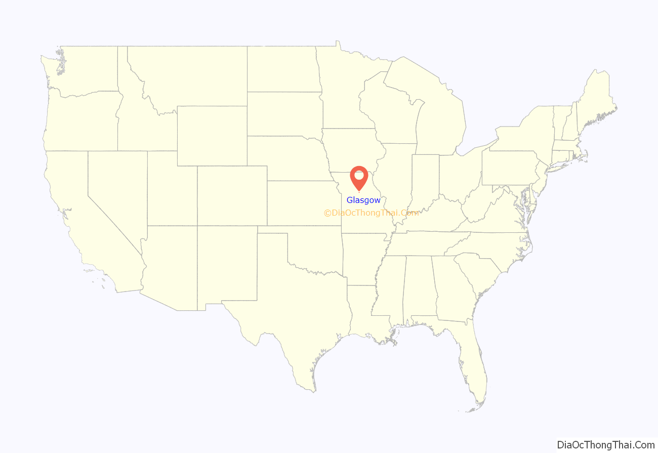
Glasgow location map. Where is Glasgow city?
History
Glasgow was laid out and platted in 1836, partially from land acquired from former Missouri State Treasurer James Earickson The city was named for James Glasgow, a local merchant. A post office called Glasgow has been in operation since 1837.
The Battle of Glasgow was fought on October 15, 1864, in and near Glasgow as part of Price’s Missouri Expedition during the American Civil War. Although the battle resulted in a Confederate victory and the capture of significant war material, it had little long-term benefit as Price was ultimately defeated at Westport a week later, bringing his campaign in Missouri to an end.
There is a historical record of extrajudicial violence. On January 20, 1891, an African American man, Olli Truxton, was killed by a white lynch mob in Glasgow. On August 3, 1891, an African American man, Harrison Mickey, was killed by a black lynch mob in Glasgow.
The Campbell Chapel African Methodist Episcopal Church, Glasgow Commercial Historic District, Glasgow Presbyterian Church, Glasgow Public Library, and Inglewood are listed on the National Register of Historic Places.
Glasgow Road Map
Glasgow city Satellite Map
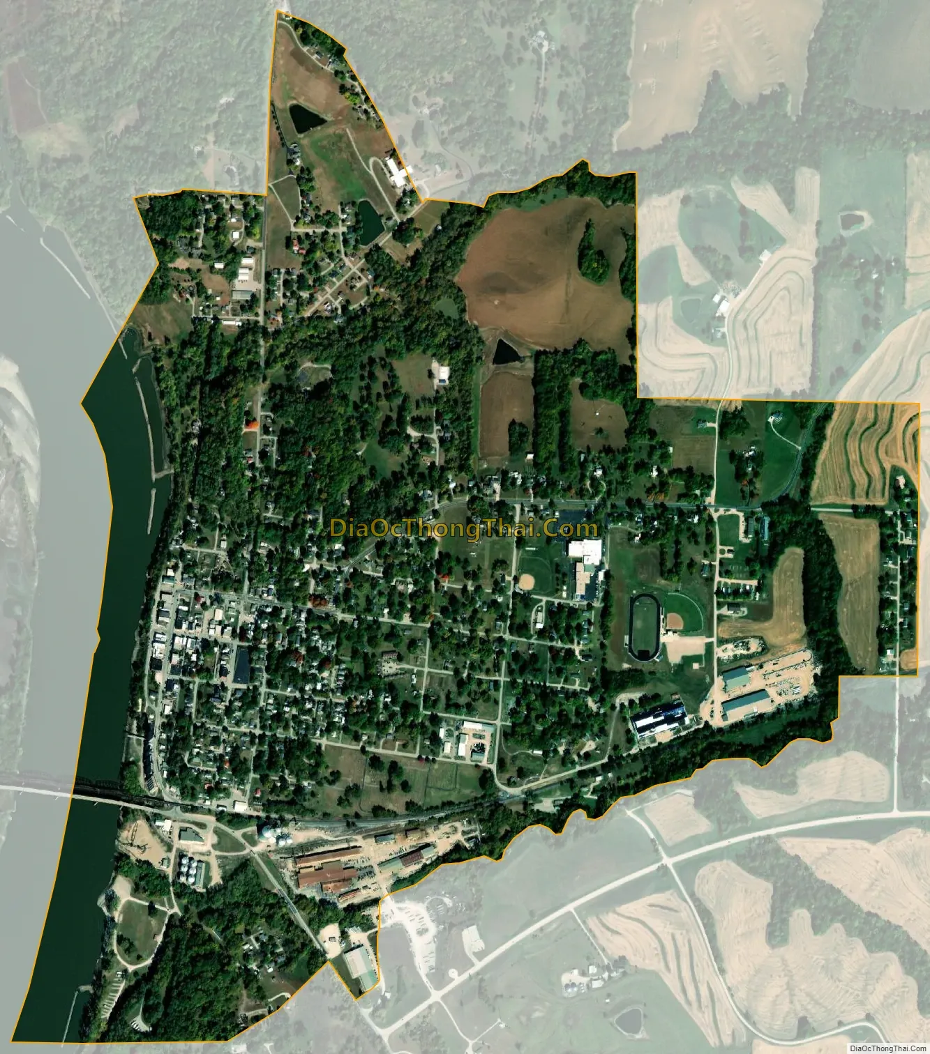
Geography
The city is on the bank of the Missouri River. It is served by Missouri routes 5, 87 and 240. Greggs Creek flows past the south side of the community.
According to the United States Census Bureau, the city has a total area of 1.42 square miles (3.68 km), of which 1.30 square miles (3.37 km) is land and 0.12 square miles (0.31 km) is water.
See also
Map of Missouri State and its subdivision:- Adair
- Andrew
- Atchison
- Audrain
- Barry
- Barton
- Bates
- Benton
- Bollinger
- Boone
- Buchanan
- Butler
- Caldwell
- Callaway
- Camden
- Cape Girardeau
- Carroll
- Carter
- Cass
- Cedar
- Chariton
- Christian
- Clark
- Clay
- Clinton
- Cole
- Cooper
- Crawford
- Dade
- Dallas
- Daviess
- De Kalb
- Dent
- Douglas
- Dunklin
- Franklin
- Gasconade
- Gentry
- Greene
- Grundy
- Harrison
- Henry
- Hickory
- Holt
- Howard
- Howell
- Iron
- Jackson
- Jasper
- Jefferson
- Johnson
- Knox
- Laclede
- Lafayette
- Lawrence
- Lewis
- Lincoln
- Linn
- Livingston
- Macon
- Madison
- Maries
- Marion
- McDonald
- Mercer
- Miller
- Mississippi
- Moniteau
- Monroe
- Montgomery
- Morgan
- New Madrid
- Newton
- Nodaway
- Oregon
- Osage
- Ozark
- Pemiscot
- Perry
- Pettis
- Phelps
- Pike
- Platte
- Polk
- Pulaski
- Putnam
- Ralls
- Randolph
- Ray
- Reynolds
- Ripley
- Saint Charles
- Saint Clair
- Saint Francois
- Saint Louis
- Sainte Genevieve
- Saline
- Schuyler
- Scotland
- Scott
- Shannon
- Shelby
- Stoddard
- Stone
- Sullivan
- Taney
- Texas
- Vernon
- Warren
- Washington
- Wayne
- Webster
- Worth
- Wright
- Alabama
- Alaska
- Arizona
- Arkansas
- California
- Colorado
- Connecticut
- Delaware
- District of Columbia
- Florida
- Georgia
- Hawaii
- Idaho
- Illinois
- Indiana
- Iowa
- Kansas
- Kentucky
- Louisiana
- Maine
- Maryland
- Massachusetts
- Michigan
- Minnesota
- Mississippi
- Missouri
- Montana
- Nebraska
- Nevada
- New Hampshire
- New Jersey
- New Mexico
- New York
- North Carolina
- North Dakota
- Ohio
- Oklahoma
- Oregon
- Pennsylvania
- Rhode Island
- South Carolina
- South Dakota
- Tennessee
- Texas
- Utah
- Vermont
- Virginia
- Washington
- West Virginia
- Wisconsin
- Wyoming