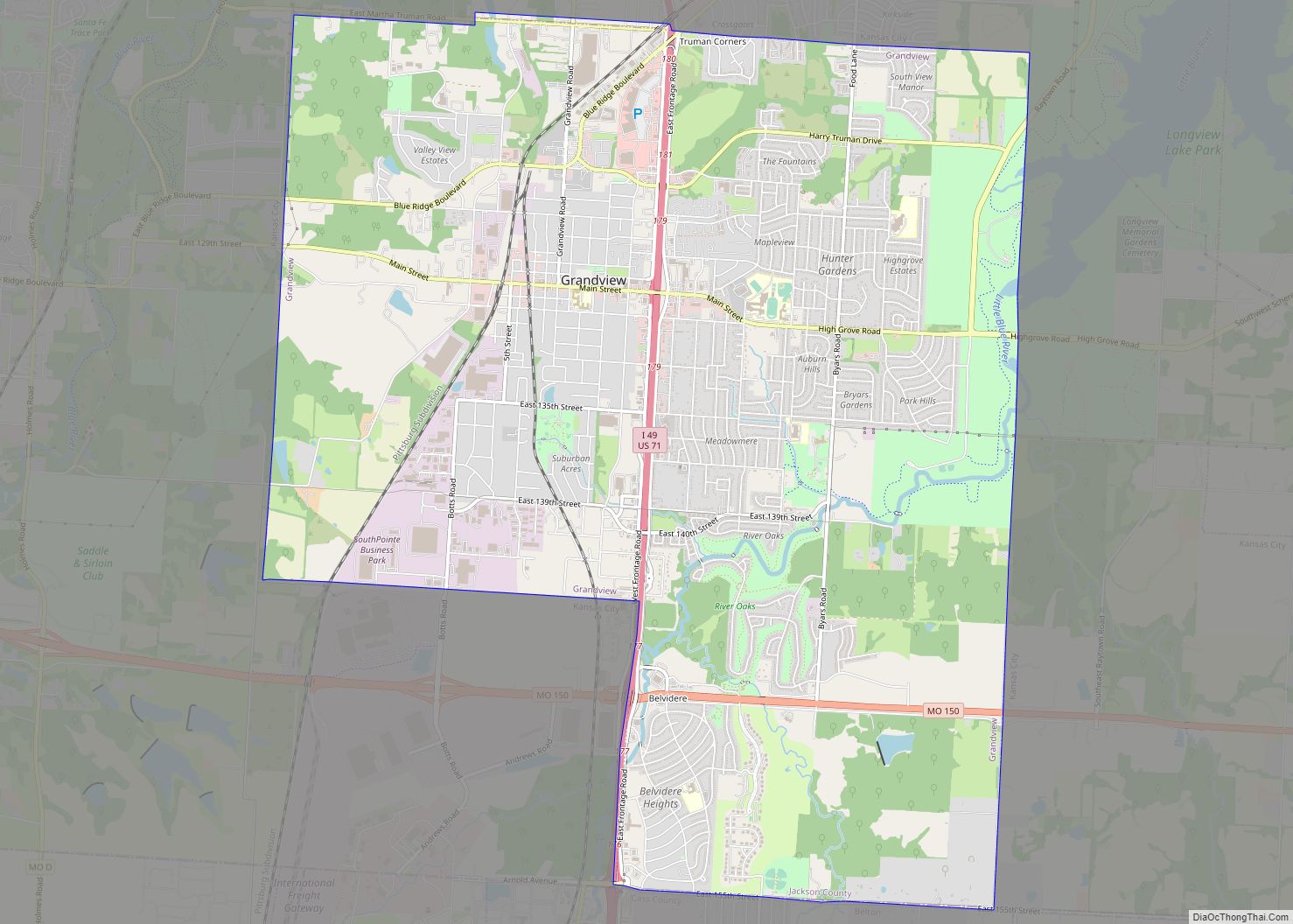
Lake Lotawana is a city in Jackson County, Missouri, United States and is located 35 miles southeast of downtown Kansas City bordering Blue Springs and Lee’s Summit. The population was 2,310 as of the 2020 census. It is part of the Kansas City metropolitan area.
The city derives its name from the lake that takes up most of the city, which is said to be named after an Indian princess.
| Name: | Lake Lotawana city |
|---|---|
| LSAD Code: | 25 |
| LSAD Description: | city (suffix) |
| State: | Missouri |
| County: | Jackson County |
| Incorporated: | 1958 |
| Elevation: | 896 ft (273 m) |
| Total Area: | 11.30 sq mi (29.26 km²) |
| Land Area: | 10.31 sq mi (26.71 km²) |
| Water Area: | 0.98 sq mi (2.55 km²) |
| Total Population: | 2,310 |
| Population Density: | 223.97/sq mi (86.47/km²) |
| ZIP code: | 64064, 64086, 64029, 64070 |
| Area code: | 816 |
| FIPS code: | 2939980 |
| GNISfeature ID: | 0720753 |
| Website: | www.lakelotawana.org |
Online Interactive Map
Click on ![]() to view map in "full screen" mode.
to view map in "full screen" mode.
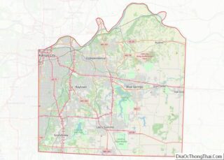
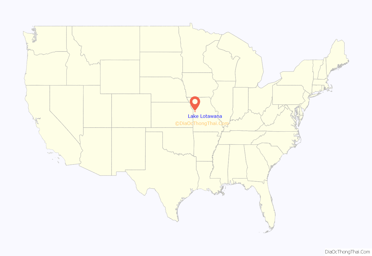
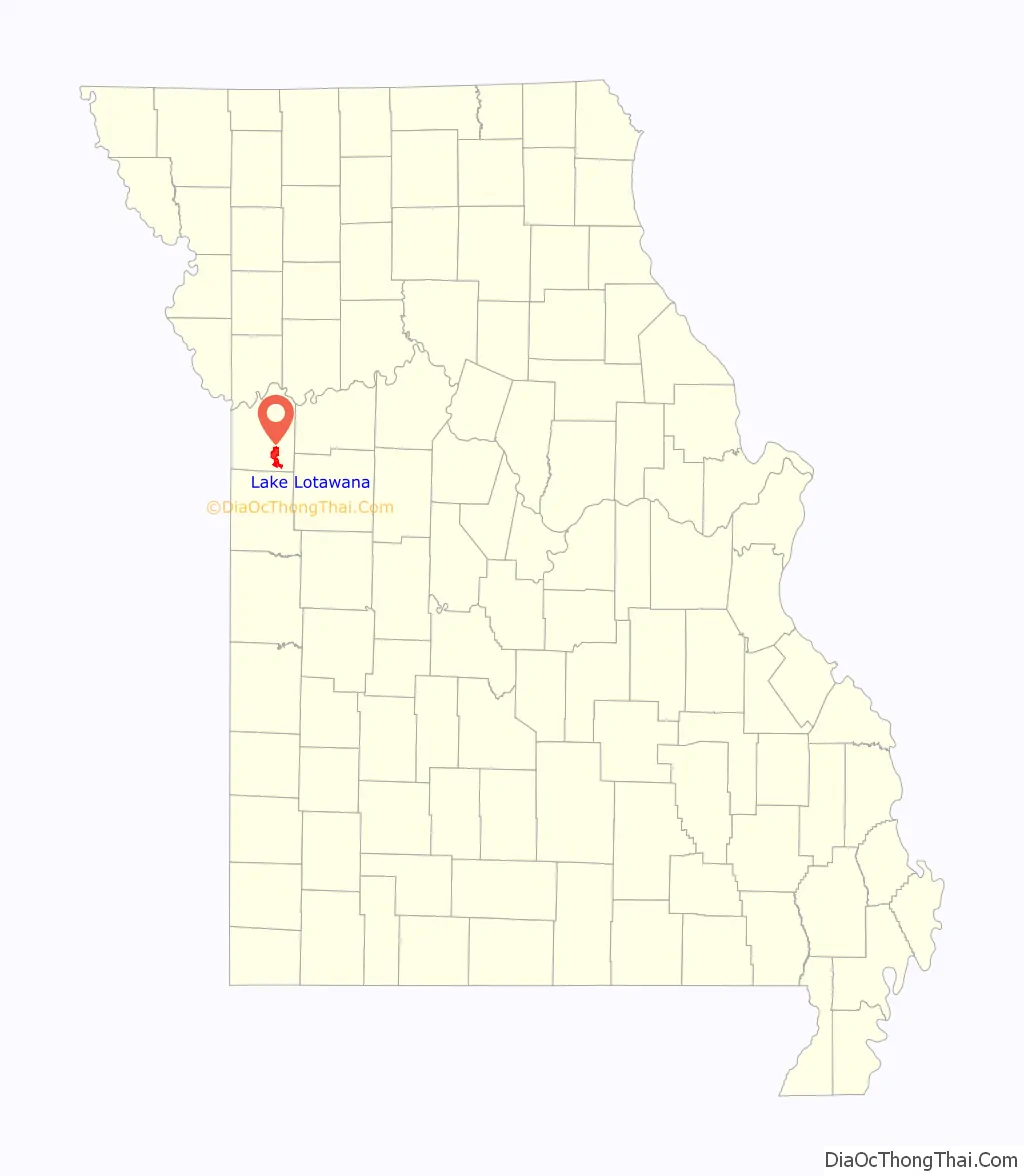
Lake Lotawana location map. Where is Lake Lotawana city?
History
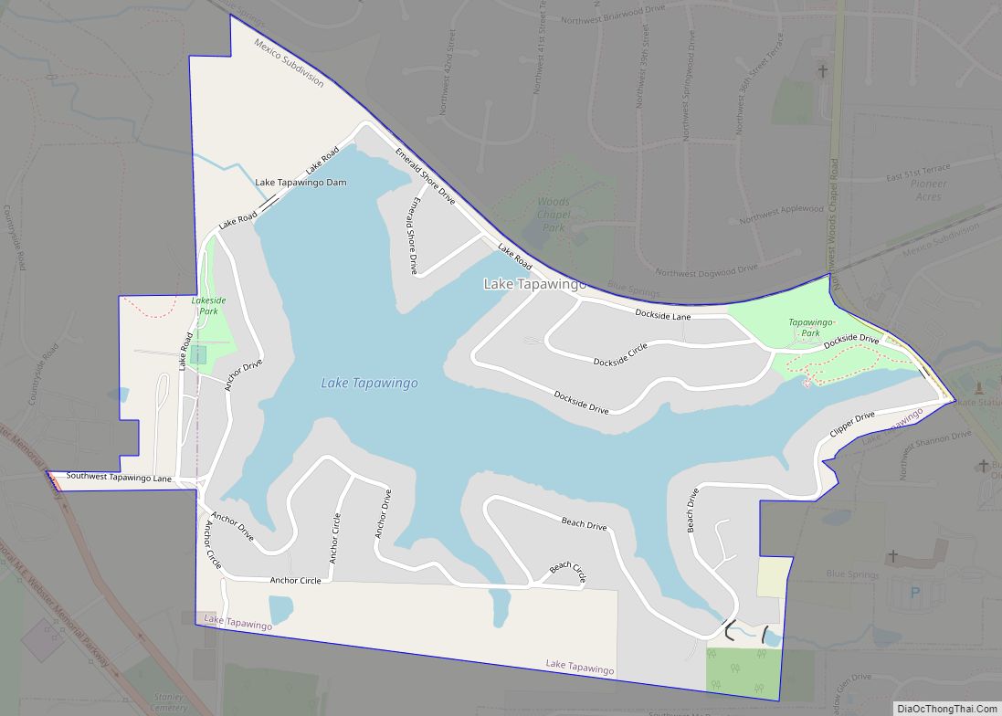
Lake Lotawana was conceived, purchased, built and developed by Milton Thompson, owner of nearby Highland Farms, the world’s largest Hereford cattle breeding farm at that time (1927). He had previously developed nearby Lake Tapawingo, a lake community with retreats for wealthy Kansas City businessmen. Permission for the new lake was requested November 7, 1927 and surveying was completed June 13, 1928. The dam was completed in the fall of 1929 just before the stock market crash that ushered in the Great Depression. An extended drought meant the lake did not fill completely until the Spring of 1935. Early land sales were slow due to the Depression.
Lake Lotawana was named after a fabled Native American princess whose name meant “sparkling water”. The legend of Princess Lotawana tells of her life in the Catskill Mountains of New York. In her legend, she was murdered on her wedding day by a jealous spurned suitor.
The area of Sni-A-Bar creek that later became Lake Lotawana was used as a hideout and staging area by Quantrill’s Raiders during the Civil War. This band of irregulars conducted raids against Union Army units and pro-Union and Abolitionist residents of Missouri and Kansas. There are accounts that they engaged in the Battle of Quantrill’s Cove on August 13, 1862, where they defeated a Union Cavalry force under Major Emory L. Foster. Accounts of the incident are not clear, but this engagement was a spillover from the Battle of Lone Jack. This battle was supposed to have taken place near present-day Quantrill’s Cove, near the west end of the lake. Quantrill’s group also staged the famous and better known raid against Lawrence, Kansas, known as the Lawrence massacre on August 21, 1863. The brutality of the raid resulted in the Order No. 11 by Union Brigadier General Thomas C. Ewing, garrisoned in present-day Kansas City. This order resulted in the forced relocation of all Confederate sympathizers in four counties, including the area of present-day Lake Lotawana. It was meant to clear the counties of a civilian support structure, and resulted in much property loss by the residents of the area. Most homes were burnt to the ground and people had to leave with little more than the clothes on their backs and what they could load into a wagon. The band of Quantrill’s Raiders continued their efforts to harass the Union forces after the order was implemented. There were rumors that stolen property from the raid on Lawrence was buried by Quantrill’s men in or near the Sni-a-Bar creek valley that later became Lake Lotawana. Treasure Cove in the C Block of the lake was named in reference to the buried treasure.
After the Civil War, settlers returned to the area, mostly developing the surrounding area as farms. Sni-A-Bar creek remained a heavily timbered valley, not as suitable for crops or livestock. There was a sulphur spring in block T inside Gate 3 that was a site of picnics and revivals. Most famously, the Baptist Minister Joab Powell of the Union Church (near the modern day intersection of 7 and 50 highways) would hold revivals in what is now called Waterfall Cove. The church was destroyed by a tornado in 1894.
Milton Thompson purchased much of the land, employing Oliver Sheley to survey the lake. He later resided at C-23 until his death in 1967. Originally, the lake had locked gates, with guards stationed to check for passes. Many of the original homes were cabins, made of logs, meant for summer vacation dwellings only. A mixture of summer cabins and permanent dwellings were built through the 1930s. The dam required many repairs and upgrades through the 1930s and 1940s, including the first WPA project in Jackson County, Missouri.
Early organization of the area was managed by the Lake Lotawana Development Company.[7] The city was incorporated into a fourth class city on November 24, 1958.
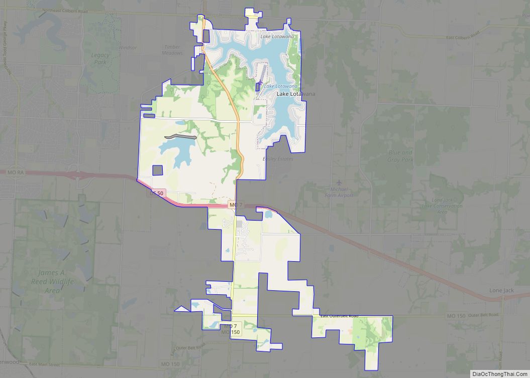
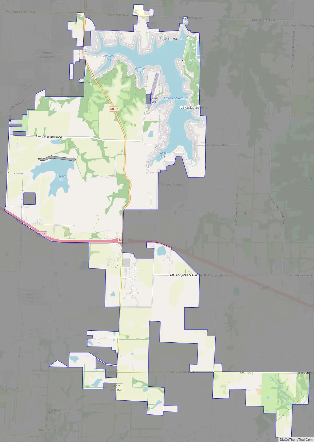
Lake Lotawana Road Map
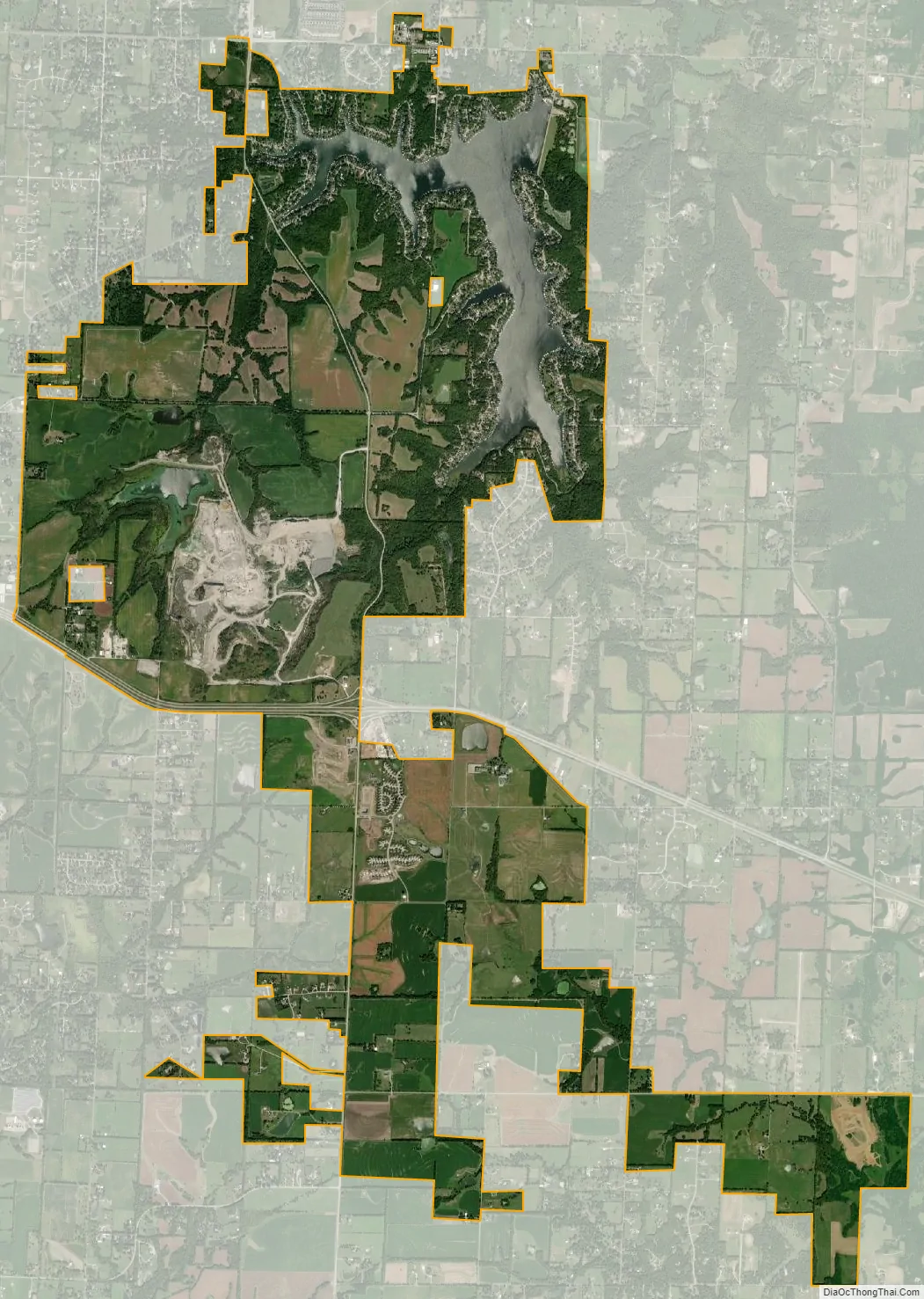
Lake Lotawana city Satellite Map
Geography
Lake Lotawana is located at 38°55′36″N 94°15′12″W / 38.92667°N 94.25333°W / 38.92667; -94.25333 (38.926627, −94.253201).
According to the United States Census Bureau, the City has a total area of 11.29 square miles (29.24 km), of which 10.31 square miles (26.70 km) is land and 0.98 square miles (2.54 km) is water.
According to the Lake Lotawana website the lake has 600 acres of surface water and 27 miles of shoreline.
The City originally had approximately 2.3 square miles of area. Two annexations in 2001 and 2004, respectively, expanded the City’s boundary south beyond U.S. Highway 50. This included the 2200 acre Barber property, and the Foxberry and Oak Haven subdivisions. The City presently encompasses roughly 11.3 square miles.
See also
Map of Missouri State and its subdivision:- Adair
- Andrew
- Atchison
- Audrain
- Barry
- Barton
- Bates
- Benton
- Bollinger
- Boone
- Buchanan
- Butler
- Caldwell
- Callaway
- Camden
- Cape Girardeau
- Carroll
- Carter
- Cass
- Cedar
- Chariton
- Christian
- Clark
- Clay
- Clinton
- Cole
- Cooper
- Crawford
- Dade
- Dallas
- Daviess
- De Kalb
- Dent
- Douglas
- Dunklin
- Franklin
- Gasconade
- Gentry
- Greene
- Grundy
- Harrison
- Henry
- Hickory
- Holt
- Howard
- Howell
- Iron
- Jackson
- Jasper
- Jefferson
- Johnson
- Knox
- Laclede
- Lafayette
- Lawrence
- Lewis
- Lincoln
- Linn
- Livingston
- Macon
- Madison
- Maries
- Marion
- McDonald
- Mercer
- Miller
- Mississippi
- Moniteau
- Monroe
- Montgomery
- Morgan
- New Madrid
- Newton
- Nodaway
- Oregon
- Osage
- Ozark
- Pemiscot
- Perry
- Pettis
- Phelps
- Pike
- Platte
- Polk
- Pulaski
- Putnam
- Ralls
- Randolph
- Ray
- Reynolds
- Ripley
- Saint Charles
- Saint Clair
- Saint Francois
- Saint Louis
- Sainte Genevieve
- Saline
- Schuyler
- Scotland
- Scott
- Shannon
- Shelby
- Stoddard
- Stone
- Sullivan
- Taney
- Texas
- Vernon
- Warren
- Washington
- Wayne
- Webster
- Worth
- Wright
- Alabama
- Alaska
- Arizona
- Arkansas
- California
- Colorado
- Connecticut
- Delaware
- District of Columbia
- Florida
- Georgia
- Hawaii
- Idaho
- Illinois
- Indiana
- Iowa
- Kansas
- Kentucky
- Louisiana
- Maine
- Maryland
- Massachusetts
- Michigan
- Minnesota
- Mississippi
- Missouri
- Montana
- Nebraska
- Nevada
- New Hampshire
- New Jersey
- New Mexico
- New York
- North Carolina
- North Dakota
- Ohio
- Oklahoma
- Oregon
- Pennsylvania
- Rhode Island
- South Carolina
- South Dakota
- Tennessee
- Texas
- Utah
- Vermont
- Virginia
- Washington
- West Virginia
- Wisconsin
- Wyoming