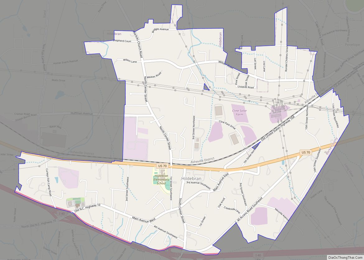
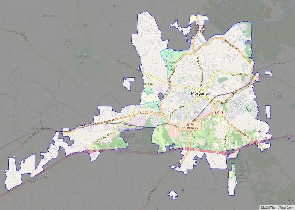
Morganton is a city in and the county seat of Burke County, North Carolina, United States. The population was 16,918 at the 2010 census. Morganton is approximately 75 miles (121 km) northwest of Charlotte.
Morganton is one of the principal cities in the Hickory-Lenoir-Morganton, NC Metropolitan Statistical Area. A site five miles north of Morganton has been identified as the Mississippian culture chiefdom of Joara, occupied from AD 1400 to AD 1600. This was also the site of Fort San Juan, built in 1567 by a Spanish expedition as the first European settlement in the interior of North America, 40 years before the English settlement of Jamestown, Virginia.
| Name: | Morganton city |
|---|---|
| LSAD Code: | 25 |
| LSAD Description: | city (suffix) |
| State: | North Carolina |
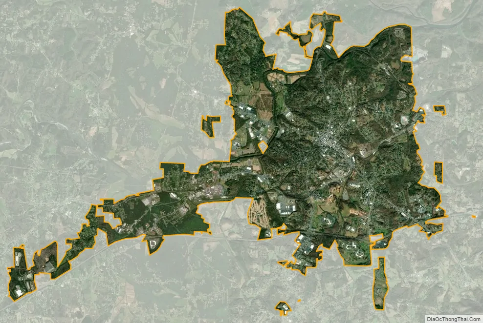
| County: | Burke County |
| Founded: | 1777 |
| Incorporated: | 1784 |
| Elevation: | 1,161 ft (354 m) |
| Total Area: | 19.24 sq mi (49.84 km²) |
| Land Area: | 19.24 sq mi (49.84 km²) |
| Water Area: | 0.00 sq mi (0.00 km²) |
| Total Population: | 17,474 |
| Population Density: | 908.02/sq mi (350.59/km²) |
| ZIP code: | 28655, 28680 |
| Area code: | 828 |
| FIPS code: | 3744400 |
| GNISfeature ID: | 0990244 |
| Website: | www.ci.morganton.nc.us |
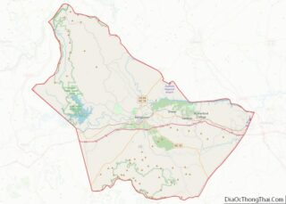
Online Interactive Map
Click on ![]() to view map in "full screen" mode.
to view map in "full screen" mode.
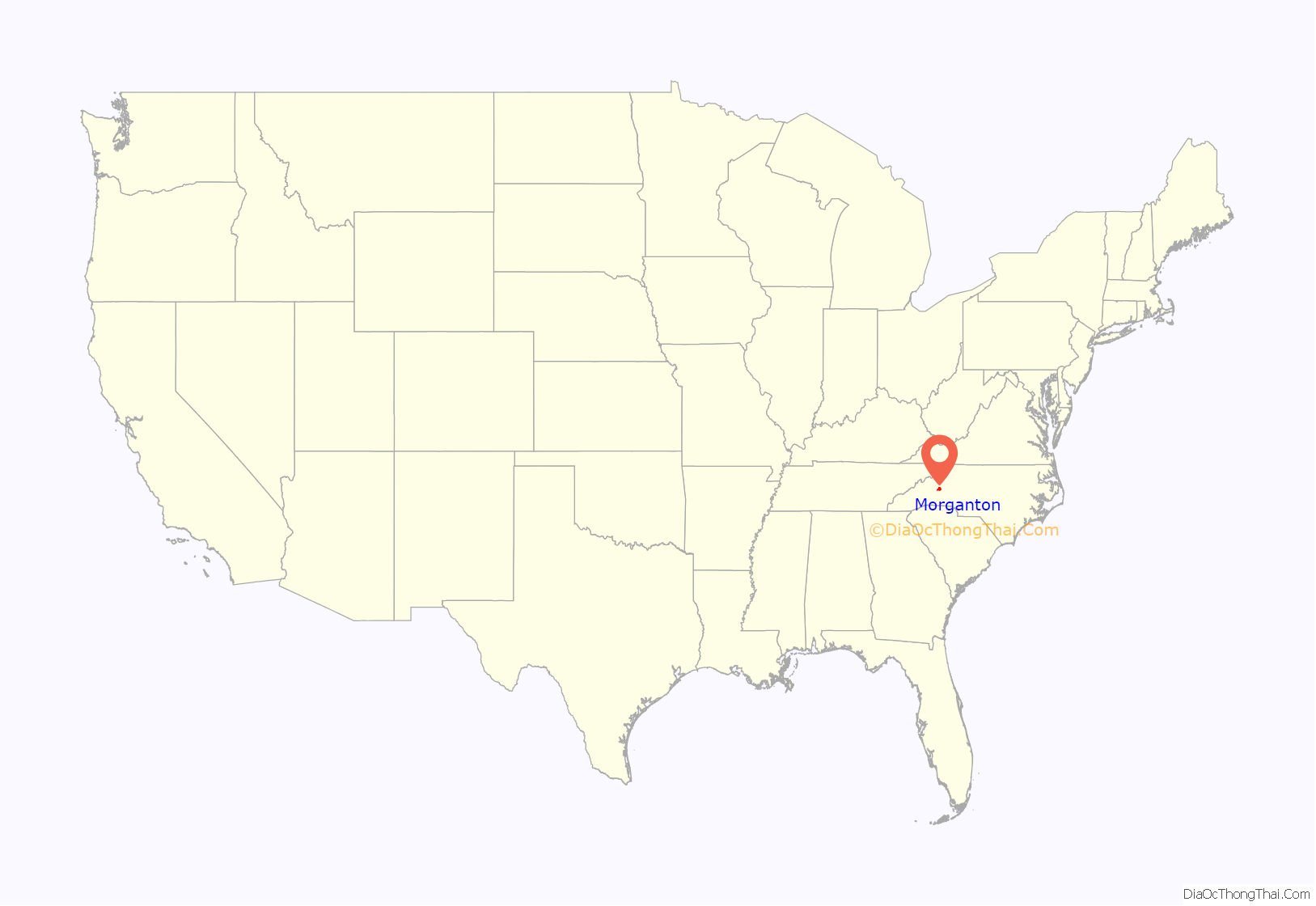
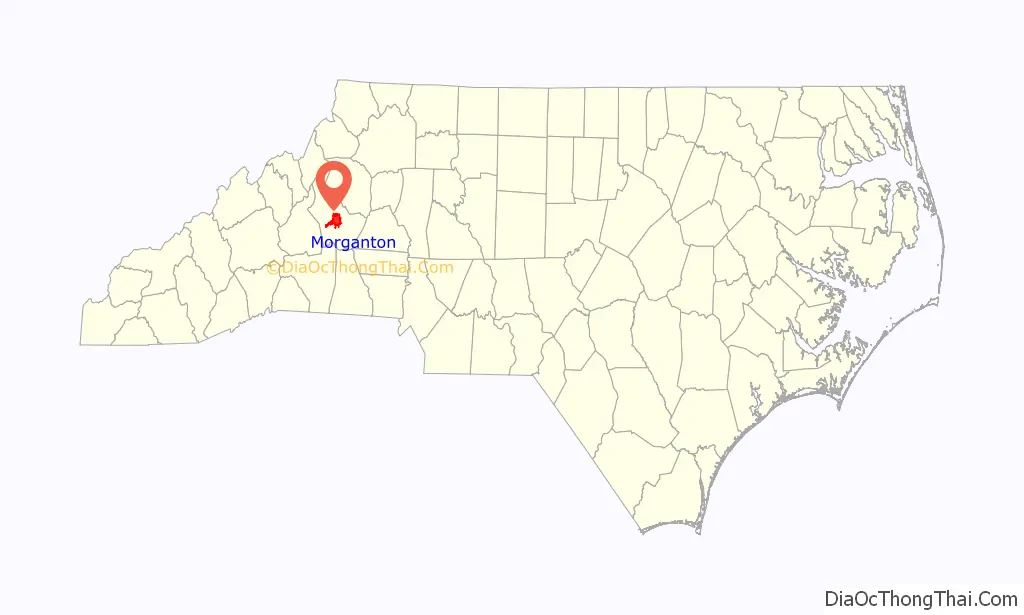
Morganton location map. Where is Morganton city?
History
Joara archeological site
The oldest-known European inland (non-coastal) settlement in the United States of Fort San Juan has been identified at Joara, a former Mississippian culture chiefdom located about five miles north of present-day Morganton. In 1567 a Spanish expedition built the fort there, while seeking to establish an interior route to Mexican silver mines. This was more than 40 years before the English settled Jamestown, Virginia, their first permanent settlement in North America.
The Spanish left a 31-man garrison that occupied the fort for 18 months before being overcome in a Mississippian attack. Five other Spanish forts in the larger interior region were also destroyed about that time. Only one soldier survived. The fort and Indian settlement have been under professional excavation since the early 21st century, with findings published since 2004. Europeans associated with the British colonies did not try to settle this far west for nearly 200 years, organizing Burke County in 1777.
Today Joara is identified as a significant archaeological and historic site near the Watersee River in the Upper Catawba Valley. Construction of its mounds is believed to have been started by the people of the Mississippian culture by AD 1000, and they occupied the site continuously from 1400AD to 1600AD. Based on additional archeological excavations at the “Berry Site” that revealed the remains of a defensive moat constructed in European style, researchers in 2013 concluded that this was the site of Fort San Juan and Joara. Earlier evidence found in the area included “military artifacts and burned remains of Spanish-built huts.”
19th century
During the Civil War, the Western North Carolina Railroad stopped just a few miles east of Morganton and a Confederate training camp, named Camp Vance after North Carolina’s wartime governor Zebulon Vance (whose wife, Hariette Espy Vance, was from Morganton), which was located just outside of town. Both the railroad and the camp were the targets of a raid across the mountains from Tennessee, by the Union Loyalists of the 3rd North Carolina Mounted Infantry in July 1864. On April 17, 1865 there was a small skirmish fought in Morganton, as part of Stoneman’s 1865 raid through North Carolina.
After the Civil War, Morgantonian Tod R. Caldwell, became the only Governor of North Carolina from Morganton, when he took over the office after the impeachment of William Woods Holden in 1871.
Public welfare facilities, such as the North Carolina School for the Deaf: Main Building and Western North Carolina Insane Asylum, were first authorized by the state legislature in the late 19th century.
20th century to present
In the early 20th century, textile mills were developed in the Piedmont as industry left union-dominated areas of the Northeast United States. During the century, however, these industrial jobs gradually moved offshore.
In the late 20th century, Morganton and Burke County, was still largely rural and with big poultry farms, which became locations for industrial-scale poultry processing plants. These jobs attracted many new immigrants to the state from Central America, leading to an increase in the Latino population in the area.
During the 1990s, Guatemalan-born workers in Morganton, worked to organize a union at the Case Farms poultry plant but were ultimately unsuccessful. Labor and factory work have changed in the “Nuevo South”, where many Latino immigrants work in low-paid industrial jobs. They are competing with globalization in some industries. At the state level, North Carolina is working to encourage immigrant communities and their contributions.
On January 31, 2006, an explosion occurred at Synthron Inc., a paint additive chemical manufacturer’s plant in Morganton. Workers at Synthron reported hearing a loud hiss minutes before the explosion. Most were able to escape the building before the blast, but even some who were outside were thrown as far as 20 feet (6.1 m). The explosion was heard and felt as far away as 50 miles (80 km).
On the day of the explosion, operations appeared normal until after the steam was turned off and the polymer initiating solution was pumped into the reactor. The operator in charge noted that initially the reaction did not proceed as vigorously as expected, but later the solvent evaporated and the condensed solvent flow returning to the reactor appeared within normal range. A few minutes later, the operator heard a loud hissing and saw vapor venting from the reactor manway. The irritating vapor forced him out of the building. Three other employees also left the building because of the vapors. The operator reentered the building wearing a respirator and started emergency cooling water flow to the reactor. The building exploded less than 30 seconds after he exited the second time. The US Chemical Safety Board (CSB) stated that the solvent vapor leaked from the overheated and over-pressurised process reactor, forming a flammable vapour cloud inside the building that ignited.
A total of 14 people were injured in the blast, of whom one man later died. In addition, at least 300 fish died due to chemicals leaking into a creek behind the Synthron plant which leads into the Catawba River.
National Register of Historic Places
Properties recognized for their historic significance date primarily to the late 19th and early 20th centuries, the period of more dense development. They include public facilities, such as the state school for the deaf, numerous private homes and former business facilities, as well as several historic districts. They reflect the development of the area by yeoman farmers, and later cotton planters who had plantations, as well as the development of cotton and textile mills, followed by other industries.
They include the Avery Avenue Historic District, Avery Avenue School, Alphonse Calhoun Avery House, Bellevue, Broughton Hospital Historic District, Burke County Courthouse, Creekside, U. S. B. Dale’s Market, Dunavant Cotton Manufacturing Company, Gaither House, Garrou-Morganton Full-Fashioned Hosiery Mills, Gaston Chapel, Hunting Creek Railroad Bridge, Jonesboro Historic District, John Alexander Lackey House, Magnolia Place, Morganton Downtown Historic District, Mountain View, North Carolina School for the Deaf Historic District, North Carolina School for the Deaf: Main Building, North Green Street-Bouchelle Street Historic District, Quaker Meadows, Quaker Meadows Cemetery, Dr. Joseph Bennett Riddle House, South King Street Historic District, Swan Ponds, Tate House, Franklin Pierce Tate House, West Union Street Historic District, Western North Carolina Insane Asylum, and White Street-Valdese Avenue Historic District are listed on the National Register of Historic Places.
Morganton Road Map
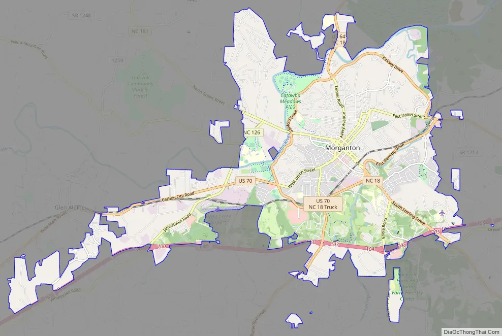
Morganton city Satellite Map
Geography
Morganton is located in central Burke County in the Catawba River valley in the foothills of the Appalachian Mountains. Interstate 40 passes through the southern part of the city, leading east 19 miles (31 km) to Hickory and west 54 miles (87 km) to Asheville. U.S. Route 70 passes east–west through the center of the city paralleling I-40, and U.S. Route 64 passes north–south, leading northeast 15 miles (24 km) to Lenoir and southwest 32 miles (51 km) to Rutherfordton.
According to the United States Census Bureau, Morganton has a total area of 19.2 square miles (49.6 km), all land.
Climate
Morganton, NC, has a humid subtropical climate (Cfa) and is located in hardiness zone 7b.
See also
Map of North Carolina State and its subdivision:- Alamance
- Alexander
- Alleghany
- Anson
- Ashe
- Avery
- Beaufort
- Bertie
- Bladen
- Brunswick
- Buncombe
- Burke
- Cabarrus
- Caldwell
- Camden
- Carteret
- Caswell
- Catawba
- Chatham
- Cherokee
- Chowan
- Clay
- Cleveland
- Columbus
- Craven
- Cumberland
- Currituck
- Dare
- Davidson
- Davie
- Duplin
- Durham
- Edgecombe
- Forsyth
- Franklin
- Gaston
- Gates
- Graham
- Granville
- Greene
- Guilford
- Halifax
- Harnett
- Haywood
- Henderson
- Hertford
- Hoke
- Hyde
- Iredell
- Jackson
- Johnston
- Jones
- Lee
- Lenoir
- Lincoln
- Macon
- Madison
- Martin
- McDowell
- Mecklenburg
- Mitchell
- Montgomery
- Moore
- Nash
- New Hanover
- Northampton
- Onslow
- Orange
- Pamlico
- Pasquotank
- Pender
- Perquimans
- Person
- Pitt
- Polk
- Randolph
- Richmond
- Robeson
- Rockingham
- Rowan
- Rutherford
- Sampson
- Scotland
- Stanly
- Stokes
- Surry
- Swain
- Transylvania
- Tyrrell
- Union
- Vance
- Wake
- Warren
- Washington
- Watauga
- Wayne
- Wilkes
- Wilson
- Yadkin
- Yancey
- Alabama
- Alaska
- Arizona
- Arkansas
- California
- Colorado
- Connecticut
- Delaware
- District of Columbia
- Florida
- Georgia
- Hawaii
- Idaho
- Illinois
- Indiana
- Iowa
- Kansas
- Kentucky
- Louisiana
- Maine
- Maryland
- Massachusetts
- Michigan
- Minnesota
- Mississippi
- Missouri
- Montana
- Nebraska
- Nevada
- New Hampshire
- New Jersey
- New Mexico
- New York
- North Carolina
- North Dakota
- Ohio
- Oklahoma
- Oregon
- Pennsylvania
- Rhode Island
- South Carolina
- South Dakota
- Tennessee
- Texas
- Utah
- Vermont
- Virginia
- Washington
- West Virginia
- Wisconsin
- Wyoming