Brookford is a town in Catawba County, North Carolina, United States. The population was 442 at the 2020 census. It is part of the Hickory–Lenoir–Morganton Metropolitan Statistical Area. The Town of Brookford was incorporated March 1, 1907. Brookford began as a mill village, deriving its name from the combination of the two owner’s names Holbrook and Shuford. The town has 4.56 miles of roadage.
| Name: | Brookford town |
|---|---|
| LSAD Code: | 43 |
| LSAD Description: | town (suffix) |
| State: | North Carolina |
| County: | Catawba County |
| Elevation: | 932 ft (284 m) |
| Total Area: | 1.63 sq mi (2.63 km²) |
| Land Area: | 0.61 sq mi (1.58 km²) |
| Water Area: | 0.02 sq mi (0.05 km²) |
| Total Population: | 442 |
| Population Density: | 725.78/sq mi (280.03/km²) |
| ZIP code: | 28602 |
| Area code: | 828 |
| FIPS code: | 3708140 |
| GNISfeature ID: | 1019316 |
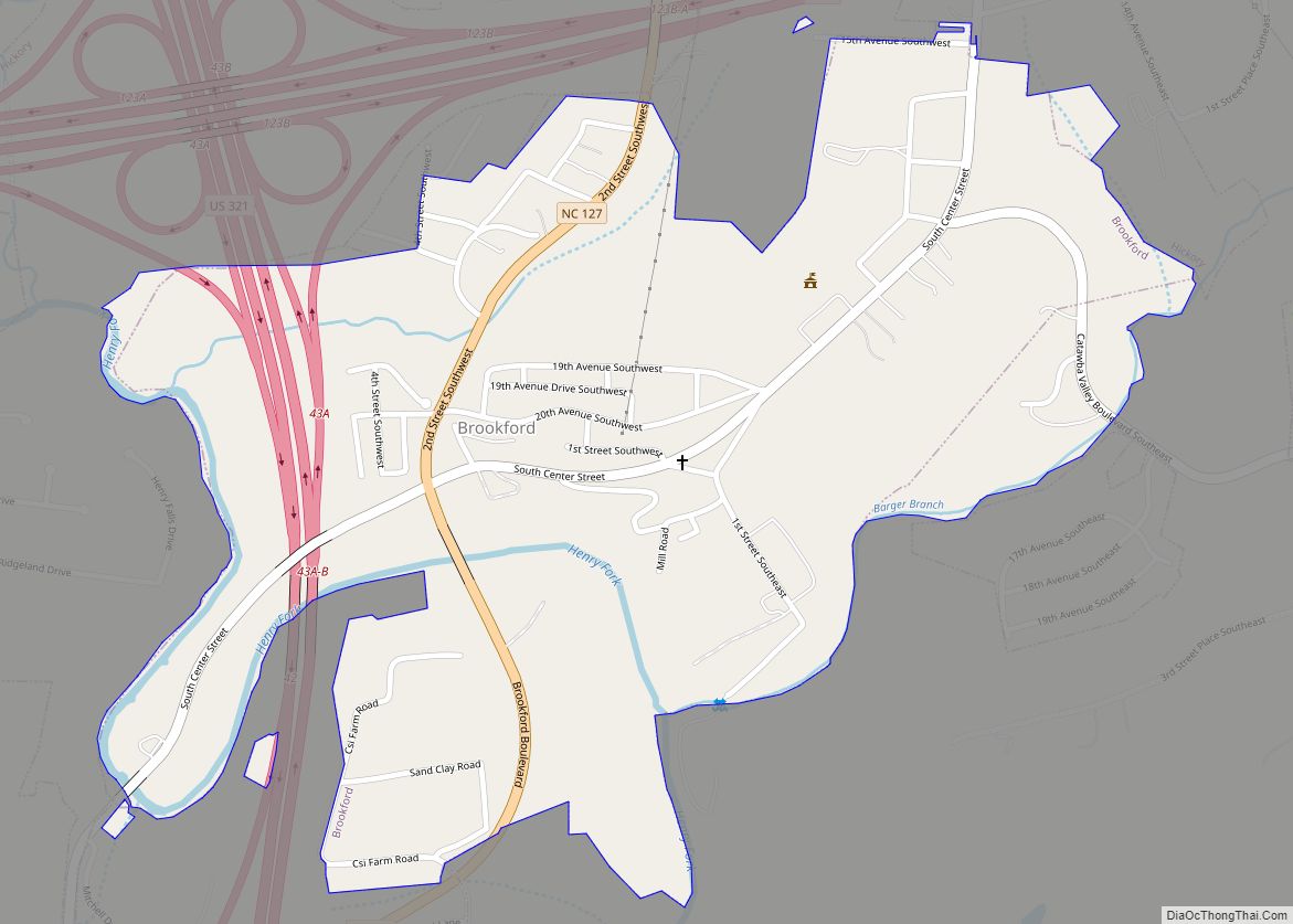
Online Interactive Map
Click on ![]() to view map in "full screen" mode.
to view map in "full screen" mode.
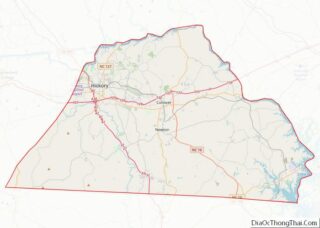
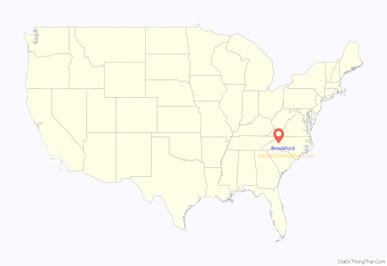
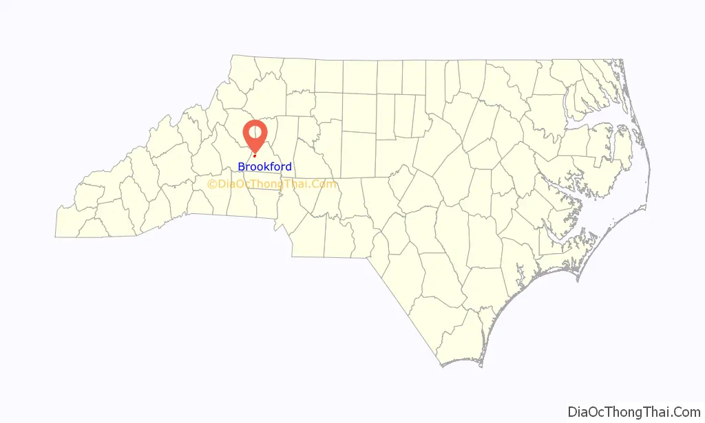
Brookford location map. Where is Brookford town?
Brookford Road Map
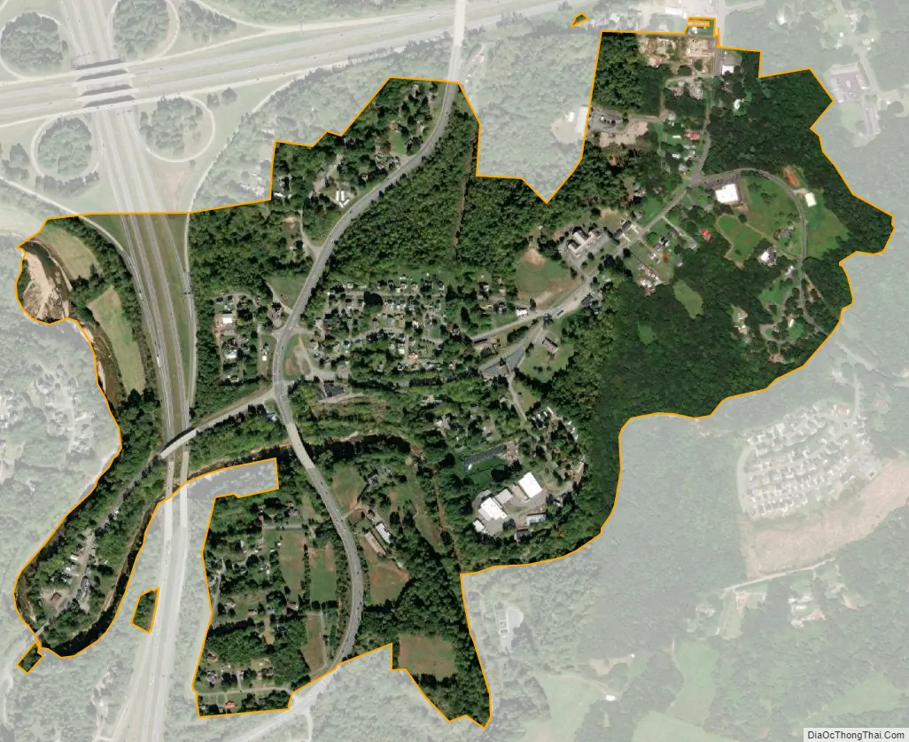
Brookford city Satellite Map
Geography
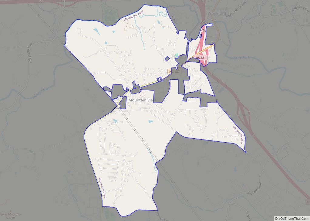
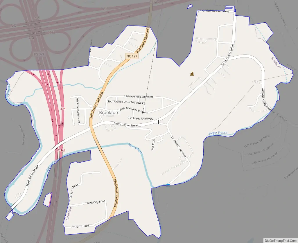
Brookford is located in western Catawba County at 35°42′13″N 81°20′48″W / 35.70361°N 81.34667°W / 35.70361; -81.34667 (35.703482, -81.346786). It is bordered to the north by the City of Hickory and to the southwest by the unincorporated community of Mountain View.
The town is located just to the southeast of the junction of Interstate 40 with U.S. Route 321 south of Hickory. As both of those highways are limited-access, the closest direct access to Brookford is from Exit 42 on US 321, southwest of the town. The exit connects to North Carolina Highway 127, known as Brookford Boulevard, which runs through the center of the town.
Brookford is located on hills on the north side of the Henry Fork River, a tributary of the South Fork Catawba River. According to the United States Census Bureau, the town has a total area of 0.62 square miles (1.6 km), of which 0.019 square miles (0.05 km), or 3.09%, is water.
See also
Map of North Carolina State and its subdivision:- Alamance
- Alexander
- Alleghany
- Anson
- Ashe
- Avery
- Beaufort
- Bertie
- Bladen
- Brunswick
- Buncombe
- Burke
- Cabarrus
- Caldwell
- Camden
- Carteret
- Caswell
- Catawba
- Chatham
- Cherokee
- Chowan
- Clay
- Cleveland
- Columbus
- Craven
- Cumberland
- Currituck
- Dare
- Davidson
- Davie
- Duplin
- Durham
- Edgecombe
- Forsyth
- Franklin
- Gaston
- Gates
- Graham
- Granville
- Greene
- Guilford
- Halifax
- Harnett
- Haywood
- Henderson
- Hertford
- Hoke
- Hyde
- Iredell
- Jackson
- Johnston
- Jones
- Lee
- Lenoir
- Lincoln
- Macon
- Madison
- Martin
- McDowell
- Mecklenburg
- Mitchell
- Montgomery
- Moore
- Nash
- New Hanover
- Northampton
- Onslow
- Orange
- Pamlico
- Pasquotank
- Pender
- Perquimans
- Person
- Pitt
- Polk
- Randolph
- Richmond
- Robeson
- Rockingham
- Rowan
- Rutherford
- Sampson
- Scotland
- Stanly
- Stokes
- Surry
- Swain
- Transylvania
- Tyrrell
- Union
- Vance
- Wake
- Warren
- Washington
- Watauga
- Wayne
- Wilkes
- Wilson
- Yadkin
- Yancey
- Alabama
- Alaska
- Arizona
- Arkansas
- California
- Colorado
- Connecticut
- Delaware
- District of Columbia
- Florida
- Georgia
- Hawaii
- Idaho
- Illinois
- Indiana
- Iowa
- Kansas
- Kentucky
- Louisiana
- Maine
- Maryland
- Massachusetts
- Michigan
- Minnesota
- Mississippi
- Missouri
- Montana
- Nebraska
- Nevada
- New Hampshire
- New Jersey
- New Mexico
- New York
- North Carolina
- North Dakota
- Ohio
- Oklahoma
- Oregon
- Pennsylvania
- Rhode Island
- South Carolina
- South Dakota
- Tennessee
- Texas
- Utah
- Vermont
- Virginia
- Washington
- West Virginia
- Wisconsin
- Wyoming