Polkville is a small town in Cleveland County, North Carolina, United States. The population was 545 at the 2010 census.
| Name: | Polkville city |
|---|---|
| LSAD Code: | 25 |
| LSAD Description: | city (suffix) |
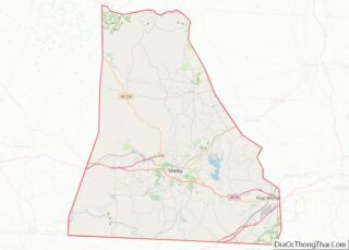
| State: | North Carolina |
| County: | Cleveland County |
| Elevation: | 1,093 ft (333 m) |
| Total Area: | 1.86 sq mi (4.83 km²) |
| Land Area: | 1.86 sq mi (4.83 km²) |
| Water Area: | 0.00 sq mi (0.00 km²) |
| Total Population: | 516 |
| Population Density: | 276.97/sq mi (106.94/km²) |
| ZIP code: | 28136 |
| Area code: | 704 |
| FIPS code: | 3753160 |
| GNISfeature ID: | 0992645 |
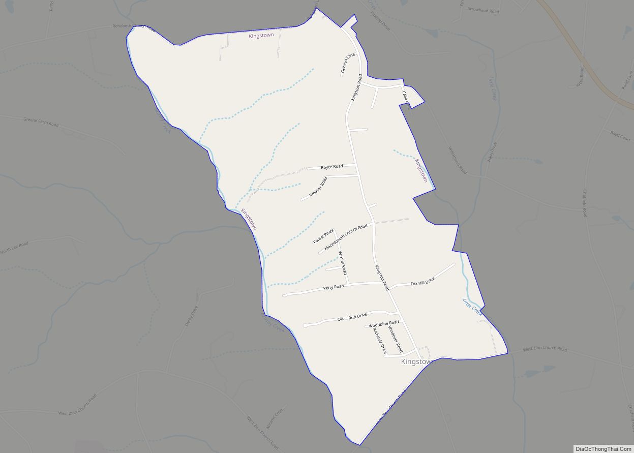
Online Interactive Map
Click on ![]() to view map in "full screen" mode.
to view map in "full screen" mode.
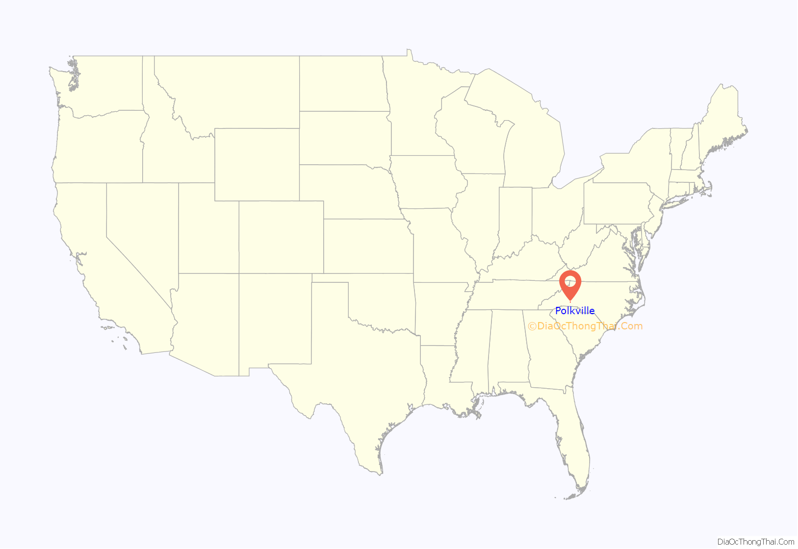
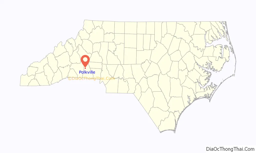
Polkville location map. Where is Polkville city?
History
The John Lattimore House was listed on the National Register of Historic Places in 1982.
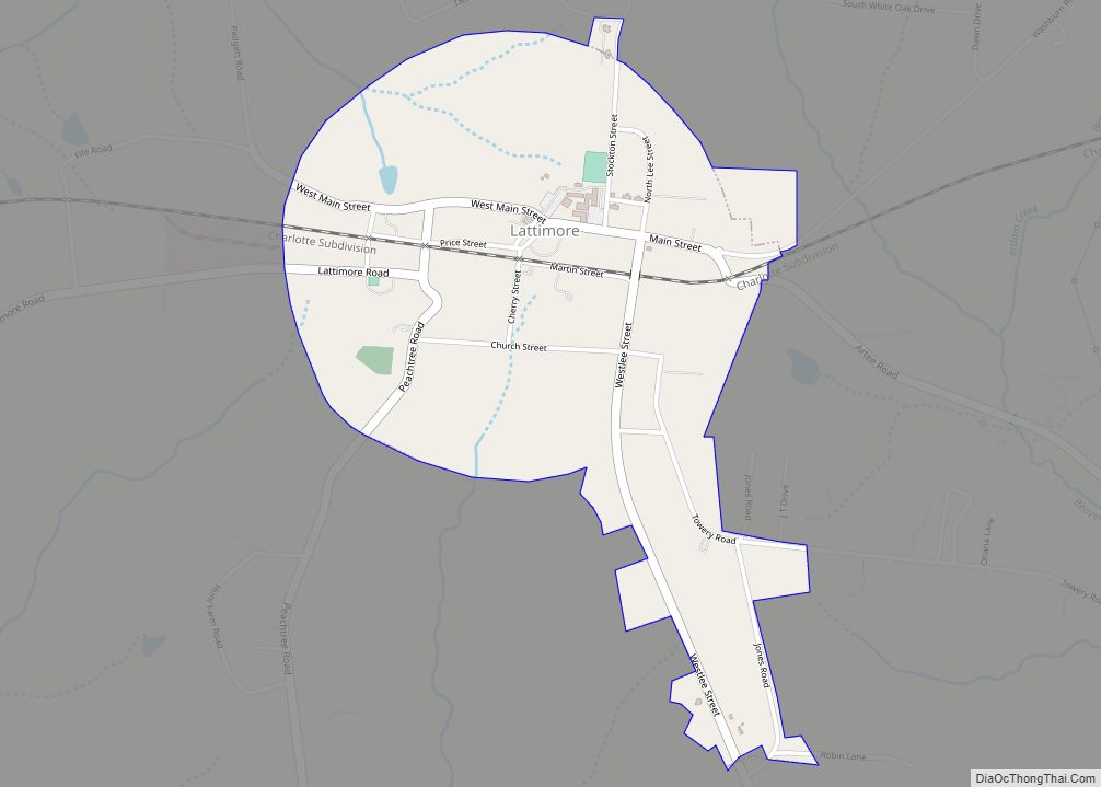
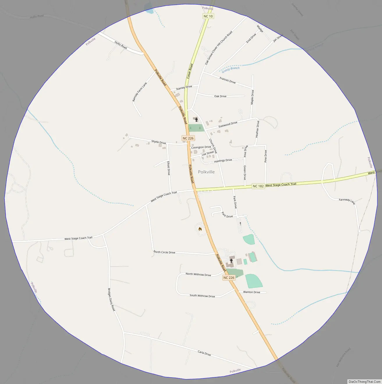
Polkville Road Map
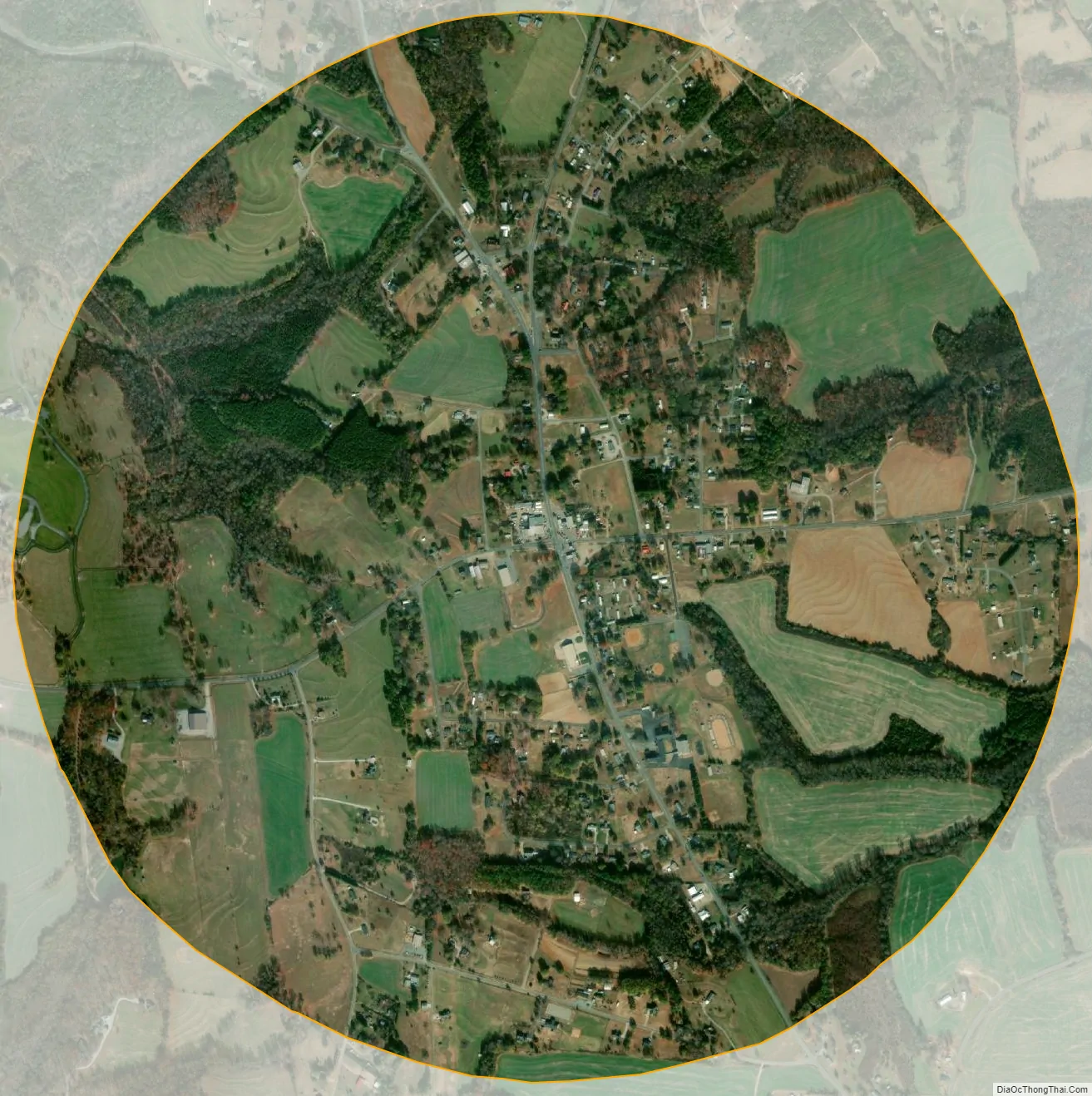
Polkville city Satellite Map
Geography
Polkville is located in northwestern Cleveland County at 35°25′3″N 81°38′34″W / 35.41750°N 81.64278°W / 35.41750; -81.64278 (35.417528, -81.642738).
North Carolina Highway 226 passes through the center of the town, leading southeast 12 miles (19 km) to Shelby and northwest over the South Mountains 31 miles (50 km) to Marion. North Carolina Highway 182 has its western terminus in Polkville at NC 226, and leads east 25 miles (40 km) to Lincolnton. North Carolina Highway 10 has its southwestern terminus in Polkville, leading northeast 36 miles (58 km) to Newton.
According to the United States Census Bureau, Polkville has a total area of 1.9 square miles (4.8 km), all land.
See also
Map of North Carolina State and its subdivision:- Alamance
- Alexander
- Alleghany
- Anson
- Ashe
- Avery
- Beaufort
- Bertie
- Bladen
- Brunswick
- Buncombe
- Burke
- Cabarrus
- Caldwell
- Camden
- Carteret
- Caswell
- Catawba
- Chatham
- Cherokee
- Chowan
- Clay
- Cleveland
- Columbus
- Craven
- Cumberland
- Currituck
- Dare
- Davidson
- Davie
- Duplin
- Durham
- Edgecombe
- Forsyth
- Franklin
- Gaston
- Gates
- Graham
- Granville
- Greene
- Guilford
- Halifax
- Harnett
- Haywood
- Henderson
- Hertford
- Hoke
- Hyde
- Iredell
- Jackson
- Johnston
- Jones
- Lee
- Lenoir
- Lincoln
- Macon
- Madison
- Martin
- McDowell
- Mecklenburg
- Mitchell
- Montgomery
- Moore
- Nash
- New Hanover
- Northampton
- Onslow
- Orange
- Pamlico
- Pasquotank
- Pender
- Perquimans
- Person
- Pitt
- Polk
- Randolph
- Richmond
- Robeson
- Rockingham
- Rowan
- Rutherford
- Sampson
- Scotland
- Stanly
- Stokes
- Surry
- Swain
- Transylvania
- Tyrrell
- Union
- Vance
- Wake
- Warren
- Washington
- Watauga
- Wayne
- Wilkes
- Wilson
- Yadkin
- Yancey
- Alabama
- Alaska
- Arizona
- Arkansas
- California
- Colorado
- Connecticut
- Delaware
- District of Columbia
- Florida
- Georgia
- Hawaii
- Idaho
- Illinois
- Indiana
- Iowa
- Kansas
- Kentucky
- Louisiana
- Maine
- Maryland
- Massachusetts
- Michigan
- Minnesota
- Mississippi
- Missouri
- Montana
- Nebraska
- Nevada
- New Hampshire
- New Jersey
- New Mexico
- New York
- North Carolina
- North Dakota
- Ohio
- Oklahoma
- Oregon
- Pennsylvania
- Rhode Island
- South Carolina
- South Dakota
- Tennessee
- Texas
- Utah
- Vermont
- Virginia
- Washington
- West Virginia
- Wisconsin
- Wyoming