Weaverville is a town in Buncombe County, North Carolina, United States. The population was 3,120 at the 2010 census. It is part of the Asheville Metropolitan Statistical Area.
| Name: | Weaverville town |
|---|---|
| LSAD Code: | 43 |
| LSAD Description: | town (suffix) |
| State: | North Carolina |
| County: | Buncombe County |
| Elevation: | 2,178 ft (664 m) |
| Total Area: | 3.89 sq mi (10.07 km²) |
| Land Area: | 3.88 sq mi (10.05 km²) |
| Water Area: | 0.01 sq mi (0.02 km²) |
| Total Population: | 4,567 |
| Population Density: | 1,177.37/sq mi (454.58/km²) |
| ZIP code: | 28787 |
| Area code: | 828 |
| FIPS code: | 3771560 |
| GNISfeature ID: | 996908 |
| Website: | www.weavervillenc.org |
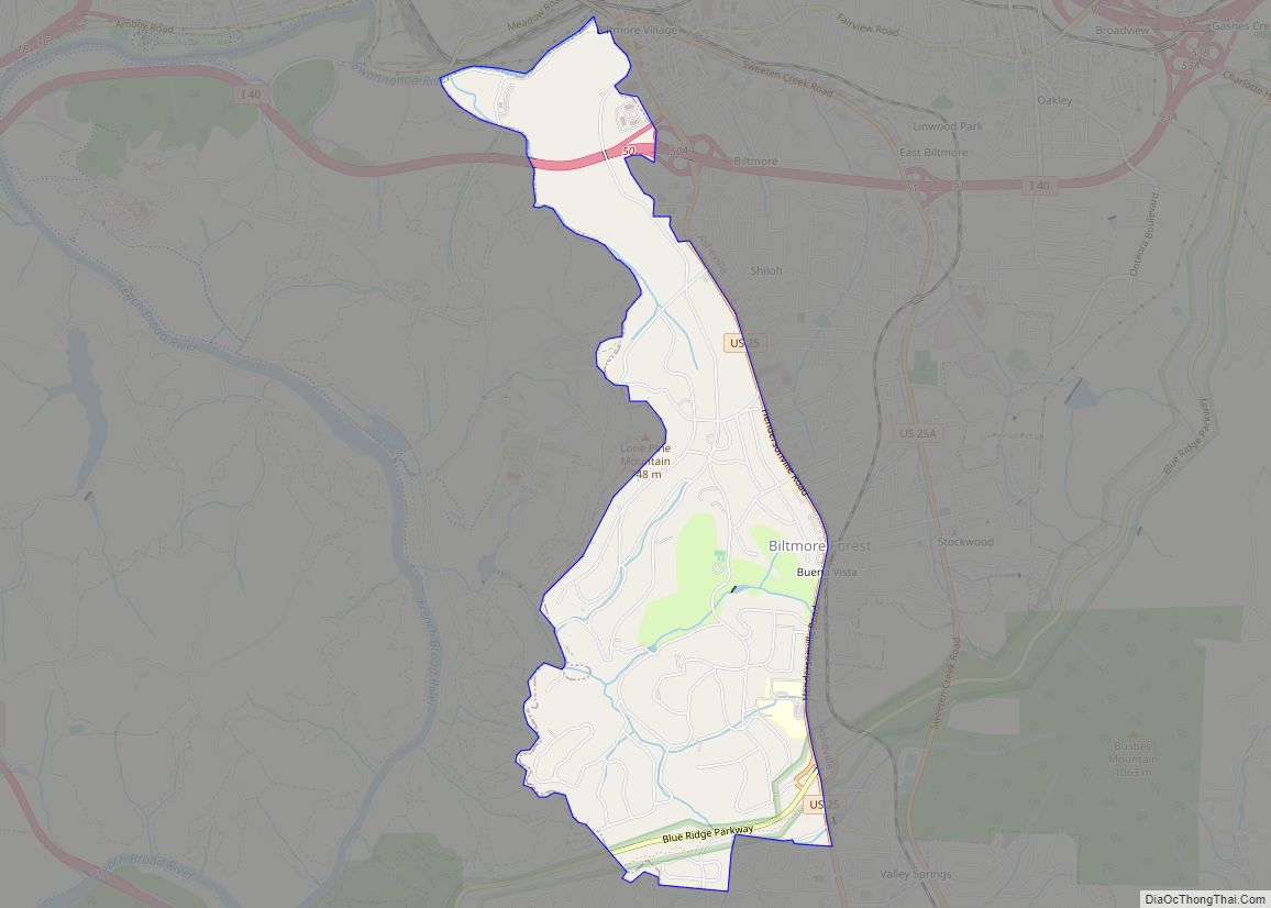
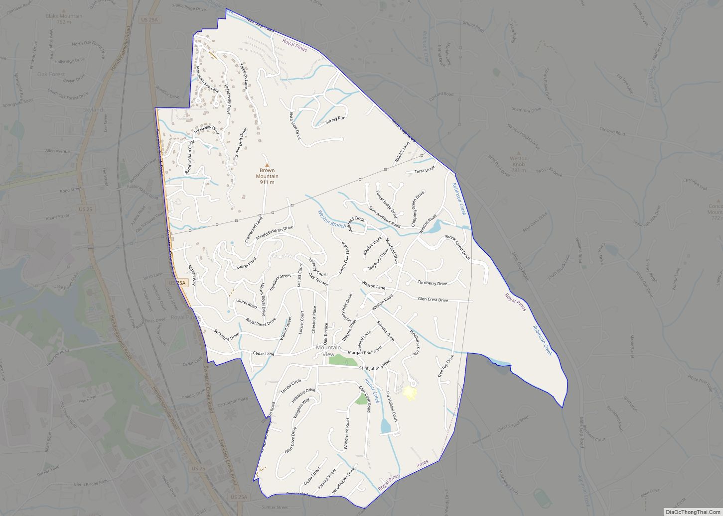
Online Interactive Map
Click on ![]() to view map in "full screen" mode.
to view map in "full screen" mode.
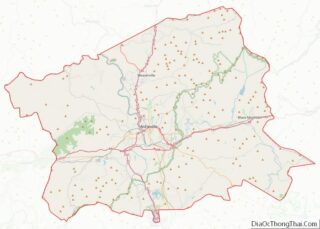
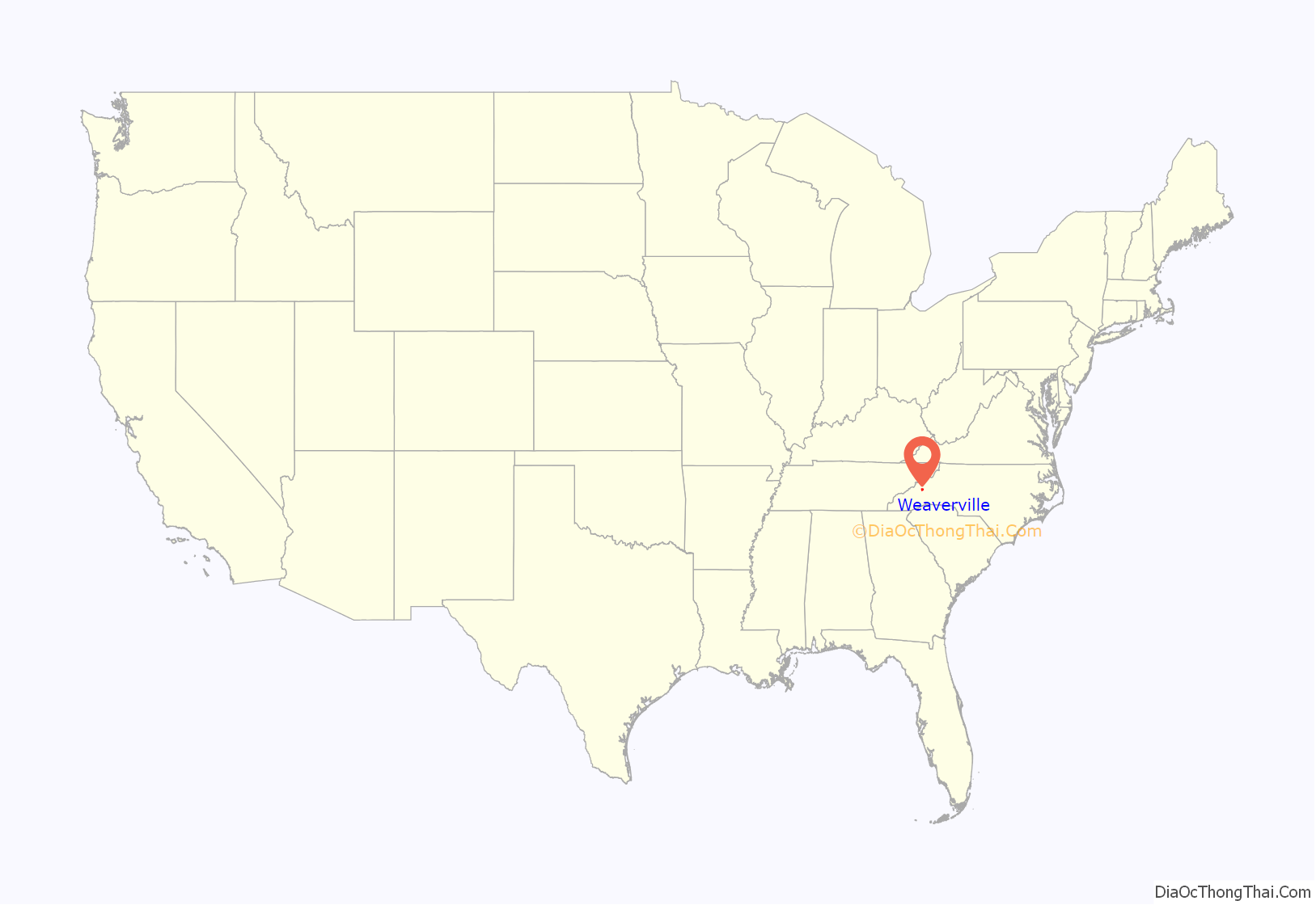
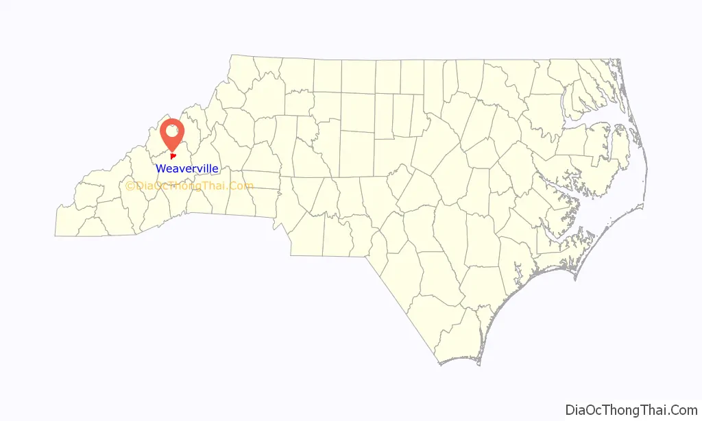
Weaverville location map. Where is Weaverville town?
History
Chartered in 1875 and named for Michael Montraville Weaver who gave the land for the town, Weaverville sits along the Dry Ridge (named by the Indians for its relatively arid conditions). The Treaty of Holston signed in 1786 cleared the way for settlers to move into the area. Among the first settlers were John and Elizabeth Weaver, parents of the town’s founder. Early residents, friends, and relatives soon began gathering for religious camp meetings near the south end of College Street. On land first known as the Reems Creek Camp Grounds, a large conference house (built in the 1830s) housed the Methodist assembly which became the first school in the area in 1840.
By 1862, 121 families were in the Reems Creek area, many owning more than 1,000 acres (400 ha). Weaverville College, chartered in 1873, attracted many families. The former president’s house is now the Dry Ridge Bed and Breakfast. A four-year college, it was downsized in 1912 to junior college status, merging in 1934 with Rutherford and Brevard Colleges to continue in Brevard. In 1912 a public school (grades 1-7) was located at the west end of Church Street. The first full-time public school on Main Street was established in 1921. In 1927 grades 11-12 attended school in the Robinsom-Lotspeich house (now the Inn on Main Street Bed and Breakfast). Weaverville High School, built by the WPA in 1927, opened on the south end of Main Street, but later merged secondary-school operations with four other area schools (Flat Creek, Red Oak, French Broad, and Barnardsville) in 1954 to form North Buncombe High School. Today, Weaverville is home to two public schools: Weaverville Primary School at 39 S. Main Street, and Weaverville Elementary School at 129 S. Main Street. Both are part of the Buncombe County School system. Weaverville Primary School is home to kindergarten and first grade. Weaverville Elementary School is home to grades 2-4. Weaverville resident children in grades 5-6 attend North Windy Ridge School; those in grades 7-8 attend North Buncombe Middle School; and those in grades 9-12 attend North Buncombe High School, all three of which are north of the town limits.
Business and private residences were built along Main Street. Dr. J.A. Reagan was the first mayor, and with a town council Weaverville began to develop roads and walkways. A police chief developed law and order. With the arrival of electricity and the arrival of an electric trolley the town prospered. Land development boomed. Post offices, starting in 1860, were located in McClure’s log cabin, Vandiver’s Store (now Blue Mountain Pizza) and Shope’s Furniture. A new post office was completed in 2001 on North Main.
The Fire Department was established in 1912, with the first truck purchased in 1922. A fire station was built in 1958 on Merchants Alley, behind the 12 N. Main Town Hall. It moved into the Reagan Building on S. Main Street and then finally onto Monticello Road.
North Carolina’s Civil War governor, Zebulon B. Vance, was born in the nearby Reems Creek community. Reems Creek itself flows through Weaverville adjacent to the town’s Lake Louise Park. The mill at Reem’s Creek was portrayed in “Picturesque America,” a famous 19th century work of illustrated American scenes published in 1872.
The Dr. John G. & Nannie H. Barrett Farm, Brigman-Chambers House, Joseph P. Eller House, Weaverville United Methodist Church, and Zebulon H. Baird House are listed on the National Register of Historic Places.
The Solstice East residential treatment center for girls is located in Weaverville.
Development
Construction began in March 2017 of the 35,000-square-foot ASPCA Behavioral Rehabilitation Center at an old cement plant on Murphy Hill Road. The $9 million project will “likely to be the first-ever facility dedicated strictly to providing behavioral rehabilitation to canine victims of cruelty and neglect in the United States.”
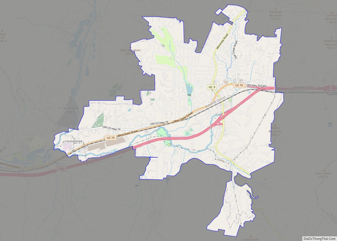
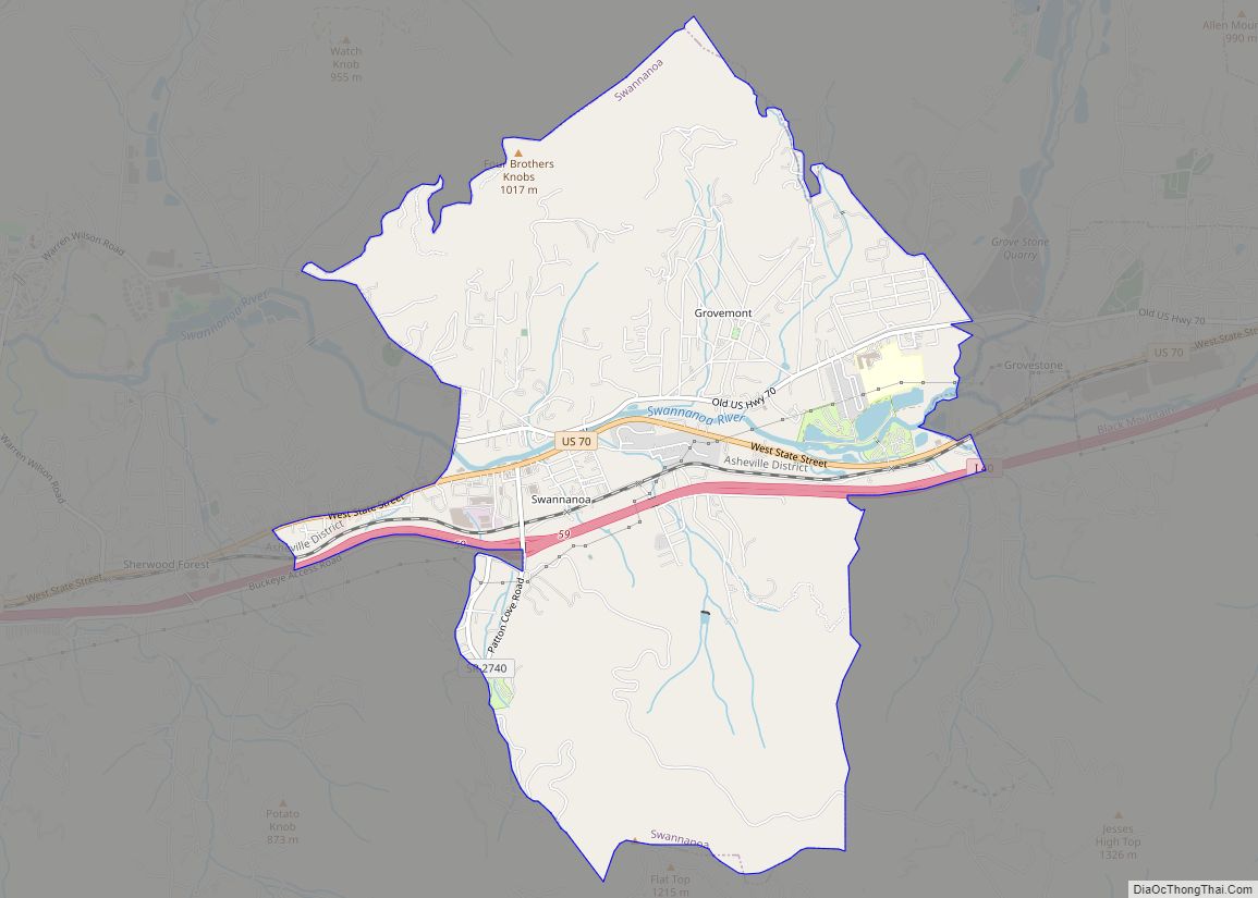
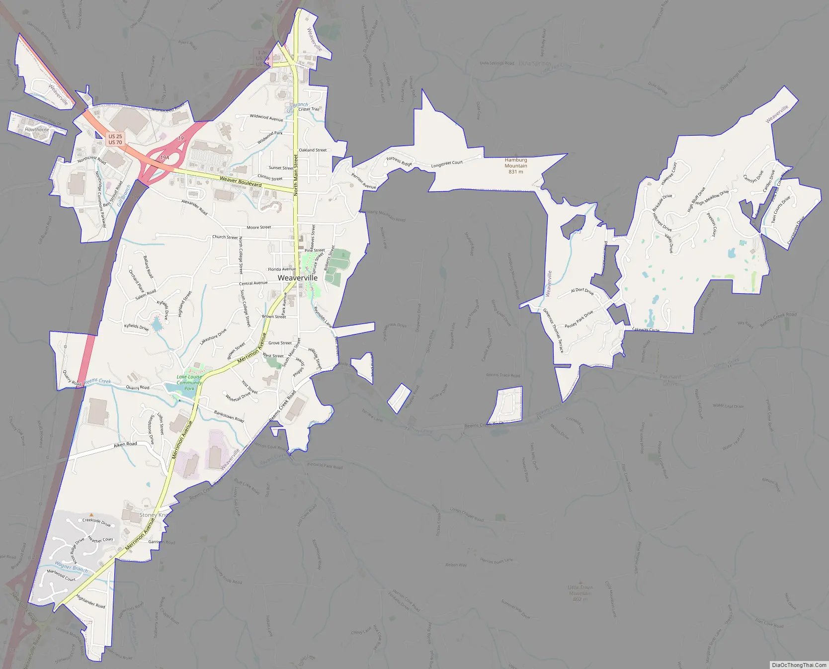
Weaverville Road Map
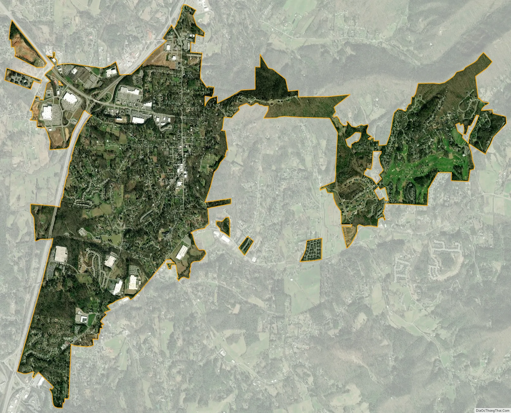
Weaverville city Satellite Map
Geography
Interstate 26, concurrent with U.S. Routes 23 and 19, runs along the western edge of the town, with access from exits 18, 19, and 21. I-26 leads south 9 miles (14 km) to downtown Asheville and 51 miles (82 km) north to Johnson City, Tennessee. U.S. Routes 25 and 70 head west from exit 19, leading 52 miles (84 km) to Newport, Tennessee.
According to the United States Census Bureau, the town has a total area of 3.4 square miles (8.9 km), of which 0.008 square miles (0.02 km), or 0.24%, is water, including a man-made lake on the southern outskirts of town named Lake Louise.
See also
Map of North Carolina State and its subdivision:- Alamance
- Alexander
- Alleghany
- Anson
- Ashe
- Avery
- Beaufort
- Bertie
- Bladen
- Brunswick
- Buncombe
- Burke
- Cabarrus
- Caldwell
- Camden
- Carteret
- Caswell
- Catawba
- Chatham
- Cherokee
- Chowan
- Clay
- Cleveland
- Columbus
- Craven
- Cumberland
- Currituck
- Dare
- Davidson
- Davie
- Duplin
- Durham
- Edgecombe
- Forsyth
- Franklin
- Gaston
- Gates
- Graham
- Granville
- Greene
- Guilford
- Halifax
- Harnett
- Haywood
- Henderson
- Hertford
- Hoke
- Hyde
- Iredell
- Jackson
- Johnston
- Jones
- Lee
- Lenoir
- Lincoln
- Macon
- Madison
- Martin
- McDowell
- Mecklenburg
- Mitchell
- Montgomery
- Moore
- Nash
- New Hanover
- Northampton
- Onslow
- Orange
- Pamlico
- Pasquotank
- Pender
- Perquimans
- Person
- Pitt
- Polk
- Randolph
- Richmond
- Robeson
- Rockingham
- Rowan
- Rutherford
- Sampson
- Scotland
- Stanly
- Stokes
- Surry
- Swain
- Transylvania
- Tyrrell
- Union
- Vance
- Wake
- Warren
- Washington
- Watauga
- Wayne
- Wilkes
- Wilson
- Yadkin
- Yancey
- Alabama
- Alaska
- Arizona
- Arkansas
- California
- Colorado
- Connecticut
- Delaware
- District of Columbia
- Florida
- Georgia
- Hawaii
- Idaho
- Illinois
- Indiana
- Iowa
- Kansas
- Kentucky
- Louisiana
- Maine
- Maryland
- Massachusetts
- Michigan
- Minnesota
- Mississippi
- Missouri
- Montana
- Nebraska
- Nevada
- New Hampshire
- New Jersey
- New Mexico
- New York
- North Carolina
- North Dakota
- Ohio
- Oklahoma
- Oregon
- Pennsylvania
- Rhode Island
- South Carolina
- South Dakota
- Tennessee
- Texas
- Utah
- Vermont
- Virginia
- Washington
- West Virginia
- Wisconsin
- Wyoming