Bloomingdale is a town in Penn Township, Parke County, in the U.S. state of Indiana. The population was 335 at the 2010 census.
| Name: | Bloomingdale town |
|---|---|
| LSAD Code: | 43 |
| LSAD Description: | town (suffix) |
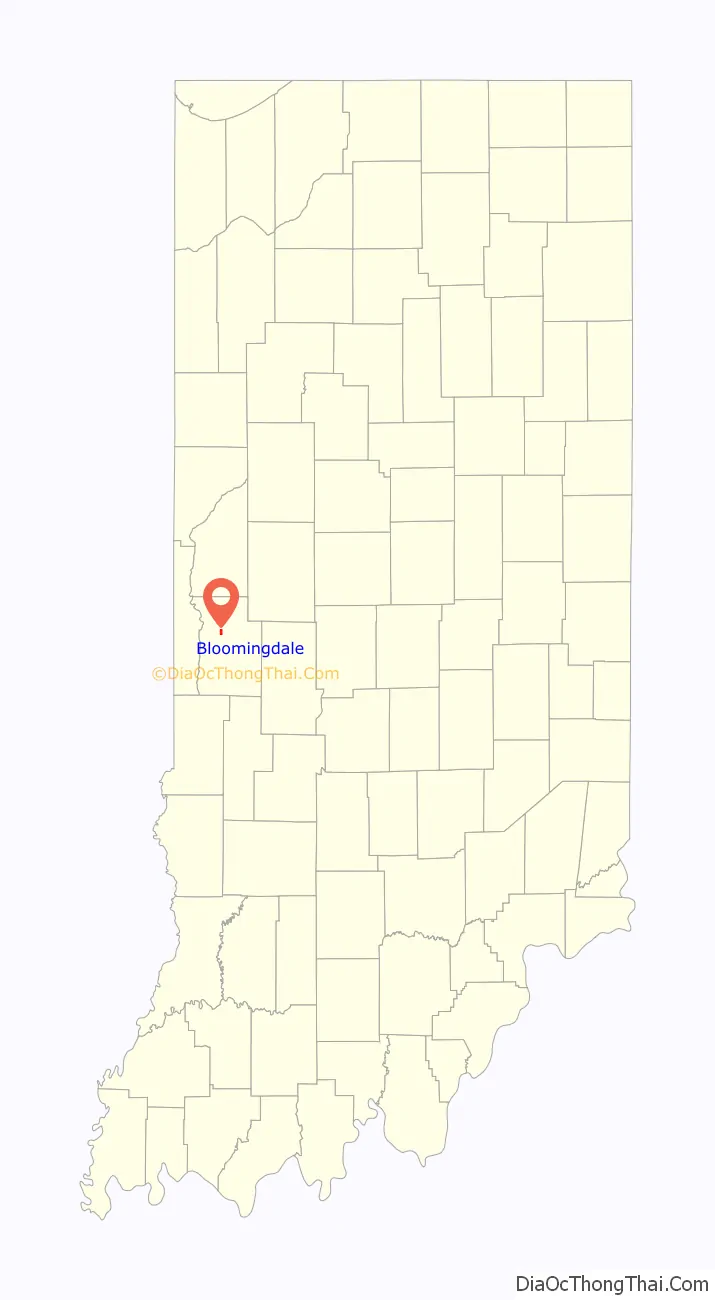
| State: | Indiana |
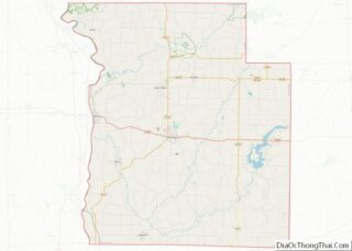
| County: | Parke County |
| Elevation: | 643 ft (196 m) |
| Total Area: | 0.58 sq mi (1.51 km²) |
| Land Area: | 0.58 sq mi (1.51 km²) |
| Water Area: | 0.00 sq mi (0.00 km²) |
| Total Population: | 269 |
| Population Density: | 462.20/sq mi (178.59/km²) |
| ZIP code: | 47832 |
| Area code: | 765 |
| FIPS code: | 1805788 |
Online Interactive Map
Click on ![]() to view map in "full screen" mode.
to view map in "full screen" mode.
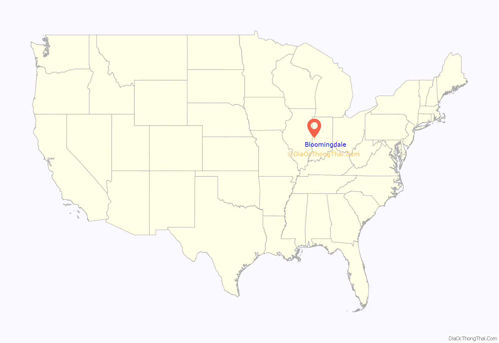
Bloomingdale location map. Where is Bloomingdale town?
History
The town of Bloomingdale was platted in 1825 or 1826, south of its present location. Originally it was named Bloomfield. A post office called Bloomingdale has been in operation since 1860.
The William Hill Polygonal Barn was listed on the National Register of Historic Places in 1993.
On June 17th, 2021, a magnitude 3.8 earthquake occurred 2 miles west of Bloomingdale. No damage was reported.
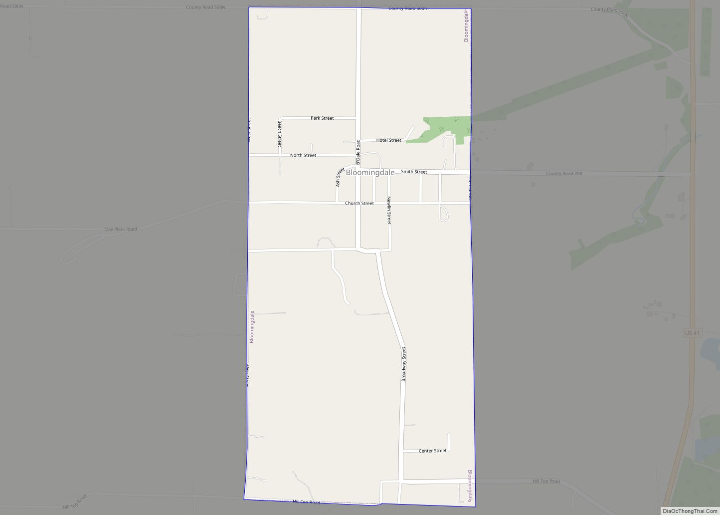
Bloomingdale Road Map

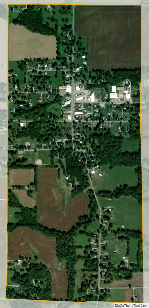
Bloomingdale city Satellite Map
Geography
Bloomingdale is located about 6 miles (9.7 km) north of the county seat of Rockville. U.S. Route 41 passes less than a mile to the east of the town.
According to the 2010 census, Bloomingdale has a total area of 0.58 square miles (1.50 km), all land.
See also
Map of Indiana State and its subdivision:- Adams
- Allen
- Bartholomew
- Benton
- Blackford
- Boone
- Brown
- Carroll
- Cass
- Clark
- Clay
- Clinton
- Crawford
- Daviess
- De Kalb
- Dearborn
- Decatur
- Delaware
- Dubois
- Elkhart
- Fayette
- Floyd
- Fountain
- Franklin
- Fulton
- Gibson
- Grant
- Greene
- Hamilton
- Hancock
- Harrison
- Hendricks
- Henry
- Howard
- Huntington
- Jackson
- Jasper
- Jay
- Jefferson
- Jennings
- Johnson
- Knox
- Kosciusko
- LaGrange
- Lake
- Lake Michigan
- LaPorte
- Lawrence
- Madison
- Marion
- Marshall
- Martin
- Miami
- Monroe
- Montgomery
- Morgan
- Newton
- Noble
- Ohio
- Orange
- Owen
- Parke
- Perry
- Pike
- Porter
- Posey
- Pulaski
- Putnam
- Randolph
- Ripley
- Rush
- Saint Joseph
- Scott
- Shelby
- Spencer
- Starke
- Steuben
- Sullivan
- Switzerland
- Tippecanoe
- Tipton
- Union
- Vanderburgh
- Vermillion
- Vigo
- Wabash
- Warren
- Warrick
- Washington
- Wayne
- Wells
- White
- Whitley
- Alabama
- Alaska
- Arizona
- Arkansas
- California
- Colorado
- Connecticut
- Delaware
- District of Columbia
- Florida
- Georgia
- Hawaii
- Idaho
- Illinois
- Indiana
- Iowa
- Kansas
- Kentucky
- Louisiana
- Maine
- Maryland
- Massachusetts
- Michigan
- Minnesota
- Mississippi
- Missouri
- Montana
- Nebraska
- Nevada
- New Hampshire
- New Jersey
- New Mexico
- New York
- North Carolina
- North Dakota
- Ohio
- Oklahoma
- Oregon
- Pennsylvania
- Rhode Island
- South Carolina
- South Dakota
- Tennessee
- Texas
- Utah
- Vermont
- Virginia
- Washington
- West Virginia
- Wisconsin
- Wyoming