Rockville is a town in Adams Township, Parke County, in the U.S. state of Indiana. The population was 2,607 at the 2010 census. The town is the county seat of Parke County. It is known as “The Covered Bridge Capital of the World”.
| Name: | Rockville town |
|---|---|
| LSAD Code: | 43 |
| LSAD Description: | town (suffix) |
| State: | Indiana |
| County: | Parke County |
| Founded: | 1824 |
| Incorporated: | 1854 |
| Elevation: | 712 ft (217 m) |
| Total Area: | 1.49 sq mi (3.87 km²) |
| Land Area: | 1.49 sq mi (3.87 km²) |
| Water Area: | 0.00 sq mi (0.00 km²) 0% |
| Total Population: | 2,510 |
| Population Density: | 1,682.31/sq mi (649.35/km²) |
| ZIP code: | 47872 |
| Area code: | 765 |
| FIPS code: | 1865520 |
| GNISfeature ID: | 442226 |
| Website: | https://www.rockville-in.gov |
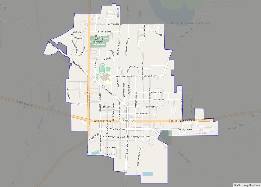
Online Interactive Map
Click on ![]() to view map in "full screen" mode.
to view map in "full screen" mode.
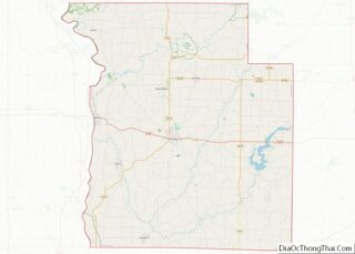
Rockville location map. Where is Rockville town?


History
Rockville was laid out in 1824, three years after the county was founded, and became the county seat. In 1825, its population was between 500 and 600. The residents voted to incorporate the town in July 1854.
The Rockville Chautauqua Pavilion and Rockville Historic District are listed on the National Register of Historic Places.
An earthquake measuring 3.8 on the moment magnitude scale was recorded in the city and confirmed by the USGS on June 17, 2021, with numerous aftershocks reported in cities around the state and Illinois
Rockville Road Map
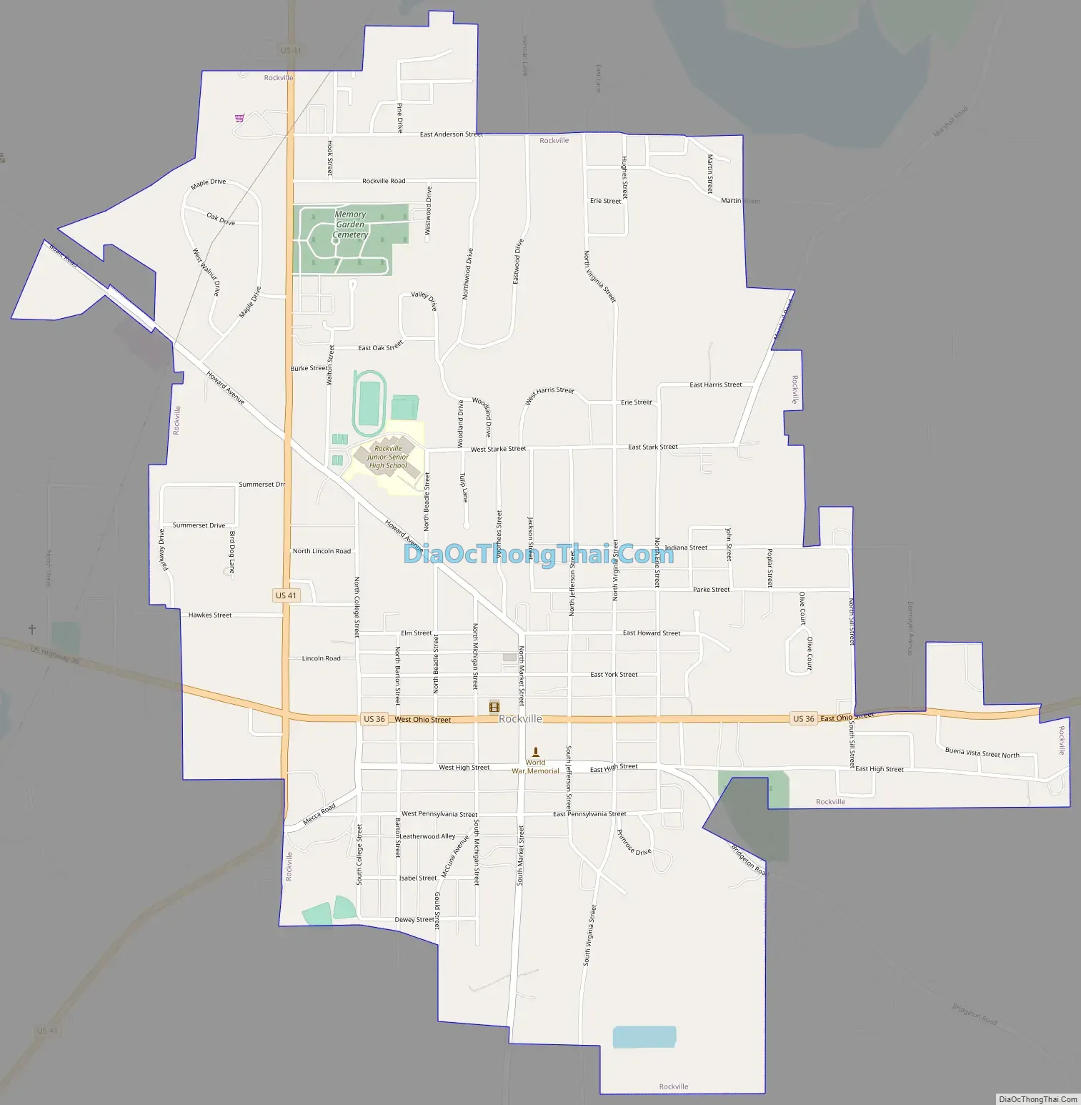
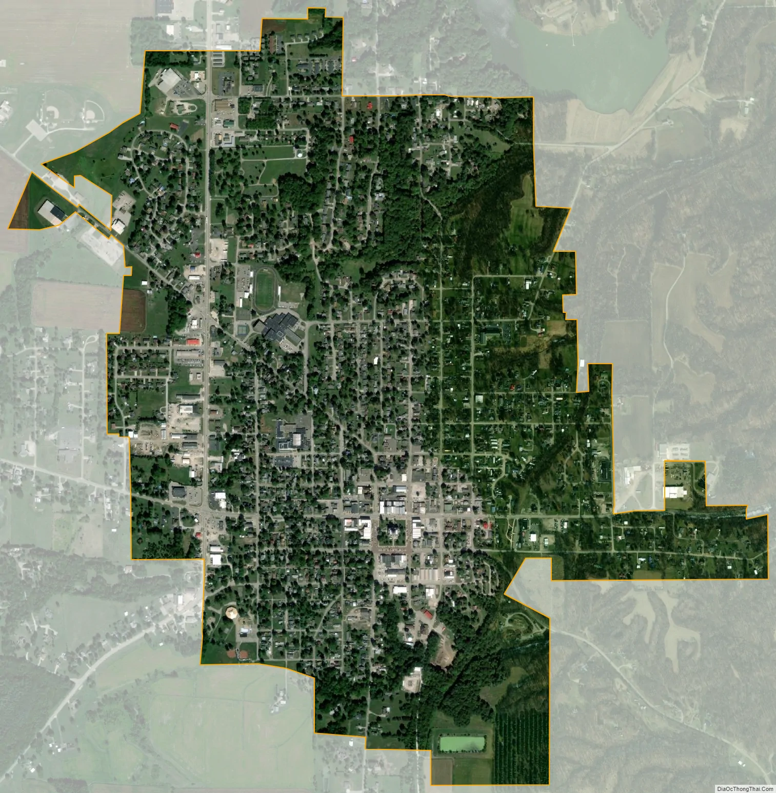
Rockville city Satellite Map
Geography
Rockville is located at the intersection of U.S. Route 36 and U.S. Route 41, about 30 miles (48 km) southwest of Crawfordsville.
According to the 2010 census, Rockville has a total area of 1.49 square miles (3.86 km), all land.
Climate
The climate in this area is characterized by hot, humid summers and generally mild to cool winters. According to the Köppen Climate Classification system, Rockville has a humid subtropical climate, abbreviated “Cfa” on climate maps.
See also
Map of Indiana State and its subdivision:- Adams
- Allen
- Bartholomew
- Benton
- Blackford
- Boone
- Brown
- Carroll
- Cass
- Clark
- Clay
- Clinton
- Crawford
- Daviess
- De Kalb
- Dearborn
- Decatur
- Delaware
- Dubois
- Elkhart
- Fayette
- Floyd
- Fountain
- Franklin
- Fulton
- Gibson
- Grant
- Greene
- Hamilton
- Hancock
- Harrison
- Hendricks
- Henry
- Howard
- Huntington
- Jackson
- Jasper
- Jay
- Jefferson
- Jennings
- Johnson
- Knox
- Kosciusko
- LaGrange
- Lake
- Lake Michigan
- LaPorte
- Lawrence
- Madison
- Marion
- Marshall
- Martin
- Miami
- Monroe
- Montgomery
- Morgan
- Newton
- Noble
- Ohio
- Orange
- Owen
- Parke
- Perry
- Pike
- Porter
- Posey
- Pulaski
- Putnam
- Randolph
- Ripley
- Rush
- Saint Joseph
- Scott
- Shelby
- Spencer
- Starke
- Steuben
- Sullivan
- Switzerland
- Tippecanoe
- Tipton
- Union
- Vanderburgh
- Vermillion
- Vigo
- Wabash
- Warren
- Warrick
- Washington
- Wayne
- Wells
- White
- Whitley
- Alabama
- Alaska
- Arizona
- Arkansas
- California
- Colorado
- Connecticut
- Delaware
- District of Columbia
- Florida
- Georgia
- Hawaii
- Idaho
- Illinois
- Indiana
- Iowa
- Kansas
- Kentucky
- Louisiana
- Maine
- Maryland
- Massachusetts
- Michigan
- Minnesota
- Mississippi
- Missouri
- Montana
- Nebraska
- Nevada
- New Hampshire
- New Jersey
- New Mexico
- New York
- North Carolina
- North Dakota
- Ohio
- Oklahoma
- Oregon
- Pennsylvania
- Rhode Island
- South Carolina
- South Dakota
- Tennessee
- Texas
- Utah
- Vermont
- Virginia
- Washington
- West Virginia
- Wisconsin
- Wyoming